


SAND: Segment 3 – Richtersveld
Distance
539 Mi.
(867 KM)Days
18
% Unpaved
95%
% Singletrack
3%
% Rideable (time)
85%
Total Ascent
29,556'
(9,009 M)High Point
3,708'
(1,130 M)Difficulty (1-10)
8?
- 4Climbing Scale Fair55 FT/MI (10 M/KM)
- 8Technical Difficulty Difficult
- 8Physical Demand Difficult
- 7Resupply & Logistics Strenuous
Contributed By
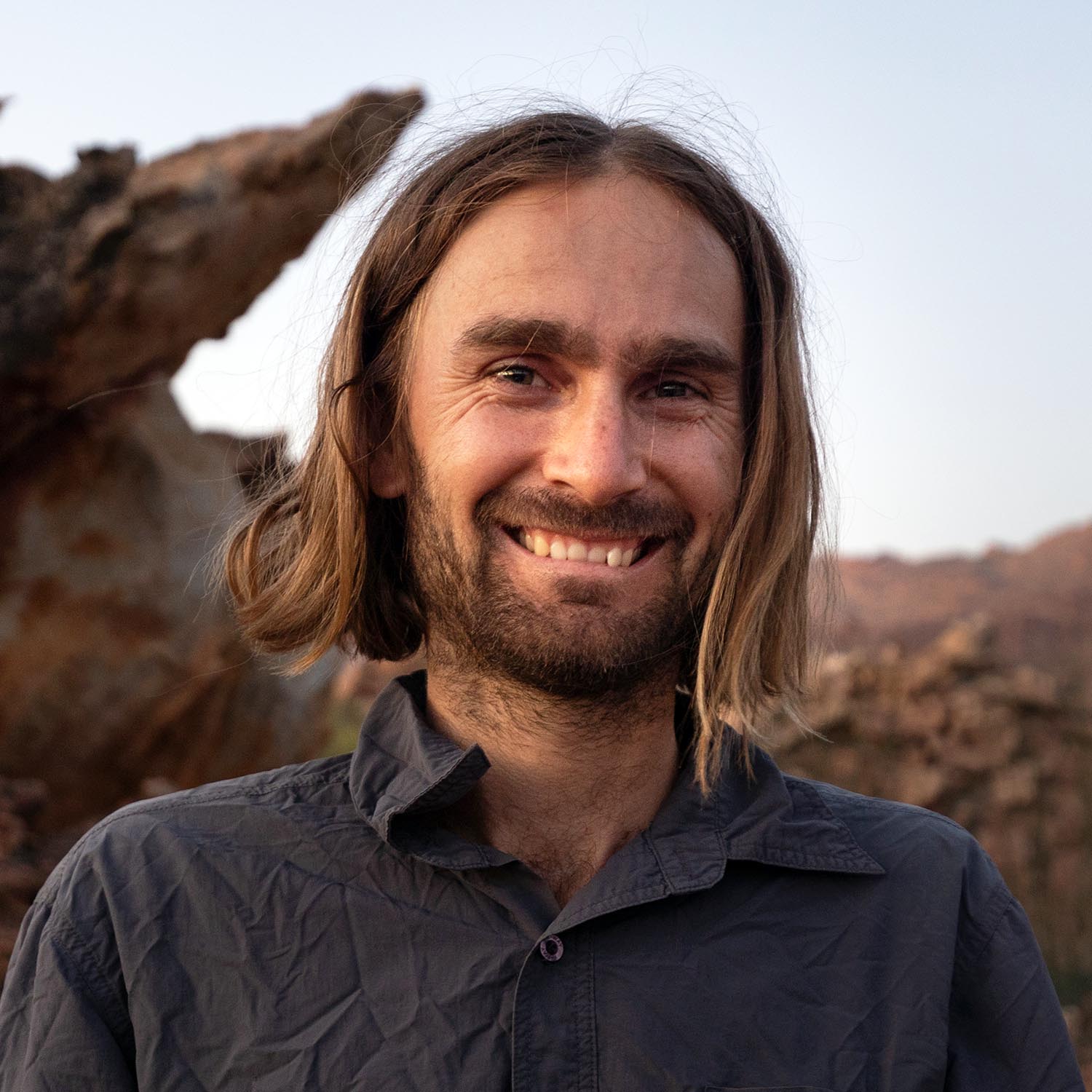
Johan Wahl
A Whale Away
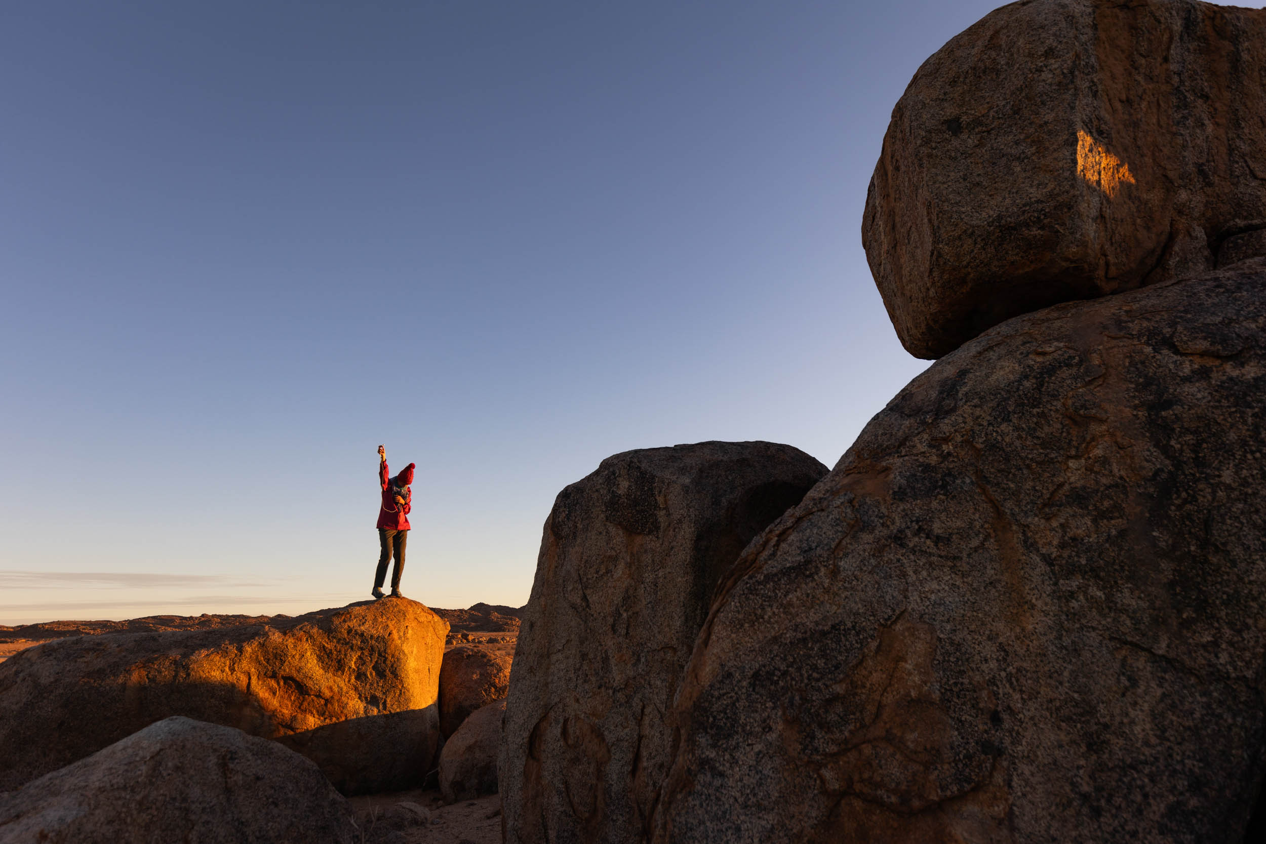
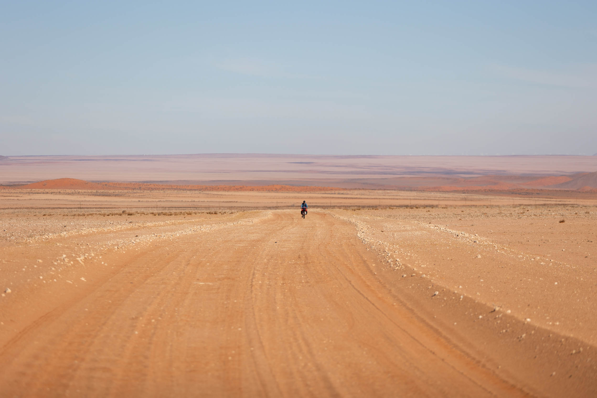
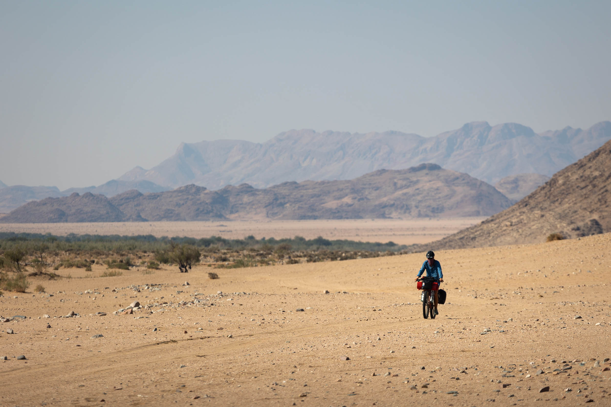
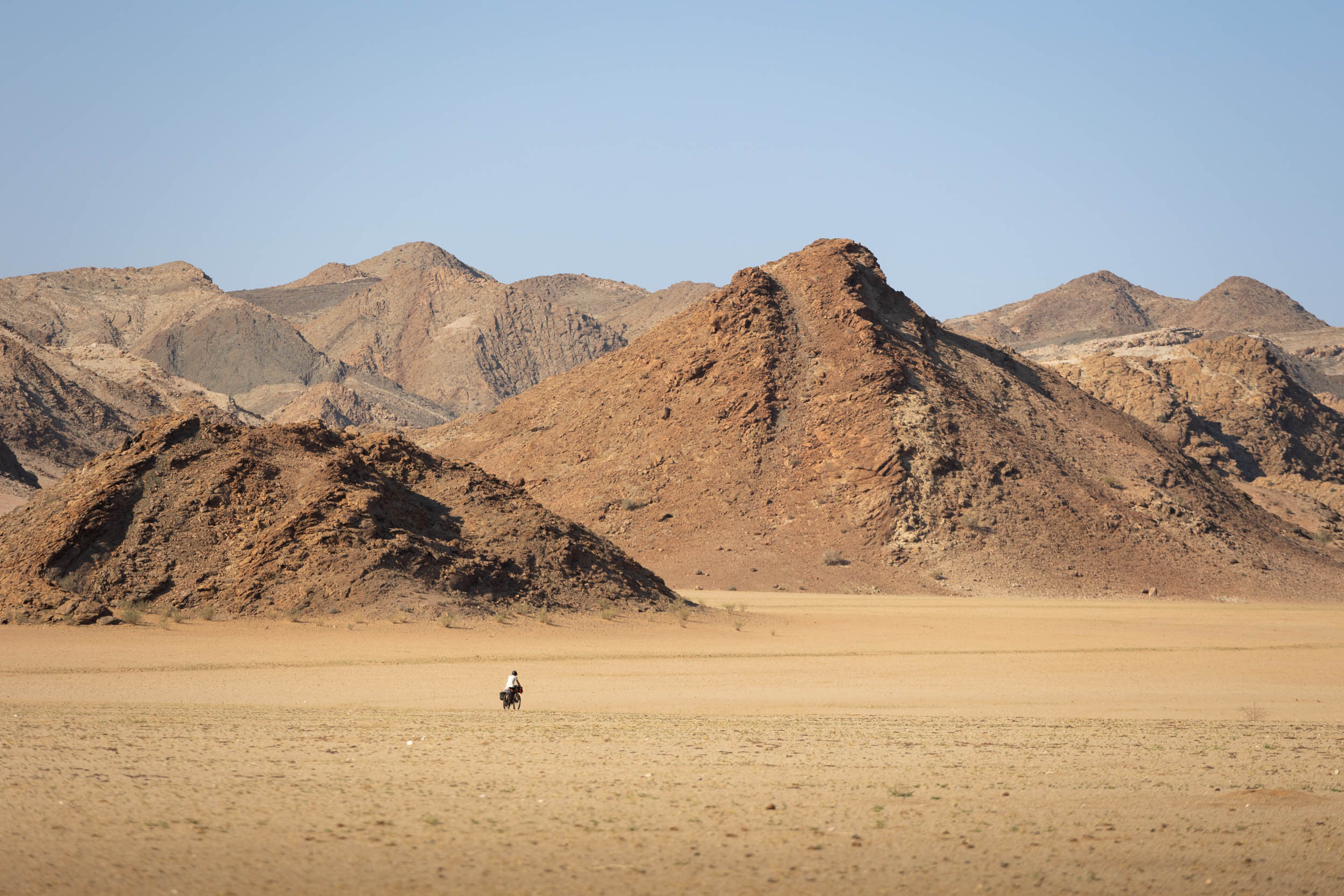
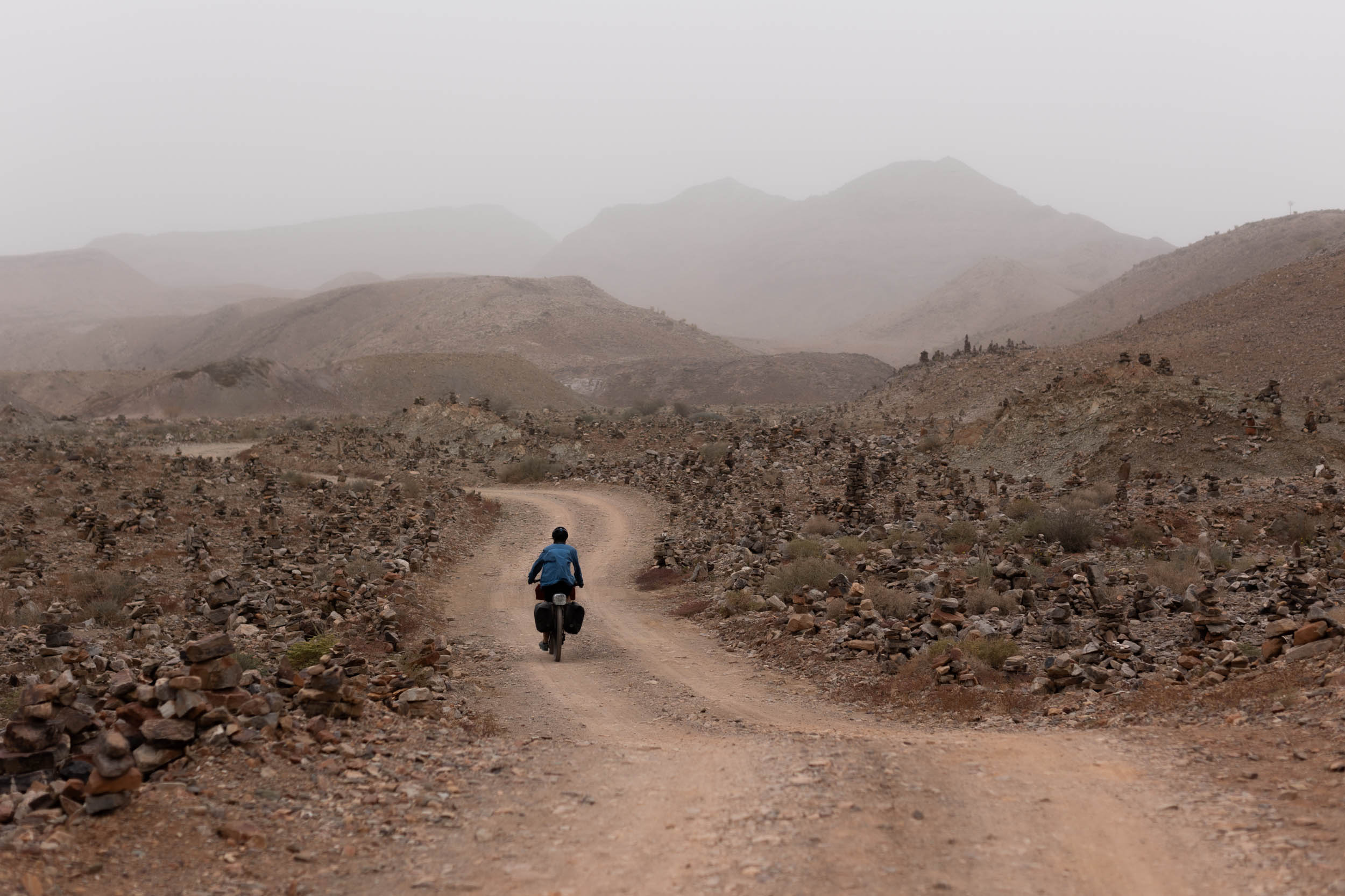
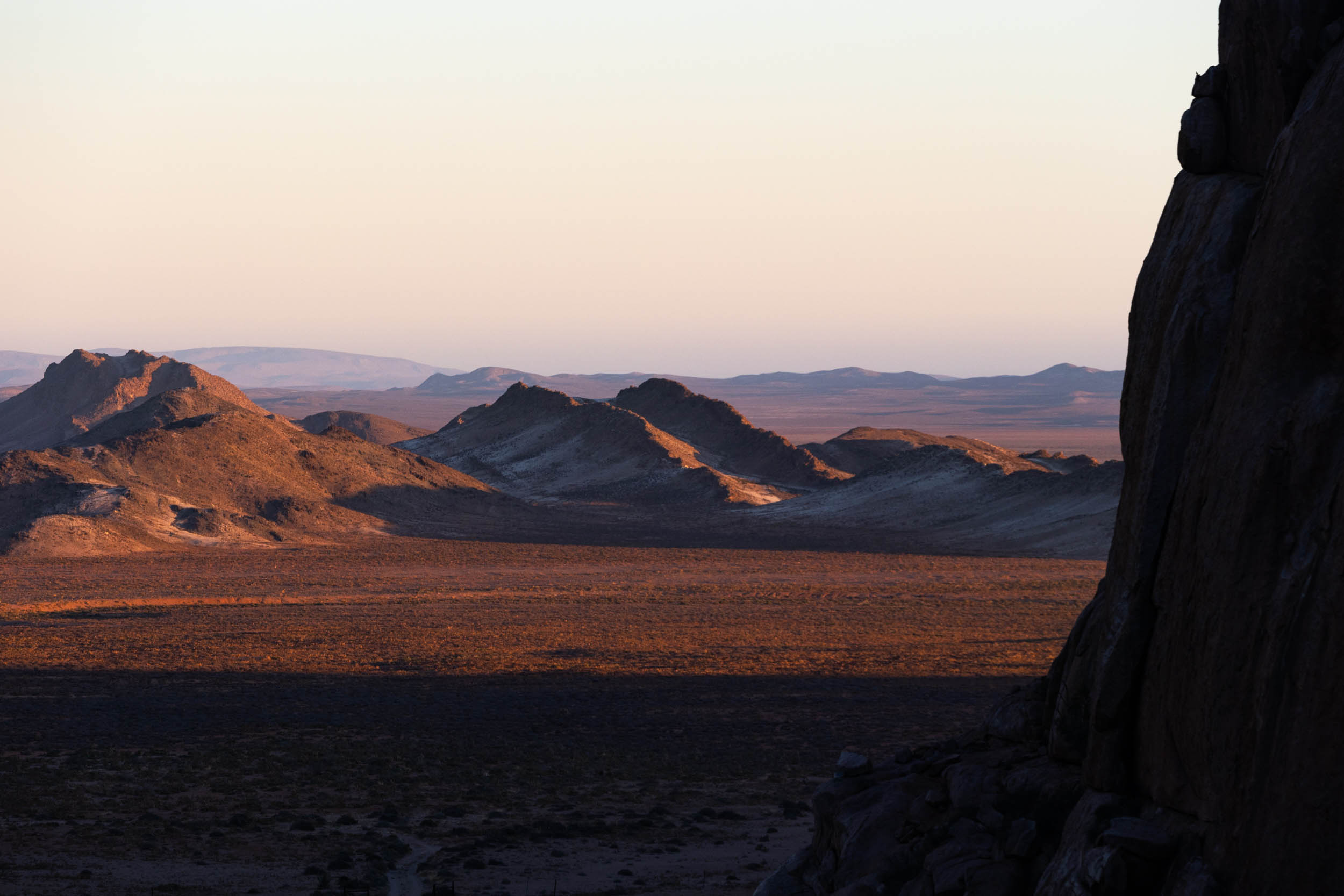
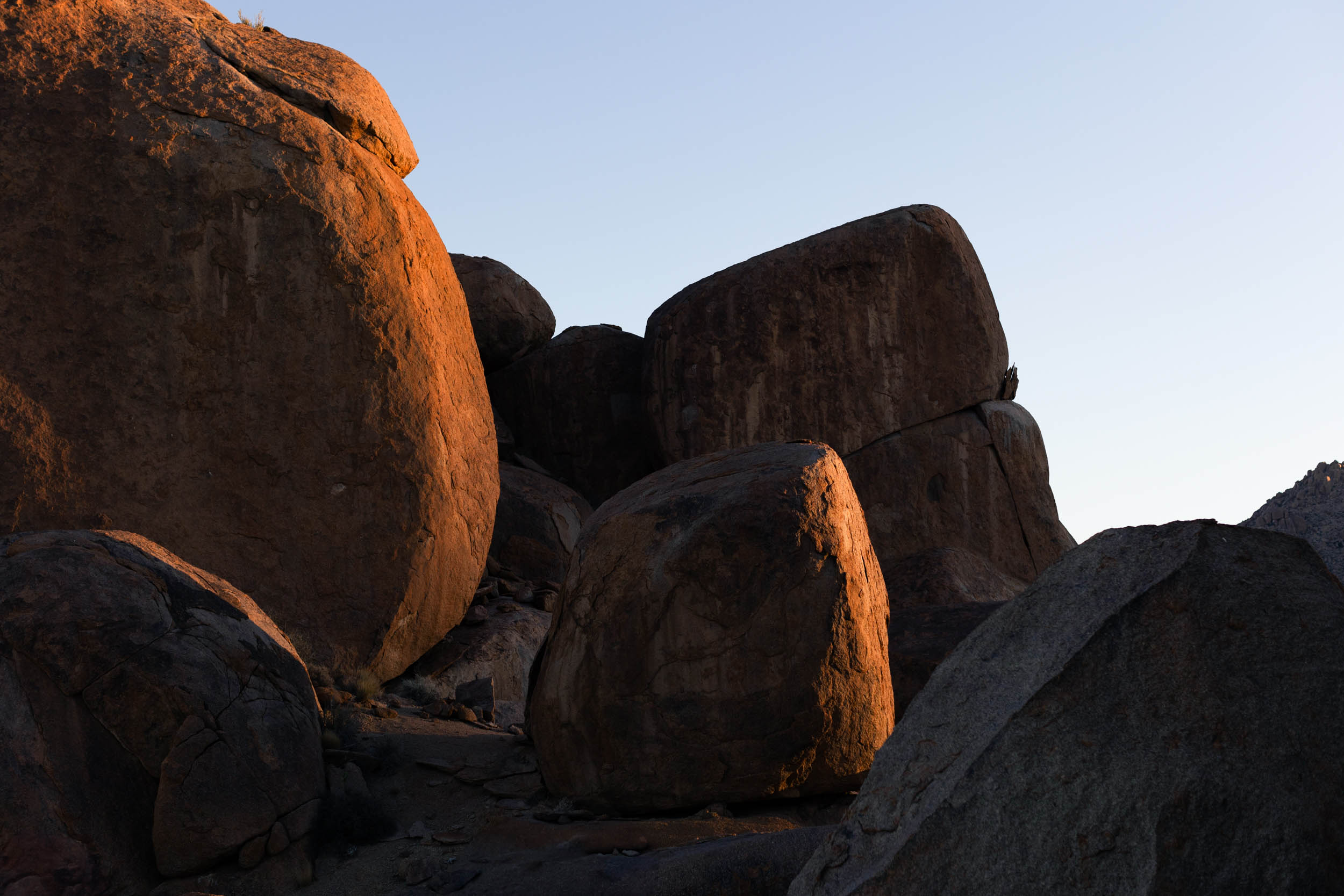
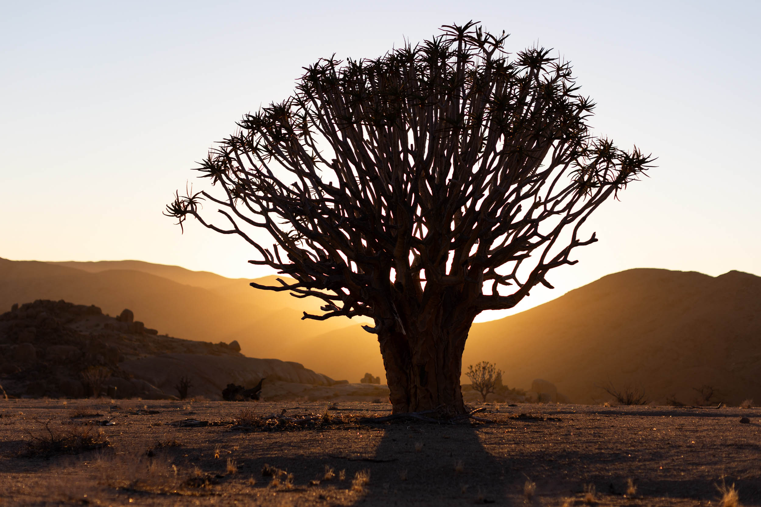
As you travel northward towards Namibia, the land becomes visibly drier, more barren, and, in the presence of rising mountains, more rugged. But it also gets increasingly beautiful the further you go. By the time you reach the Richtersveld and the Orange River—the boundary that separates South Africa from Namibia—the landscapes have matured into the full, breathtaking expression of the desert, and one that perfectly embodies the quintessential quest of the SAND route.
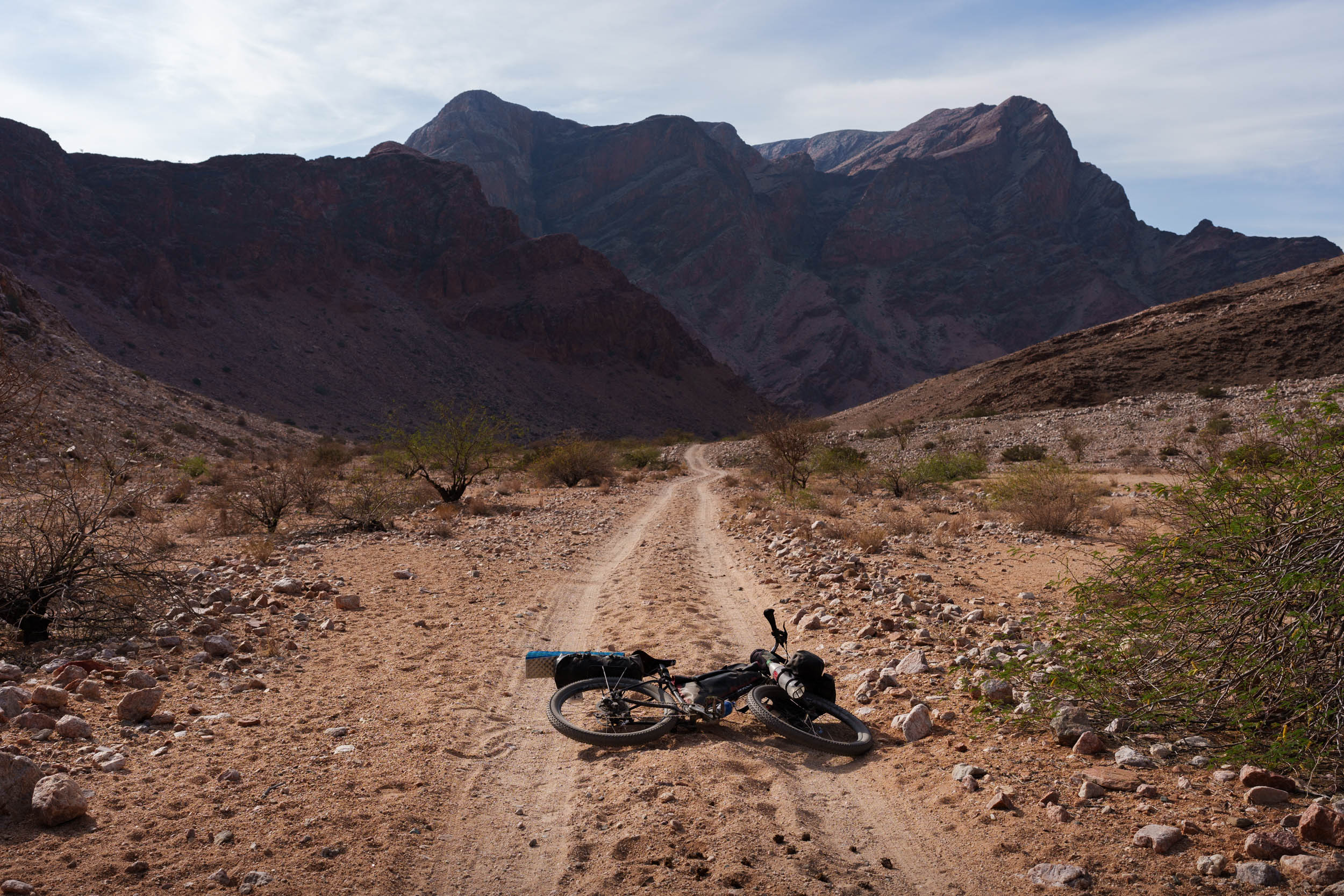
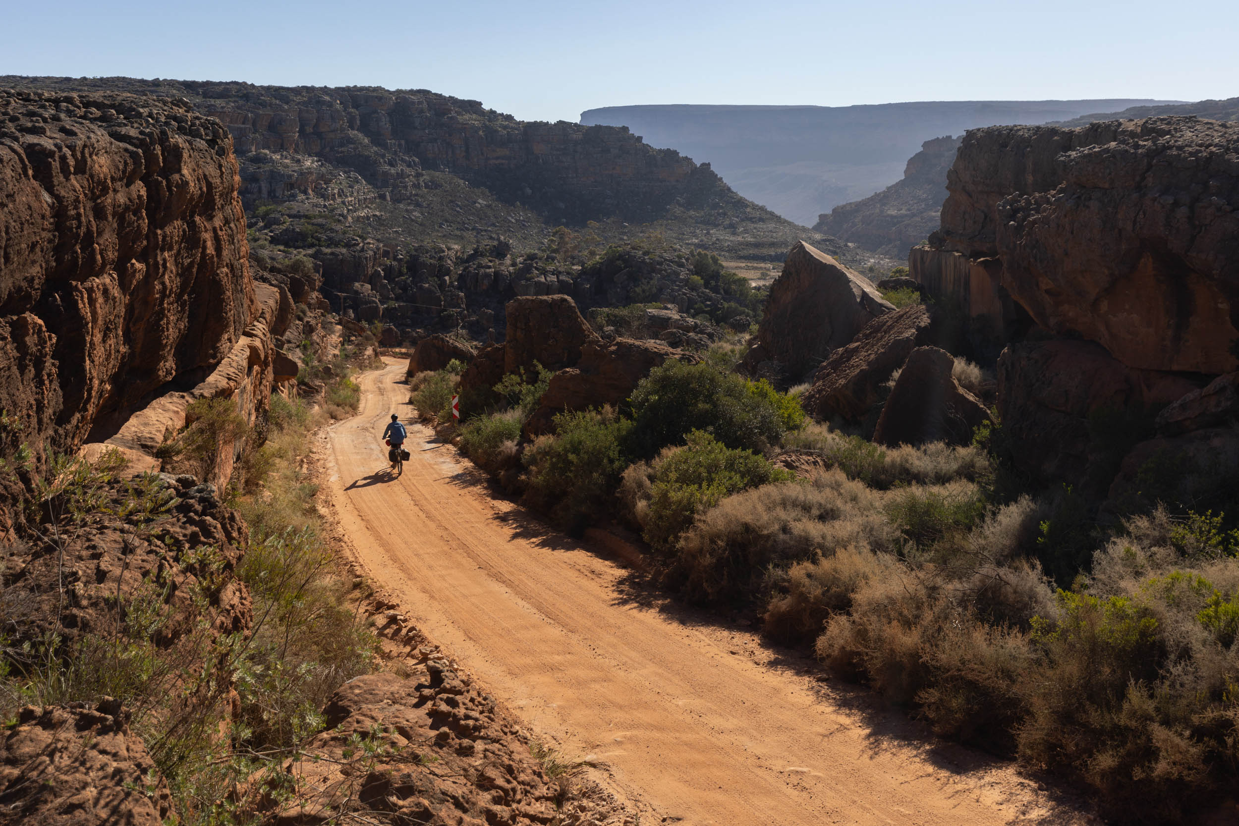
Continuing along the river, specifically on the South African side, there’s an elaborate and often thrilling network of tracks and trails that weave through the Richtersveld and beyond: a combination of gravel roads, forgotten sandy tracks, and gruelling 4×4-only passes that penetrate deep into obscure nooks and crannies of the desert. What’s more, most of these roads and tracks are completely unrestricted. This is quite significant considering that the desert is oddly difficult to penetrate otherwise, with most land typically either private or off-limits for other commercial reasons. Accordingly, this segment takes some time off from dashing north (or south) to thoroughly ramble around and absorb what the desert has to offer.
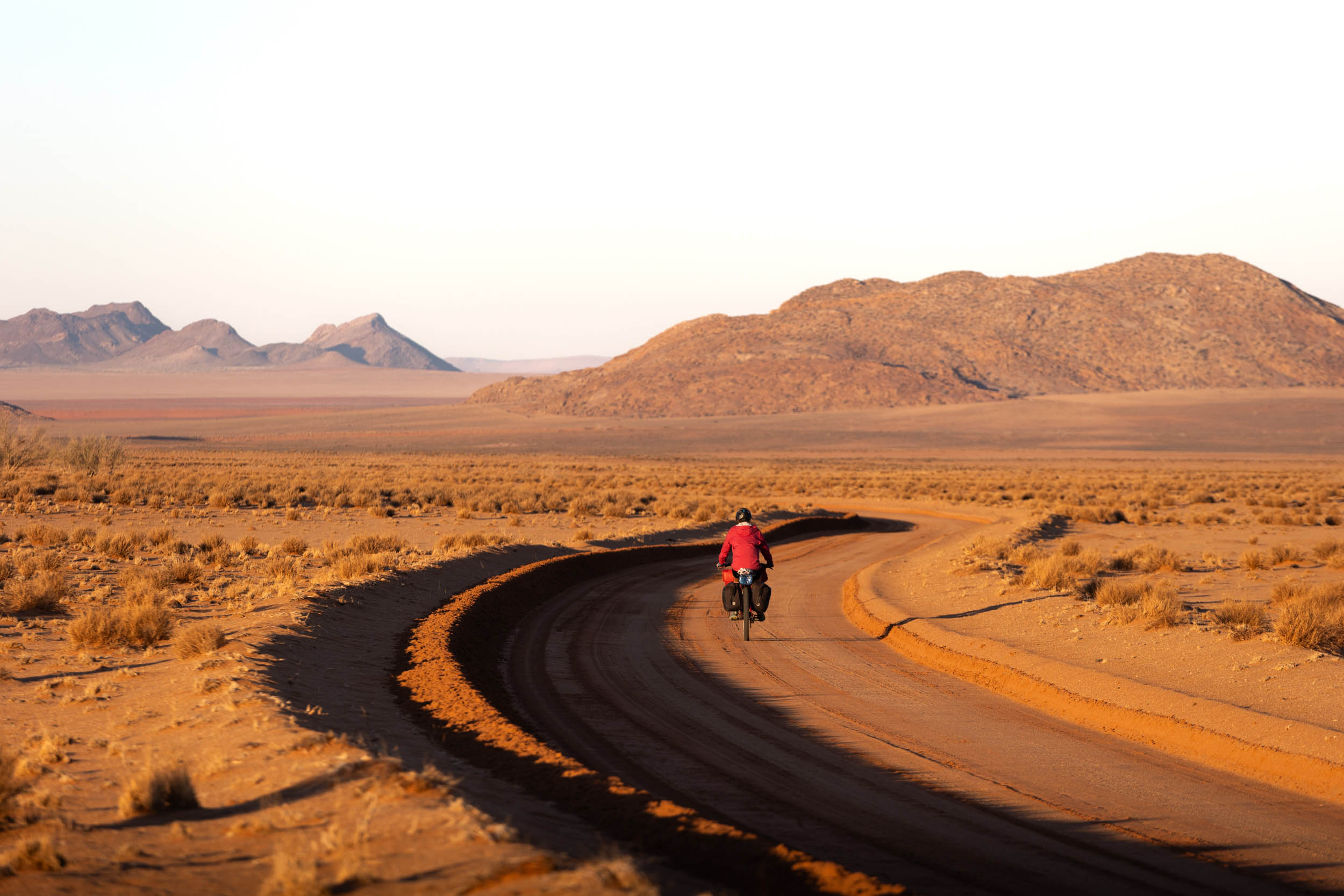
The riding begins in Springbok and ends at the Sendelingsdrift border station in the heart of the Richtersveld. It’s only a short distance away as the crow flies, but the route meanders extensively between the two and takes in some challenging terrain: a wide stretch through the notoriously inhospitable Boesmandland and an improbable link up of some of the toughest sections of the Namaqua 4×4 Trail. Indeed, some of the country’s most notorious 4×4 objectives are in the mix here, including a gruelling pass called, appropriately, “The Road to Hell.” Moreover, it’s all done in typically unforgiving conditions and with limited resupply options.
The segment is designed primarily for experienced bikepackers, especially those with an appetite for hike-a-biking. However, in recognition of the SAND route’s overarching goal to cater to riders of diverse backgrounds and abilities, this guide also proposes alternatives and detours to navigate around the more challenging terrain. Nevertheless, it’s essential to acknowledge that no off-pavement crossing of the Richtersveld is ever a walk in the park, and this segment is an invitation to embrace that inherent adventure.
Route Difficulty
This is the most challenging of the three South African segments, and it involves consistently challenging roads and tracks through an extremely remote region. It earns an 8 out of 10 for overall difficulty. For the more conservative bikepackers, we offer suggestions and alternatives for reducing the overall difficulty. Check out the Trail Notes tab for details.
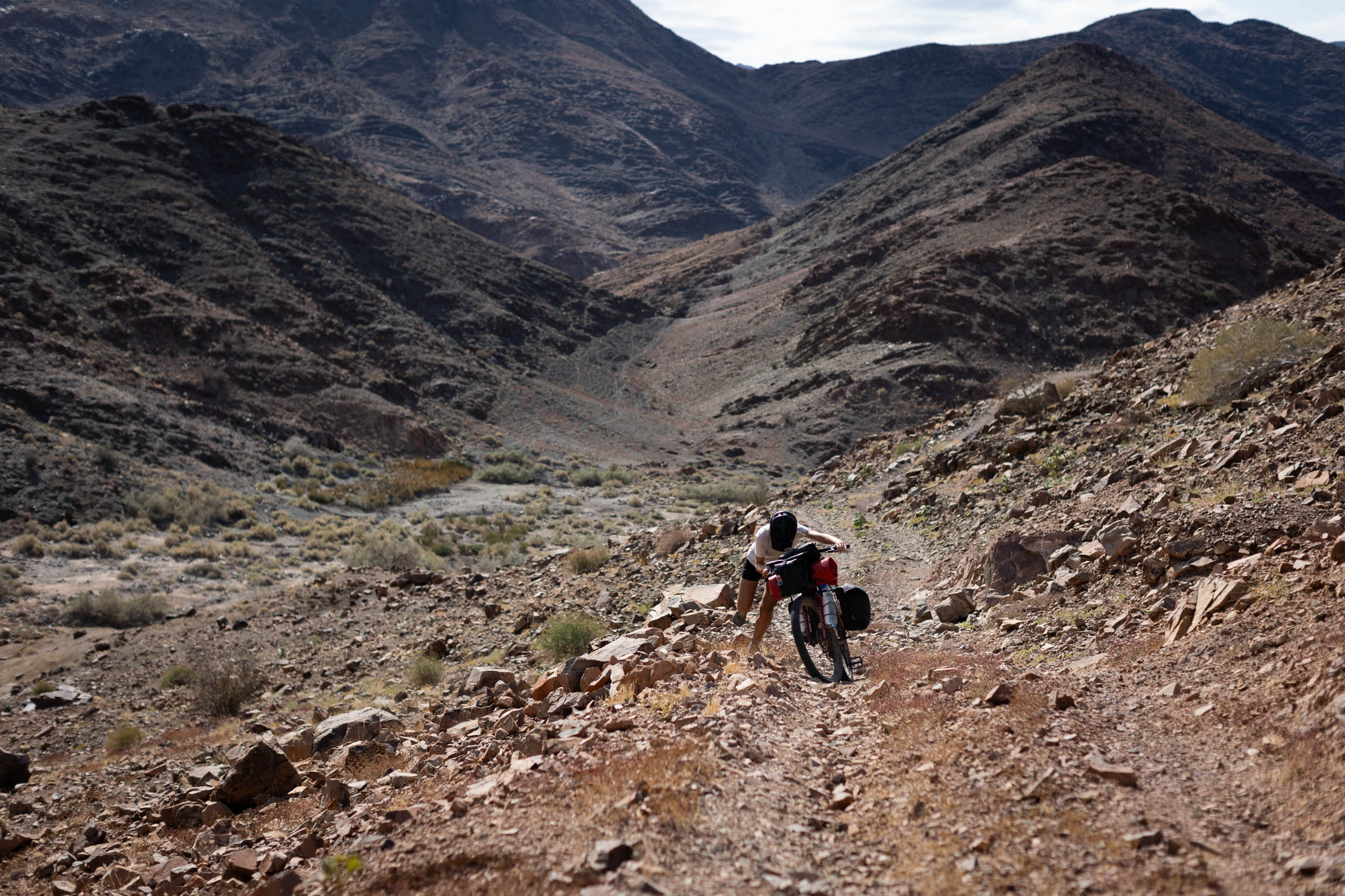
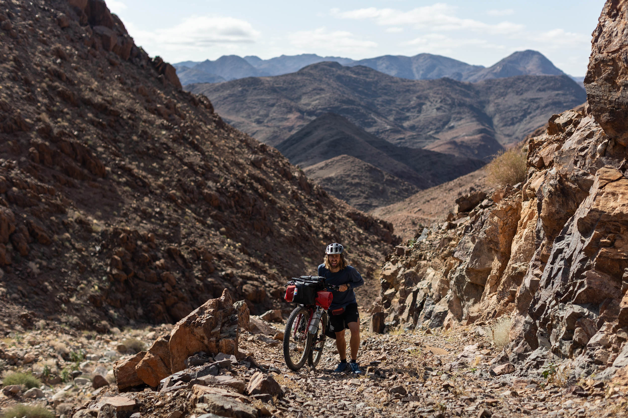
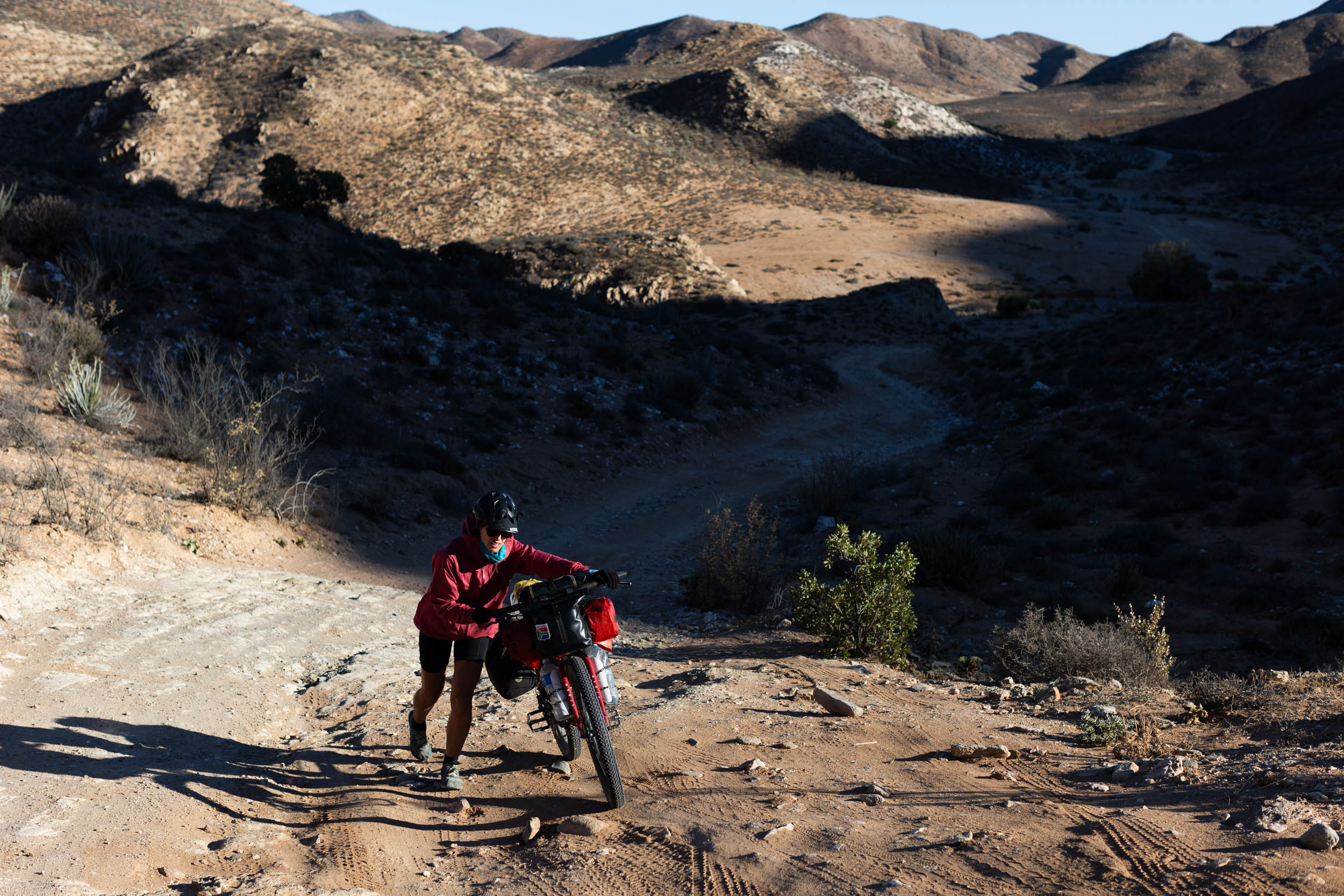
Technical difficulty (8/10): This segment still has its share of fast and rideable gravel roads, but they’re fewer and further between. A large portion of the riding is on rough doubletracks and challenging 4X4 trails. Expect plenty of soft sand, rocks, and bad corrugations, even on the bigger roads. Most riders will find themselves pushing or carrying their bikes at one point or another.
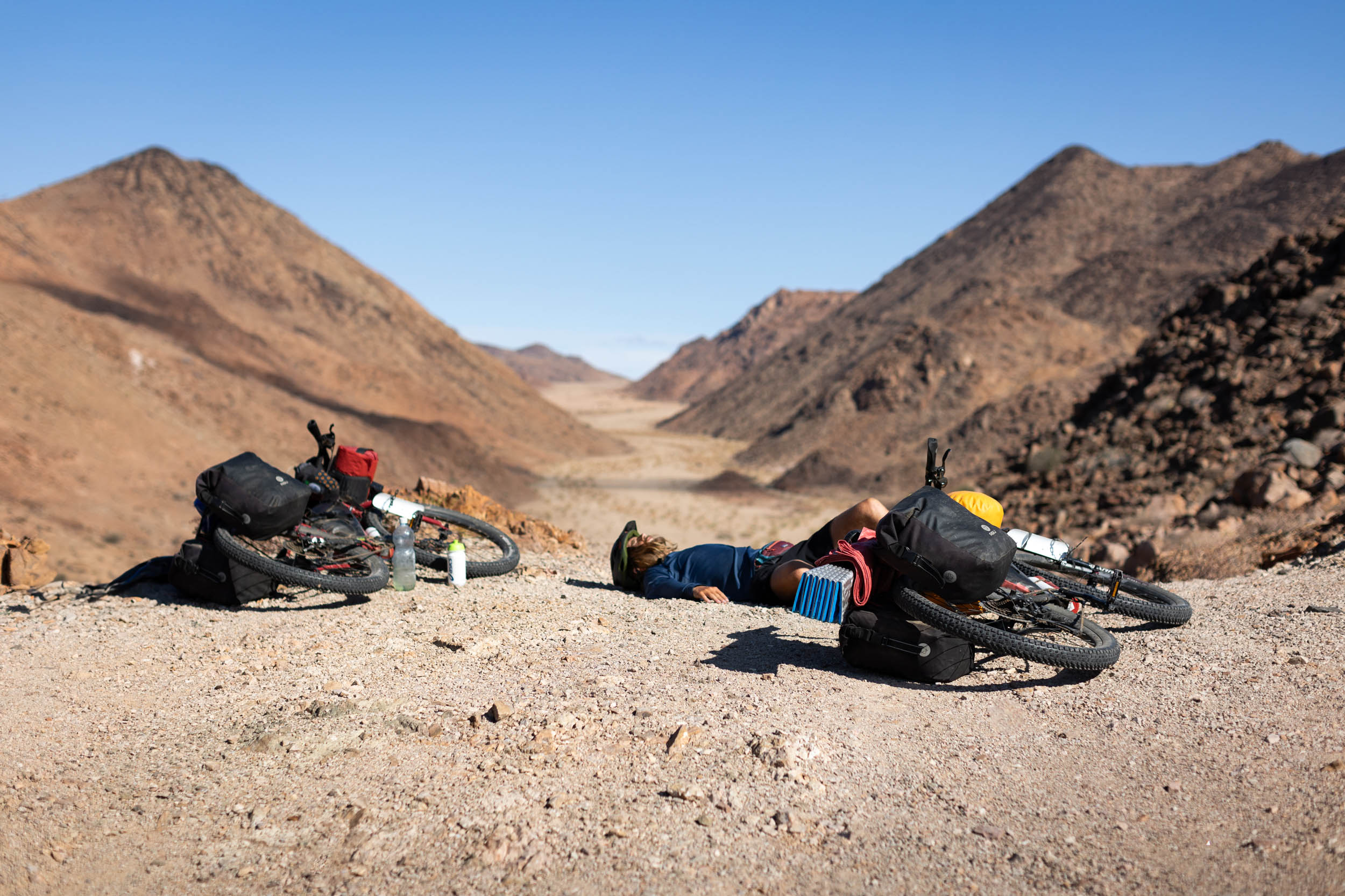
Physical demand (8/10): Save for one or two steep climbs, the terrain is mostly flat, but it’s rough, and the environment is unforgiving. The heat is usually relentless and inescapable and can make even the smallest effort feel like an arduous feat. Adding to the challenge are also other environmental factors like the midges (called “miggies”) and flies that persistently swarm around your head. In some sections, dense overgrowth and thorny shrubs also add to the challenge.
Resupply and Logistics (7/10): Overall, towns and villages are relatively frequent, and they offer enough basics to get by on, but there are one or two long stretches without anything where careful planning is needed for food and water haulage. Water especially. Don’t underestimate the seriousness of water safety in this segment. Furthermore, fresh produce and luxury food items are scarce. Any such items must usually be carried from Springbok, the start point, inevitably resulting in heavier-than-ideal setups where it matters.
Route Development
The SAND Bikepacking route was developed by South African bikepacker and photographer Johan Wahl and his partner Jana. They first attempted the route in 2021, intriguing us with inspiring images as they rode, but it wasn’t until recently that Johan fine-tuned his ideas from that initial journey into a structured route that could be repeated and published here. Private property and land access were major obstacles during that initial journey, and it took in-depth consultation with locals and landowners and several return trips to resolve. He also exchanged ideas with several prominent bikepacking-minded members of the local cycling community to ensure that the route would be well received. Longevity was one of the key considerations in planning this route, and the belief is that with this route now accessible to all, the future is bright for bikepacking in Southern Africa. Use these links to dig into Segment 1 and Segment 2 and stay tuned as we release segments 4 and 5 of this incredible 5,500+ kilometer route.


Submit Route Alert
As the leading creator and publisher of bikepacking routes, BIKEPACKING.com endeavors to maintain, improve, and advocate for our growing network of bikepacking routes all over the world. As such, our editorial team, route creators, and Route Stewards serve as mediators for route improvements and opportunities for connectivity, conservation, and community growth around these routes. To facilitate these efforts, we rely on our Bikepacking Collective and the greater bikepacking community to call attention to critical issues and opportunities that are discovered while riding these routes. If you have a vital issue or opportunity regarding this route that pertains to one of the subjects below, please let us know:
Highlights
Must Know
Camping
Food/H2O
Trail Notes
Resources
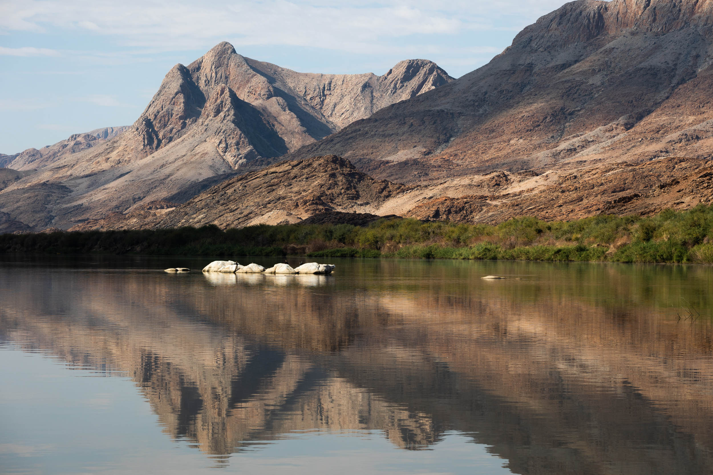
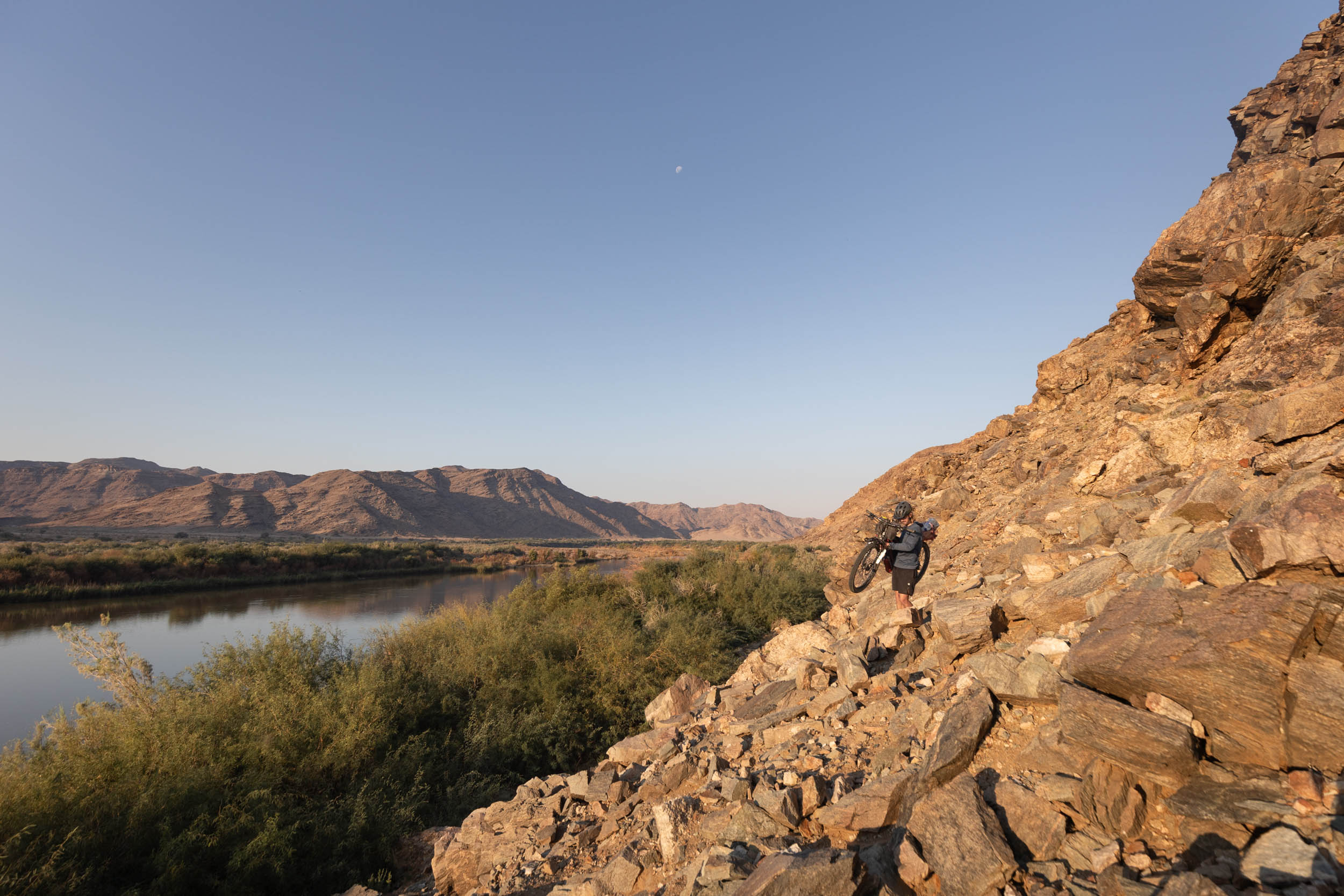
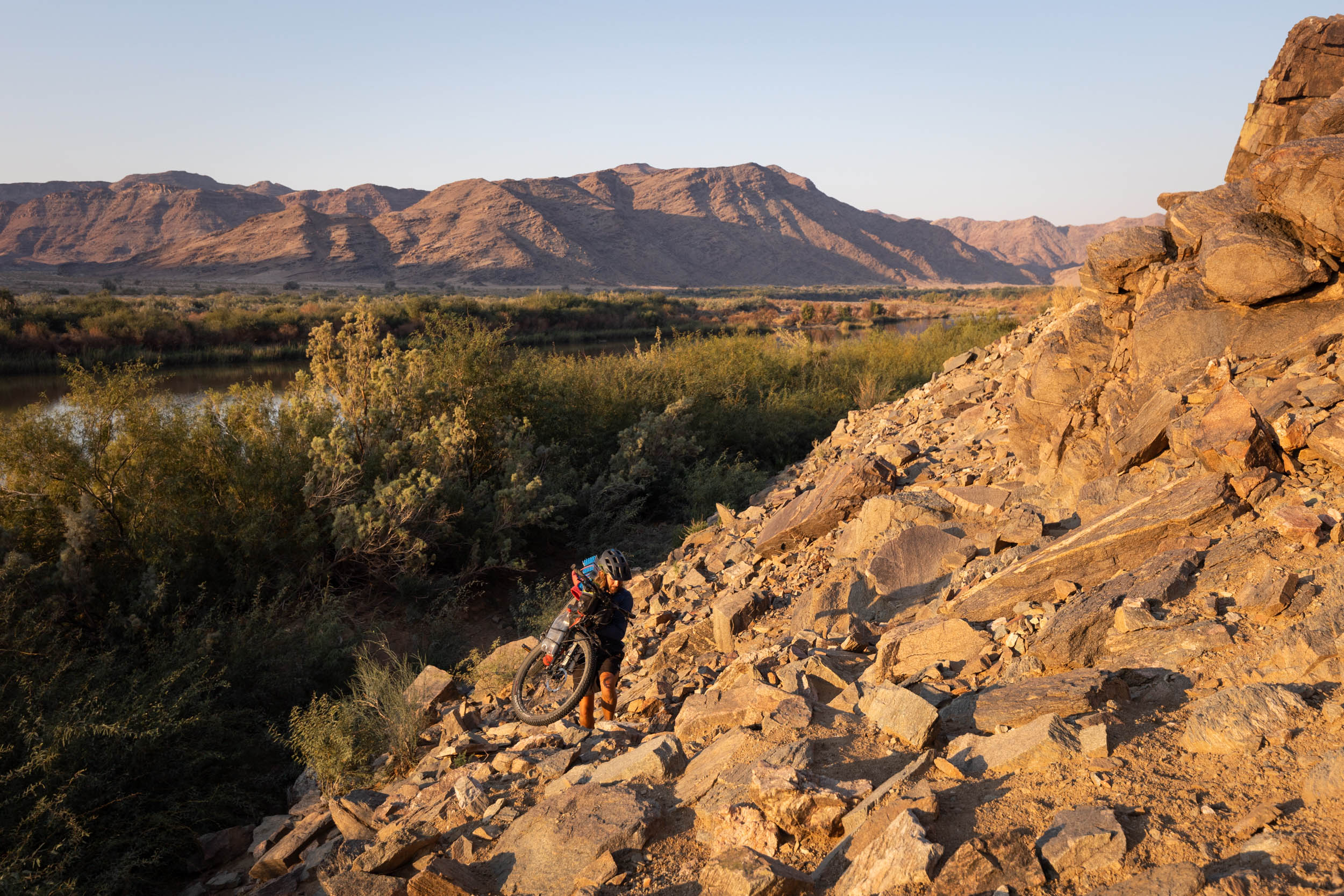
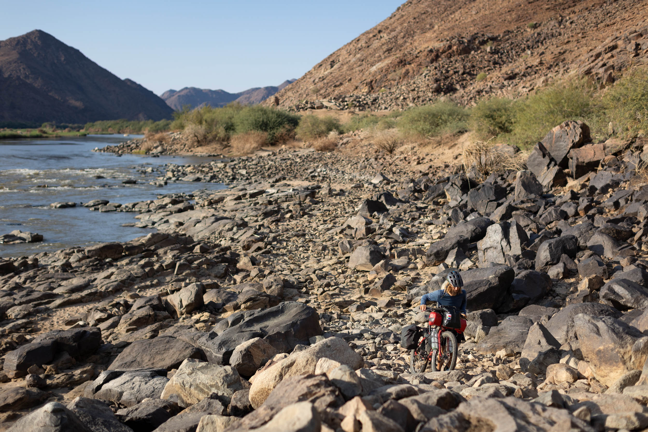
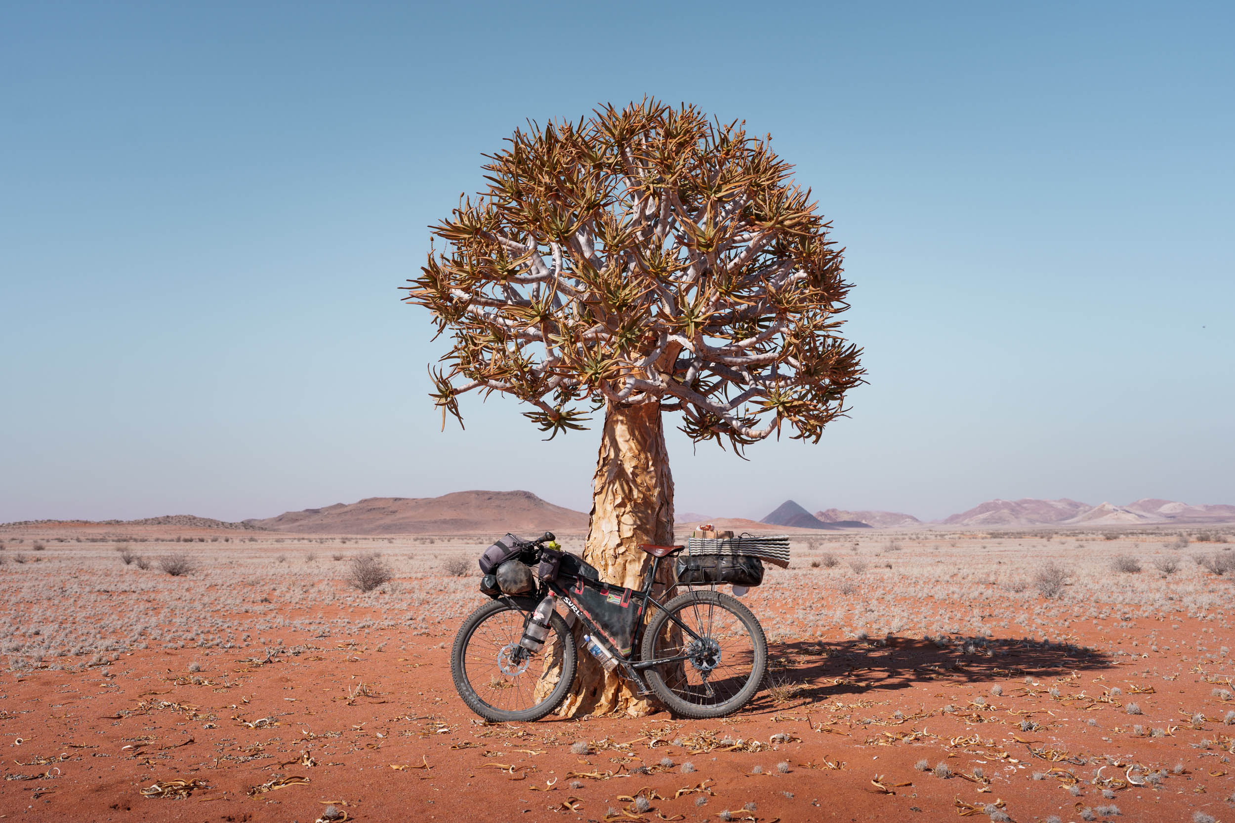
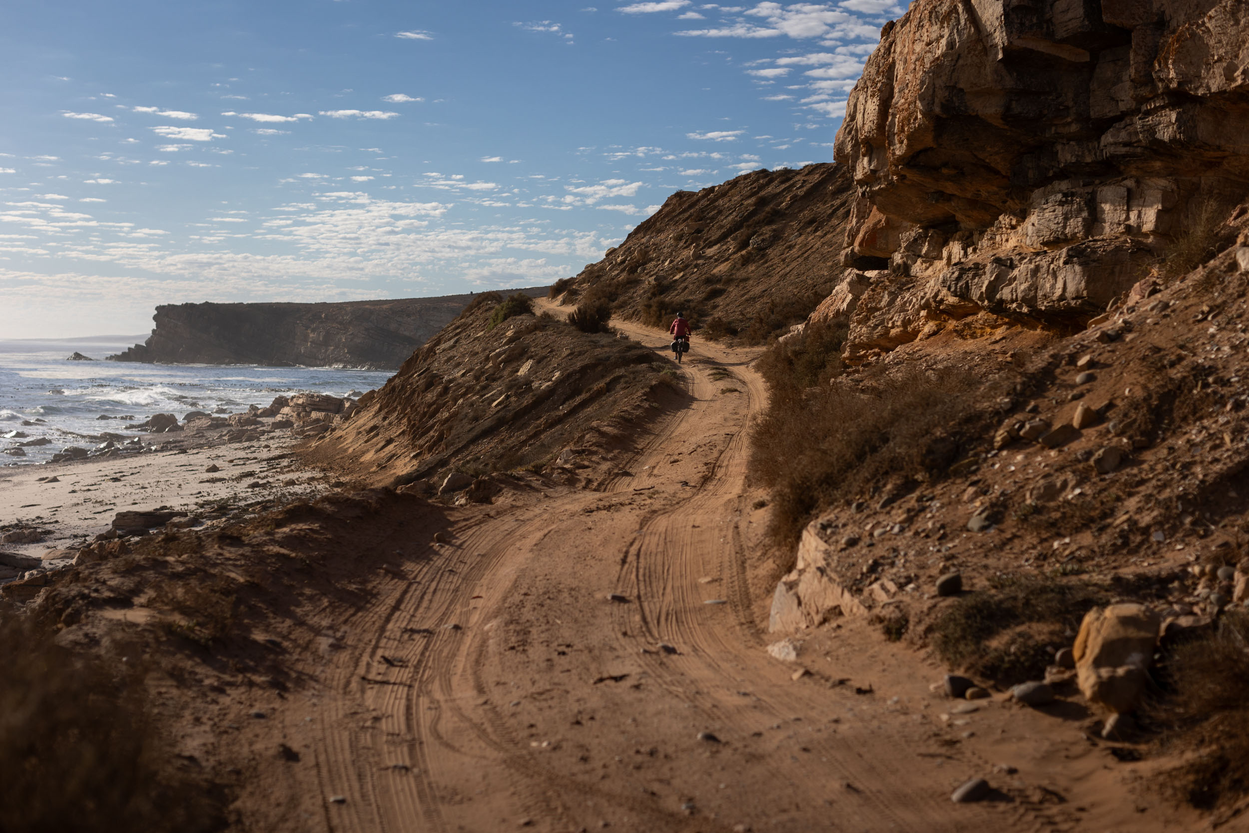
- The Orange River. The river is the region’s lifeline and the longest river in South Africa. Its inviting waters stand out in stunning contrast against the otherwise barren and arid moonscapes. Plus, nothing beats a plunge in the river after a long and hot day of bikepacking in the desert.
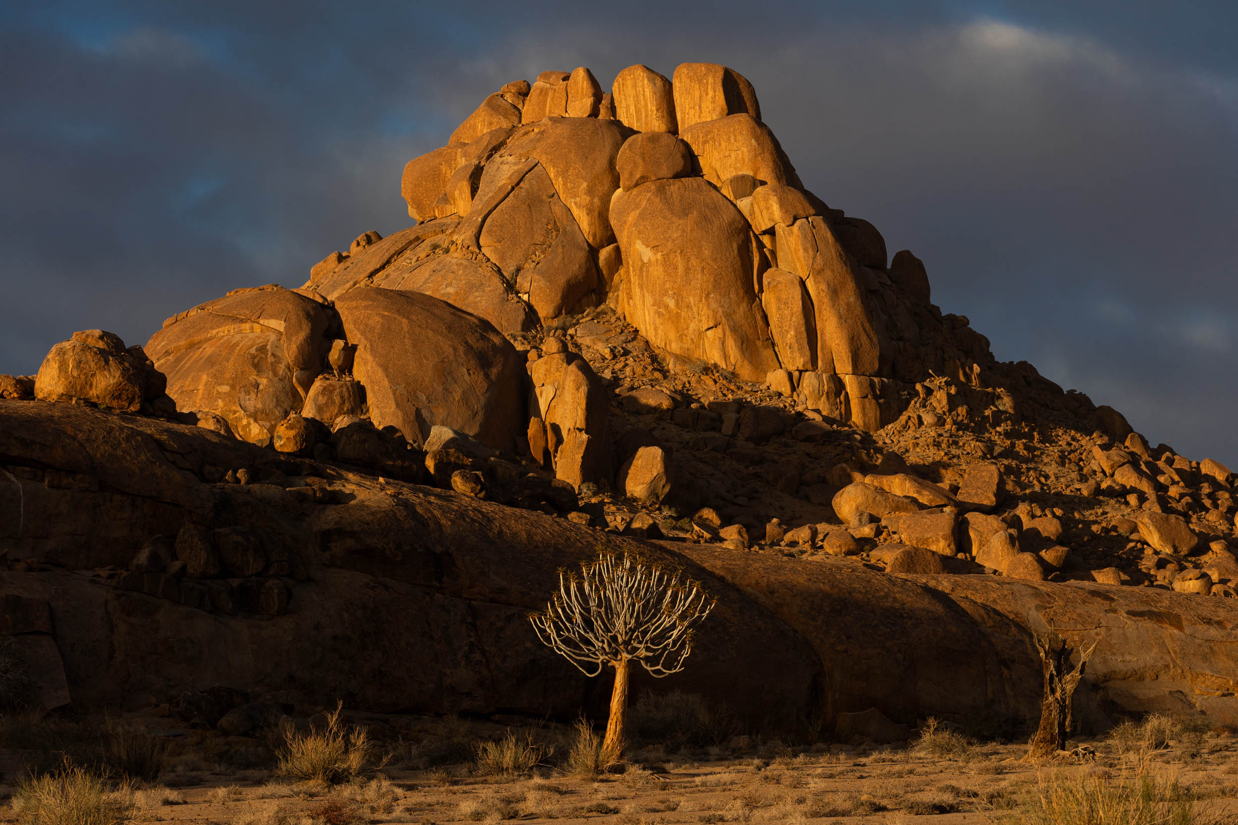
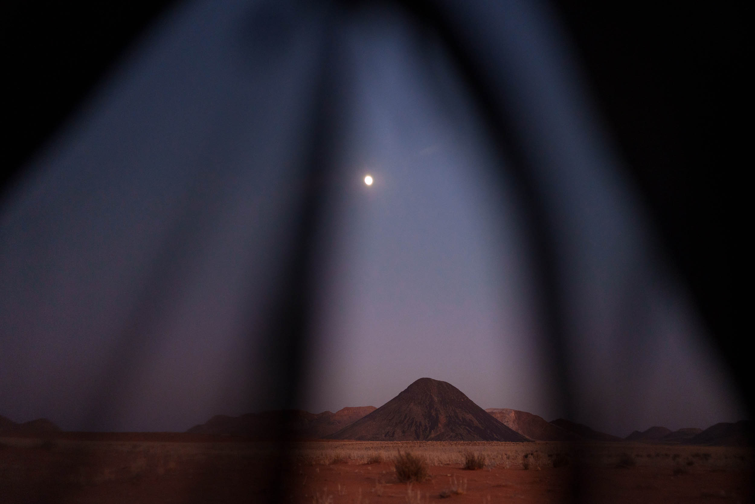
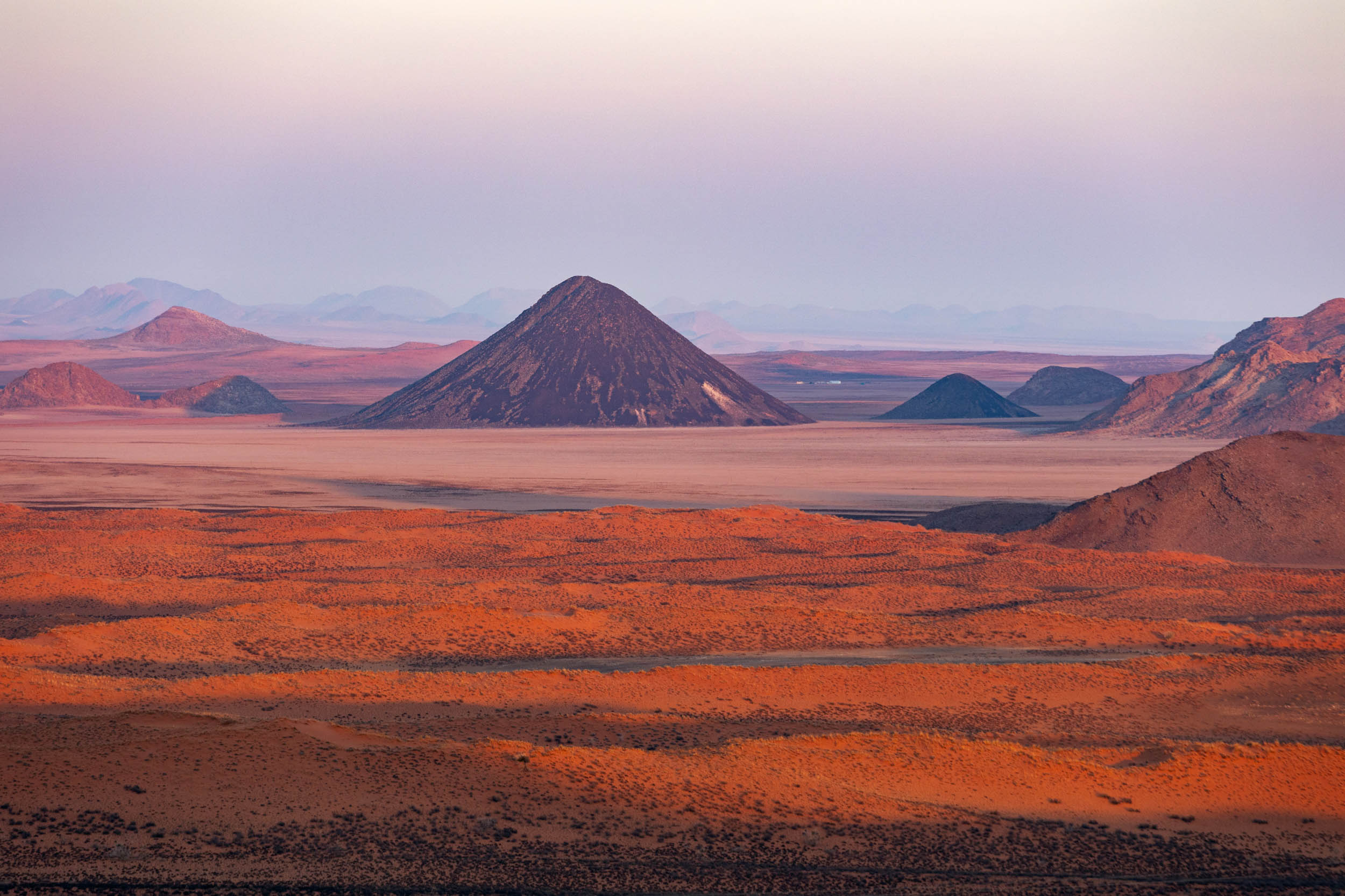
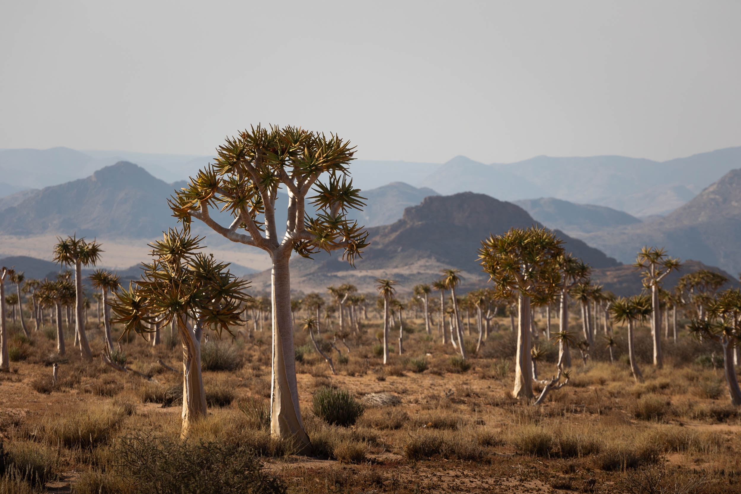
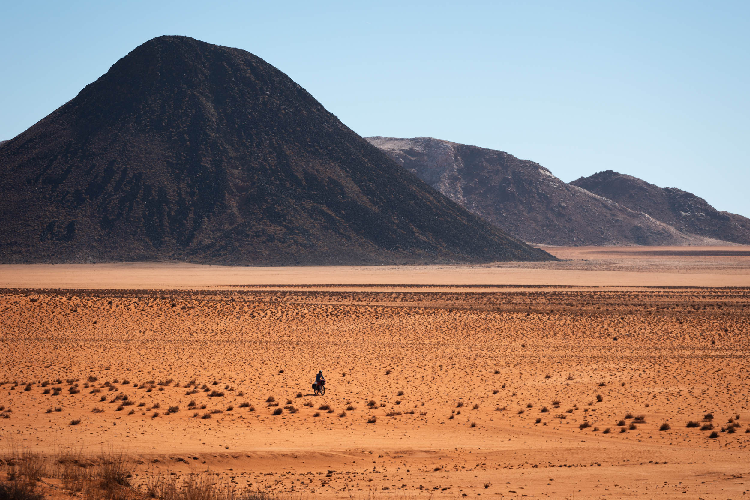
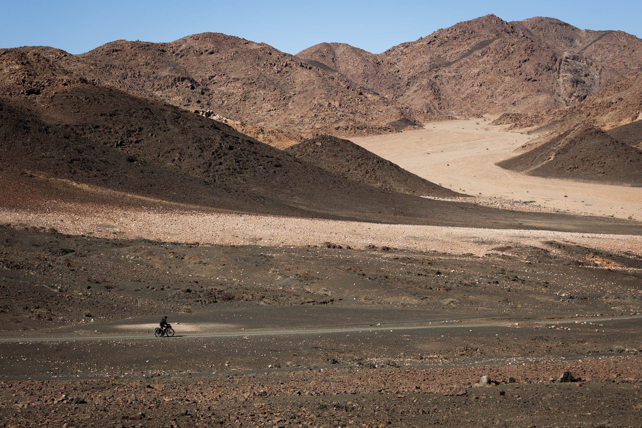
- Boesmanland. Despite the heat and the hostility of the terrain, there’s a strange allure to the solitude offered amidst Boesmanland’s red, barren plains and conical black koppies.
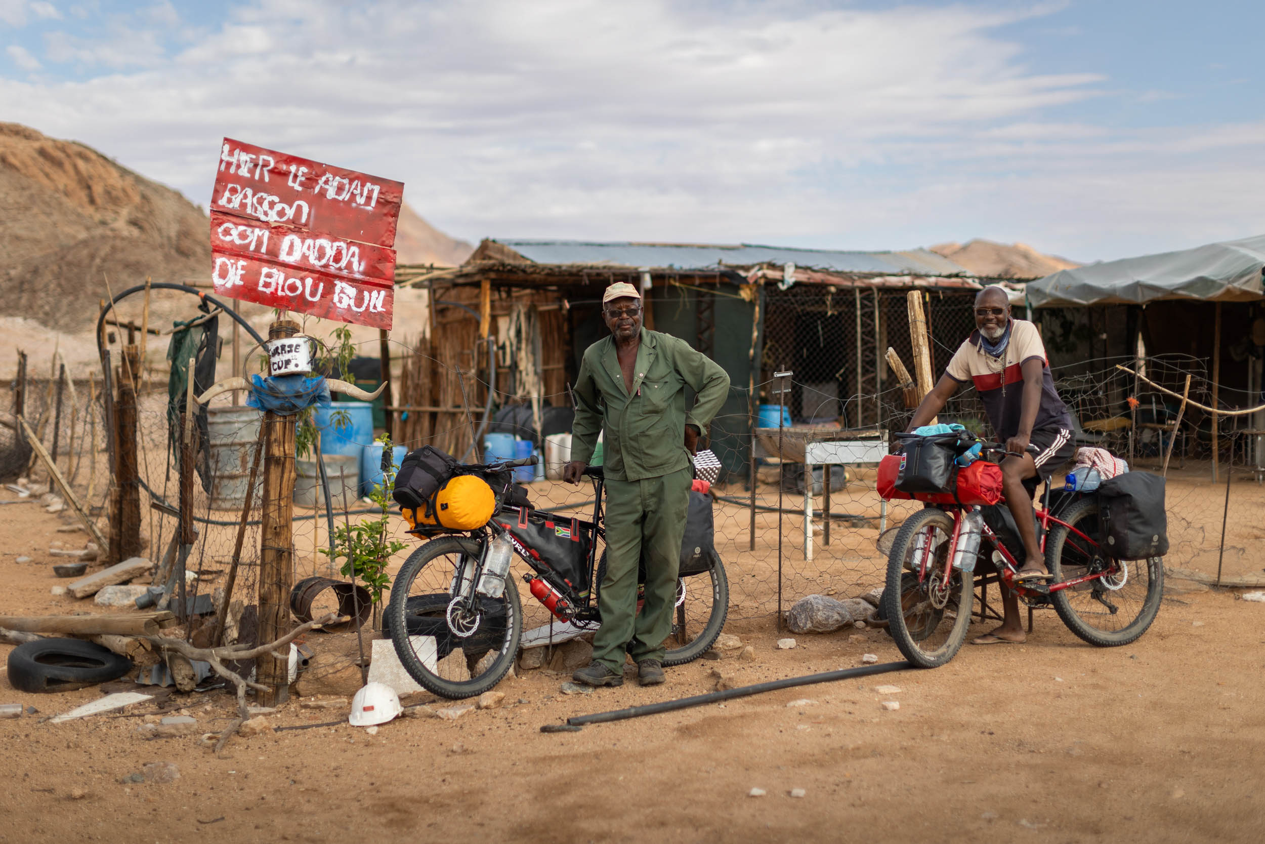
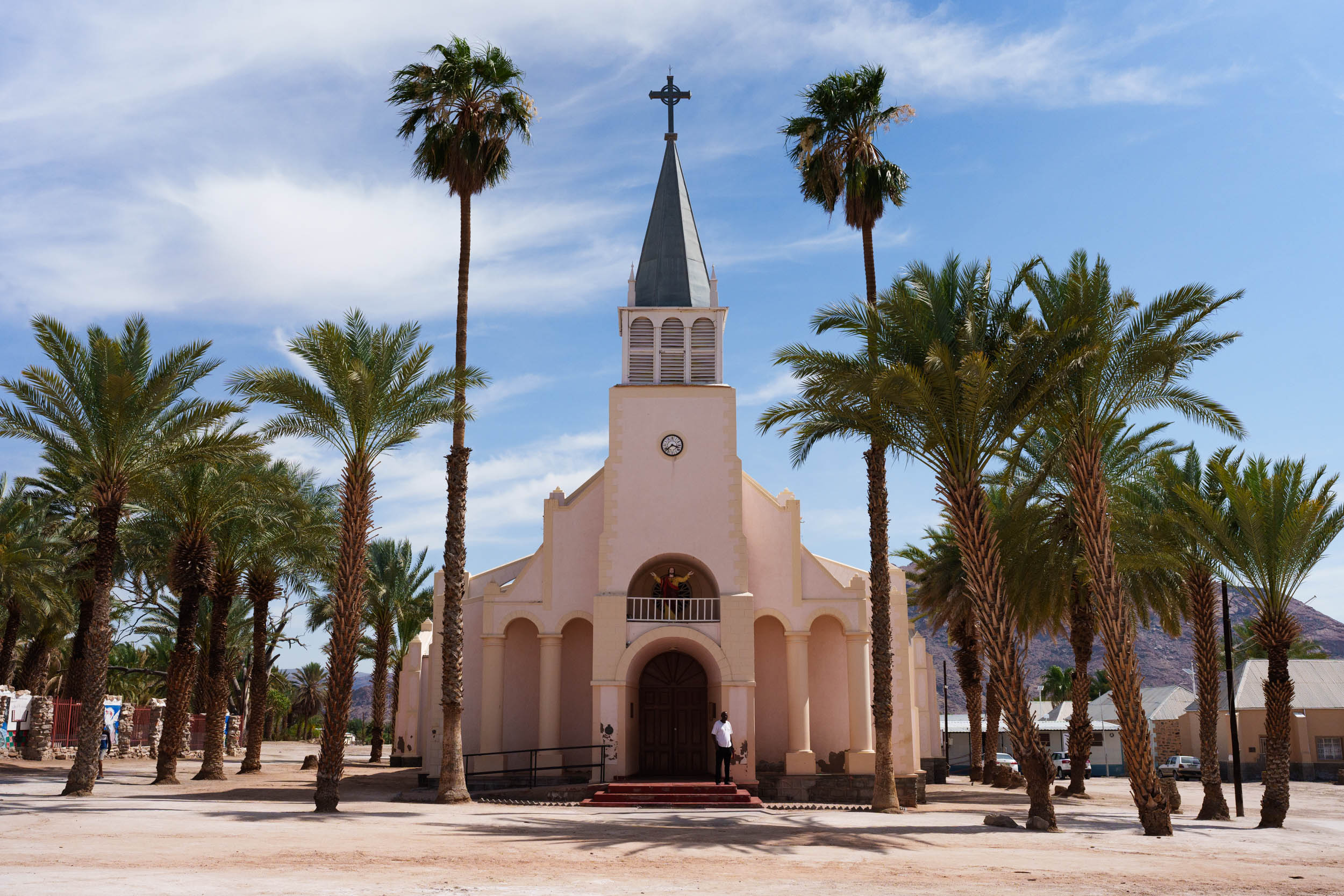
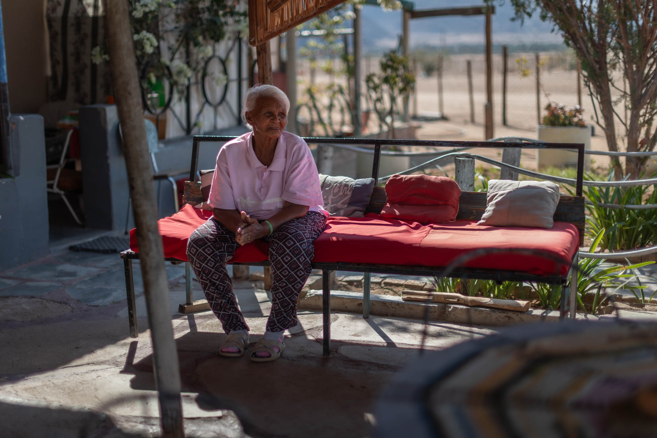
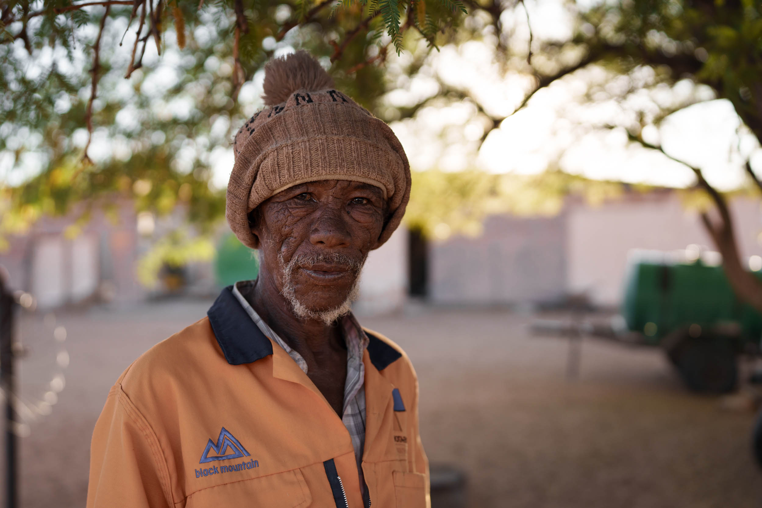
- Remote towns. Some of South Africa’s smallest, most remote, and most forgotten little towns lie along the route. Get to know the locals and delight in the small joys of a possible cold drink or, I dare say, an ice cream.
- People and culture. The Richtersveld is the only place in South Africa where a transhumance pastoral livelihood is still upheld.
- 4×4 Tracks. Take on some of the country’s most thrilling 4×4 tracks, including the infamous Road to Hell pass.
- River camps, Vioolsdrif. Escape the heat and kick back at one of the many great river camps near Vioolsdrif.
- UNESCO World Heritage Site. The Richtersveld community conservancy, directly adjacent to the National Park, is celebrated as a UNESCO World Heritage Site for its unique cultural heritage and botanical significance.
- Richtersveld National Park is widely considered the crown jewel of South Africa’s arid regions. You’ll find rugged mountainscapes, wild desert scenery, remarkable plant life, and endless 4×4 tracks to explore.
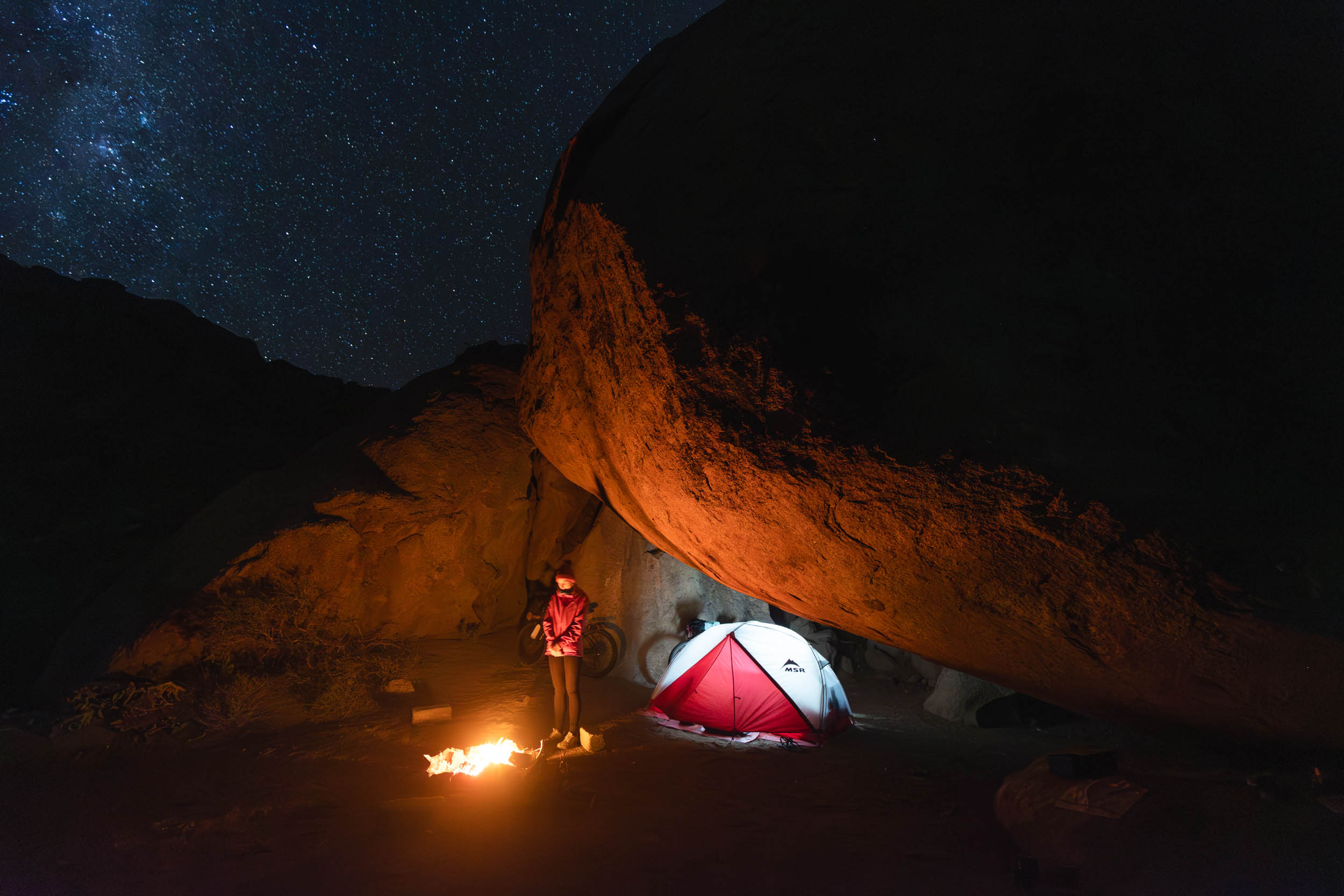
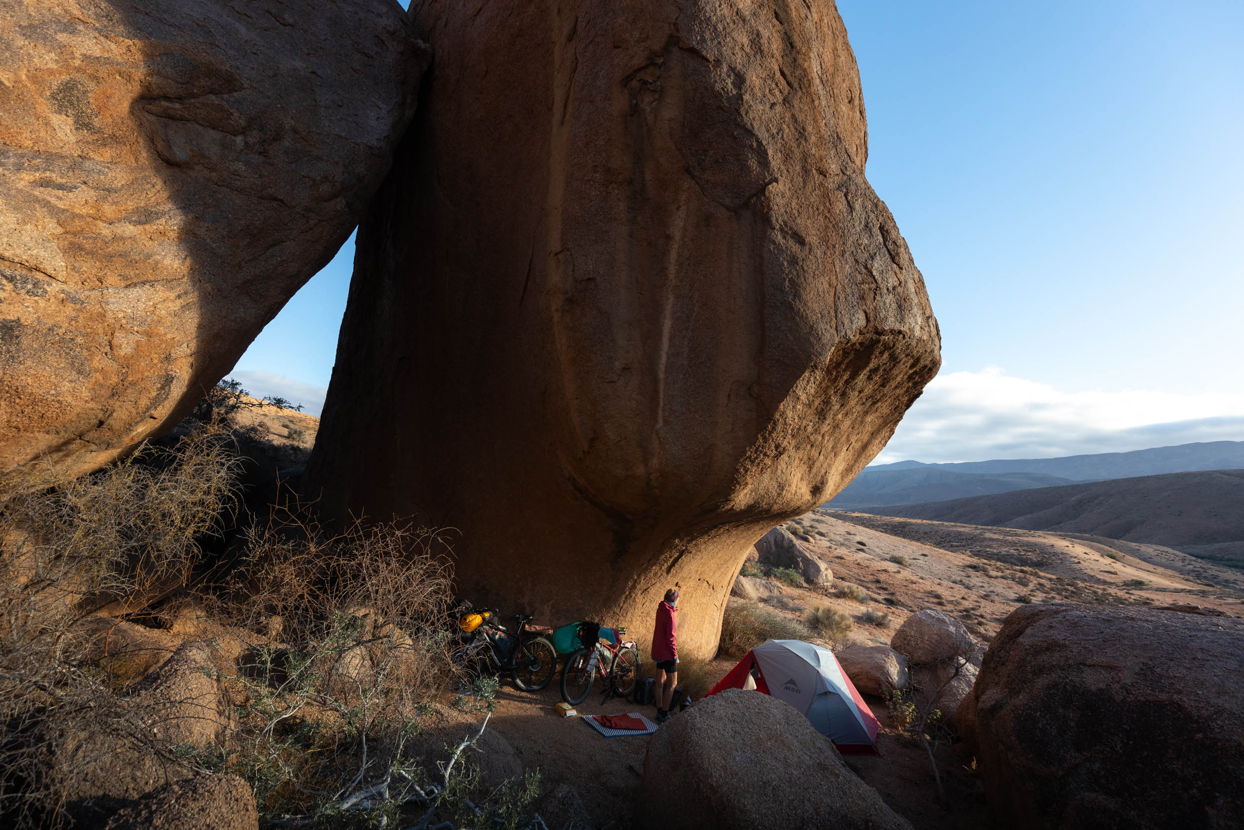
- Wild camping. Some of the finest and most spectacular wild camping opportunities in all of South Africa. River meadows, caves, open plains, and everything in between.
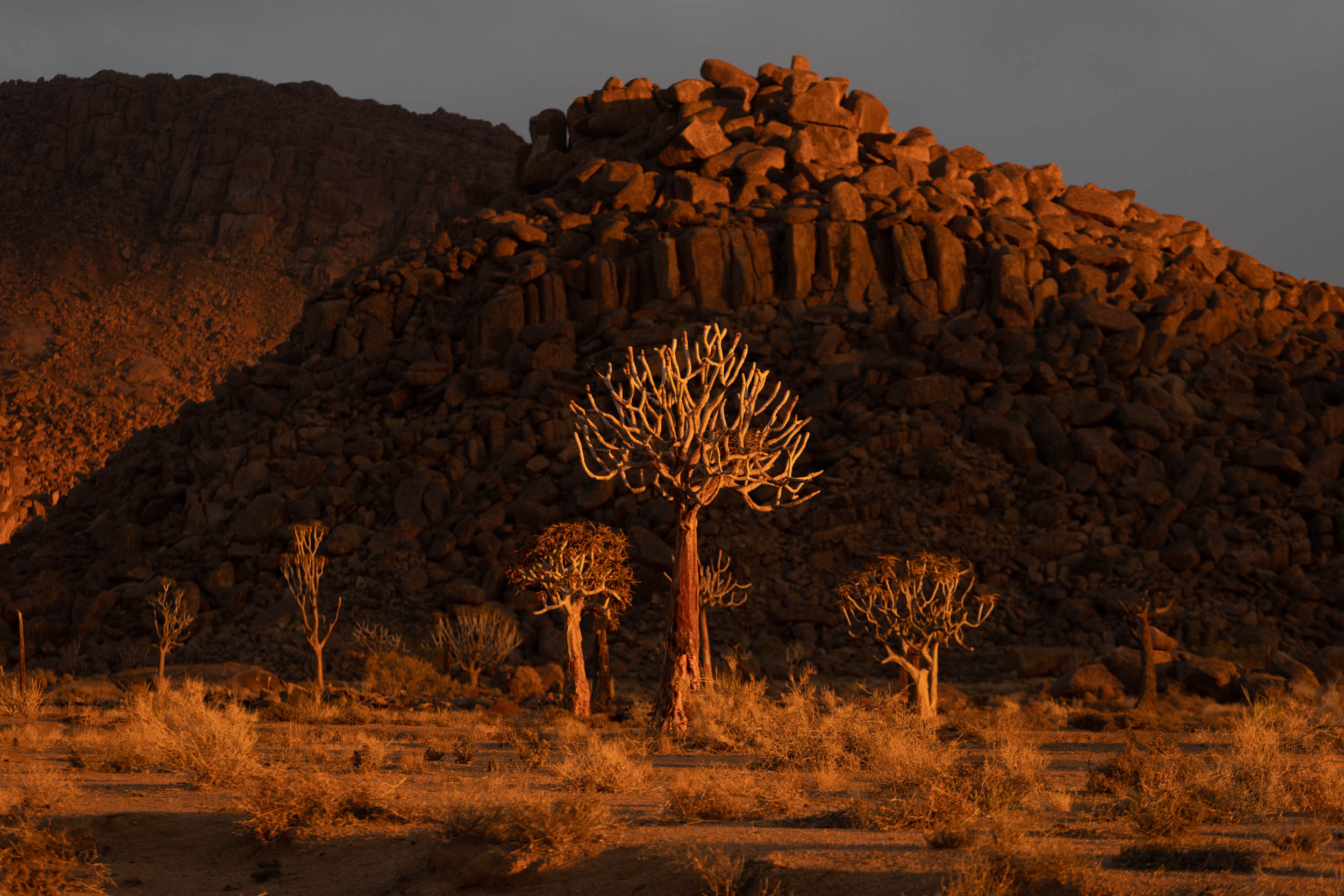
- Flora. The Richtersveld has the highest botanical diversity and endemism rates of any arid region in the world. It truly is a botanical wonder.
When to go
- The best time to go is winter: June to August.
- In summer, and even shoulder seasons, temperatures soar into the mid 40s (Celcius). When it’s that hot, there’s no escaping it. It’s not advised to attempt this segment any time outside of winter.
Logistics
- The segment starts in Springbok. It’s a regional hub and the last major town for at least the next 1,000 kilometres of the SAND route. It has plenty of accommodation options and multiple daily buses to and from other major centres such as Cape Town and Windhoek.
- It ends at the Sendelingsdrift border post, a small border station located at the far end of the Richtersveld National Park, doubling as the park’s office. There’s a small convenience store there, plus a camp site and staff housing, but nothing else, really, and no real transportation options either, apart from possibly getting a ride with other park visitors. Practically speaking, Sendelingsdrift is thus only a useful endpoint for riders intending to continue further north on the SAND route and into Namibia. With that said, the national park, and Sendelingsdrif by implication, is an essential component of this segment and one of the standout highlights of the whole SAND bikepacking route.
- Riders who wish to do the segment as a standalone segment should not feel discouraged or dismayed by the remoteness of this end point. In the Trail Notes, we offer recommendations and alternative endpoints to make it more suitable as a segment on its own. But all of the recommended options still include a visit to the park.
Park fees and permits
Permits are required for the following parks and nature reserves:
- Richtersveld National Park: Permits are issued at the Sendelingsdrif park office.
- The Namaqua 4×4 Eco Trail: This is a bit of a grey area. Technically, there is a fee for using the trail, but this route only takes in short sections of it. Moreover, it being a 4WD trail, cyclists are not technically considered trail users. Indeed, cycling is a very uncommon sight in these parts. As things stand, you may be requested to pay a fee at Klein Pella, but most likely not. For reference, I was not requested to pay on either of the two occasions I passed through there (two years apart).
- The Richtersveld Community Conservancy (UNESCO Site): The Richtersveld Nature Reserve consists of two parts: the national park and the community conservancy, which is also the UNESCO site. For the park section (see above), entry permits are compulsory, but the community conservancy portion is another grey area. There is supposed to be a fee for using conservancy facilities such as campsites. However, at the time of visiting, most campsites were unmanned and in a state of neglect. We treated these sites as wild camping sites and encountered several other visitors who did the same.
Private Land and Access
- The roads on this segment are all publicly accessible. No special permission is needed apart from the permits mentioned above. In fact, much of the segment is on community land where movement is not monitored or restricted in any way.
- Farm Gates: Where the route passes through working farms and private property, it does so on publicly accessible servitude roads. All gates on such roads are supposed to be kept unlocked. If you do encounter a locked gate, try to get permission before continuing. Please report locked gates to us. As usual, close all gates that were found closed and leave open those that were found open.
- Riding direction: This segment can be done in any direction. However, logistically, it would be better to do it from south to north (Springbok to border). This is because Springbok has excellent resupply facilities, whereas further along the route, food choice is limited.
Dangers and Animals
- Safety: Crime is notorious throughout South Africa, but if there’s one place in the country that is as good as crime-free, it’s the Richtersveld. With that said, aways still keep a close eye on your valuables when entering towns.
- Baboons inhabit the region’s mountains and “koppies.” Encounters with Baboons are quite common and usually without incident. However, they are territorial and dangerous and should not be toyed with or fed. I’ve personally had my most harrowing encounters with baboons in the Richtersveld.
- There are several species of venomous snakes throughout the region. The most notable ones to look out for are the Black Spitting Cobra and the Puffadder.
- Wear closed footwear at night. And if sleeping outside, check your sleeping bag for scorpions. Scorpions are common in Richtersveld; some of them are very venomous.
Annoyances
- The number one annoyance is midges, or ‘miggies,” especially in the vicinity of the Orange River. A face net could come in handy, but a buff and sunglasses is also fine.
- Parts of the route are also extremely dusty. Carry enough chain lube and a rag for cleaning.
- Thorn trees thrive alongside the river. Make sure to have plenty of sealant in your wheels!
Travel basics
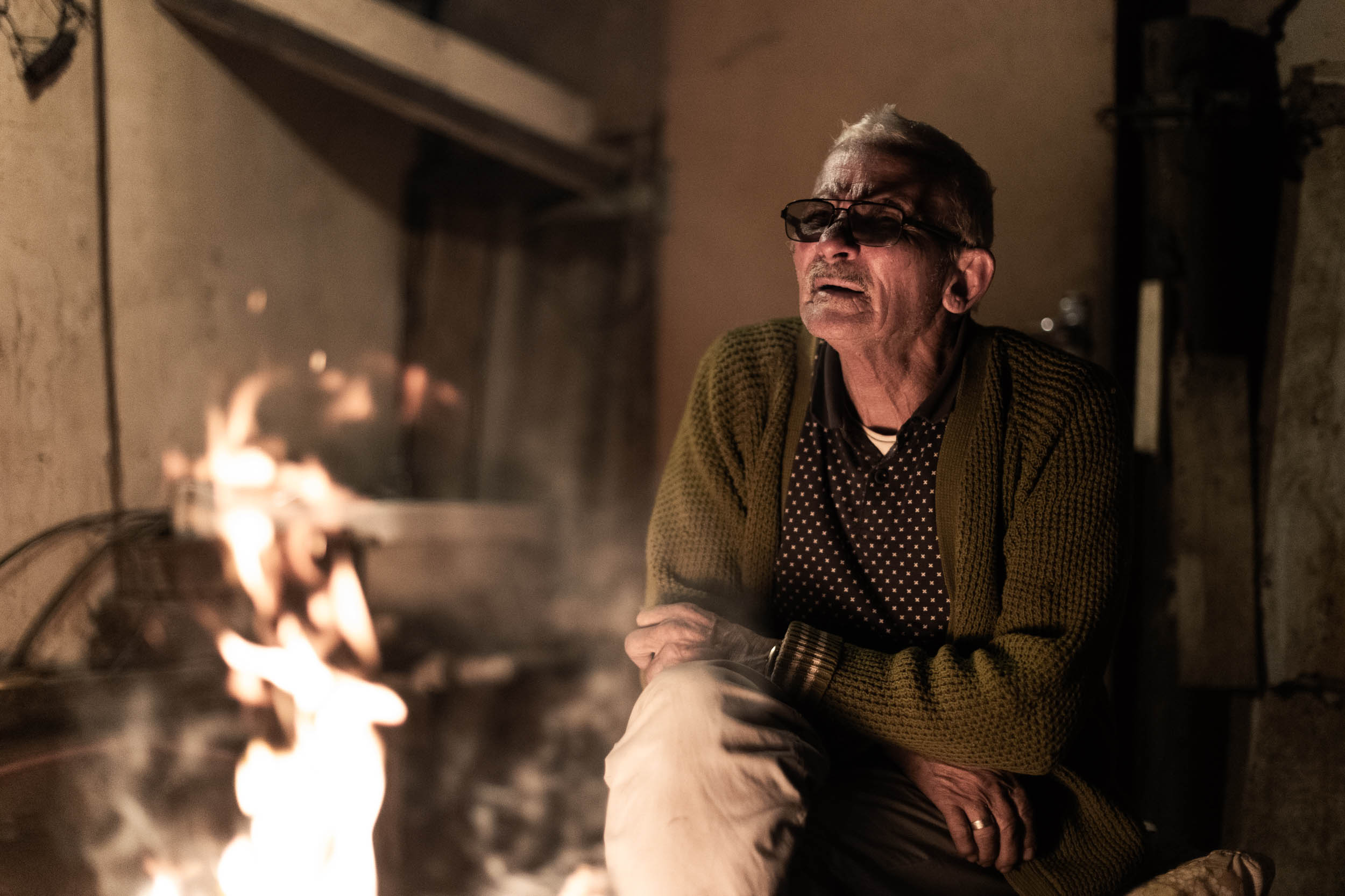
- Language: The prevailing language spoken in these parts is Afrikaans, albeit in a distinct local dialect. English is not as widespread as elsewhere in the country, but most people know some basics, and someone with good command of the language can usually be found.
- In the small town of Koeboes, you may hear people speaking in the Nama language. It’s one of the last remaining places in South Africa where the language is still spoken, but even here, Afrikaans has become more prevalent.
- Lay of the Land: The Richtersveld region is technically still in Namaqualand, the ancestral home of the Nama people. The Nama people are the largest remaining ethnic group descending from the Khoekhoe people, Southern Africa’s earliest pastoralist tribe. Nama people still occupy large areas of land in desertous Southern Africa, including Namaqualand, although here, for the most part, people are of mixed ethnicity. Accordingly, the Nama language, or Khoekoegowab, has sadly been all but lost to the region. With that said, traces of the language still persist throughout the area, from place names to regional colloquial terms used in everyday speech. Further north, in Namibia, the Nama language, in its original form, is more widely spoken.
- Money: Cards (Visa or Mastercard) are widely accepted for payment, but some small stores may prefer cash payments, especially during power cuts. Card payment is accepted at the Richtersveld park office.
- Cellphone: Generally, there’s little to no connectivity outside of larger towns. There is wifi at Klein Pella and at most campsites in Vioolsdrift, but nowhere else.
- Most South Africans use Whatsapp for messaging and calls. The country code is +27.
- Vodacom generally has the best network coverage in these parts.
Bike Info
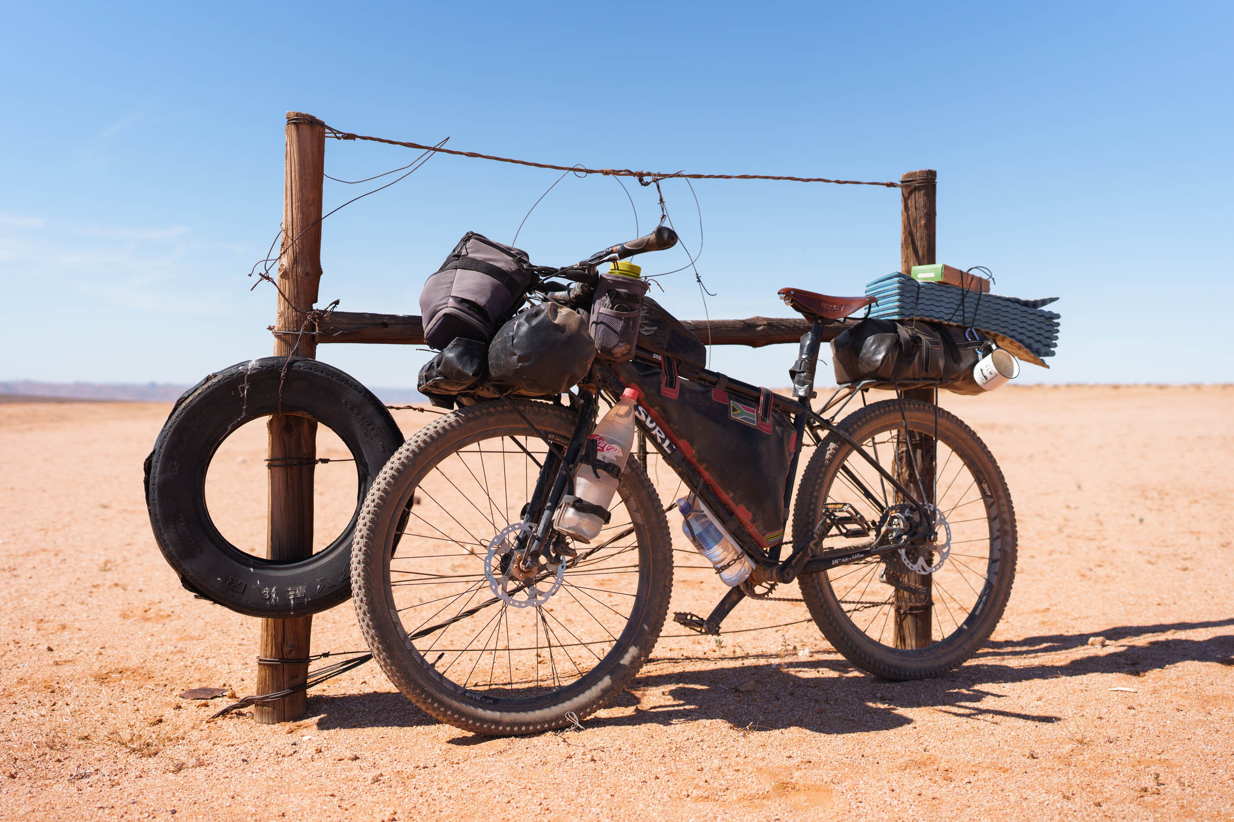
- What Bike? A capable ATB or MTB with wide, tubeless tyres. The wider, the better.
- It is possible to get through the segment on something racier, but you’ll have to skip some of the burlier sections. Refer to the Trail Notes for suggestions.
- Bike Shops: The region’s one and only bike shop is in Springbok, run by “Piet Fiets,” as the owner is locally known. It’s a basic shop catering mostly for 26ers and V-brakes, but if you’re lucky, you can find some more sophisticated parts there. But don’t count on it.
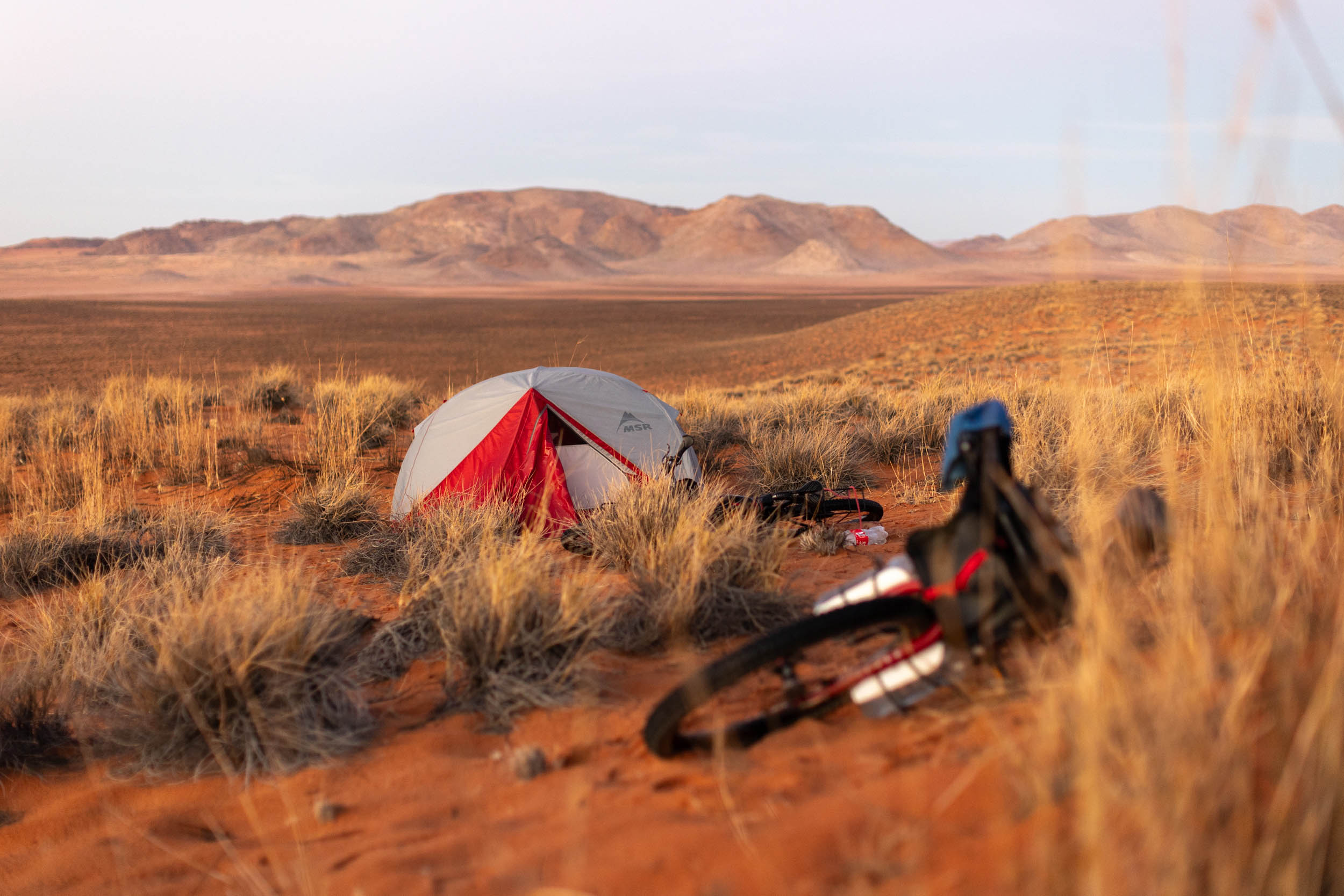
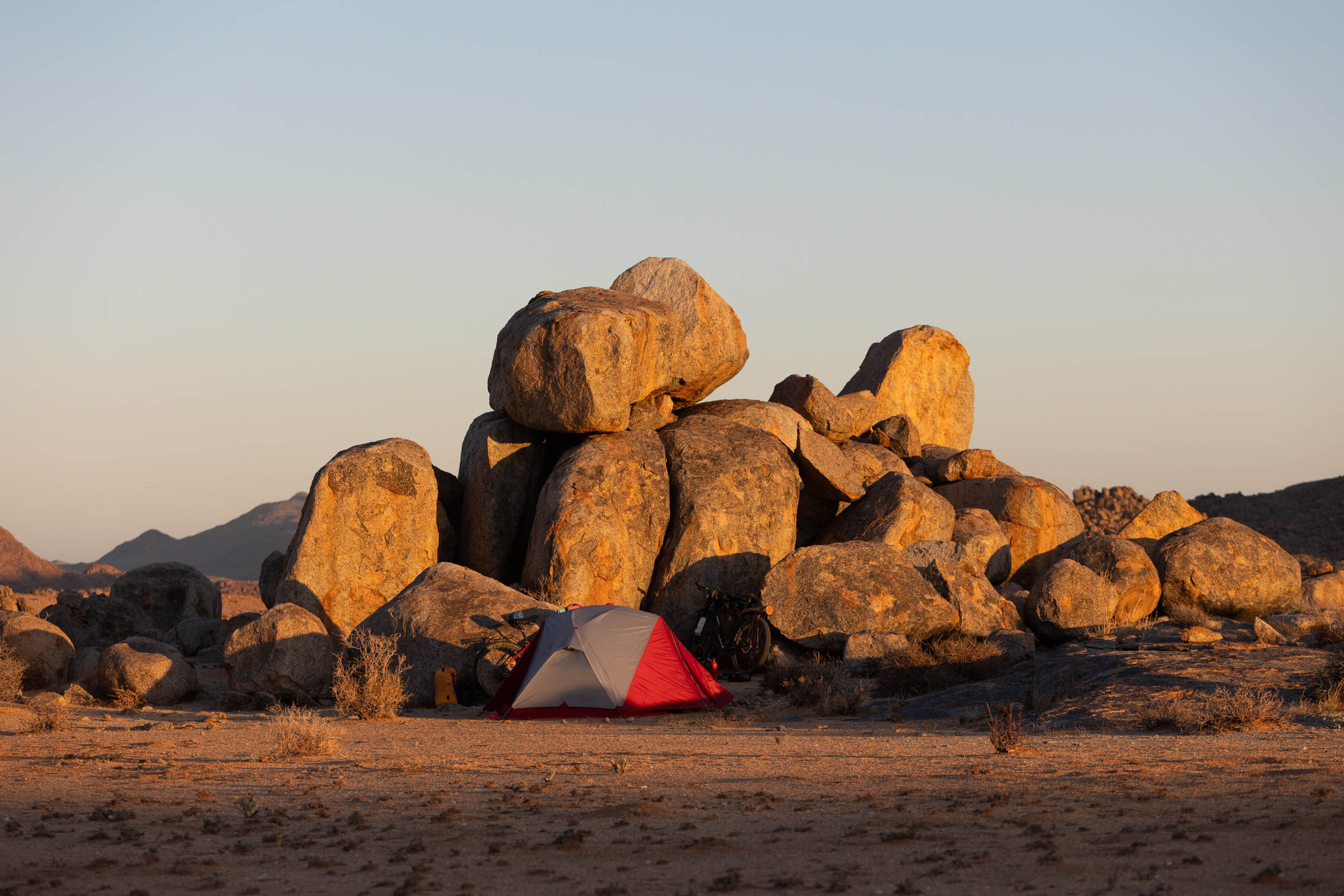
- With the exception of one or two possible guest houses (Klein Pella and Vioolsdrif), this segment mostly demands camping, especially wild camping.
- A tent is recommended to protect against insects and crawlers, more than anything else.
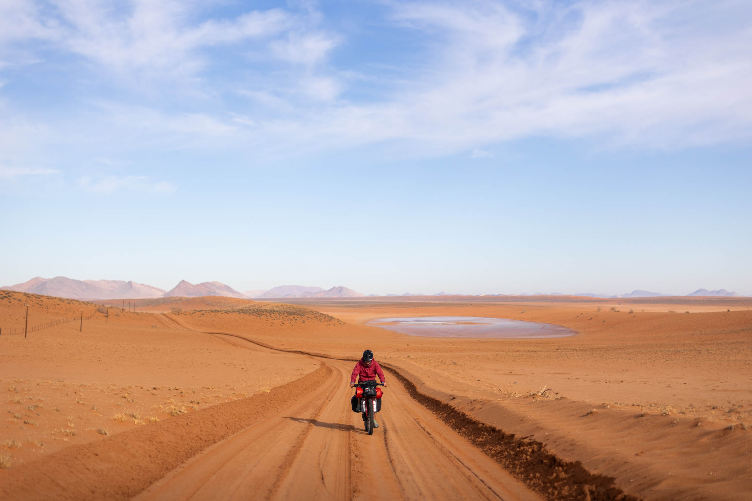
Water
Water management is critical in this segment. Here are some guidelines:
- Recommended carrying capacity: Minimum 6-8 litres.
- Critical refill opportunities are indicated on the GPX.
- Fill up at every opportunity.
- Farms are few and far between and cannot be relied on for water.
- Water can be taken from the Orange River, but it needs to be treated/filtered. Moreover, the river is hard to access most times, even when it appears temptingly close. Prominent river access spots are shown on the GPX.
- The region’s ground water has a strong mineral taste, often salty. It’s recommended to carry some juice powder to improve the taste.
- Stop cars if needed. Most drivers carry a bottle or two and will be happy to help. With that said, on some sections, you could go days without seeing a car.
Food
- All critical food resupply options are indicated on the GPX.
- Most towns and villages have at least one little convenience store.
- Take note that most of the shops in the region are closed on Sundays. They also close early on most Saturdays. Plan accordingly.
Local Food
Local meals are mostly a simple affair consisting of some sort of gravy and rice. In fact, with its exceptionally small population, the region really lacks any distinct local cuisine. However, with some luck, the usual specialities of the greater Namaqualand can still be found:
- “Biltong,” (dried meat strips) and “Droewors” (dried “boerewors” sausages)
- “Roosterkoek,” a bread roll cooked on an open fire and typically filled with apricot jam and cheese.
- “Braai” is a famous South African style barbeque.
The segment can be split roughly into three parts: Boesmanland, the river, and the Richtersveld.
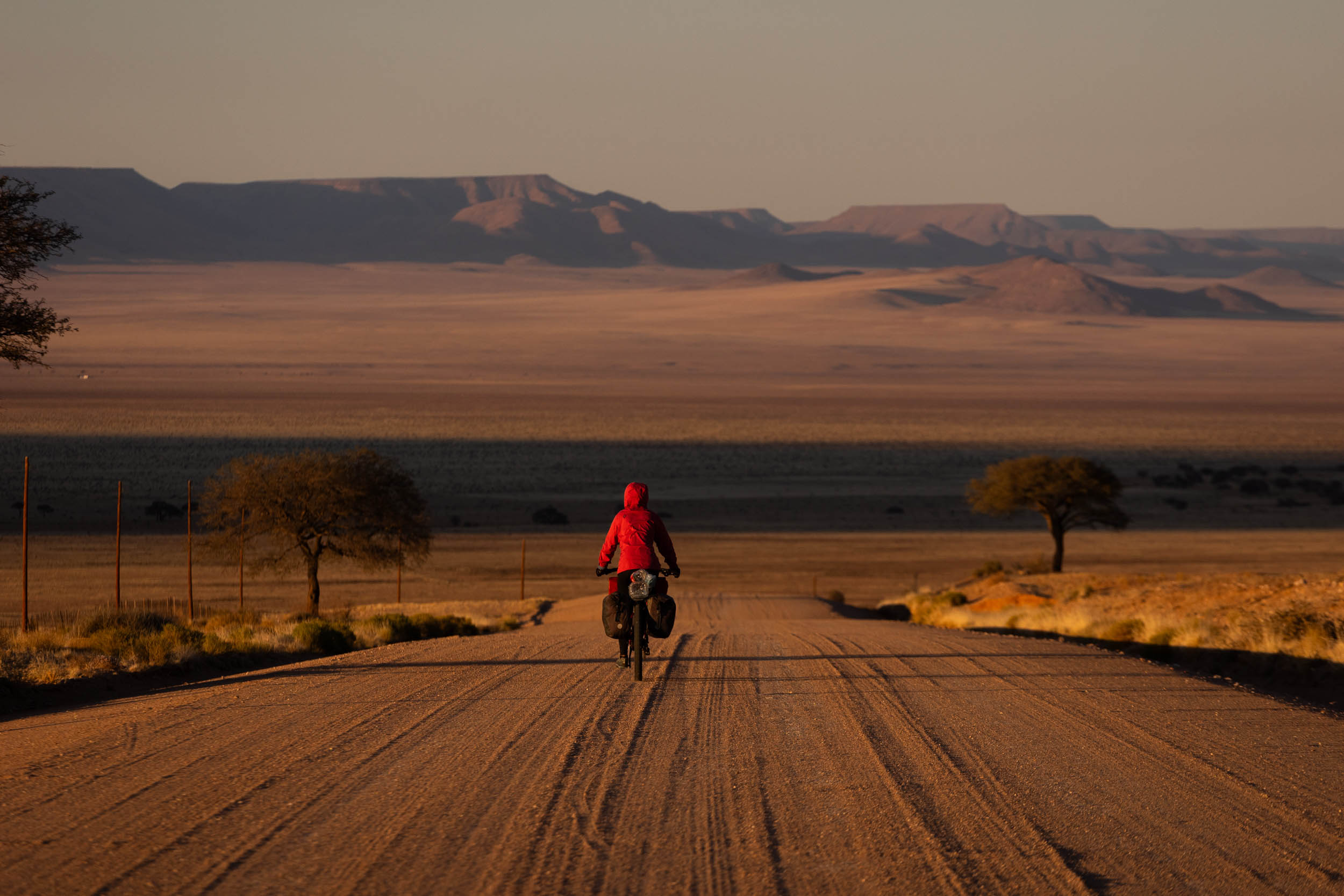
Boesmanland: Springbok to Pella
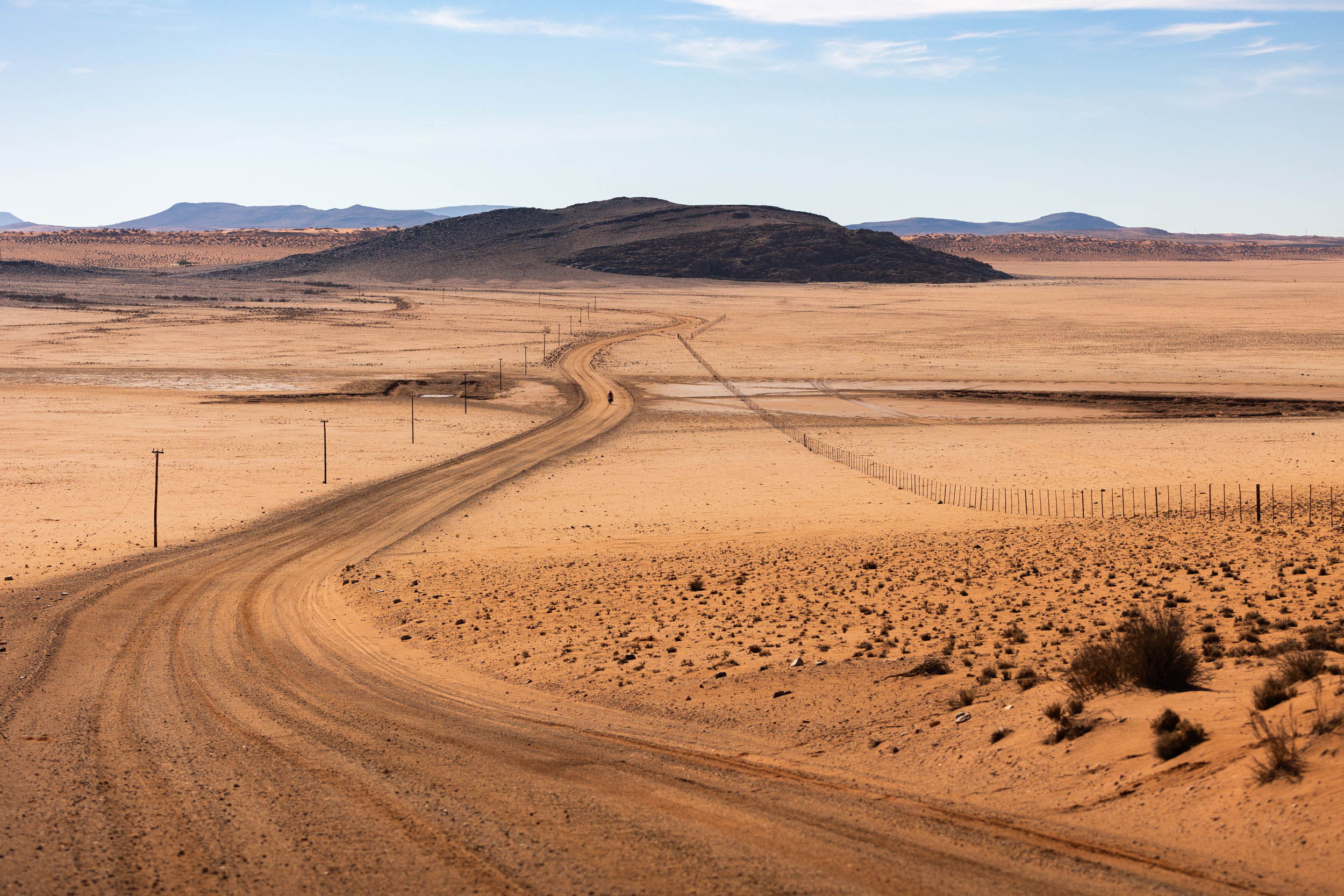
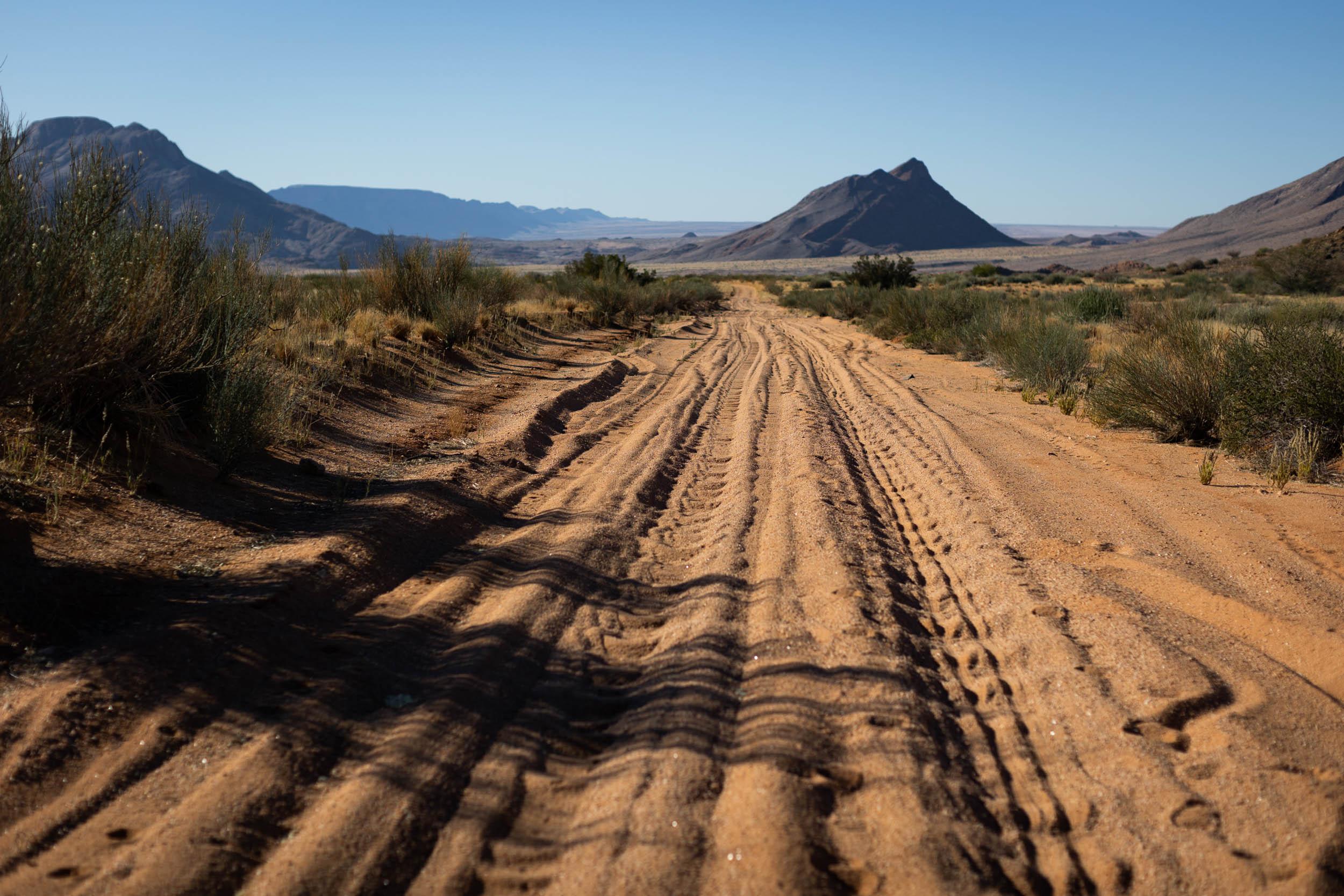
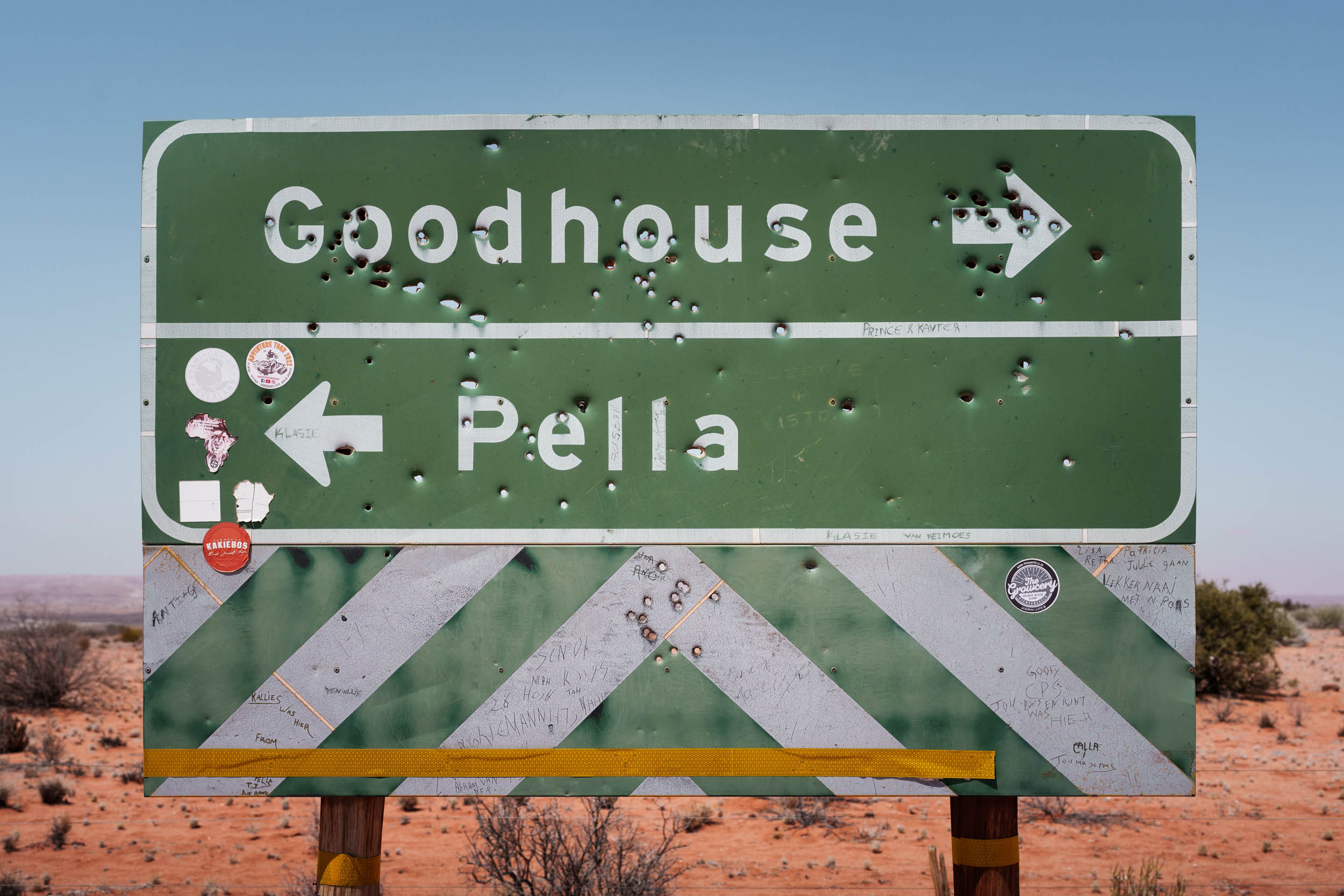
A gravel road begins just outside Springbok, connecting to Goodhouse on the banks of the Orange River, before winding its way eastward to Pella. It’s the main road serving several small river settlements, yet it’s terribly corrugated and sees very little traffic.
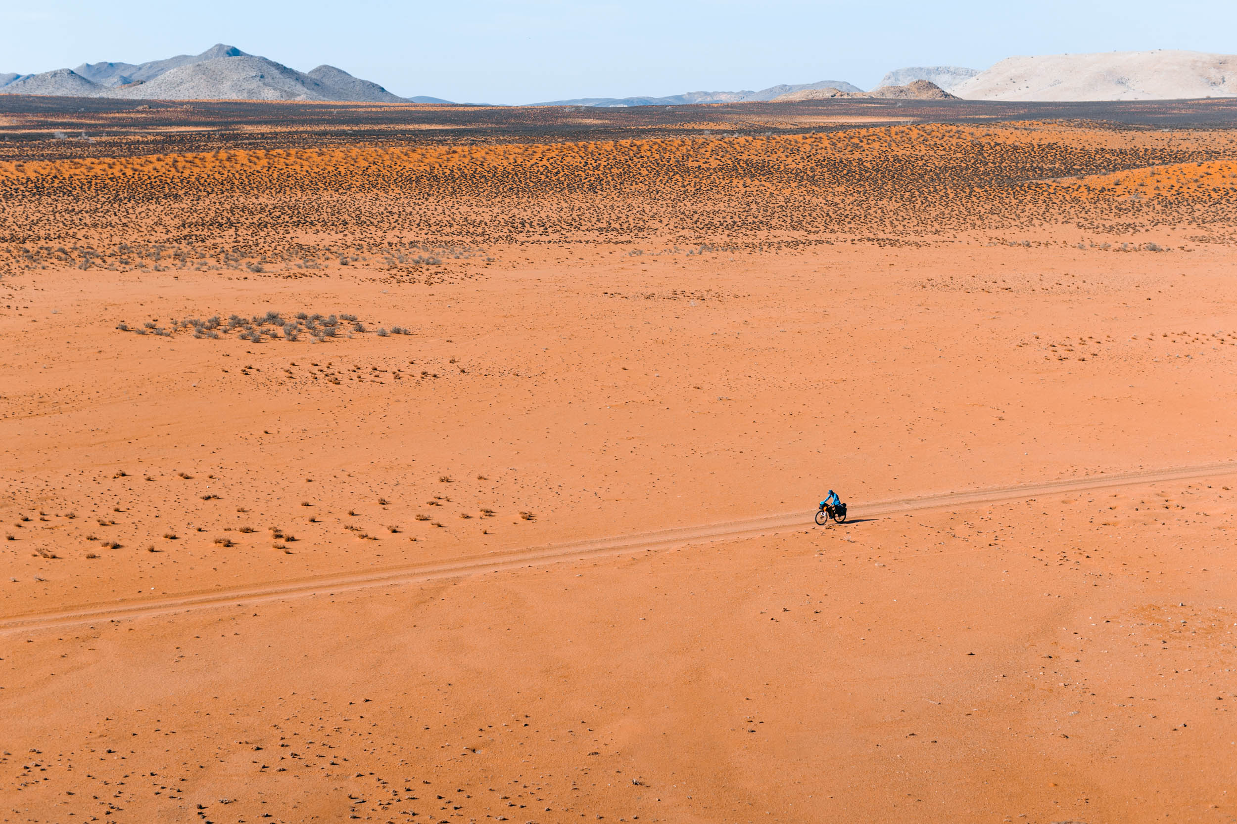
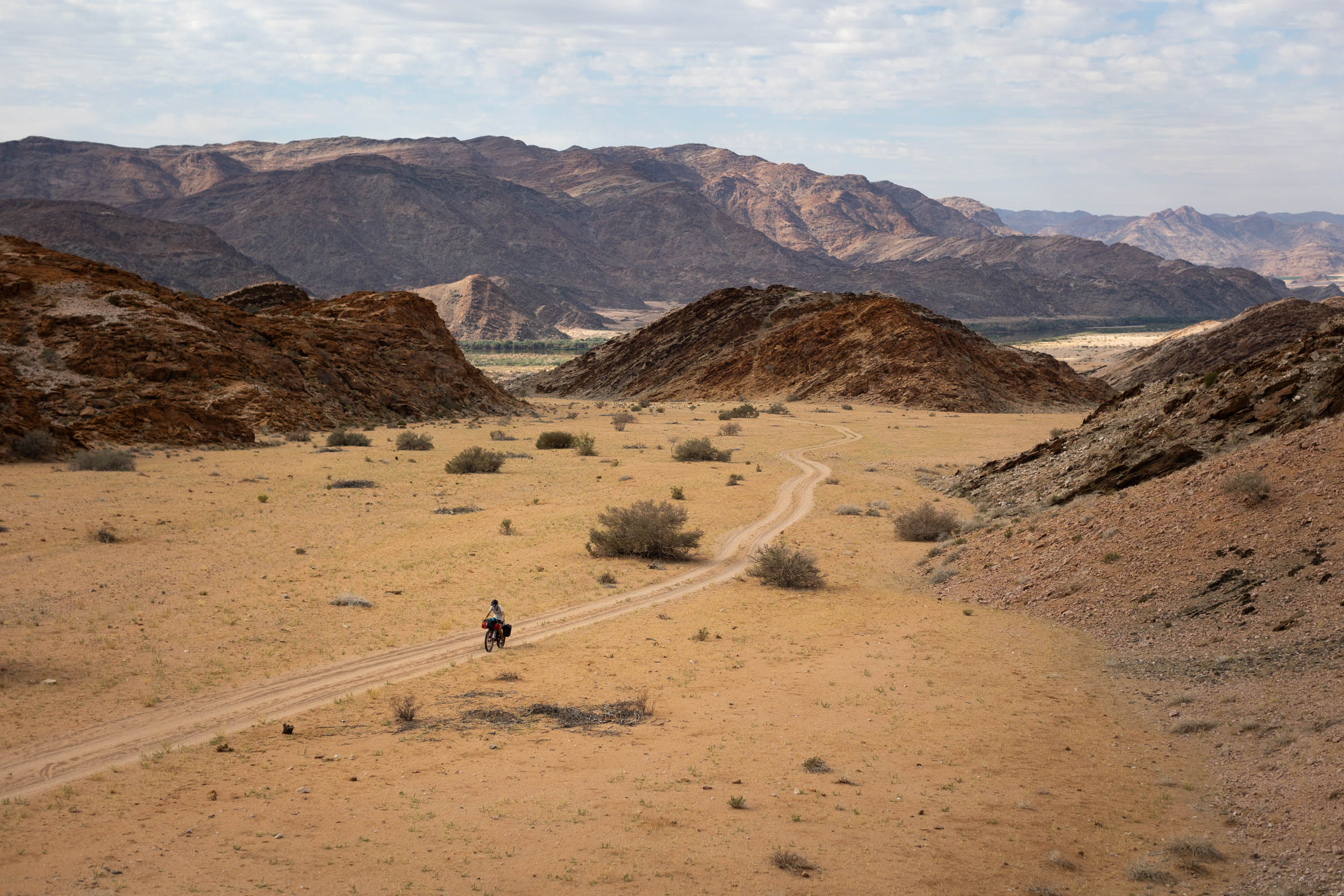
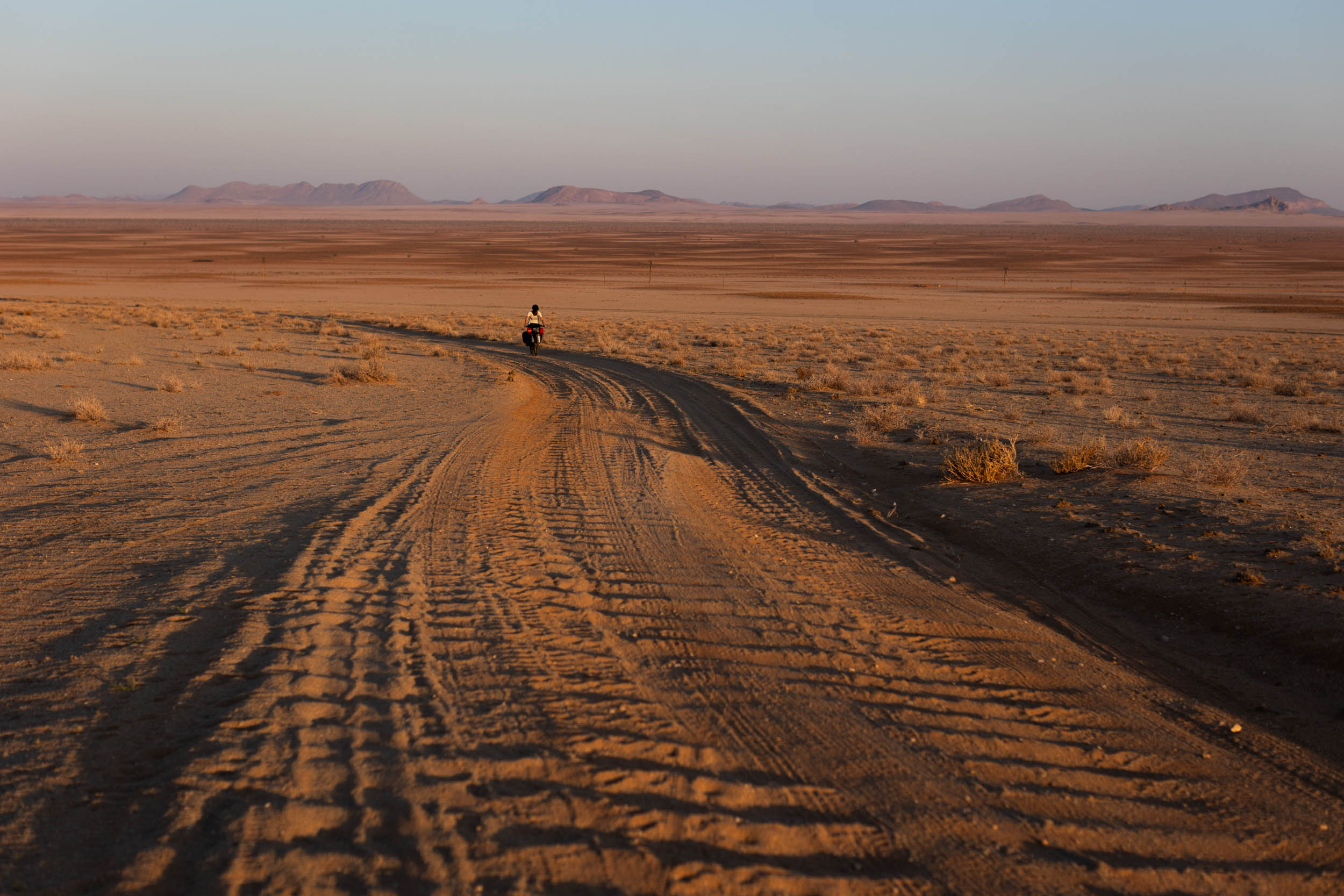
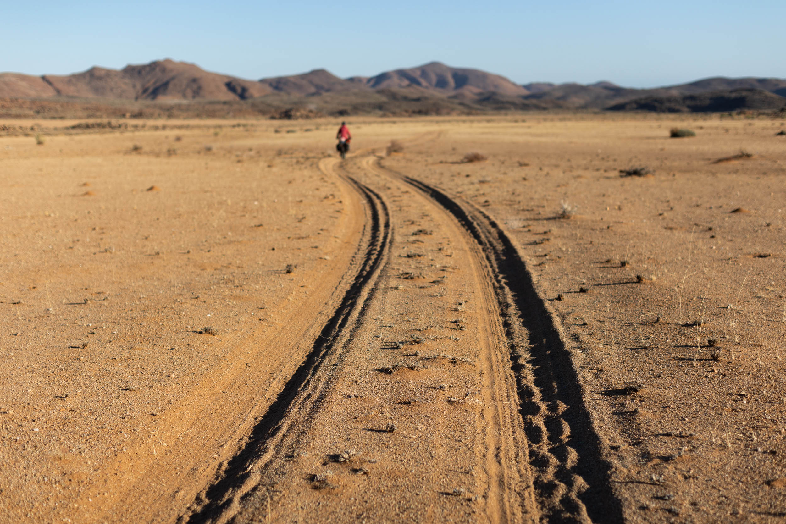
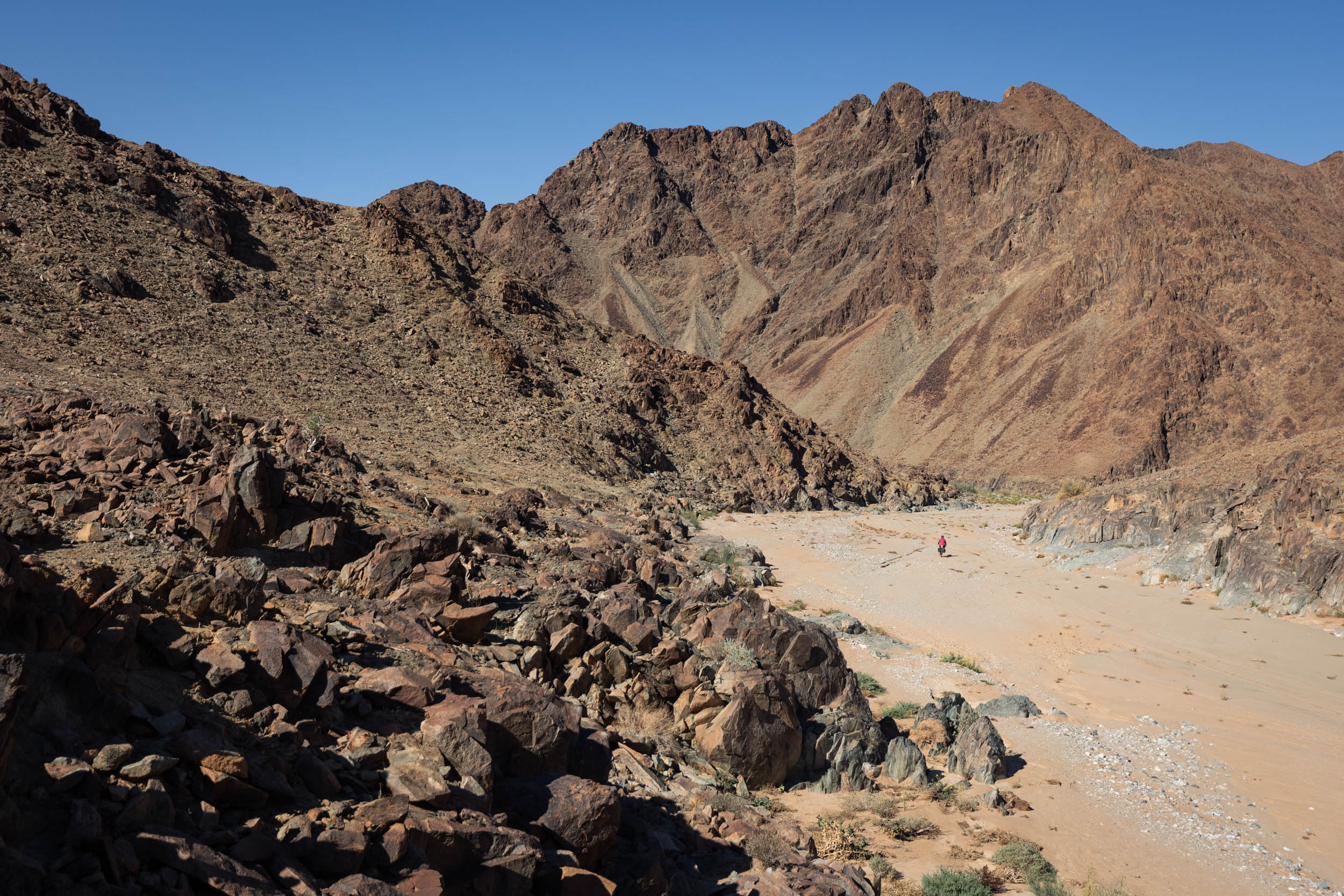
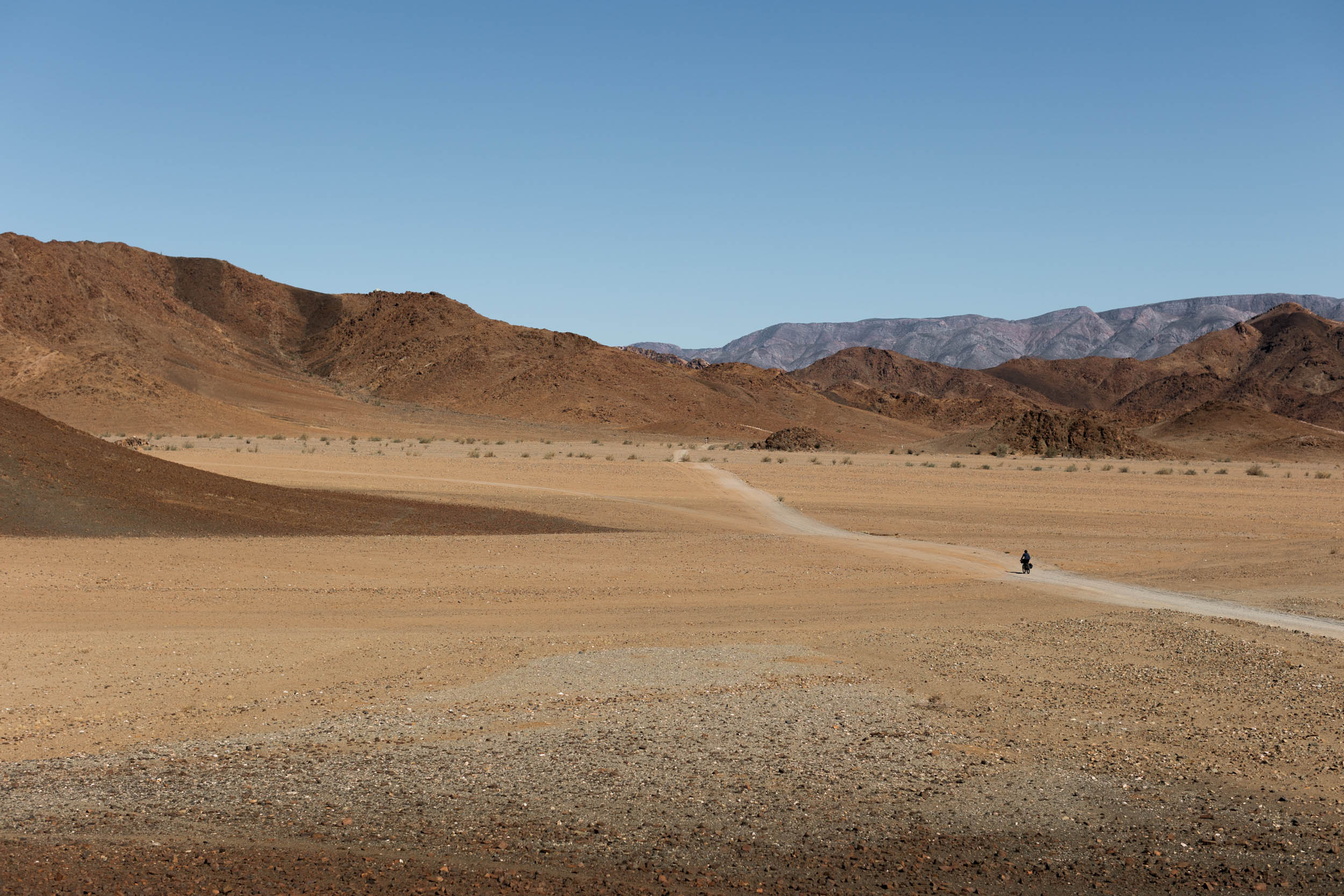
The segment starts on this gravel road and continues north for some 60 kilometres before turning off onto smaller desert tracks that head directly into barren expanses of desert to the east. The next 70 or so kilometers are on mostly sandy doubletracks where the going is slow. It’s very remote, extremely barren, and water is scarce. The reward is incredible scenery with vast orange planes and contrasting black koppies.
A note regarding the name, Boesmanland. Boesmanland means bushman land. The term bushman is sometimes considered a derogatory term in South African context, but it still persists in place names throughout the country. I ascertained from various sources that there are no other alternative recognised names for this particular region. Boesmandland, it seems, is widely accepted and embraced locally. However, it’s important to approach its usage with caution and awareness of its potential to be offensive.
The River: Pella to Vioolsdrift
After crossing through Boesmanland, you arrive back on the Goodhouse-Pella road. From here, the route does a short out-and-back into a circuit that connects Pella, Klein Pella, and the river. We refer to it here as the Pella Loop. It includes a lovely bit of riding with incredible river scenery and much-needed food and water stops at Pella and Klein Pella. The loop is best done in a clockwise direction, descending to Klein Pella first. This ensures quicker access to water and an easy descent through the worst of the sand. After completing the loop, you return again, but for the last time, on the Goodhouse-Pella gravel road, this time heading west towards where the Eco Trail splits off again.
Much of this section, including the Pella Loop, coincides with the Namakwa 4×4 Eco Trail, an established 4×4 route that stretches between Pella and Alexander Bay.
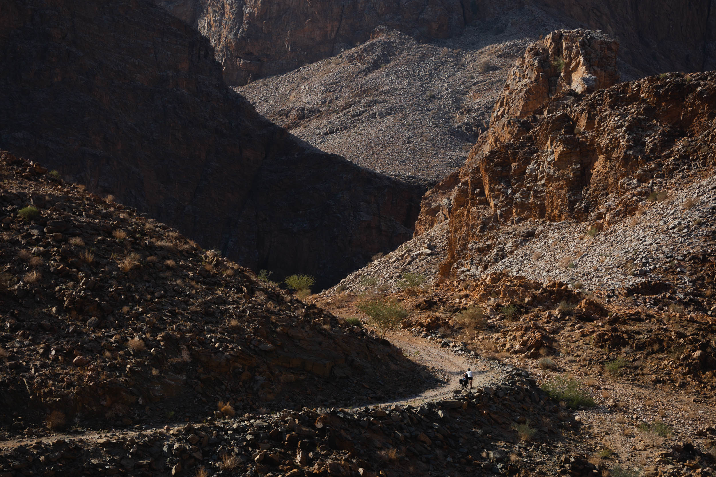
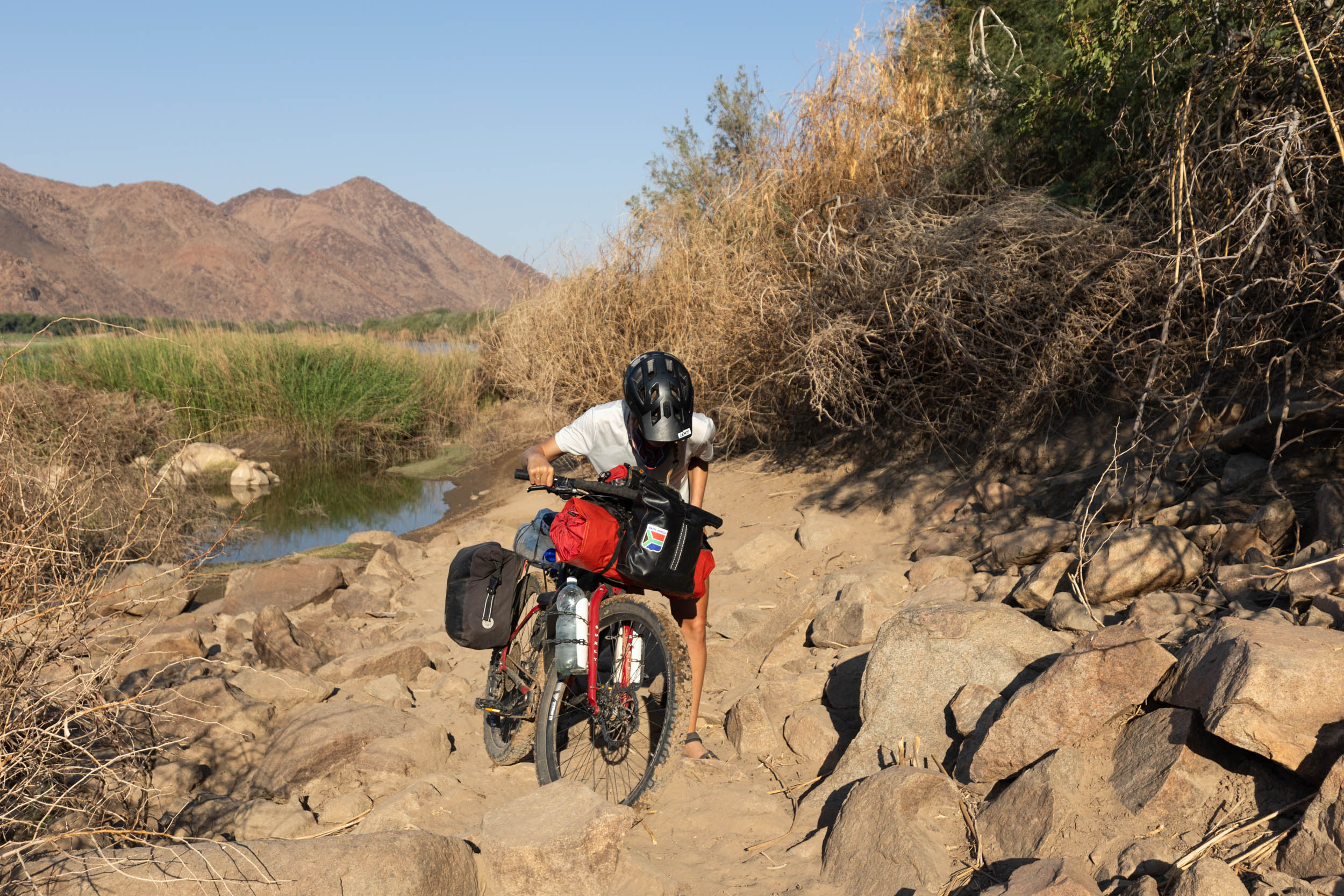
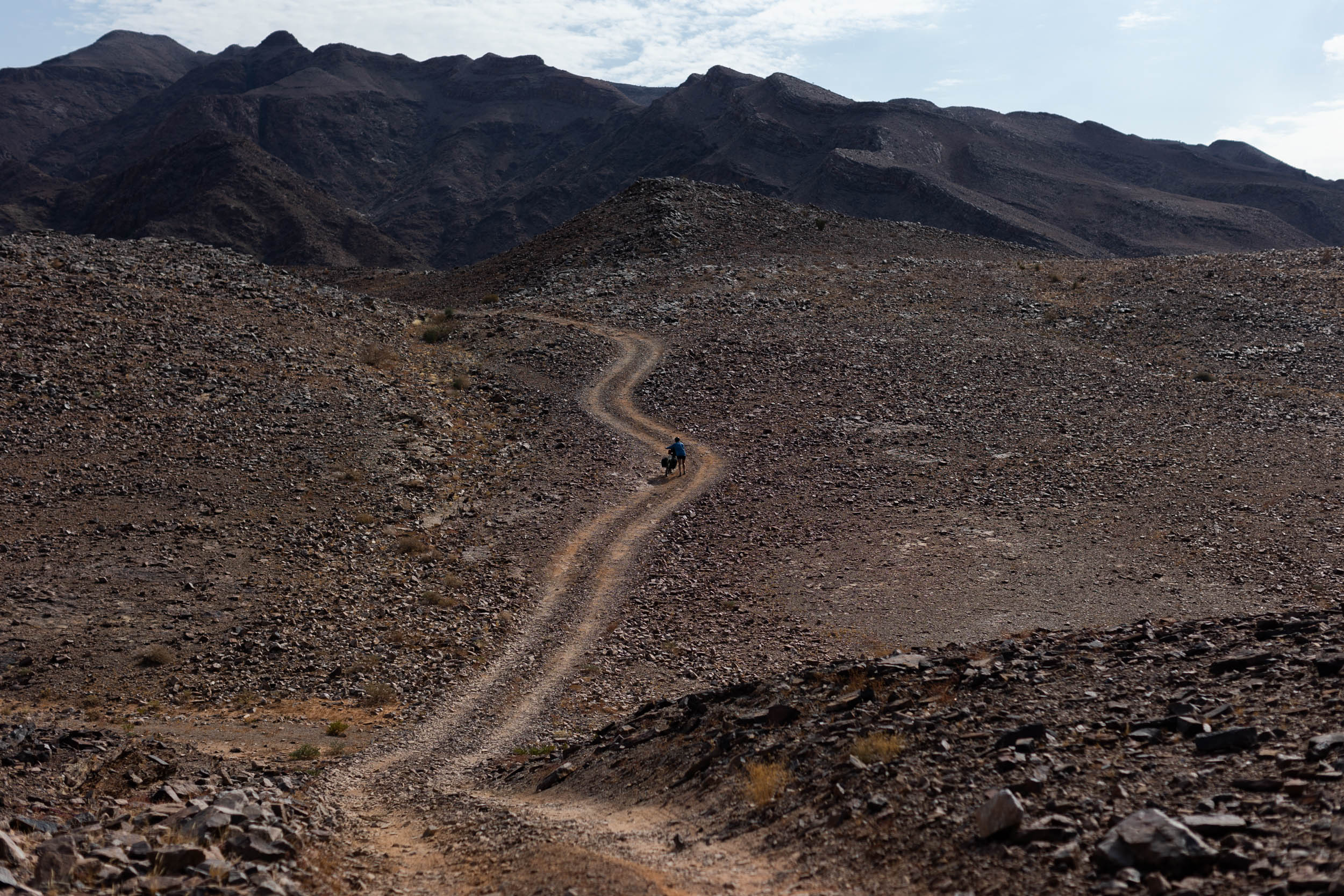
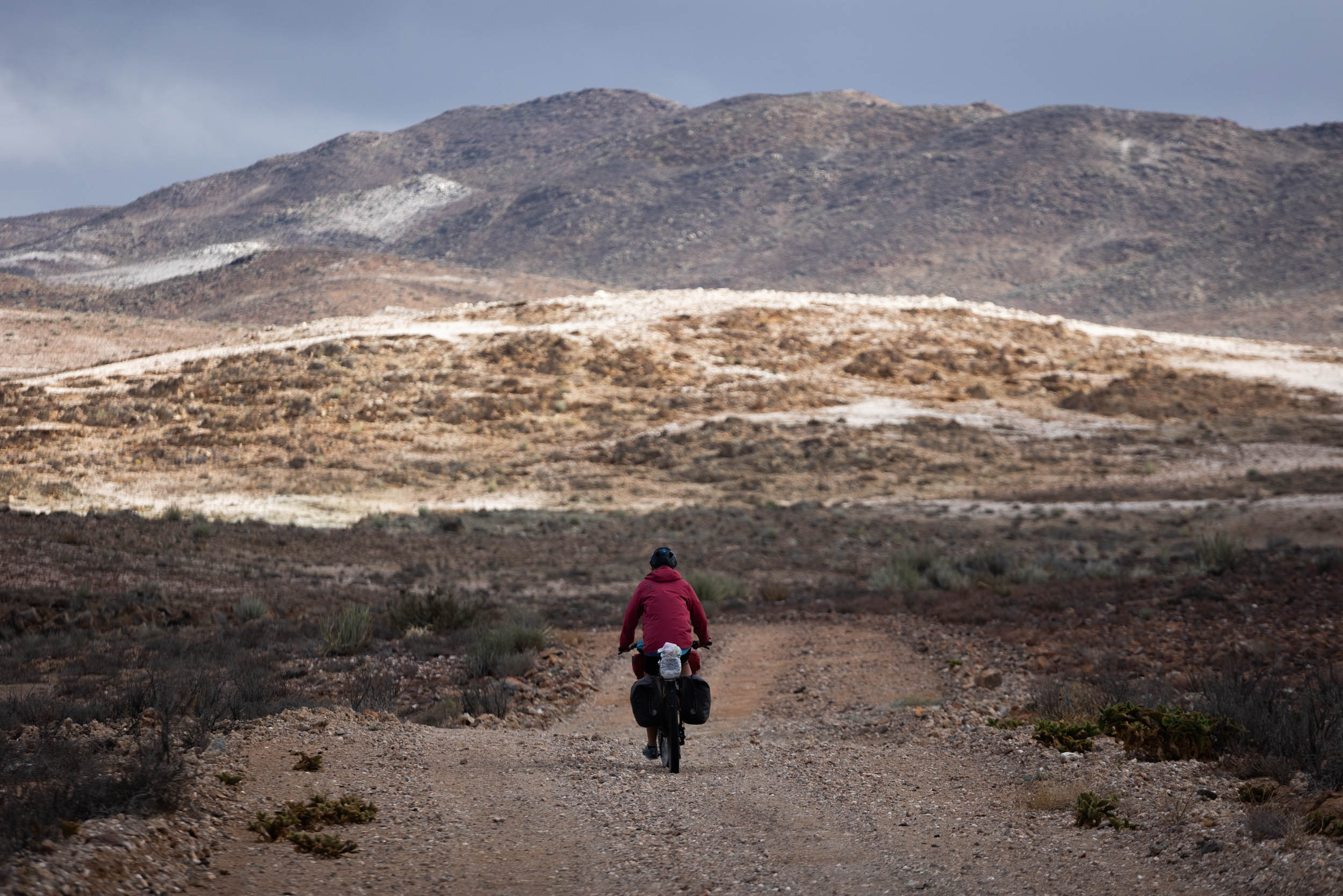
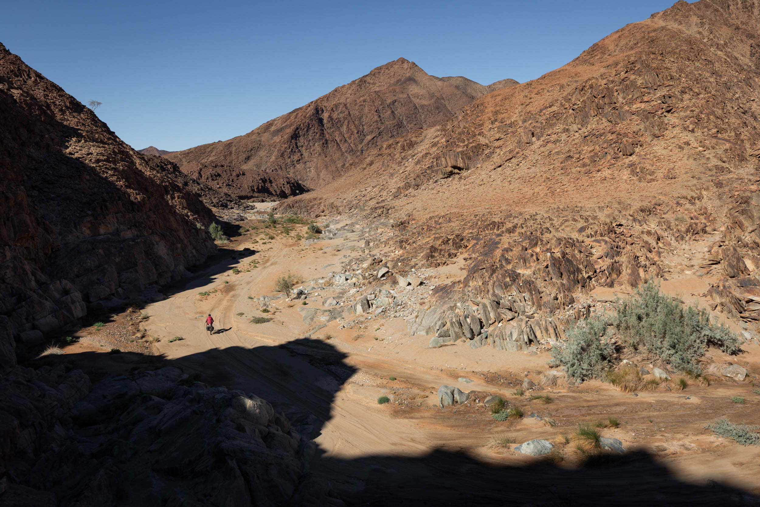
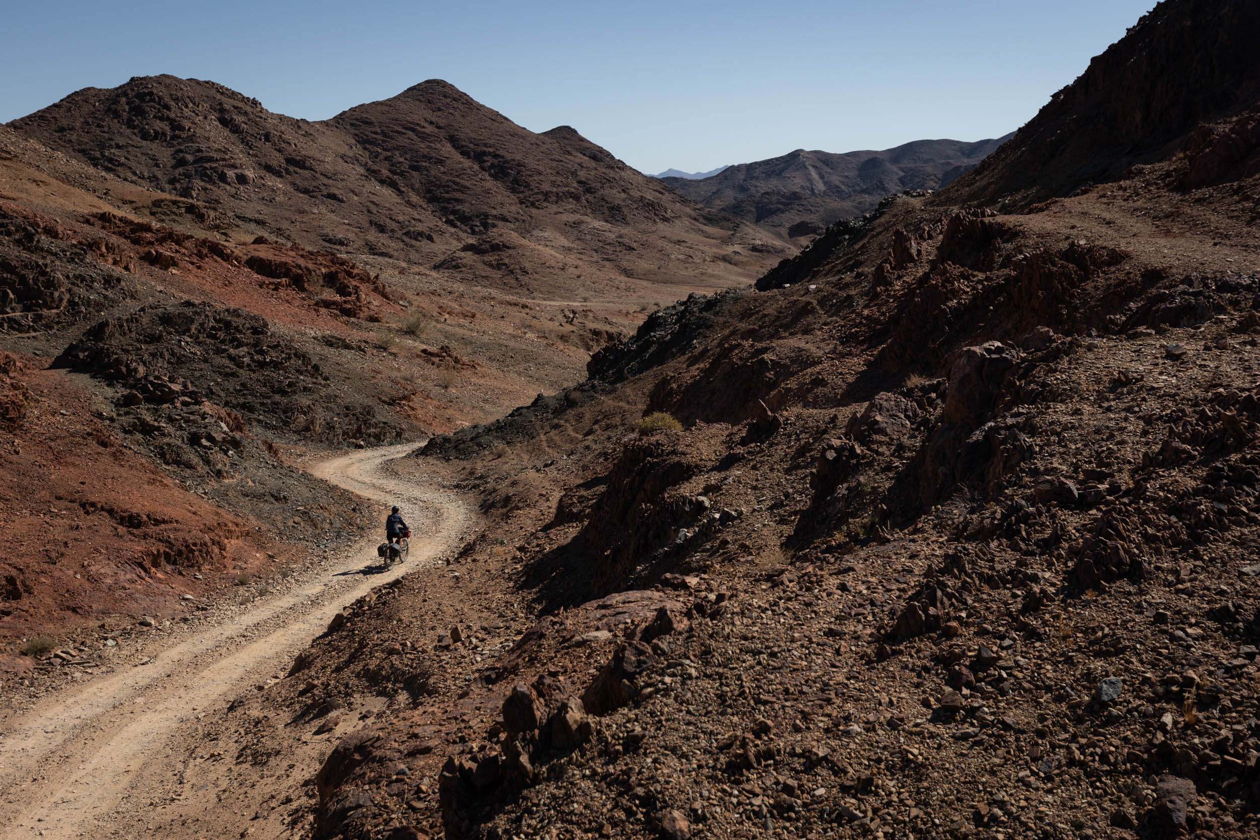
The stretch that follows is probably the meat of the segment, a combination of rough and sandy doubletracks—sometimes, no tracks at all—that more or less follows the river all the way to Vioolsdrif. You’ll pass two small towns (Witbank and Goodhouse) where you can get food and water, but for the most part, the riding is very remote. The scenery here is truly breathtaking.
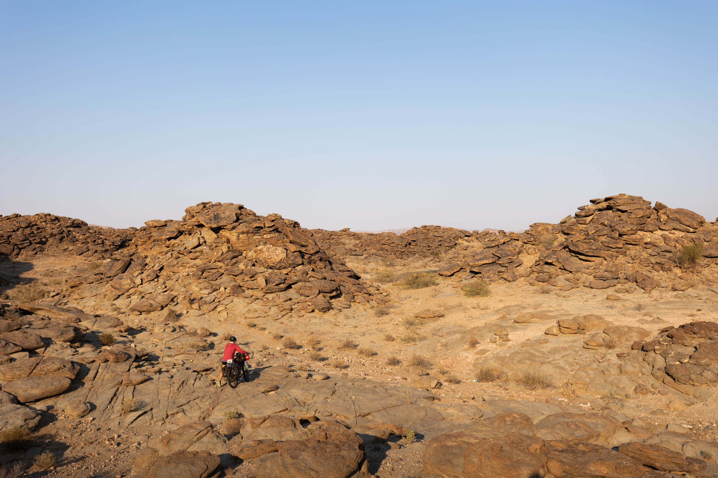
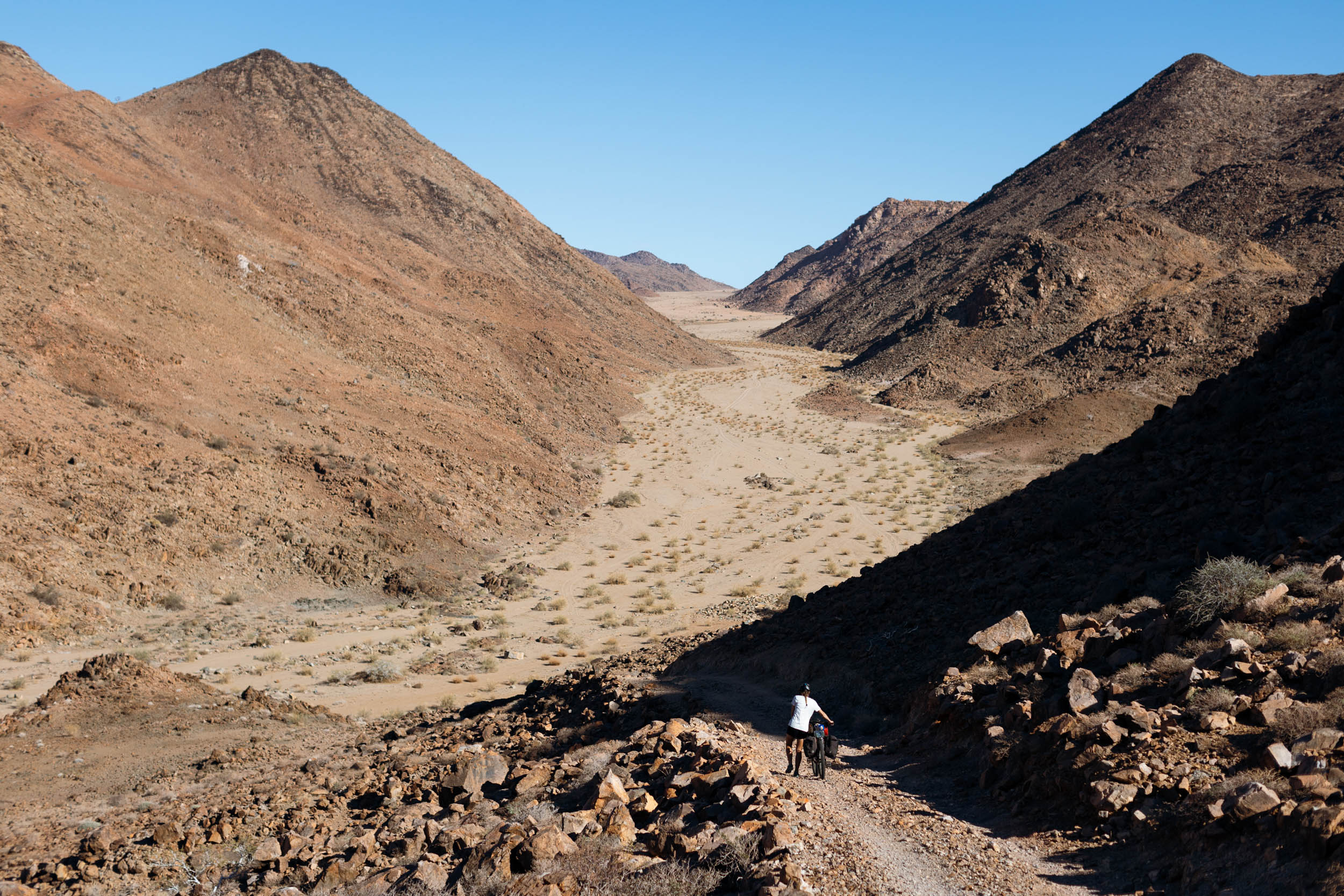
There is one particularly challenging section to be aware of: the linkup between the Kamgab 4×4 trail and the Road to Hell Pass. These are two distinct 4×4 trails on separate tributaries of the Orange River. For 4x4ers they’re typically out-and-back trails, but with bicycles and some hike-a-biking, it’s possible to link the two. Don’t take this challenge lightly. It’s a brutally tough trail in an extremely remote area. There’s no possibility of bailing out if things go south. Go in extra-well prepared. The reward is experiencing some of the most surreal desert scenery imaginable and the satisfaction of achieving something that truly can only be accomplished with a bicycle.
It is possible to skip this link-up if you prefer. In this case, follow the normal Eco Trail route further inland (as per the alternative GPX supplied below). However, be aware that even the easier alternative still crosses remote and sandy terrain and should not be taken lightly either.
Finally, the last 30 kilometres to Vioolsfrif join up with the N7 highway. By this time, you will have spent multiple days in the wild and will probably welcome the sight of the highway. It’s a quick dash downhill on the N7 to Vioolsdrif, where cold drinks and vibey river camps await. Enjoy!
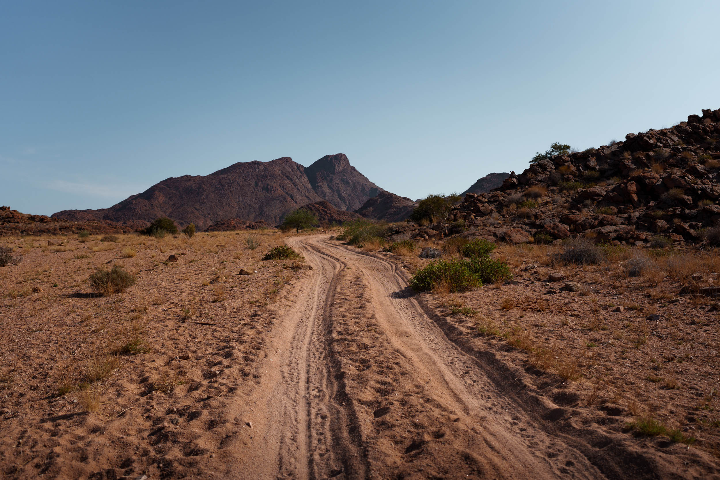
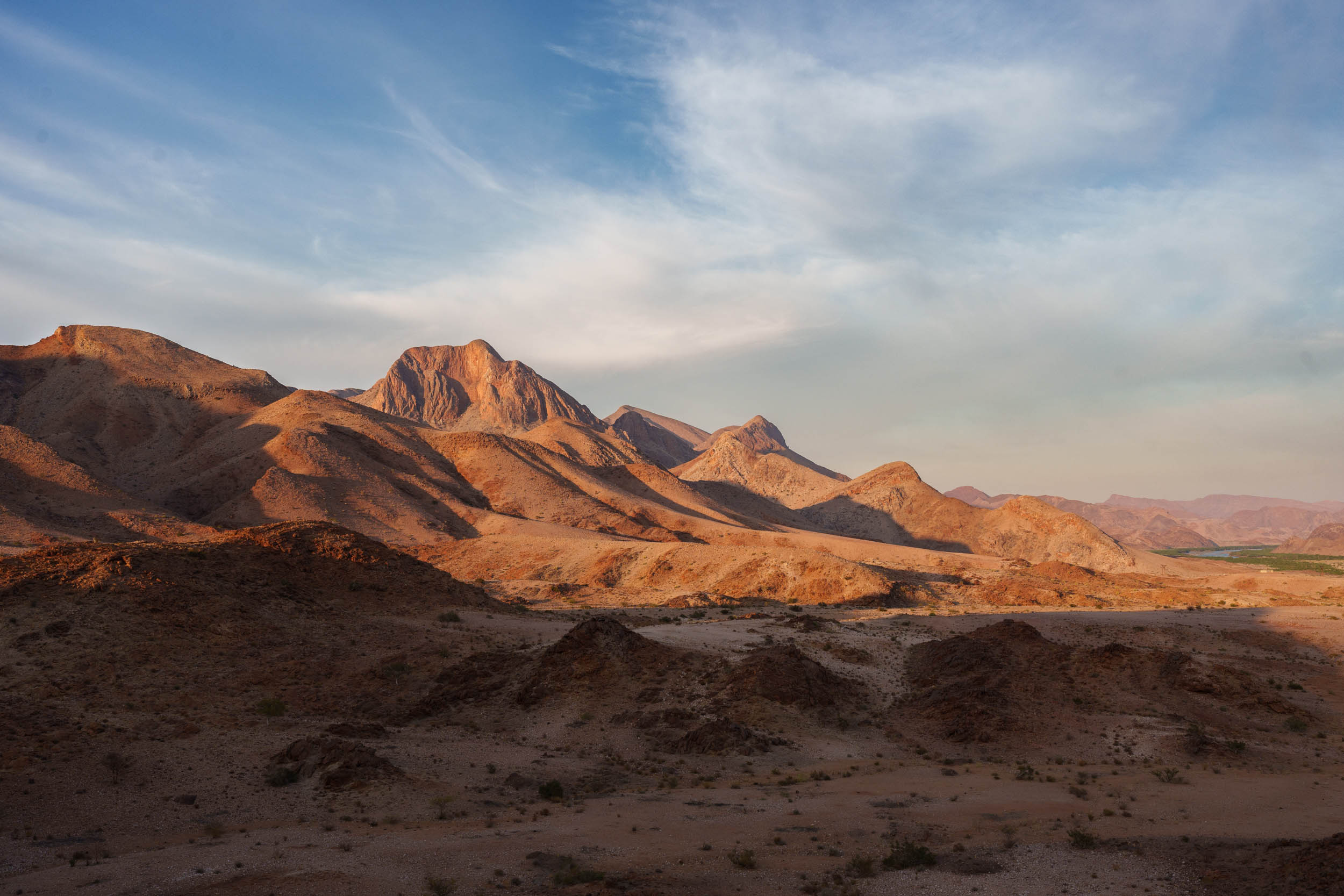
Richtersveld: Vioolsdrif to Sendelingsdrif (Namibia border)
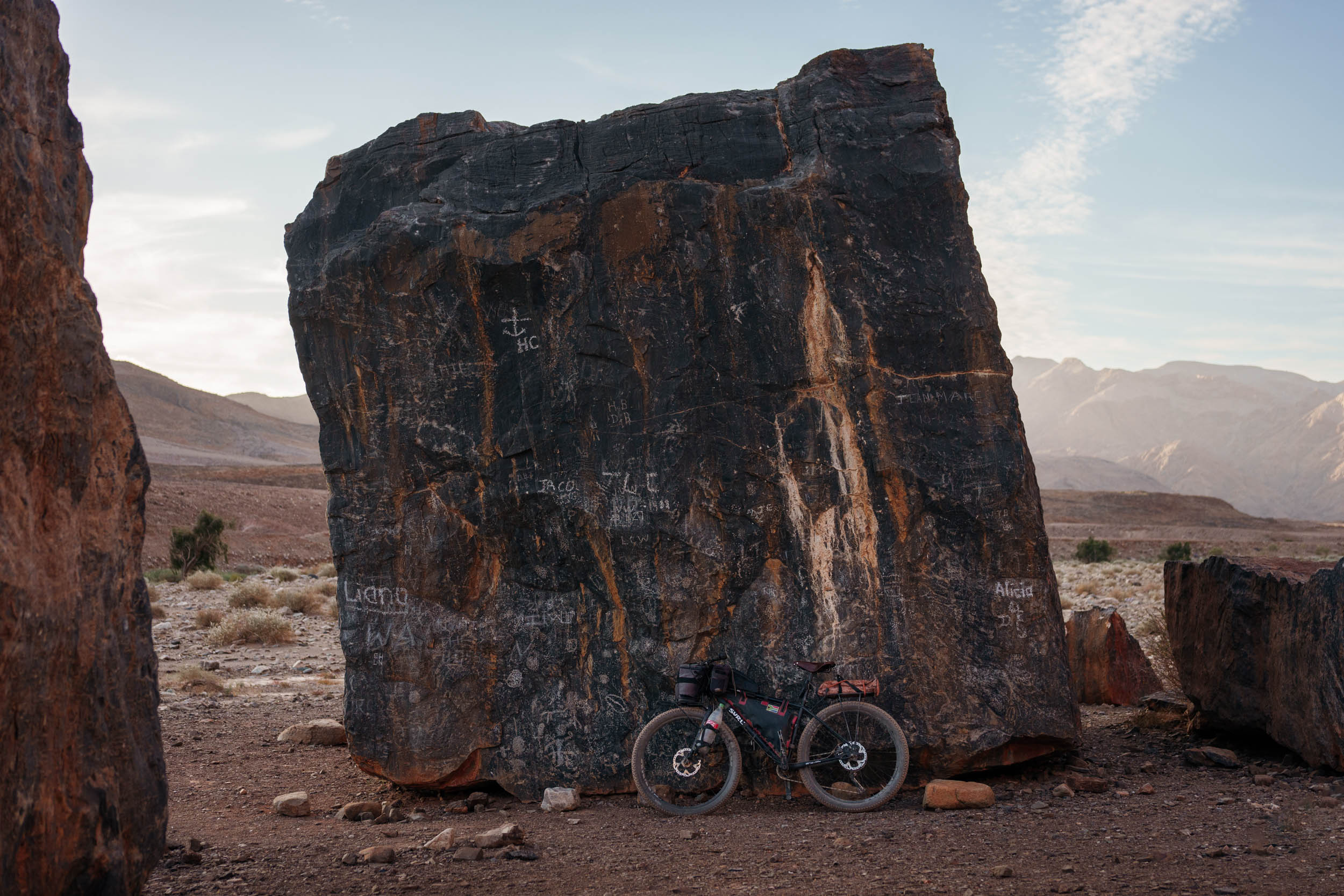
The jewel of this segment, and, arguably, the whole South African leg of the SAND route, is the Richtersveld. It’s where the best desert scenery meets excellent tracks and dreamy camp spots.
Richtersveld roads are a mix of doubletracks and chunky gravel roads, but unlike the river section before, they’re mostly rideable and indeed a joy to ride on.
There’s a logical, linear route from Vioolsdrif to the entrance of the Richtersveld National Park, but once you’re in the park, the idea is to explore at free will and to your heart’s content. The park charges quite a hefty permit fee for foreigners (close to R500 pppd at the time of writing) which needs to be paid in advance in addition to camping fees. Therefore, how long you can stay and how much you can explore inside the park depend on your budget and food-carrying capacity.
On the GPX, we’ve mapped out a circuit within the park that showcases the top viewpoints and camps. It’s estimated to take around four days to complete. However, many other combinations and alternatives exist to consider when exploring here.
The park’s entrance is at the Helskoof gate, but, inconveniently, permits must be bought at the far end of the park at the Sendelingsdrif office before you can really venture off to explore further. If you plan to continue to Namibia, the Sendelingsdrif office is also where you’ll end this segment. Therefore, whatever exploring you do inside the park will have to be an out-and-back or a loop to and from the Sendelingsdrif office. Don’t let this deter you from going in. It is well worth it, any day!
Route Alternatives and Variations
Segment 3 Lite: Many of the segment’s most formidable challenges fall within the Boesmanland and River sections. Less experienced bikepackers can side-step these parts by following this easier alternative route instead. Unfortunately, it misses out on some of the best terrain, but it still carries the overall feel of the segment, just with less adventure.
Add some spice to the Richtersveld section: Instead of taking the main Helskloof pass road at the start of the Richtersveld section, there’s an alternative, more challenging detour that can be taken.
Alternative endings: If you want to complete this segment as a standalone segment from south to north but don’t want to end at Sendelingsdrift, in need of transportation back to Springbok (there are no formal transportation services operating from Sendelingsdrift), consider one of these options:
- Cross the border to Namibia and take the paved MR118 to Oranjemund, cross back into South Africa, and arrange transportation from Alexander Bay. However, even from Alexander Bay, a much larger town than Sendelingsdrif, transportation is not guaranteed.
- Cross the border to Namibia and travel east along the river (scenic!) to reach the Vioolsdrift border. Cross back into South Africa, from where it should be relatively straightforward to get a ride back to Springbok.
Additional Resources
- The government’s official 1 in 50,000 topographic maps are an excellent source for navigation. They show detailed contours, streams, rivers, cadastral information, and even individual structures, including wind pumps and farm buildings. These maps are free to download and view using the Avenza Maps app.
- Official website of the Richtersveld National Park, including up to date rates and fees: sanparks.org
- Further reading and information about the Richtersveld World Heritage site: richtersveldwhs.org
- A list of the common snakes of Namaqualand, including emergency contact numbers (PDF)


Terms of Use: As with each bikepacking route guide published on BIKEPACKING.com, should you choose to cycle this route, do so at your own risk. Prior to setting out check current local weather, conditions, and land/road closures. While riding, obey all public and private land use restrictions and rules, carry proper safety and navigational equipment, and of course, follow the #leavenotrace guidelines. The information found herein is simply a planning resource to be used as a point of inspiration in conjunction with your own due-diligence. In spite of the fact that this route, associated GPS track (GPX and maps), and all route guidelines were prepared under diligent research by the specified contributor and/or contributors, the accuracy of such and judgement of the author is not guaranteed. BIKEPACKING.com LLC, its partners, associates, and contributors are in no way liable for personal injury, damage to personal property, or any other such situation that might happen to individual riders cycling or following this route.
Further Riding and Reading
Here are some connected/nearby routes and related reports...
Please keep the conversation civil, constructive, and inclusive, or your comment will be removed.