


Sattitla Flow
Distance
58 Mi.
(93 KM)Days
2
% Unpaved
80%
% Singletrack
0%
% Rideable (time)
98%
Total Ascent
4,895'
(1,492 M)High Point
7,304'
(2,226 M)Difficulty (1-10)
4?
- 5Climbing Scale Moderate84 FT/MI (16 M/KM)
- 3Technical Difficulty Fair
- 4Physical Demand Fair
- 5Resupply & Logistics Moderate
Contributed By
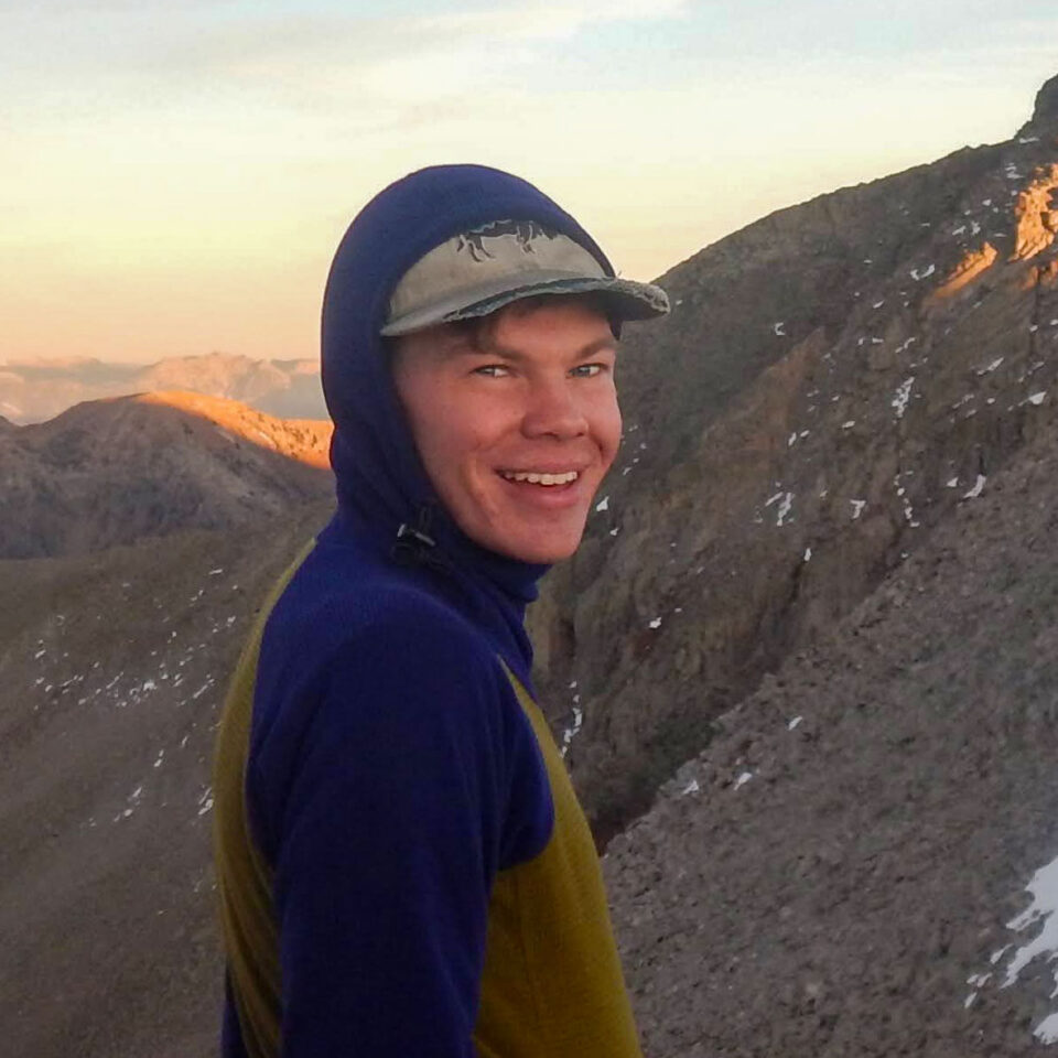
Ben Gelderloos
Guest Contributor
Ben is just another adventurous Boulder-ite who has strayed west from Colorado to the mountains of Northern California. His legs are fueled by sardines, his mind by a drive for conservation and environmentalism, and his dreams by the forests, deserts, and mountains that have shaped him.
Photos by Dallas Mignano
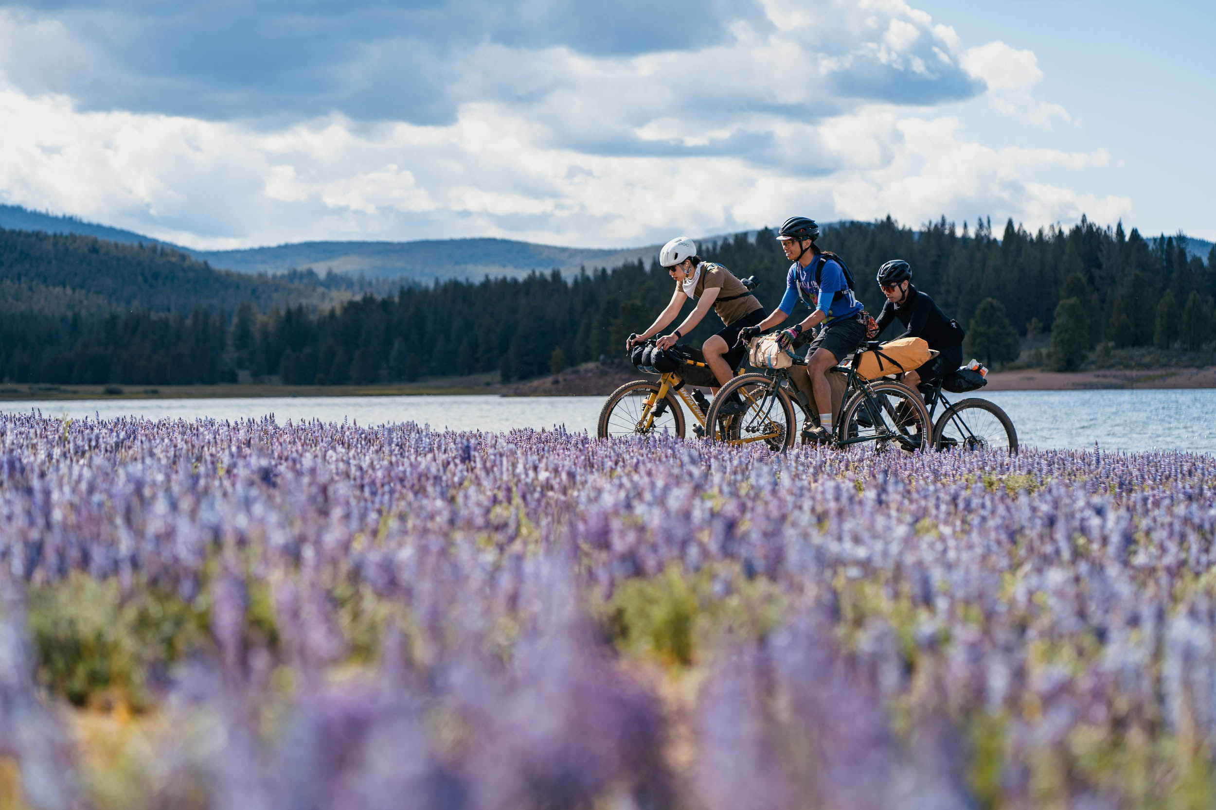
Calm and chaos are typically antonyms, and a quick bikepacking trip can highlight their differences. It’s easy to dream of escaping modern development for the slow pace of two wheels and serene nature. Our world, however, is not that binary. Complexities and chaos flow all around us, wherever we go. A bikepacker is better served not by retreating to a fictional haven, but by learning to find balance amid the chaos. Tucked into the Northeast corner of California is perhaps the best earthly embodiment of merging calm and chaos, where quiet late-stage forests are broken by fiery lava flows that have solidified into jagged edges. In a landscape of stark contrast between green and black, it is surprisingly easy to find your flow. Peaceful pedaling is intertwined with politics, as the newly designated Sáttítla Highlands National Monument risks losing essential protections for the land. Visit to help make the world better, not escape it. This route and place embody the search for balance in an uncertain world.
Sáttítla Flow explores the caldera rim, volcanic slopes, and lava flows of Sáttítla Highlands National Monument. On a mix of well-maintained gravel roads and mellow two-track with several paved connections, this route showcases the excellent recreational opportunities of this place, enabled by its protection, and shares a beautiful environment that is deeply important to Indigenous peoples. Just as the lava did hundreds and thousands of years ago, this route encourages you to flow with the landscape and take it slow. Sáttítla means “obsidian place” in the Ajumawi language and truly is a volcanic wonderland. Plan on many stops to explore the basalt plains, each unique due to its age and composition. Explore caves that hold ice all year and play with rocks that are lightweight, sharp, or just funny-looking.
This area is under threat. While a remote route like this can tempt you to detach from the world, your advocacy, actions, and even pedaling are needed to protect what makes this place special. Cuckwala National Monument in Southern California and Sáttítla Highlands National Monument were both designated by President Biden under the 1906 Antiquities Act. The area has deep significance to the Pit River Tribe, the Modoc, and other Indigenous peoples who have fought hard for decades to protect the Medicine Lake Highlands and for tribal inclusion in land management. President Trump has signaled plans to remove this designation in a change that would enable extractive development, risk the recreational opportunities of this route, and undermine the tribal sovereignty and cultural preservation of a sacred place. This route is an invitation to learn about, connect with, and fight for a piece of public land that needs our help.
The Medicine Lake highlands are sometimes described as the headwaters of California, as the heavy winters and deep aquifer supply around 20% of the Sacramento River’s water. That might surprise you: riding this route, there are few creeks or water sources in the unique geology, despite rich forests and open meadows. Plan your water use carefully and consider a water drop described in the logistics section.
Route Difficulty
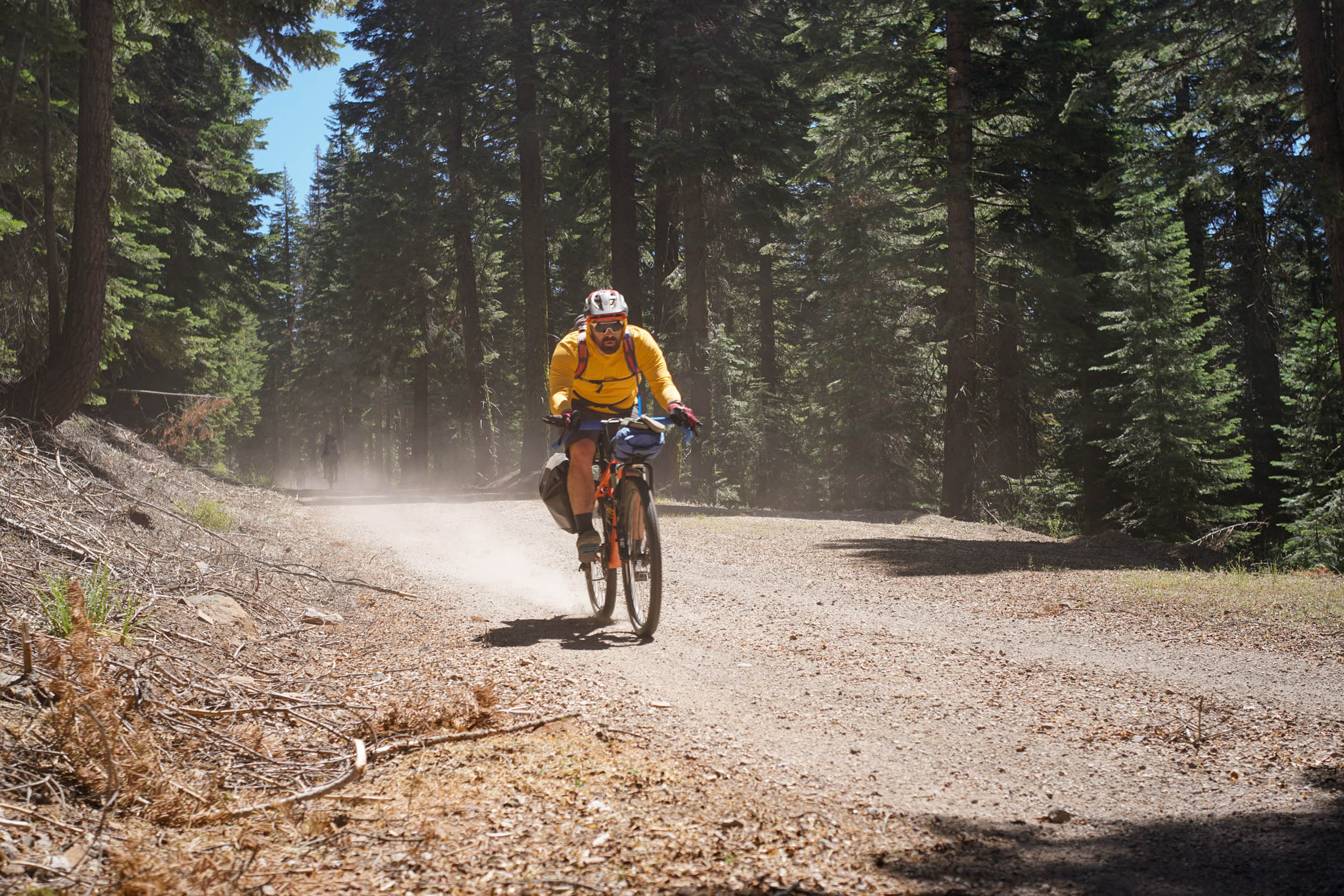
The route is not technically difficult, with gravel roads that are generally free of washboard and not frustratingly sandy. Don’t let the smooth descents get ahead of you, as the volcanic dirt can make controlled braking difficult at high speed. The climbing on the route is concentrated at the end of the first day and the second morning; it’s not steep, but it’s a slog. Resupply adds significant difficulty, as the only existing water resupply is at mile nine and at the first night’s camp, with no other services on route.
Route development: This route uses US Forest Service roads and facilities maintained by the Shasta-Trinity, Modoc, and Klamath National Forests, which enable opportunities for recreation like this on public lands. Roadside geology information helped find the stops and is part of a trove of information that aspiring rock nerds can learn more from. A special thanks to Dallas Mignano for contributions, photography, and encouragement.


Submit Route Alert
As the leading creator and publisher of bikepacking routes, BIKEPACKING.com endeavors to maintain, improve, and advocate for our growing network of bikepacking routes all over the world. As such, our editorial team, route creators, and Route Stewards serve as mediators for route improvements and opportunities for connectivity, conservation, and community growth around these routes. To facilitate these efforts, we rely on our Bikepacking Collective and the greater bikepacking community to call attention to critical issues and opportunities that are discovered while riding these routes. If you have a vital issue or opportunity regarding this route that pertains to one of the subjects below, please let us know:
Highlights
Must Know
Camping
Food/H2O
Trail Notes
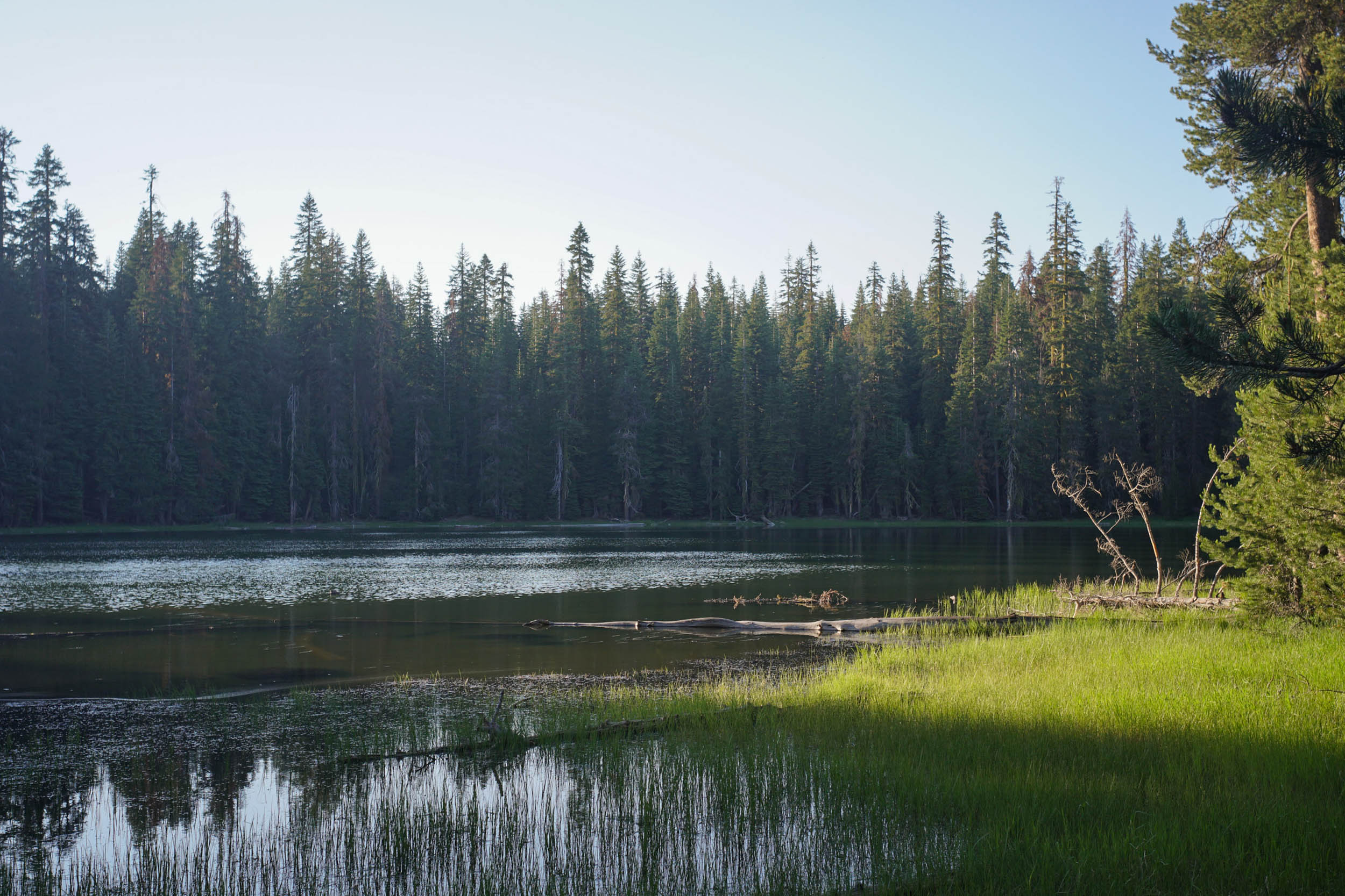
- Medicine Lake’s clear waters, soft bottom, and beauty make for a great start and end to the trip
- Views of the Medicine Lake Caldera, Mt. Shasta, and the Southern Cascades from Little Mt. Hoffman Lookout
- Exploring volcanic flows particularly at Little Glass Mountain and Shastine Crater
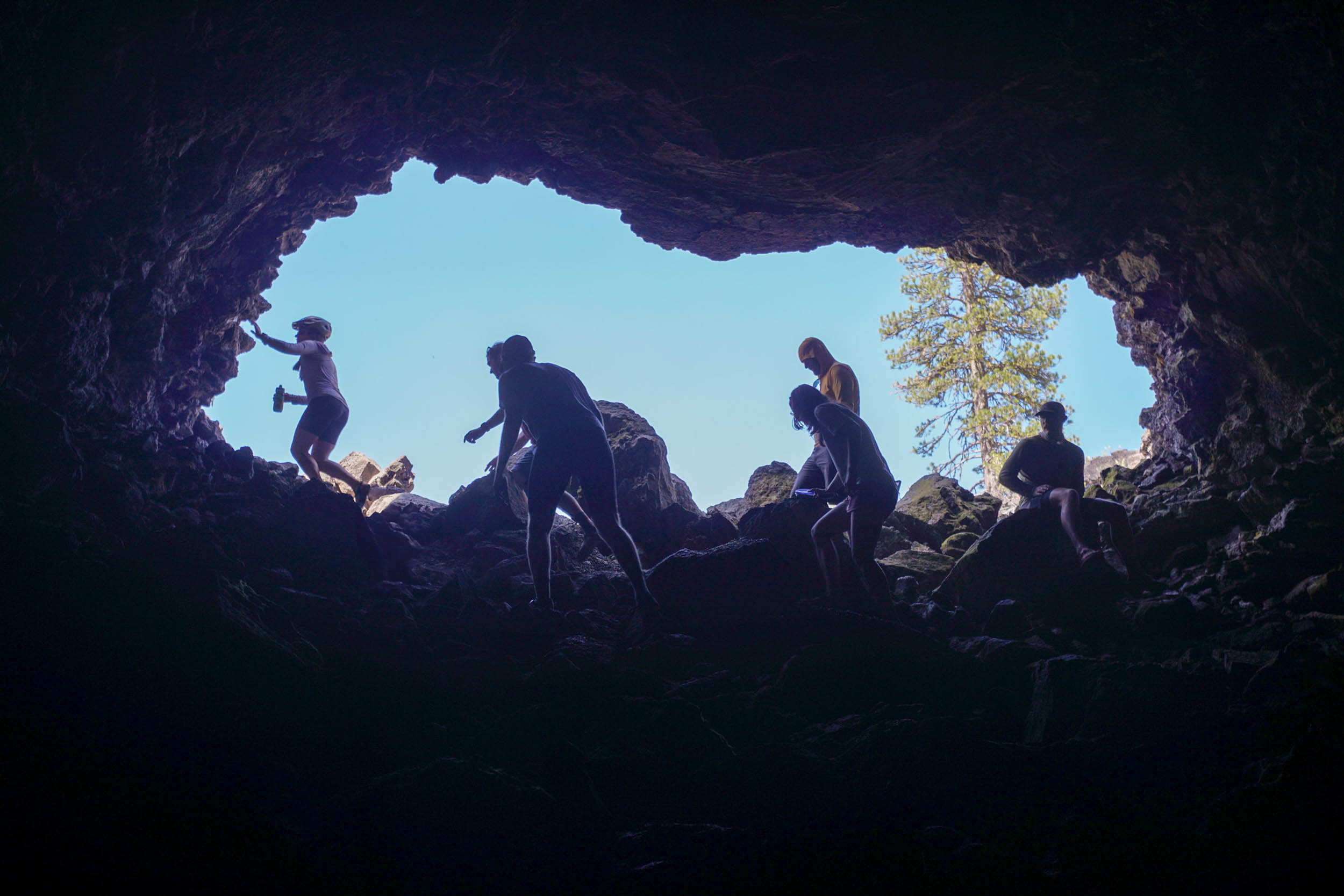
- Cool temperatures and curiosities at Jot Dean and Yellow Jacket Ice Caves
- Walking through an otherworldly landscape of obsidian and basalt on Glass Mountain
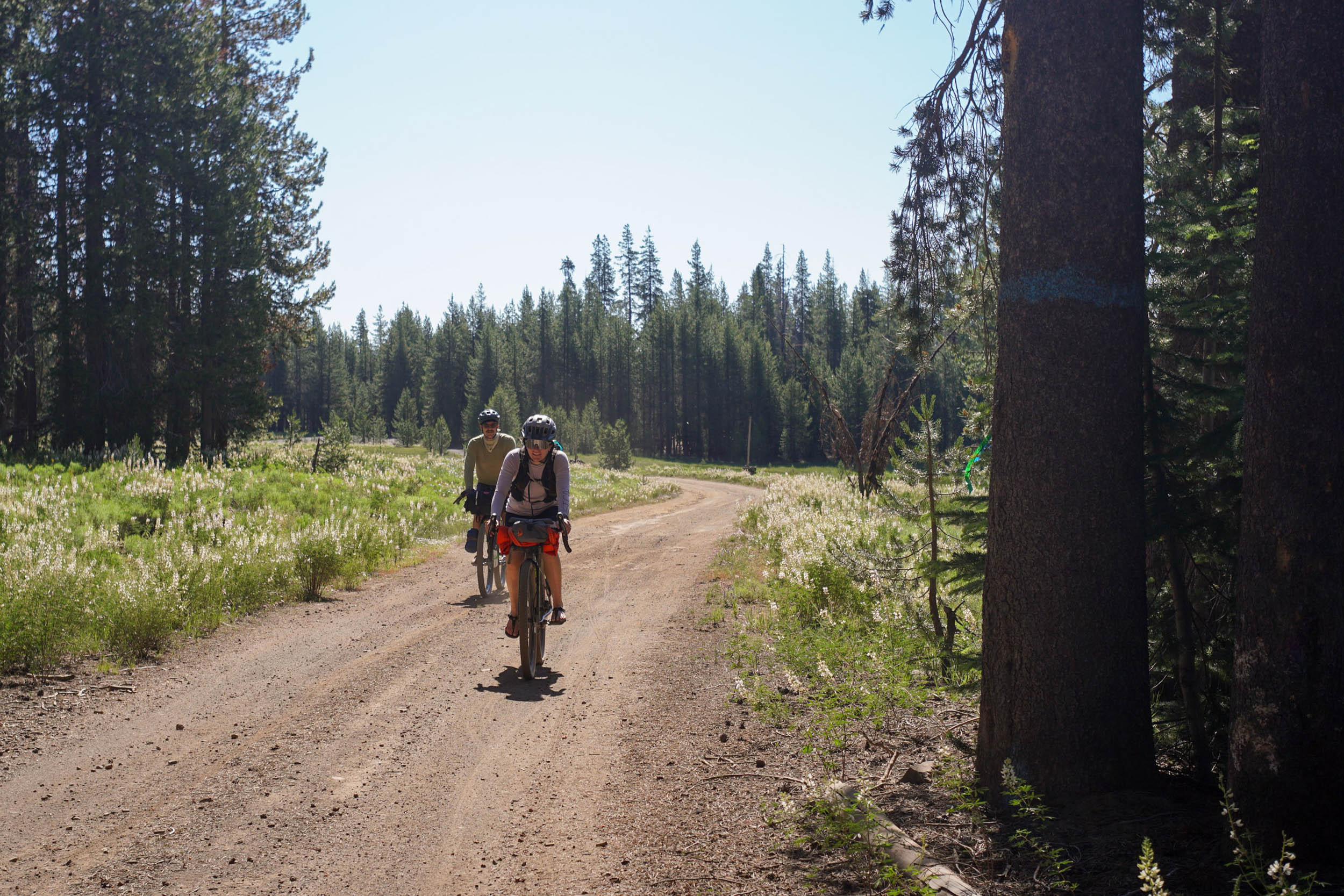
- Open meadows, diverse forests, and peaceful lakes
- Enjoying protected, public land knowing clean water, recreation, and Indigenous cultural connections are preserved in Sáttítla National Monument
- Visit with respect for a sacred place. This area includes portions of the ancestral homelands of the Pit River (Ajumawi—Atsugewi) and Modoc Peoples (Mo Wat Knii—Mo Docknii) and is of deep cultural significance for them and many other Indigenous peoples, including the Karuk, Klamath, Shasta, Siletz, Wintu, and Yana, and individual tribes that are members of these groups.
- The route can be ridden from when the area is snow-free in May or June through October. The Pit River Tribe holds a gathering on the third weekend of July each year. Camping will not be available, and the route should not be ridden to respect culturally important sites.
- Start from one of the four campgrounds around Medicine Lake. Vehicles can be left at a reserved campsite used on the night of arrival. Other nearby parking areas are day-use only, but there are pull-offs of Forest Service roads away from the lake.
- Nearby the Jot Dean Ice Cave is a convenient place to stash water when driving to the route.
- Little Mt. Hoffman Lookout is a reservable historic fire lookout. If you’re lucky, staying there would be a great way to start the trip. Otherwise, be respectful if you choose to ride to the summit of anyone you’re sharing the views with.
- There are lots of off-bike exploration opportunities on sharp volcanic basalt. Use extreme care if wearing sandals or bring close-toed shoes.
- Donations to Mount Shasta Bioregional Ecology Center can help advocate for the protection of this area and enable the region’s first co-stewardship management plan to be created for Sáttítla Highlands National Monument. National conservation non-profits and direct outreach to elected representatives can also make your voice heard for the permanent protection of national monuments.
- For the night before the trip, there are four Modoc National Forest campgrounds around Medicine Lake that are reservable through recreation.gov or on site for $15 per night.
- For the first night, free campgrounds with vault toilets exist at Paynes Spring, Blanche Lake, and Bullseye Lake. All are beautiful.
- Dispersed camping without water access is possible on the route, excluding day-use areas.
- There are no services on route and very few in the area, the closest restaurants being in McCloud or Tulelake.
- Campgrounds around Medicine Lake have spigots. Filterable water from a spring-fed pond exists at mile 9. Each campsite on the first night has access to filterable water.
- No water exists between mile 9 and 40. However, water can be stashed before starting the route at mile 22 nearby Jot Dean Ice Cave on the drive in. Hide water containers to avoid a visual disturbance, do not leave anything inside the ice cave, do not leave any food or gear due to bear activity, and do not abandon anything in the forest after your trip.
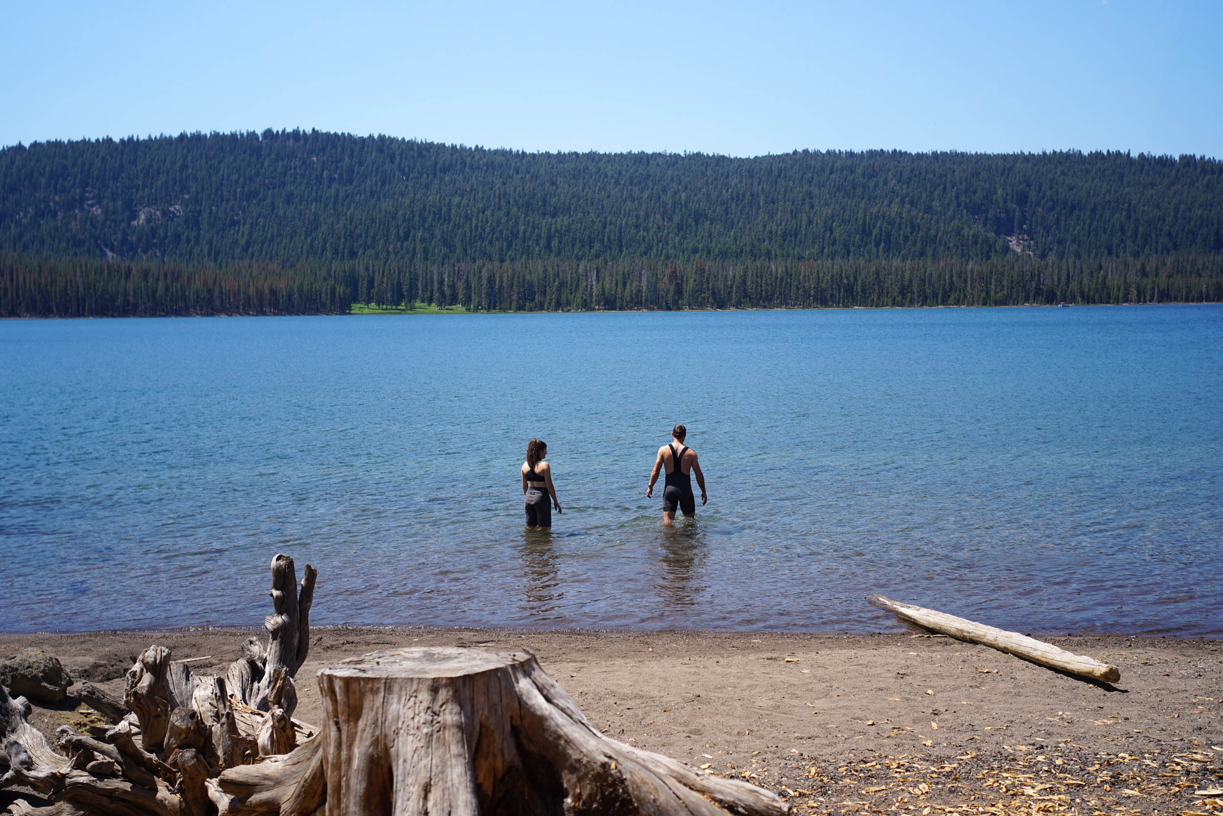
Begin the trip on the beautiful shores of Medicine Lake. The expansive lake lies at the bottom of the Medicine Lake Caldera and has no outlet for its crystal-clear waters. The lake and its surrounding highlands are part of the creation story for the Pit River Tribe, and they are a spiritual center for healing, ceremony, and culture for the Modoc, Shasta, Karuk, and Klamath. In 1999, some 33,000 acres were designated as a Traditional Cultural Property under the National Register of Historic Places, which was expanded to 73,000 in 2007. The now 224,676-acre Satittla National Monument you will experience is a testament to the scale of Indigenous connection to this place. Circle the lake on a paved road, then start climbing to the rim of the caldera. Medicine Lake Volcano is the largest volcano by volume in the Cascades and created this massive crater when it erupted 100,000 years ago.
From the rim, a stunning view is just a steep climb away at the Little Mt. Hoffman Lookout. The now-reservable lookout provides views down to Medicine Lake and of the lava flows of the next day’s riding, with Mt. Shasta and the southern Cascades towering in every direction. The sights are well worth the trip up, but so is the dirt descent to the day’s first lava stop.
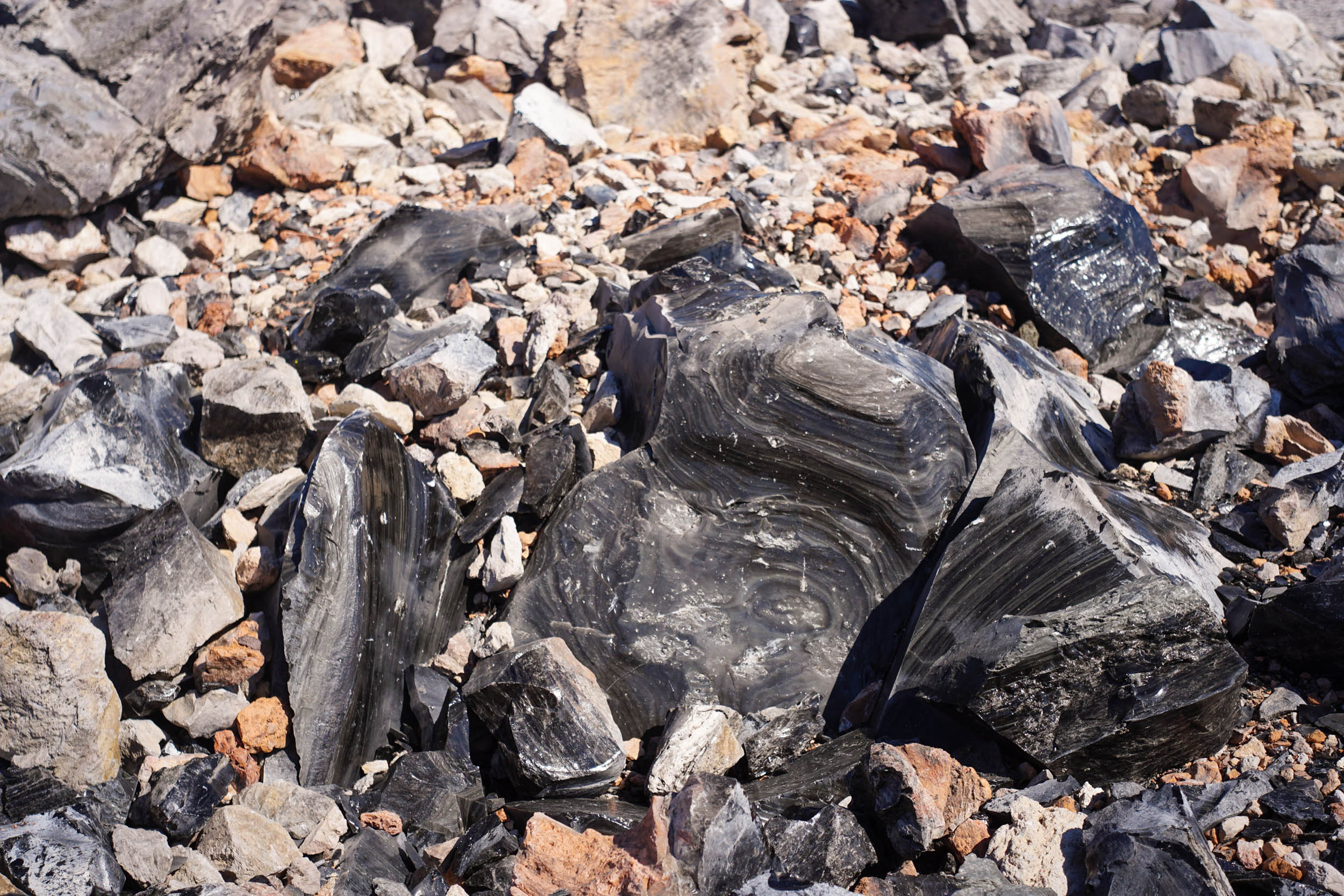
Pull off to the left at Little Glass Mountain and feel the obsidian, rhyolite, and pumice. Be careful on lava flows and handle obsidian with care. Obsidian from this flow was not used by Indigenous peoples for tool construction because it breaks too erratically. The road turns into washboarded pumice before you turn to briefly descend on a paved road.
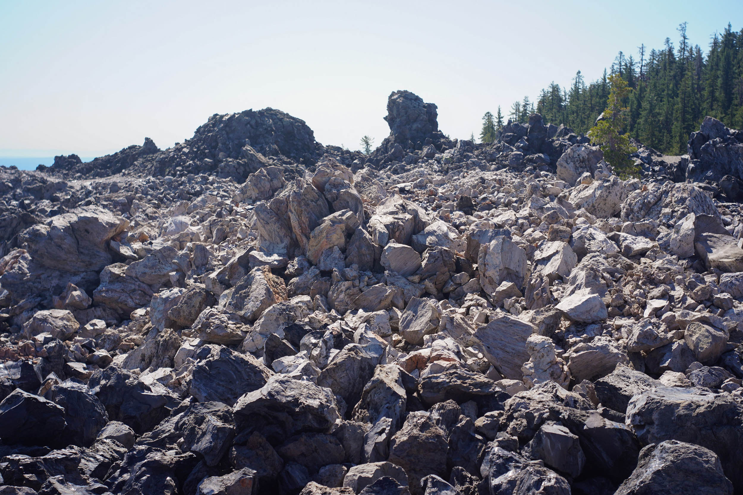
Pass fresh water at Pumice Stone Well and colorful views of Pumice Stone Mountain and Paint Pot Crater at Tilted Stone Lava Flow before turning into the open meadow of Grasshopper Flat. From here, climb up seldom-used dirt roads to the border of Giant Crater Lava Flow. This flow is 28 miles long and has one of the longest lava tubes in the world at 14 miles. Explore the vents of this flow for some giggly fun at Shastice Crater, where, if you and a buddy explore just right, you can look at each other through a 50-foot-deep hole.
An excellent lunch stop is Jot Dean Ice Cave, where you can refill water for the afternoon if you stashed containers here on the drive in. Dropping below the surface, you’ll quickly feel the cool air that lets ice persist year-round at the bottom of the cave. Start the afternoon with a fun descent and adventurous climb through the shaded woods. The second half of the day involves climbing much of what the morning descended on, with ridable grades and partial shade.
Just as the afternoon heat starts to feel heavy on your back, look to the right at Burnt Lava Flow and find Yellowjacket Cave, cozier but just as hospitable as Jot Dean Ice Cave. Continue around the perimeter of Burnt Lava Flow with views of High Hole Crater. A shortcut up 43N17 along the likely dry Paynes Creek will save some miles and climbing before camp.
Climb up through old-growth ponderosa pine from the east side of the monument to return to the volcanic highlands. At the top, three excellent camping options are available. Paynes Springs offers a meadow near a stream, while Blanche and Bullseye lakes both have abundant spots near the water. Each have pit toilet but otherwise feel far away from civilization; the area is one of the darkest and quietest places in California.
The next day begins with a speedy descent and pedal out to some of the limited pavement on the route. A viewpoint to the right gives a commanding view of the Modoc Plateau before an easy-to-miss left turn back onto dirt. You’ll get your first views of Glass Mountain peeking out of the red fir forest at the highest elevations on the route.
Just 950 years ago (that’s not old, and neither are you), Glass Mountain erupted and flowed from the caldera rim down the slope of the shield volcano. Stop at a bulldozer cut to explore this nascent landscape. Even if you brought your all-terrain bike, the sharp obsidian will be unfriendly to tires, and it is best to navigate on foot. Obsidian quarried within Sáttítla Highlands National Monument was an important resource in a broad Indigenous trade network throughout northern California, the California Coast, and southern Oregon. Leave stones behind, but appreciate the massive scale of the lava flow perched at 7,000 feet.
Depart on dustry, well-traveled roads back down into the caldera. On the right, you can spot a site used for geothermal energy exploration with a California Prop 65 sign about dangerous chemicals. The creation of geothermal power plants relying on the heated water of Medicine Lake Volcano and sprawling with transmission lines and large footprints has been and remains the greatest threat to the natural environment and Indigenous cultural significance of the Sáttítla Highlands. Geothermal development risks contaminating the area’s massive aquifer and altering hydrology that could dry up last night’s campsites, springs, and lakes, or destroy the sacred healing properties of Medicine Lake. Surface development would destroy cultural sites and Indigenous access, but also ruin your recreational experience of biking through this peaceful landscape. After protracted resistance by tribes and environmental groups since geothermal leases were issued in the 1980s, legal victories, and the 2025 monument designation have kept development off the land and water. Now, as federal agencies orient toward increasing resource extraction on public lands and challenging existing monument designations, environmental regulations, and tribal relationships, the threat is as real as ever.
By now, volcanic dust coats your bike frame and sunscreen-clad body. As you roll your last few miles, consider the role you play as a recreationist in advocating for the places you connect to. Bikes may be simple machines, but the relationships they bring us into are intricately complex. Make a left on a snowmobile track that parallels the last flow of the trip, Glass Lake Flow. Alternatively, for a little more volcanism or reflection, continue straight on pavement to the Fourmile Hill Tree Molds and return on NF Rd 77 with a quick hike to Crater Glass Flow and Pumice Crater Geologic Area.
End the ride back at Medicine Lake with a swim that will feel like the best thing in the world.


Terms of Use: As with each bikepacking route guide published on BIKEPACKING.com, should you choose to cycle this route, do so at your own risk. Prior to setting out check current local weather, conditions, and land/road closures. While riding, obey all public and private land use restrictions and rules, carry proper safety and navigational equipment, and of course, follow the #leavenotrace guidelines. The information found herein is simply a planning resource to be used as a point of inspiration in conjunction with your own due-diligence. In spite of the fact that this route, associated GPS track (GPX and maps), and all route guidelines were prepared under diligent research by the specified contributor and/or contributors, the accuracy of such and judgement of the author is not guaranteed. BIKEPACKING.com LLC, its partners, associates, and contributors are in no way liable for personal injury, damage to personal property, or any other such situation that might happen to individual riders cycling or following this route.
Further Riding and Reading
Here are some connected/nearby routes and related reports...


Please keep the conversation civil, constructive, and inclusive, or your comment will be removed.