


The Secret Mesa Loop: Fatpacking the Swell
Distance
53 Mi.
(85 KM)Days
2-3
% Unpaved
99%
% Singletrack
0%
% Rideable (time)
98%
Total Ascent
3,673'
(1,120 M)High Point
7,198'
(2,194 M)Difficulty (1-10)
7.5?
- 4Climbing Scale Fair69 FT/MI (13 M/KM)
- 6Technical Difficulty Moderate
- 7.5Physical Demand Difficult
- 7.5Resupply & Logistics Strenuous
Contributed By

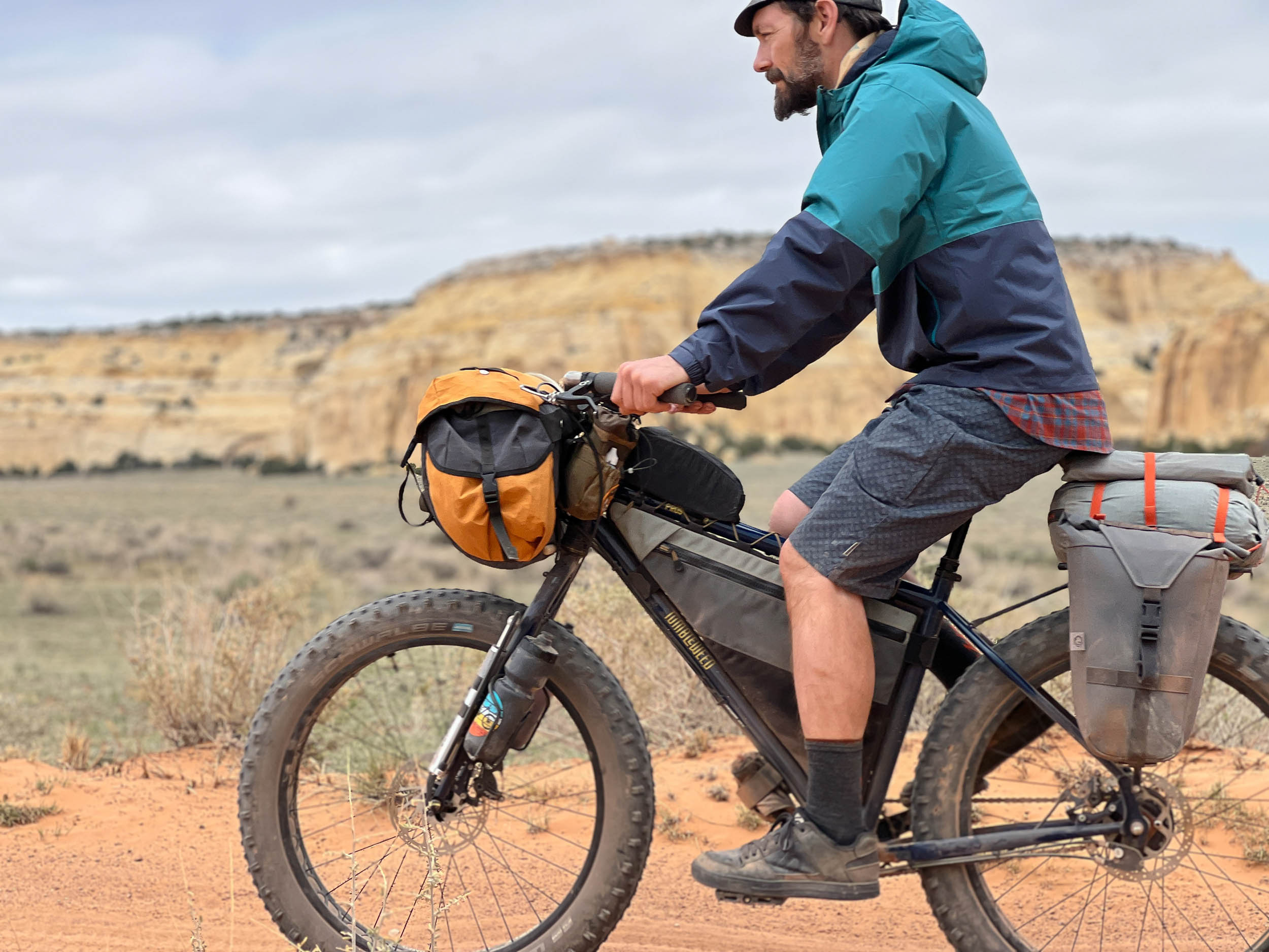
Seth Kruckenberg and Nancy Ramer
Guest Contributor
Seth grew up in Wyoming, traversing the West for the majority of his life and riding throughout the Rocky Mountains from an early age. Nancy hails from the Midwest where the Great Lakes, undulating glacial landforms, and deep woods of Wisconsin and Minnesota continue to serve as the canvas for many of their travels. Currently both residing in Boston, Massachusetts, Seth posts about their adventures (often with their two dogs in tow) on Instagram as @tipsyrider.
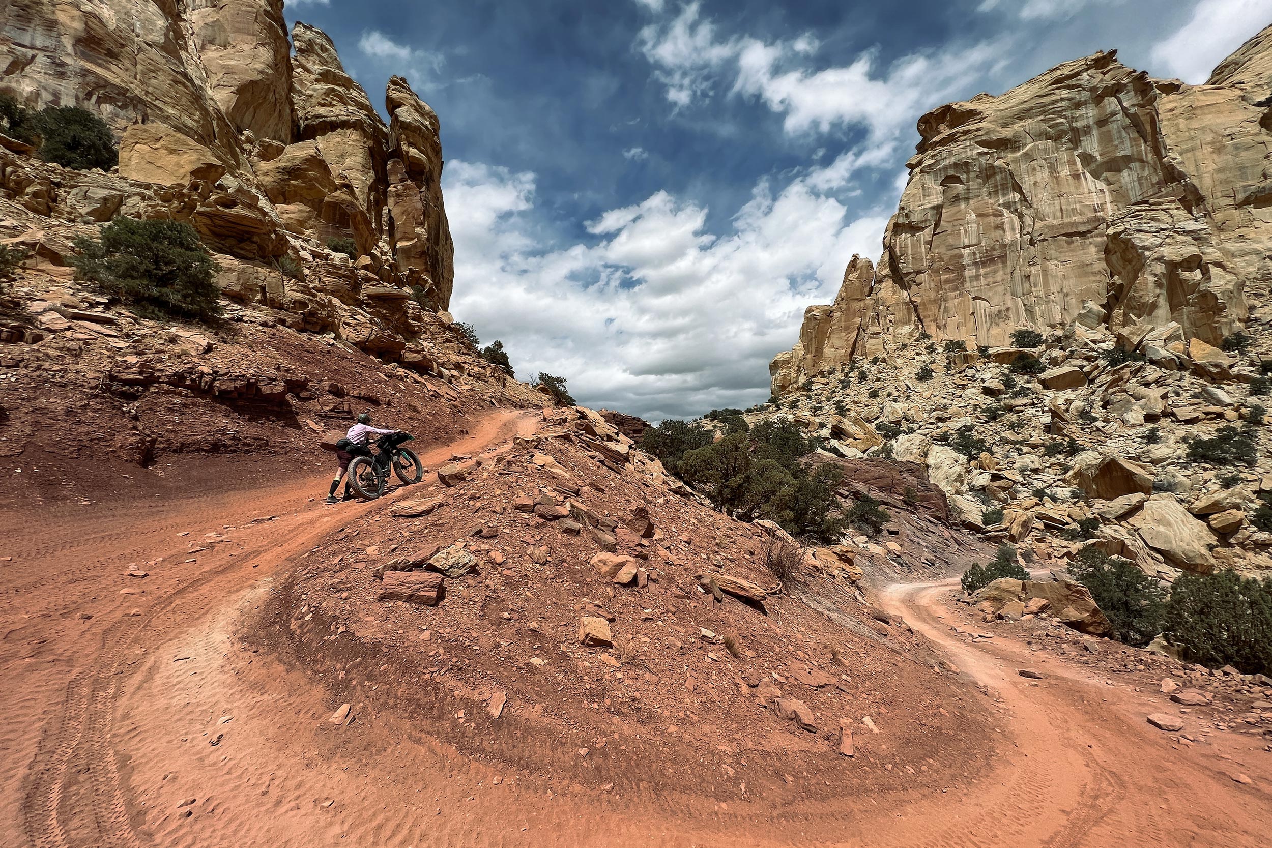
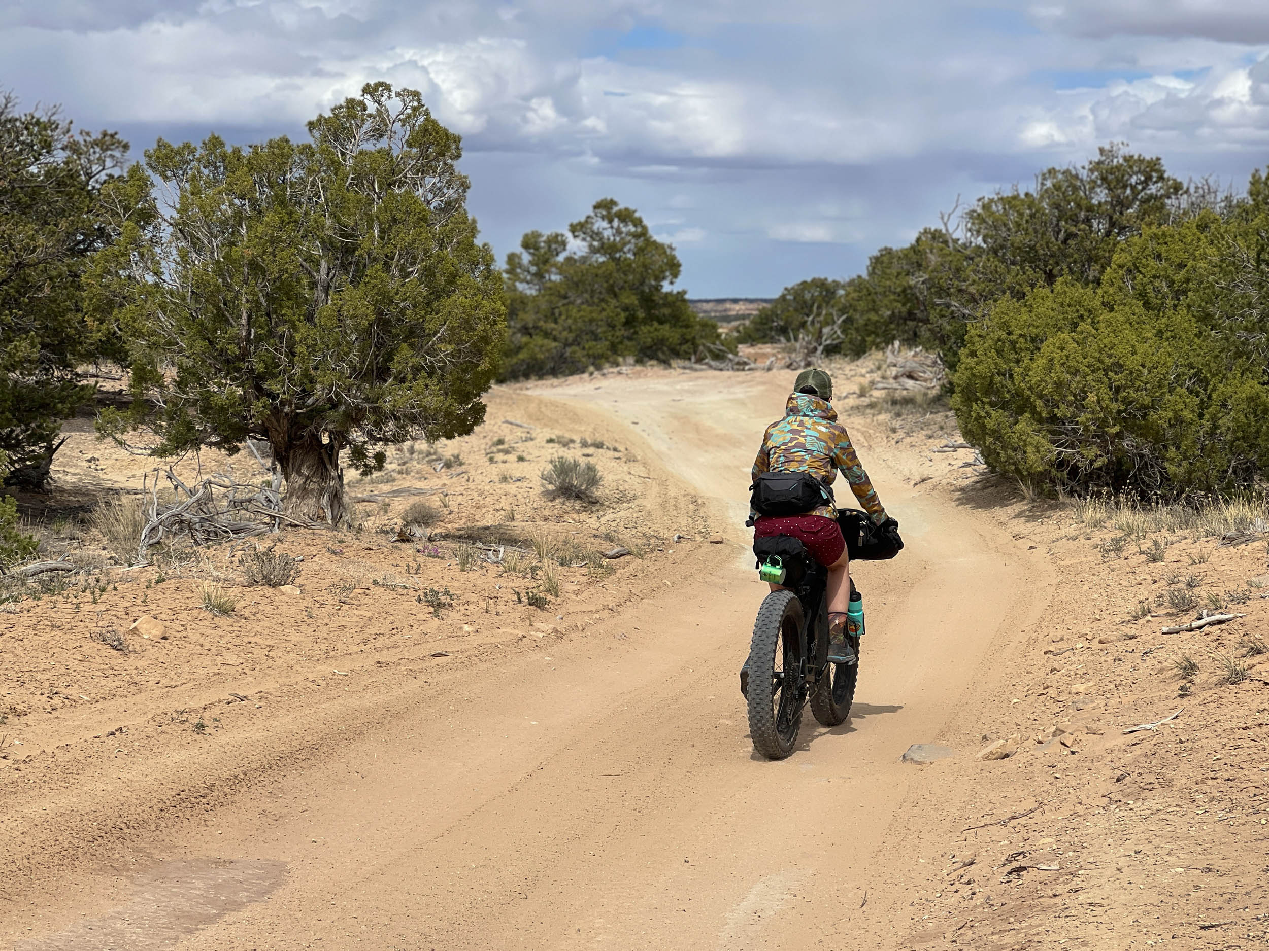
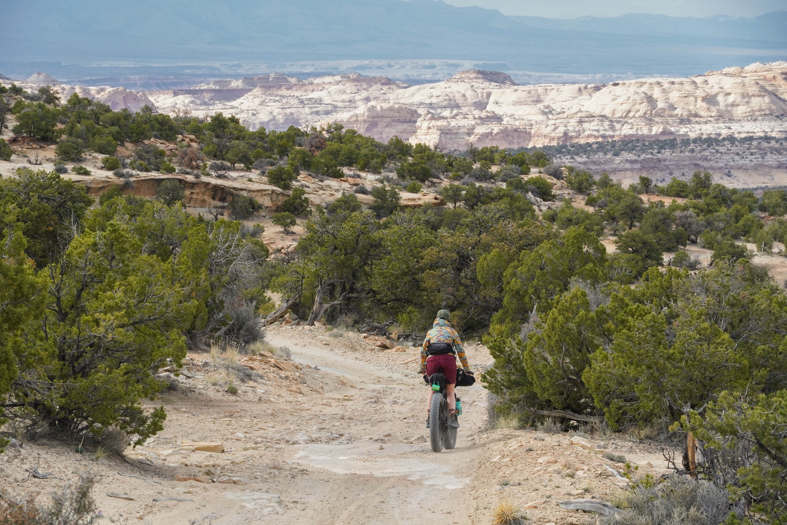
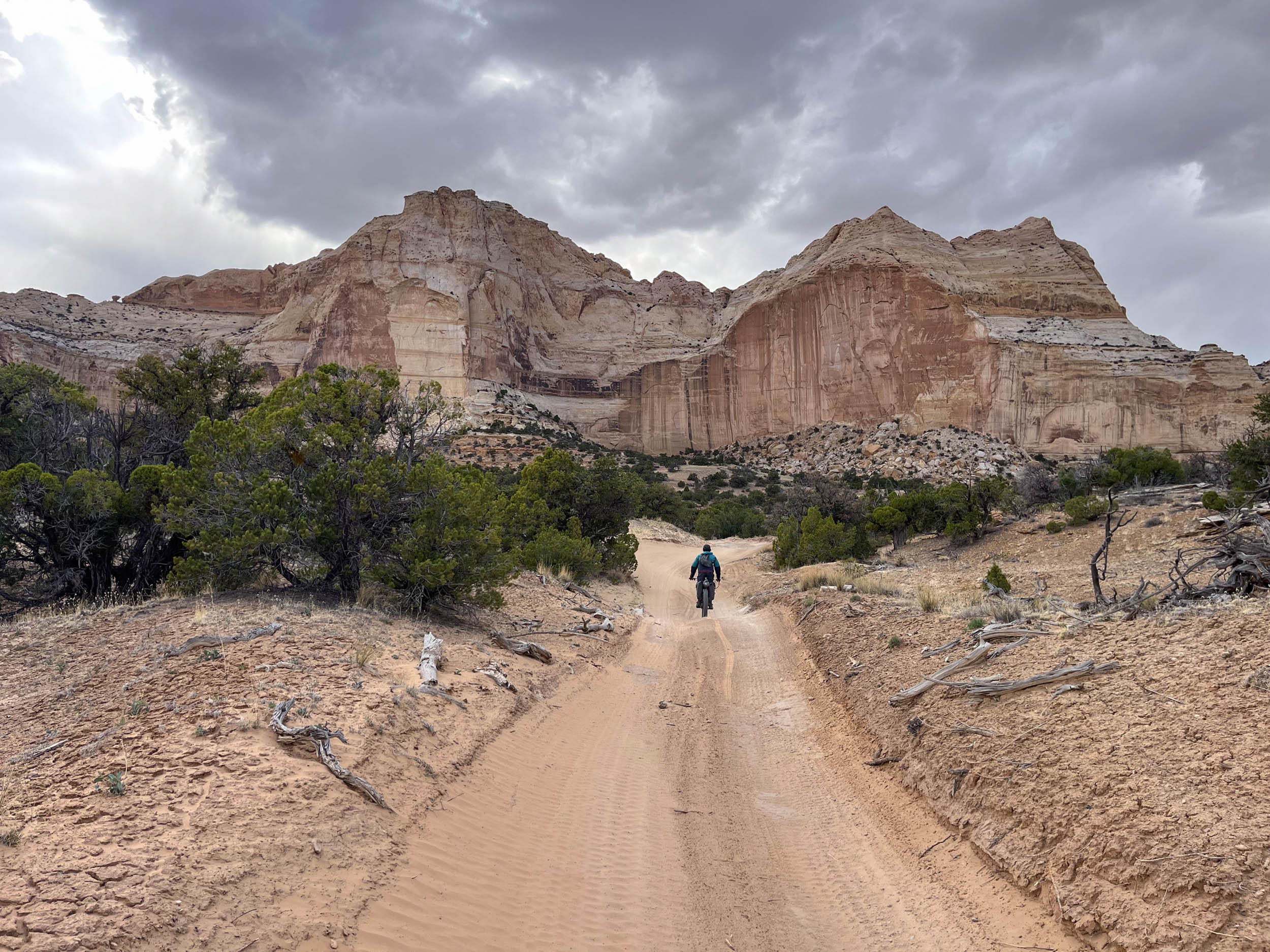
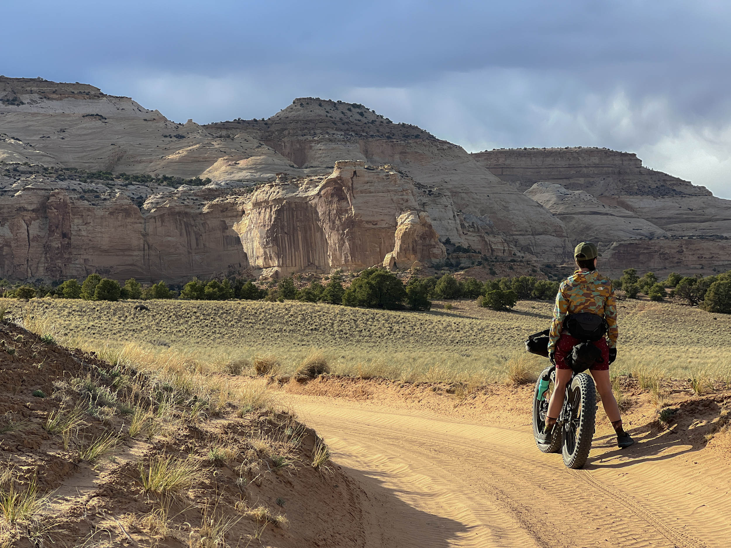
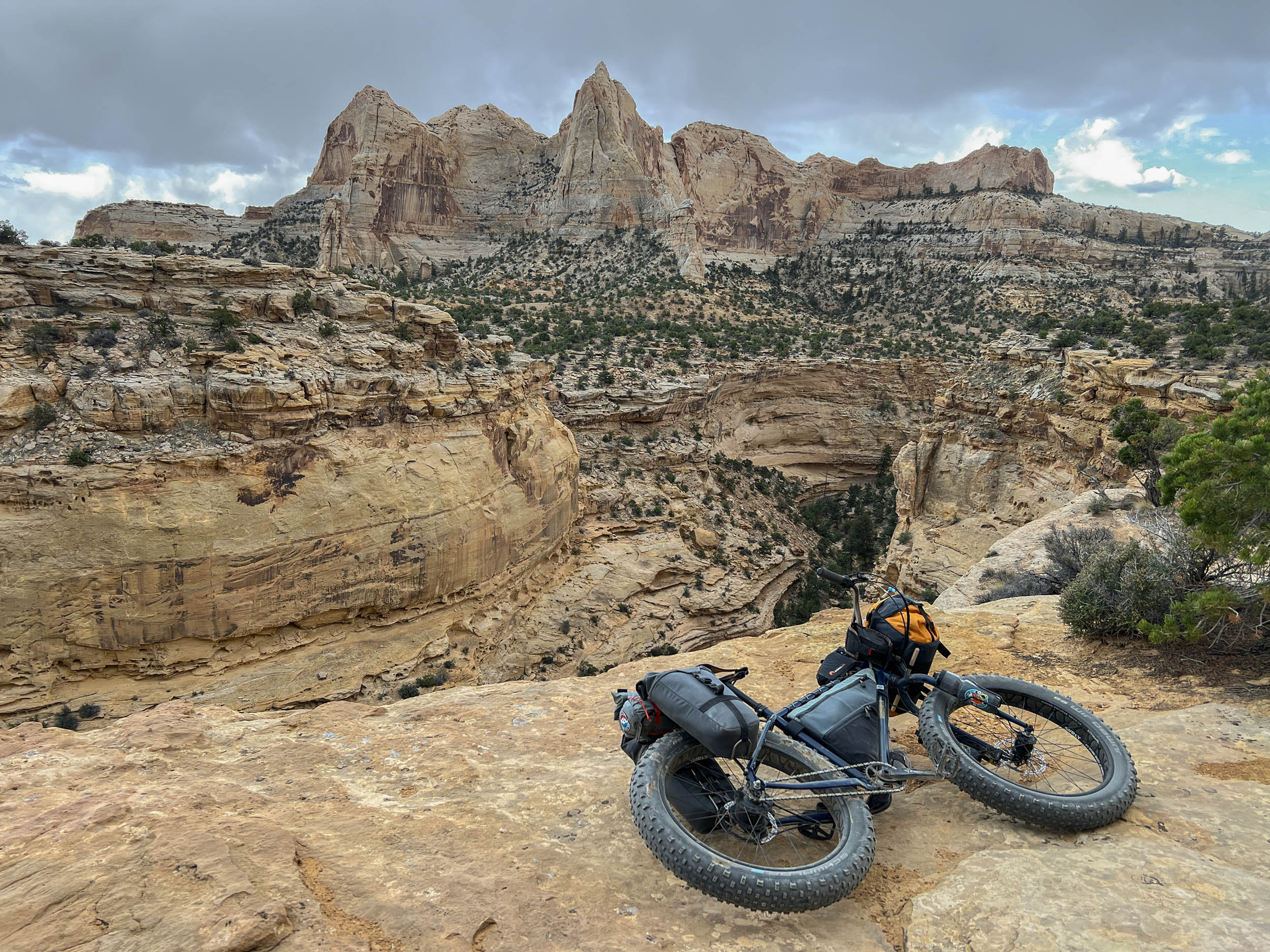
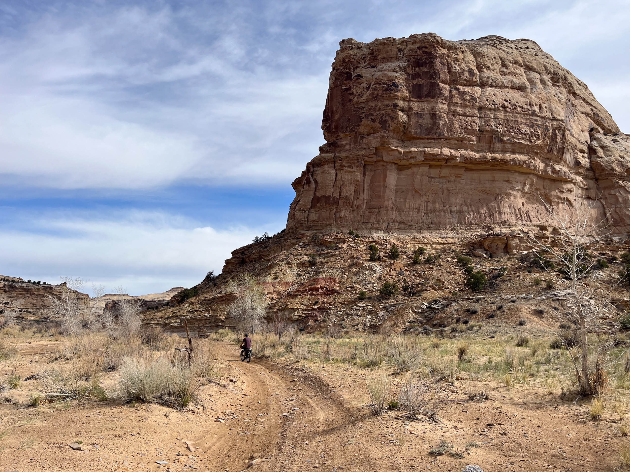
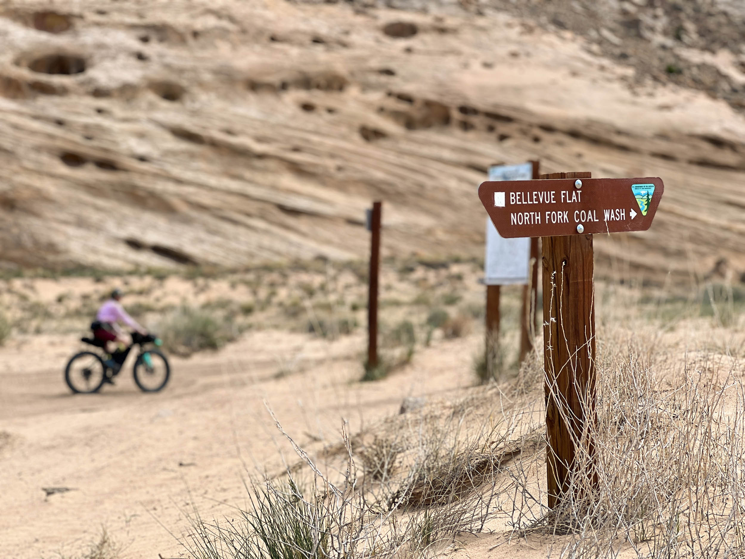
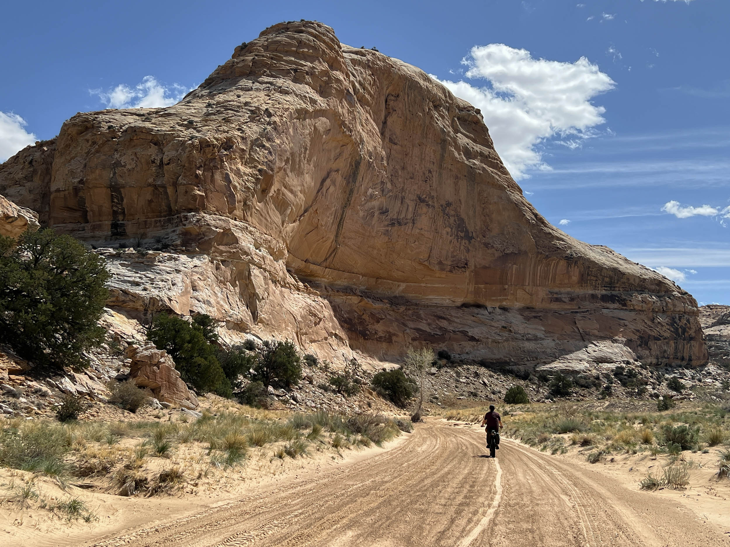
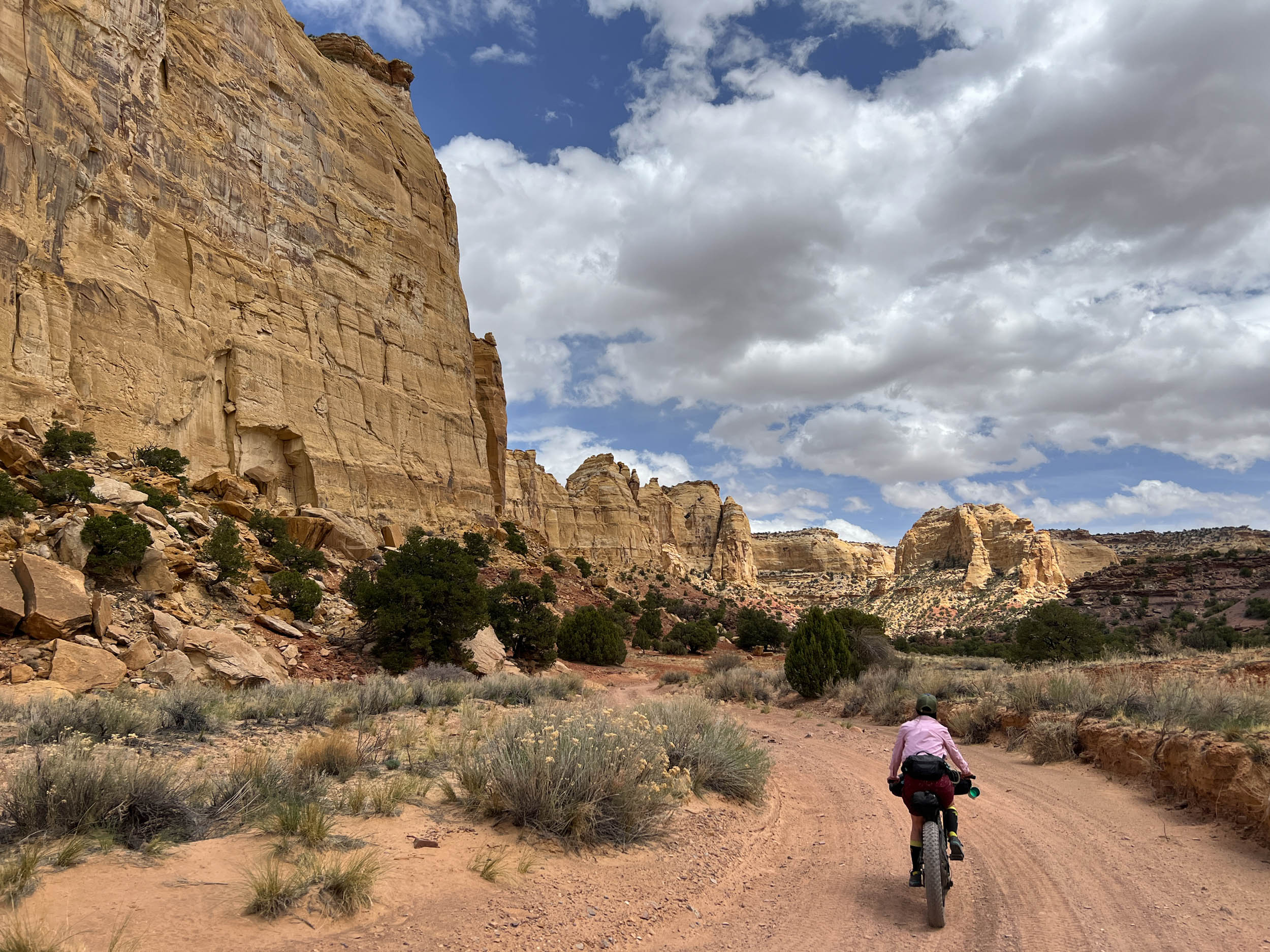
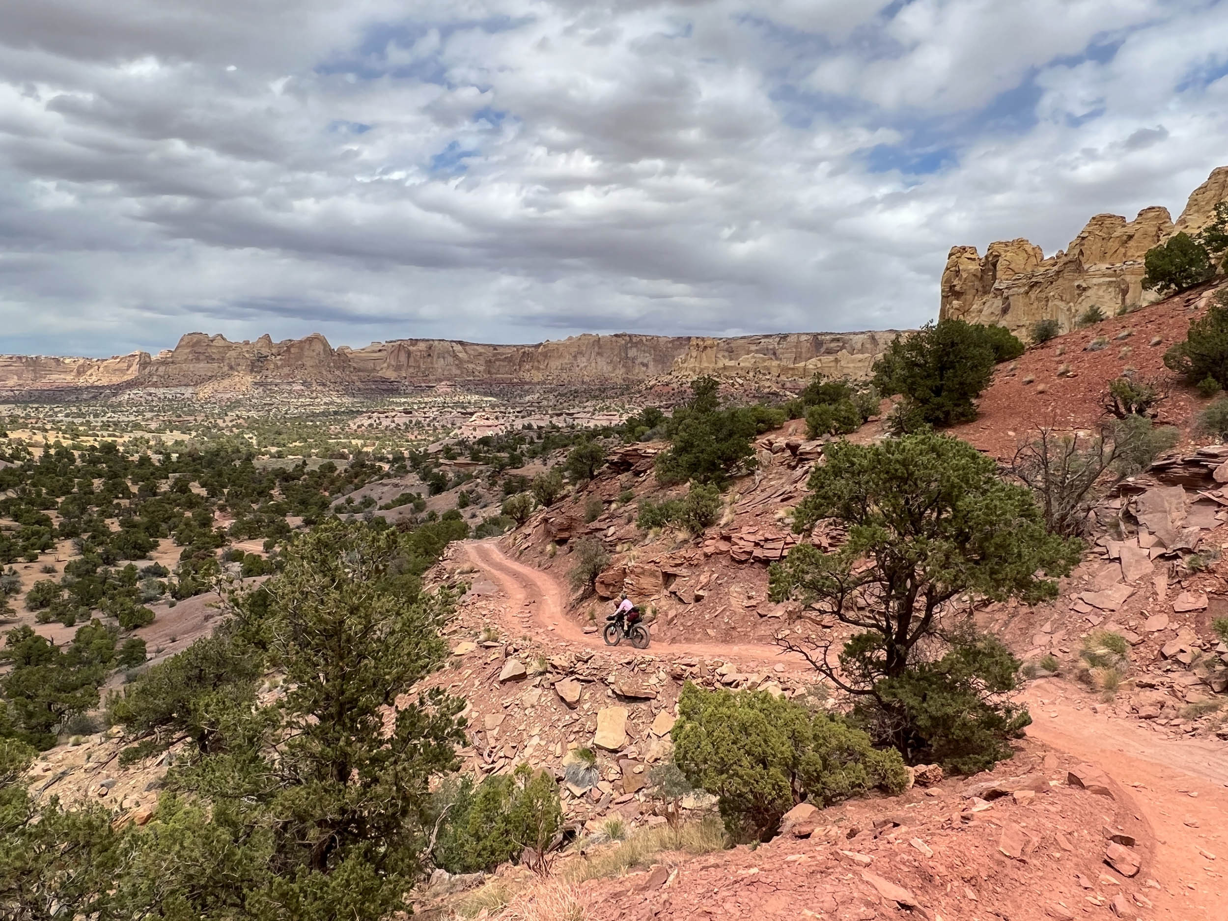
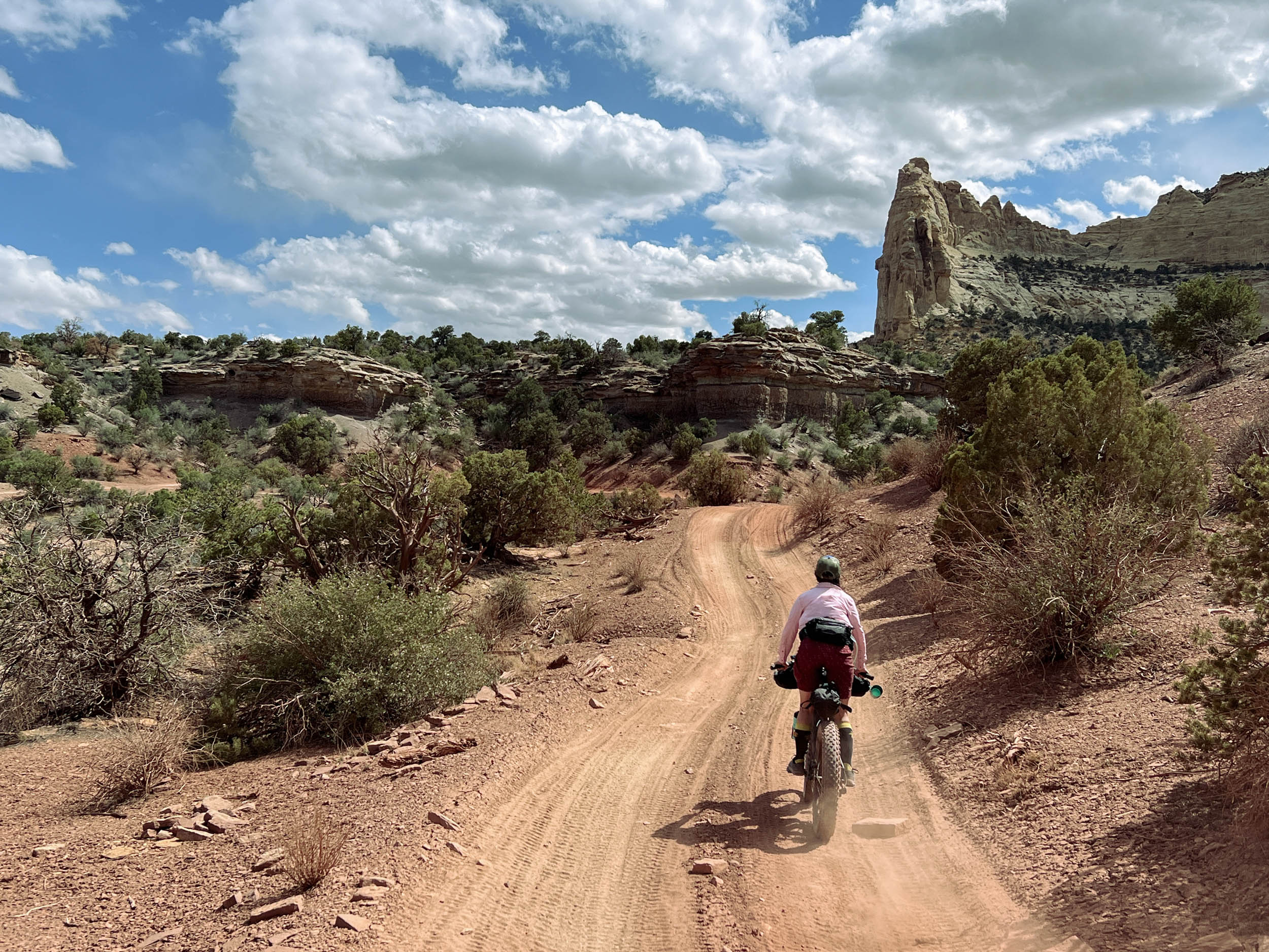
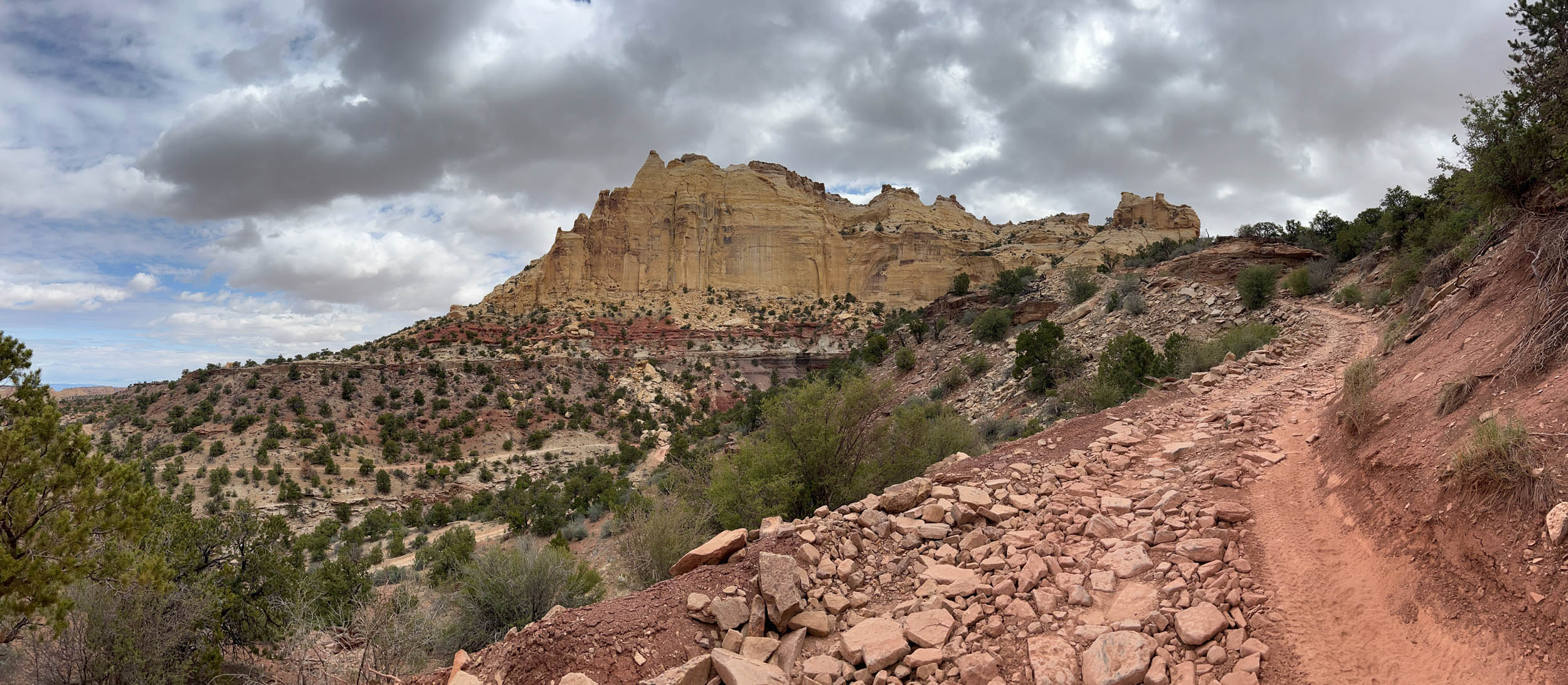
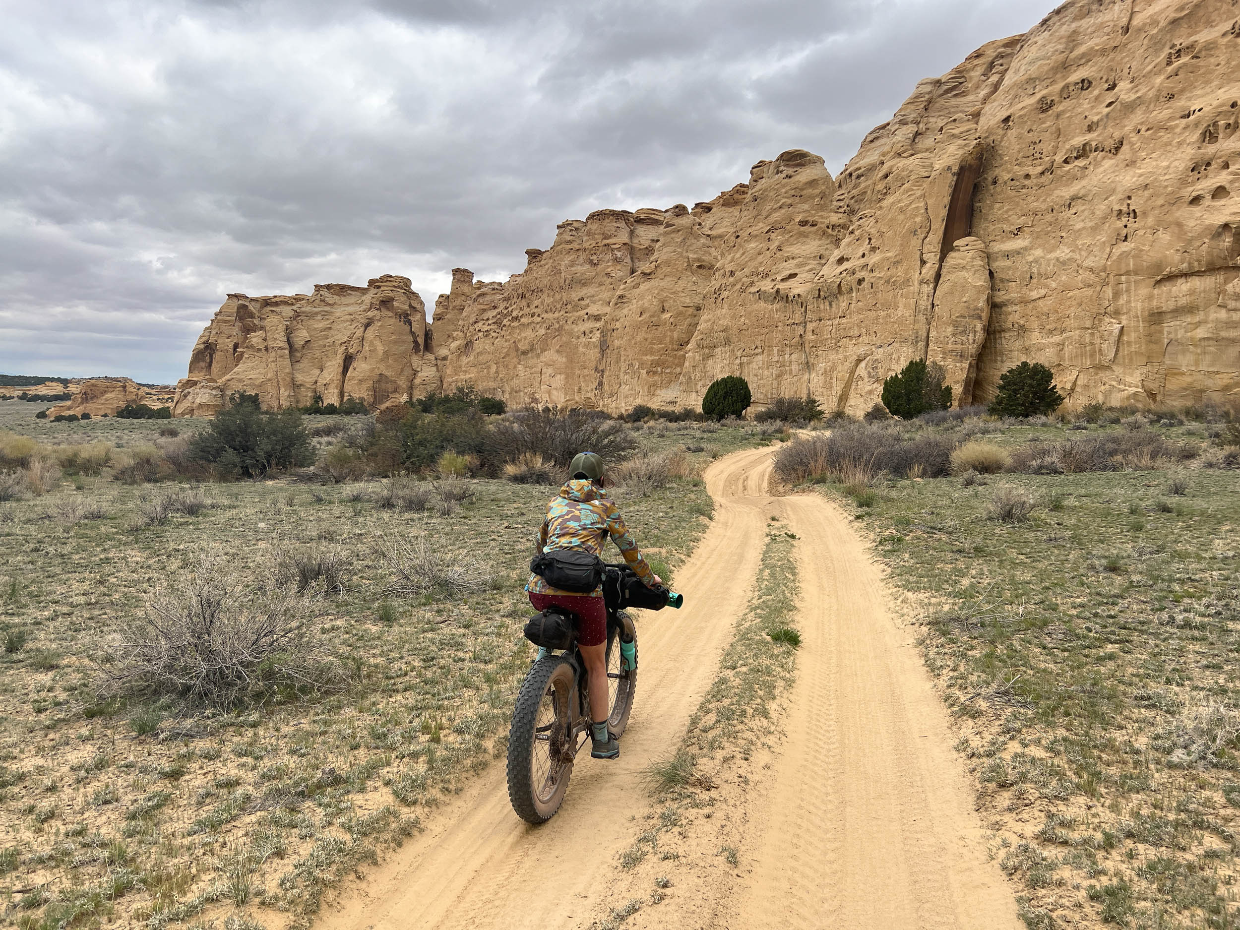
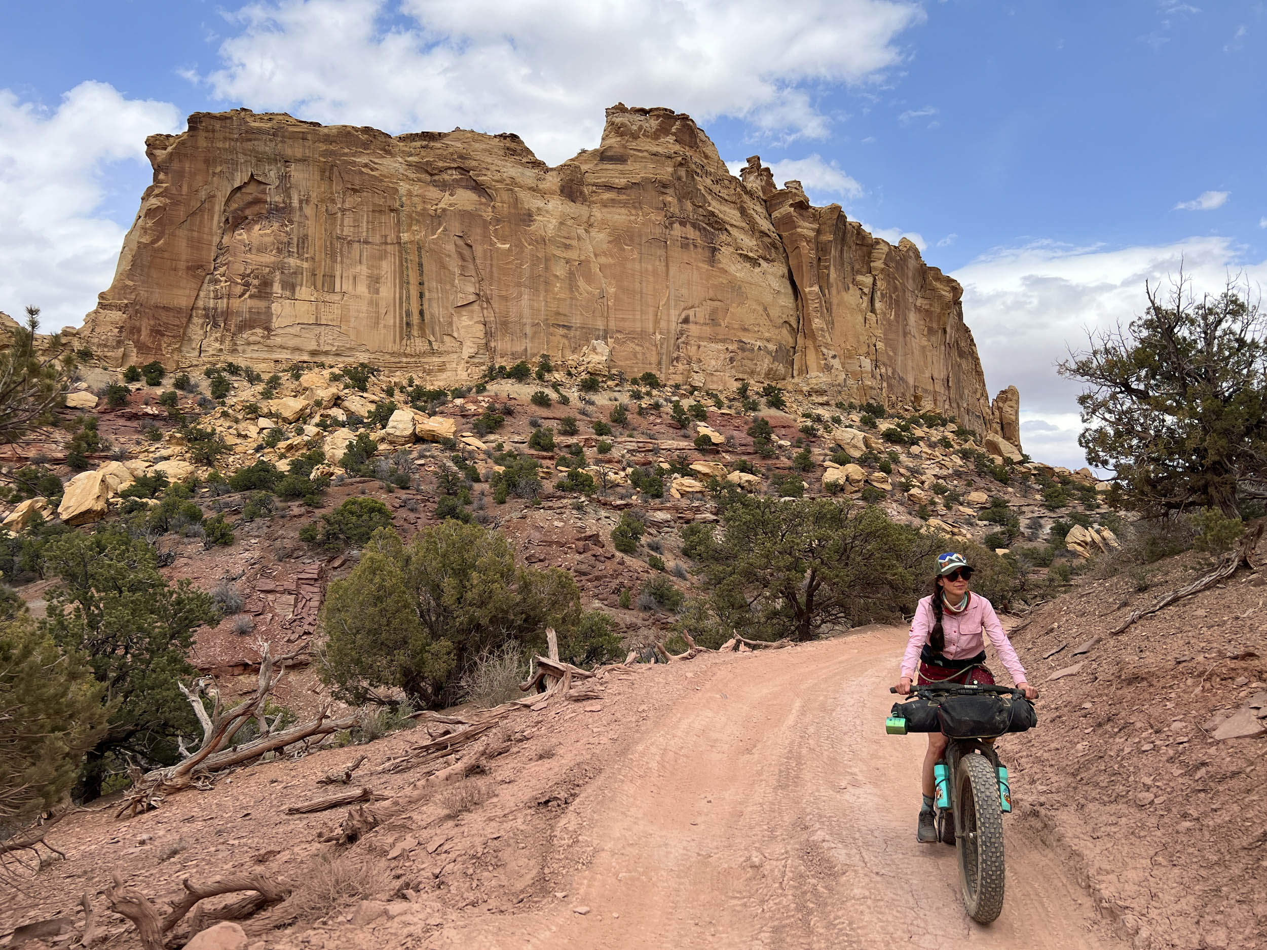
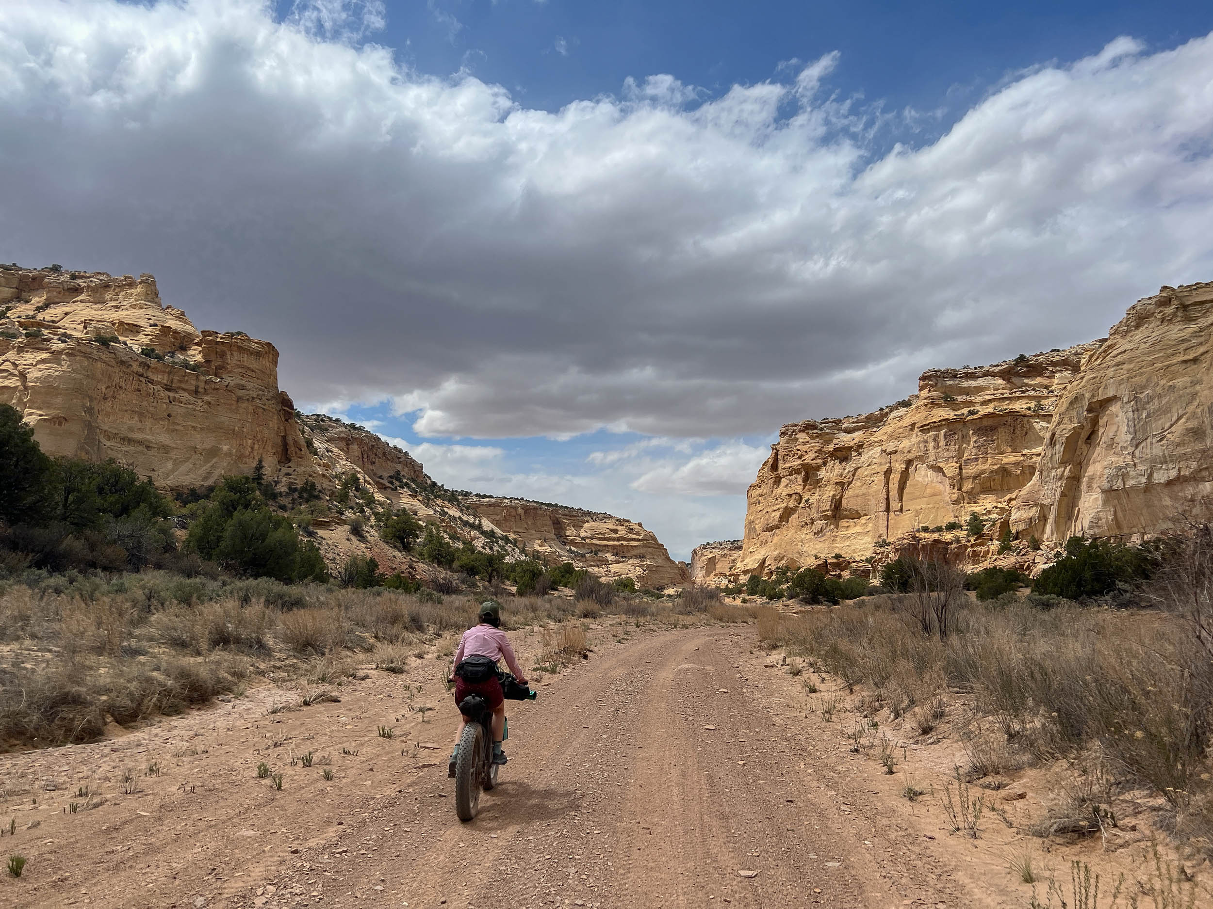
The Secret Mesa Loop is located almost entirely within the Eagle Canyon, Coal Wash, and Sid’s Mountain Wilderness Areas north of I-70. The best starting location for the route is off of Exit 116 on the south side of I-70 at Justensen Flat, where a large parking lot provides a safe and convenient location to leave a vehicle for multiple overnights. As we mention in the Trail Notes section, while it is possible to ride the route in either direction, it is recommended that the route be ridden clockwise. This direction will provide the rider with the sensation of being plunged into the heart of The Swell as they descend into the Coal Wash region along rocky doubletracks set at the foot of towering cliffs of Navajo Sandstone and along rimrock trails perched above deep canyons incised into strata of the underlying Kayenta Sandstone.
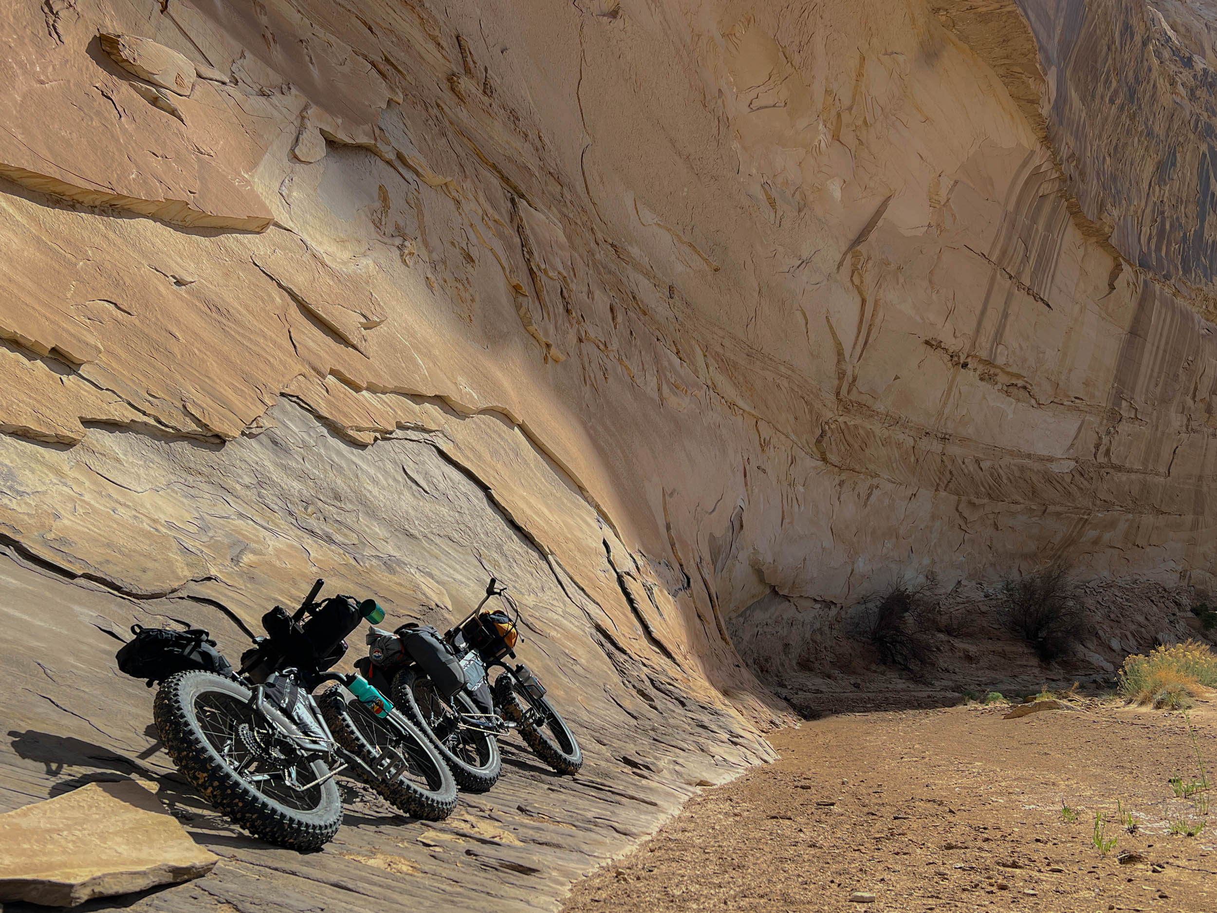
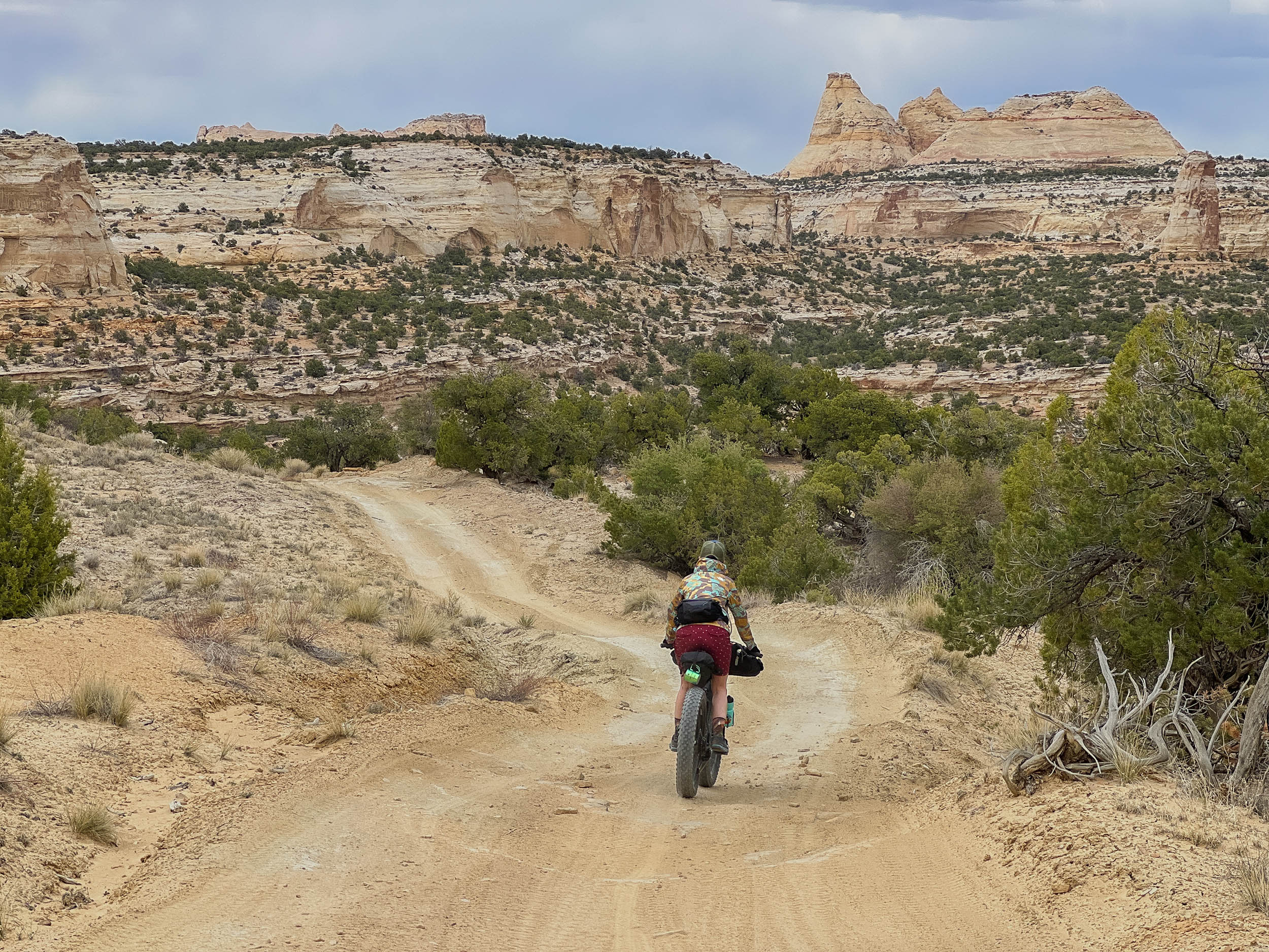
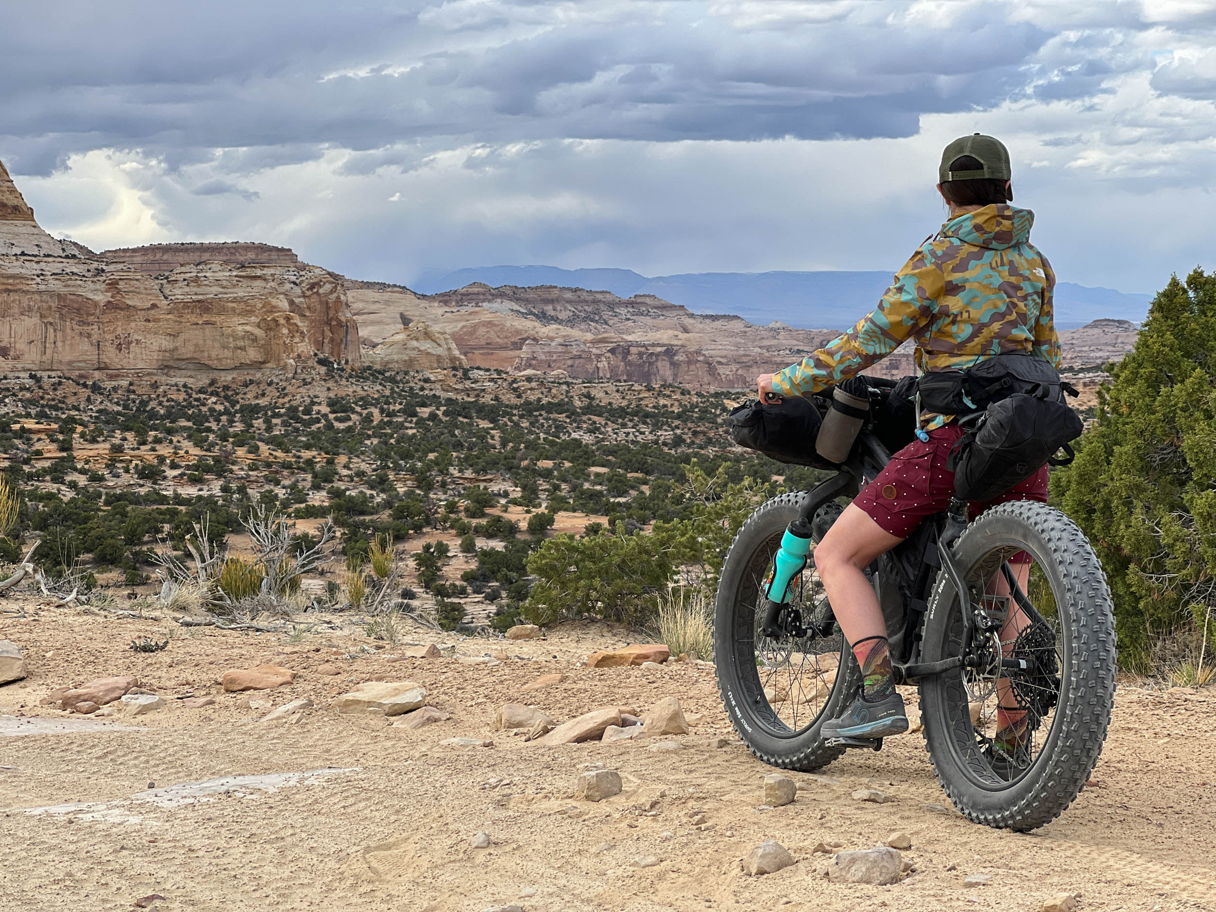
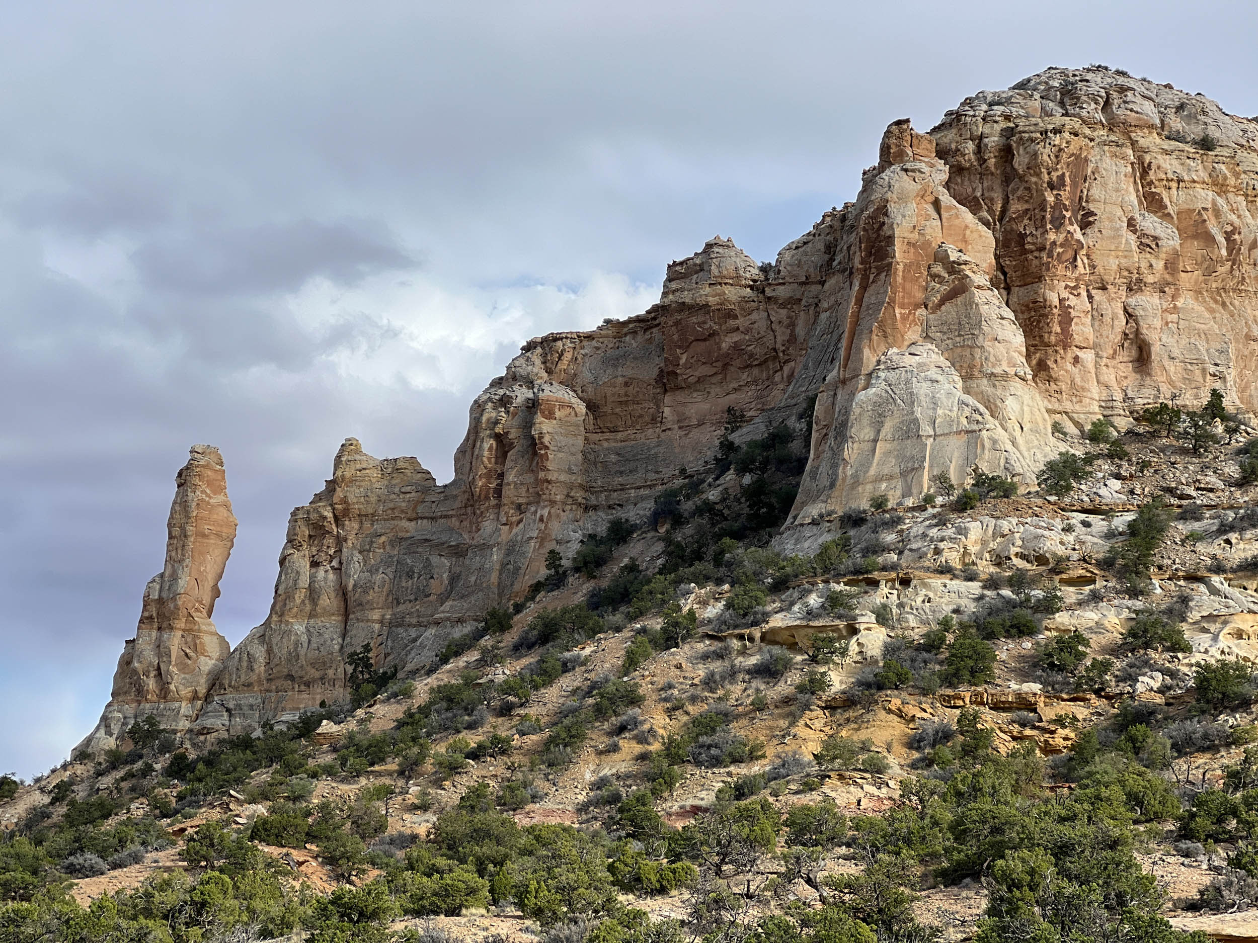
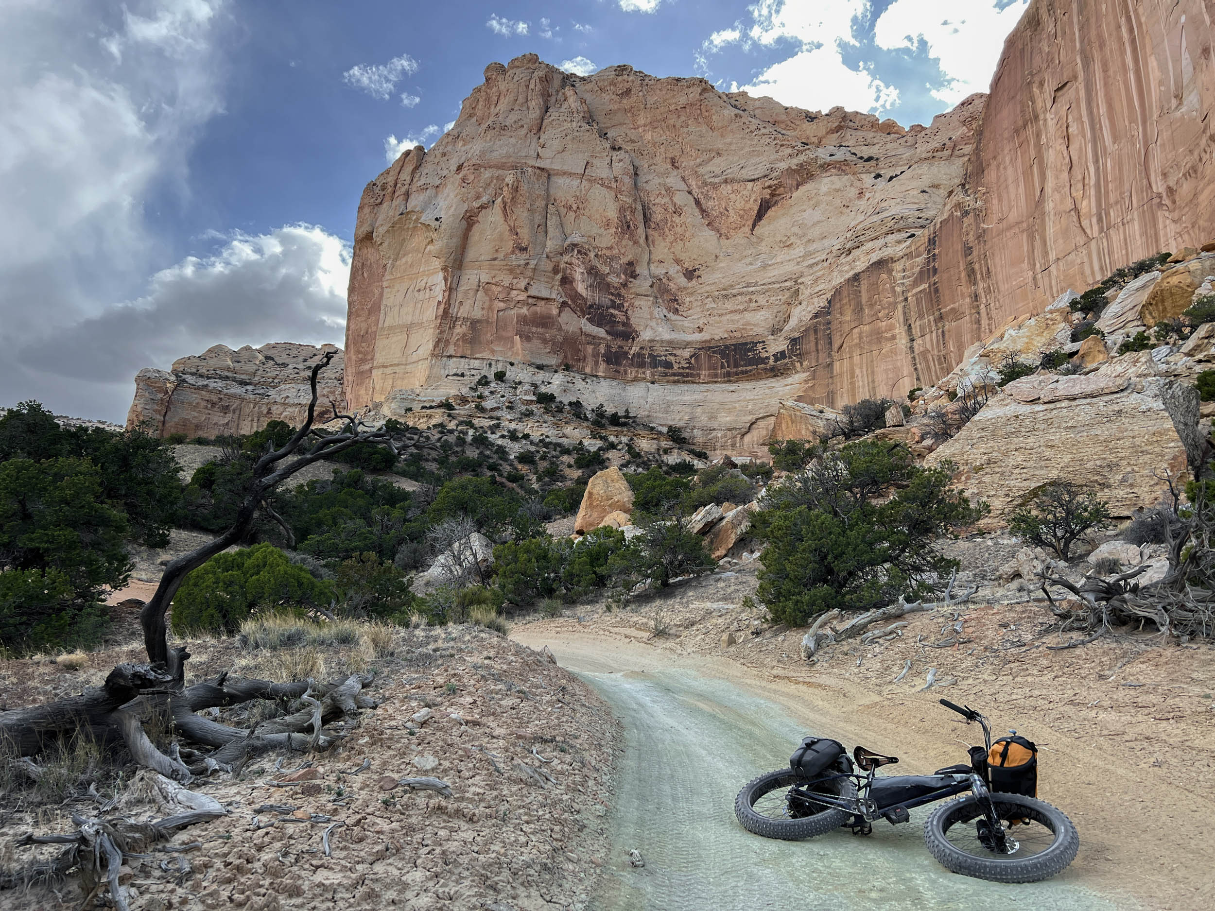
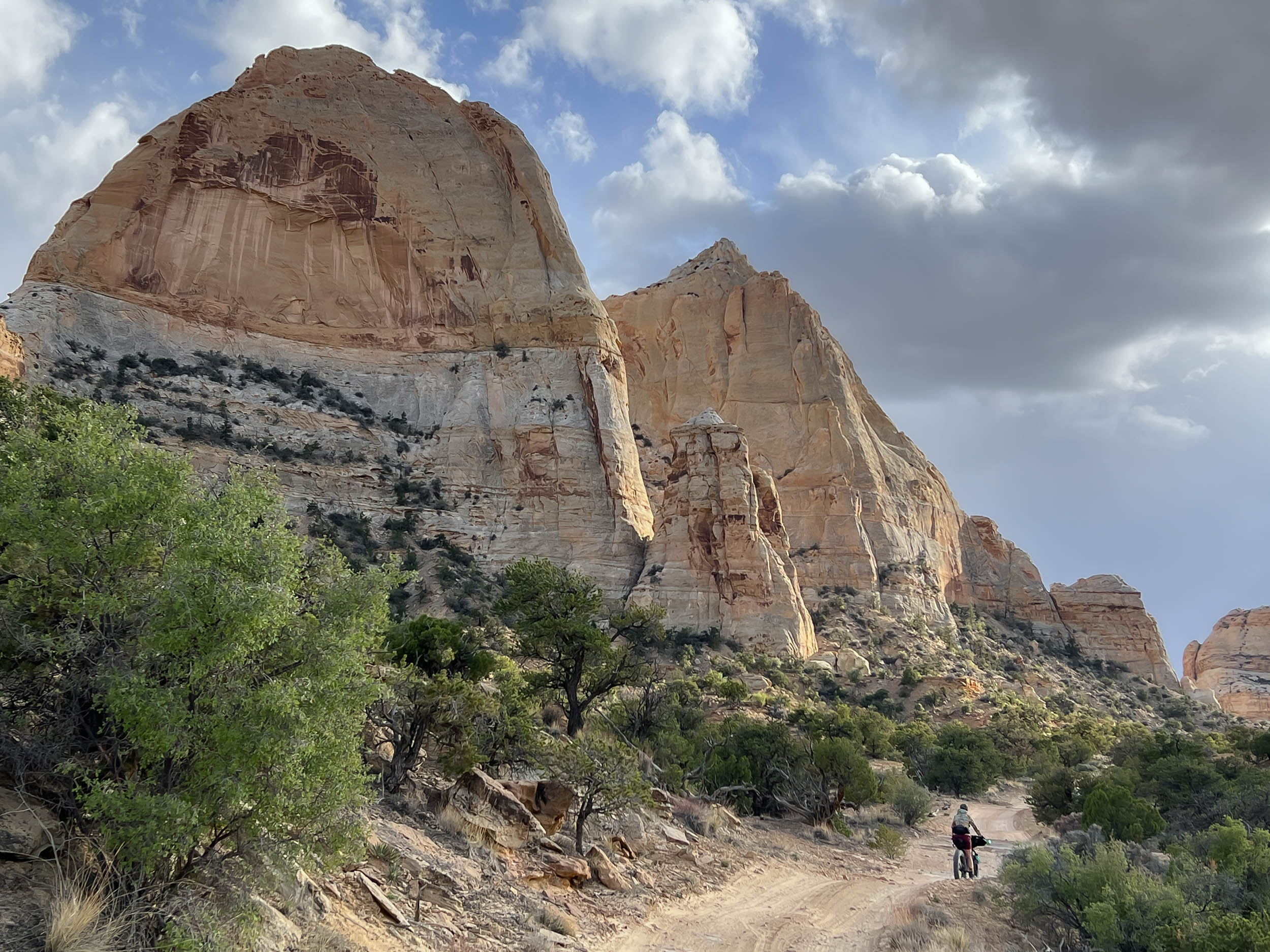
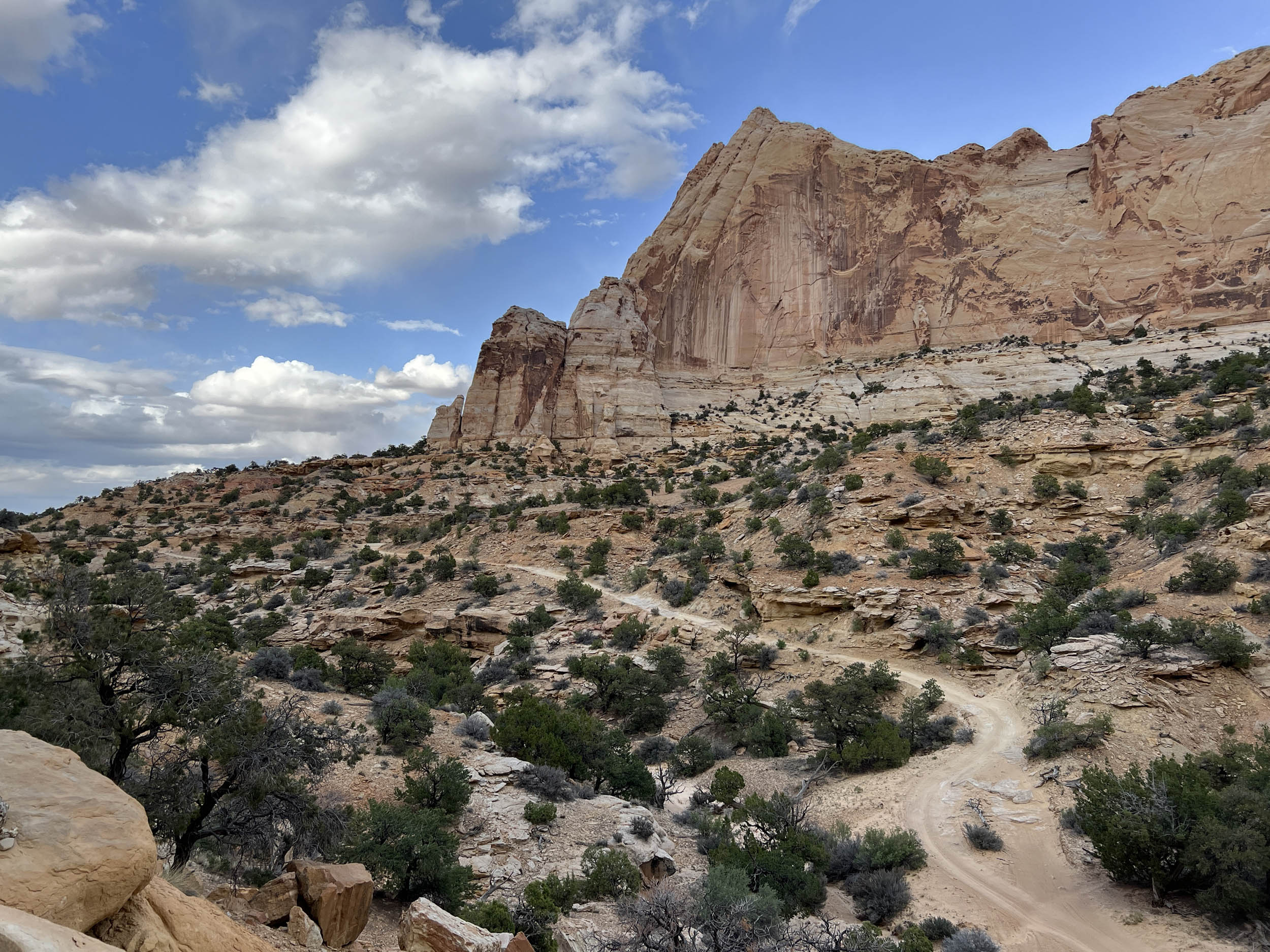
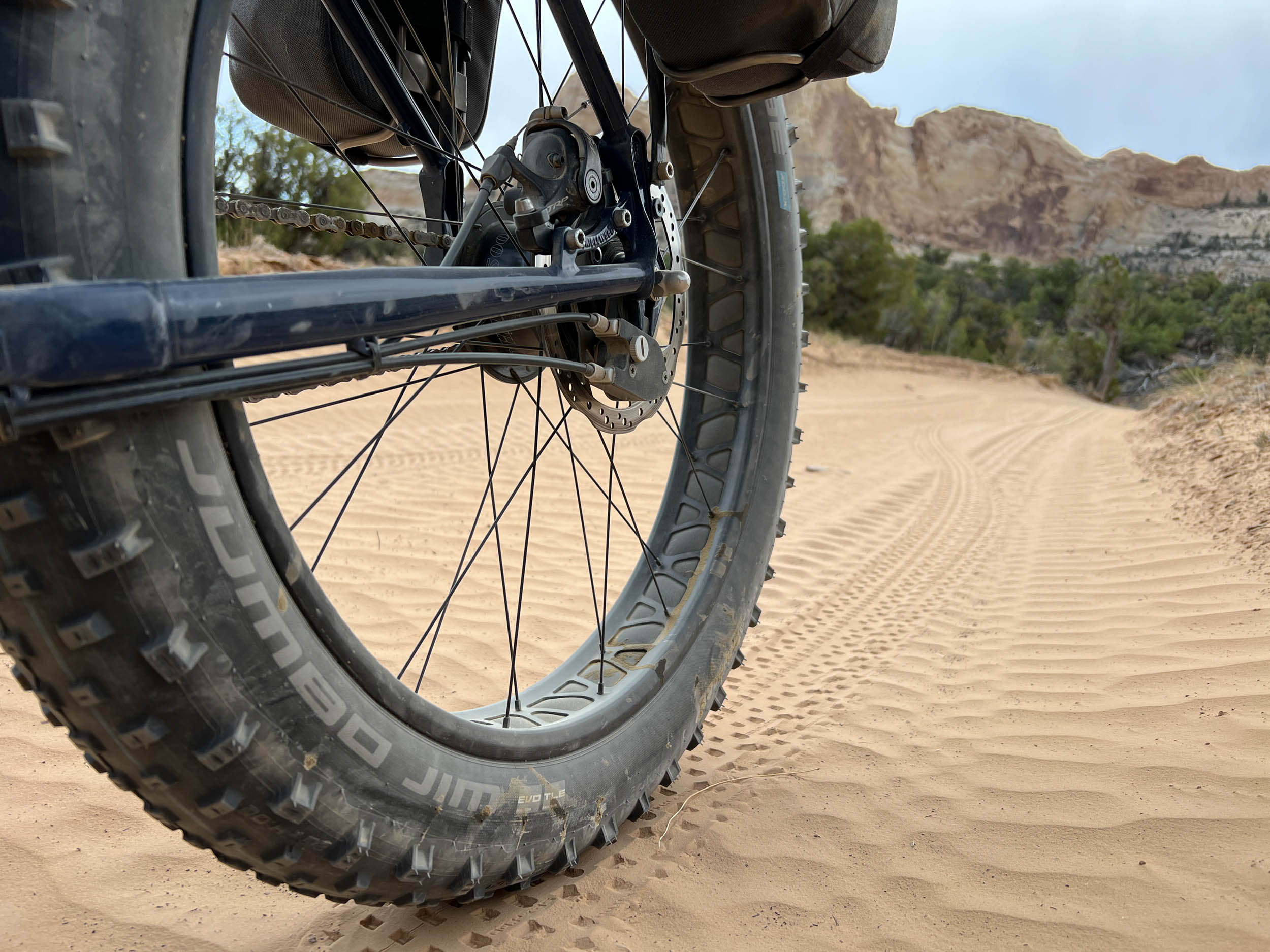
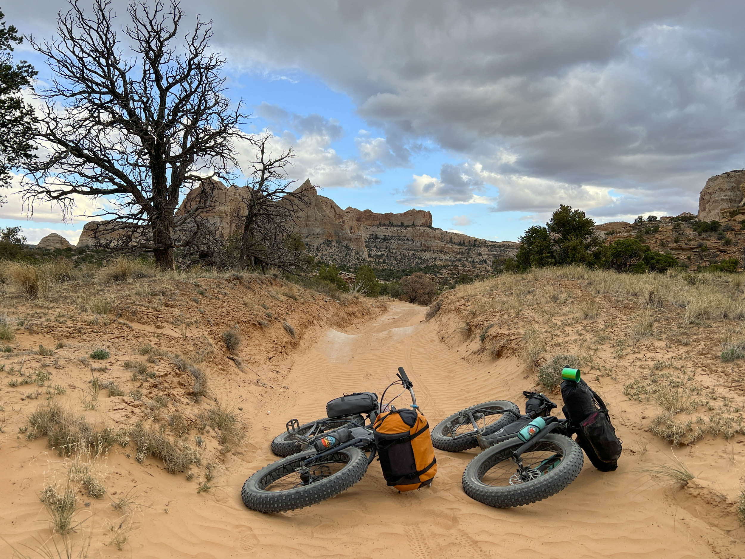
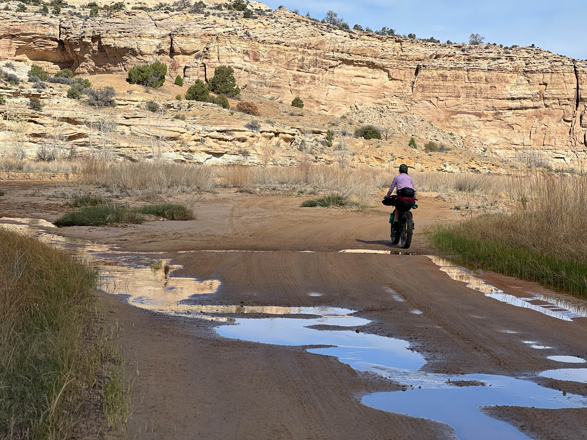
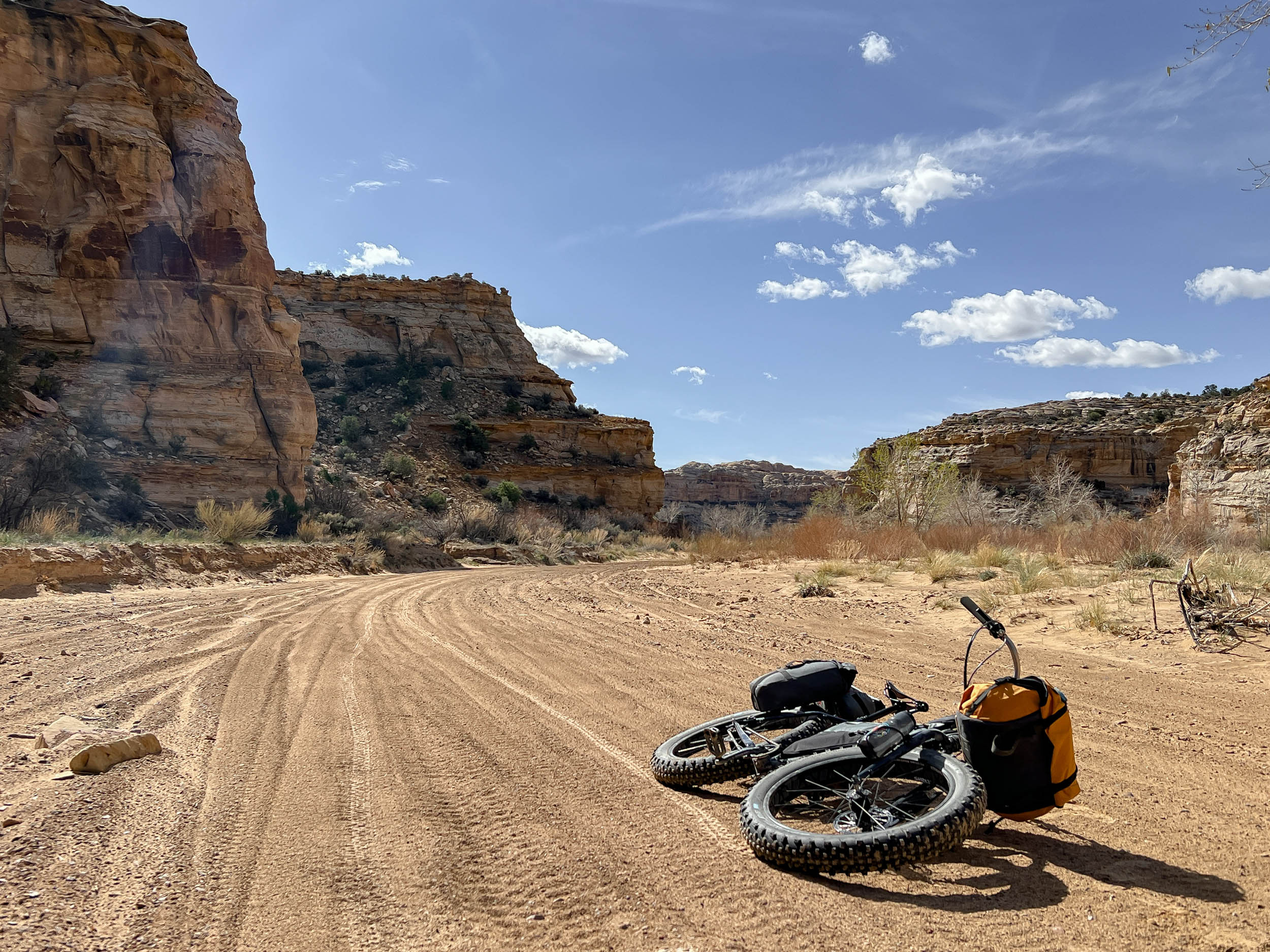
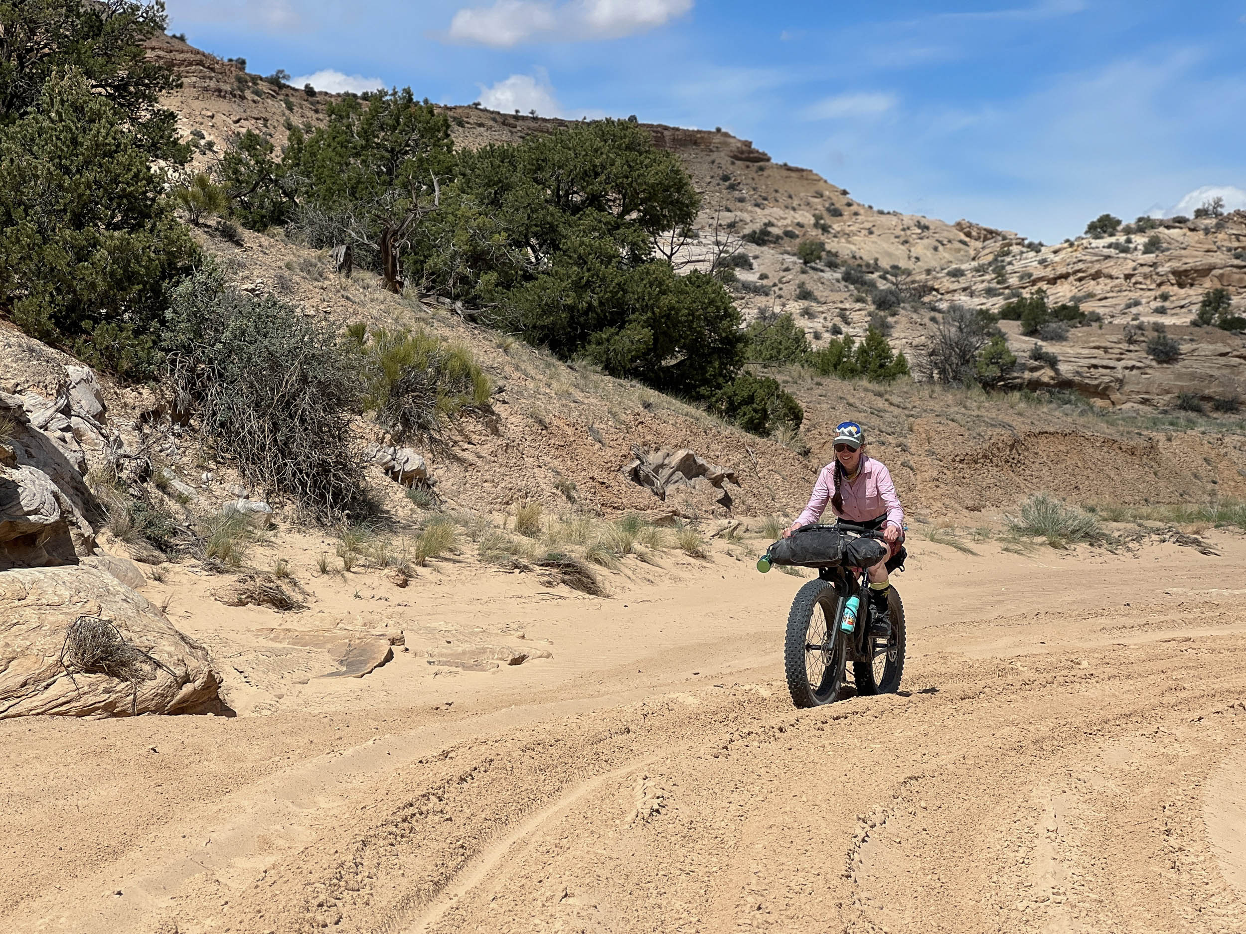
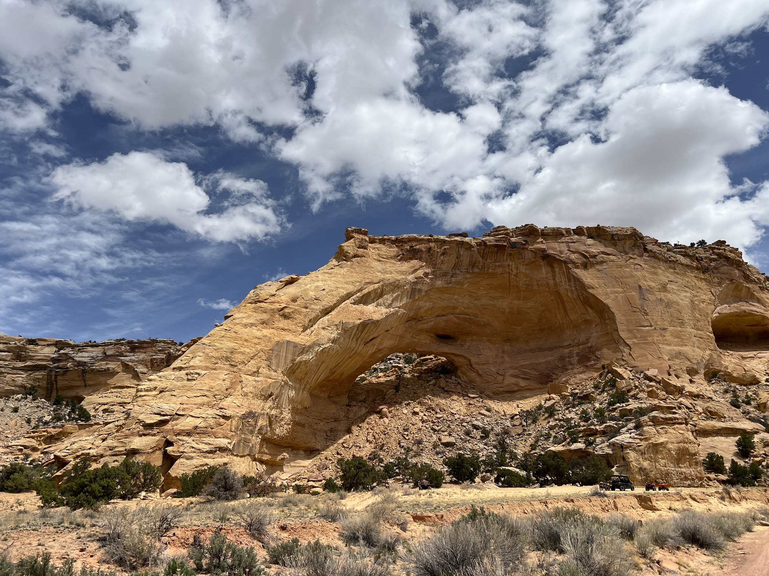
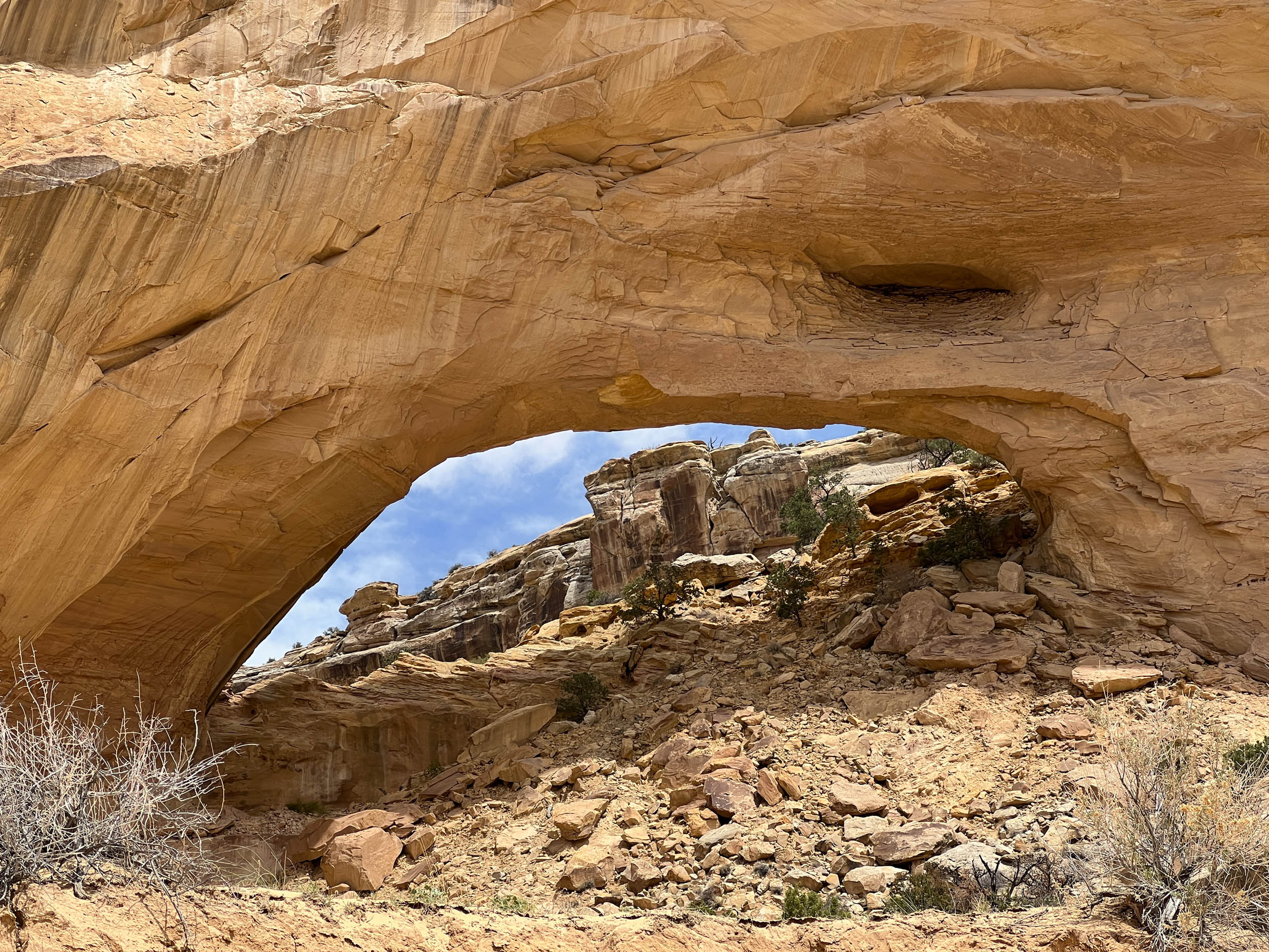
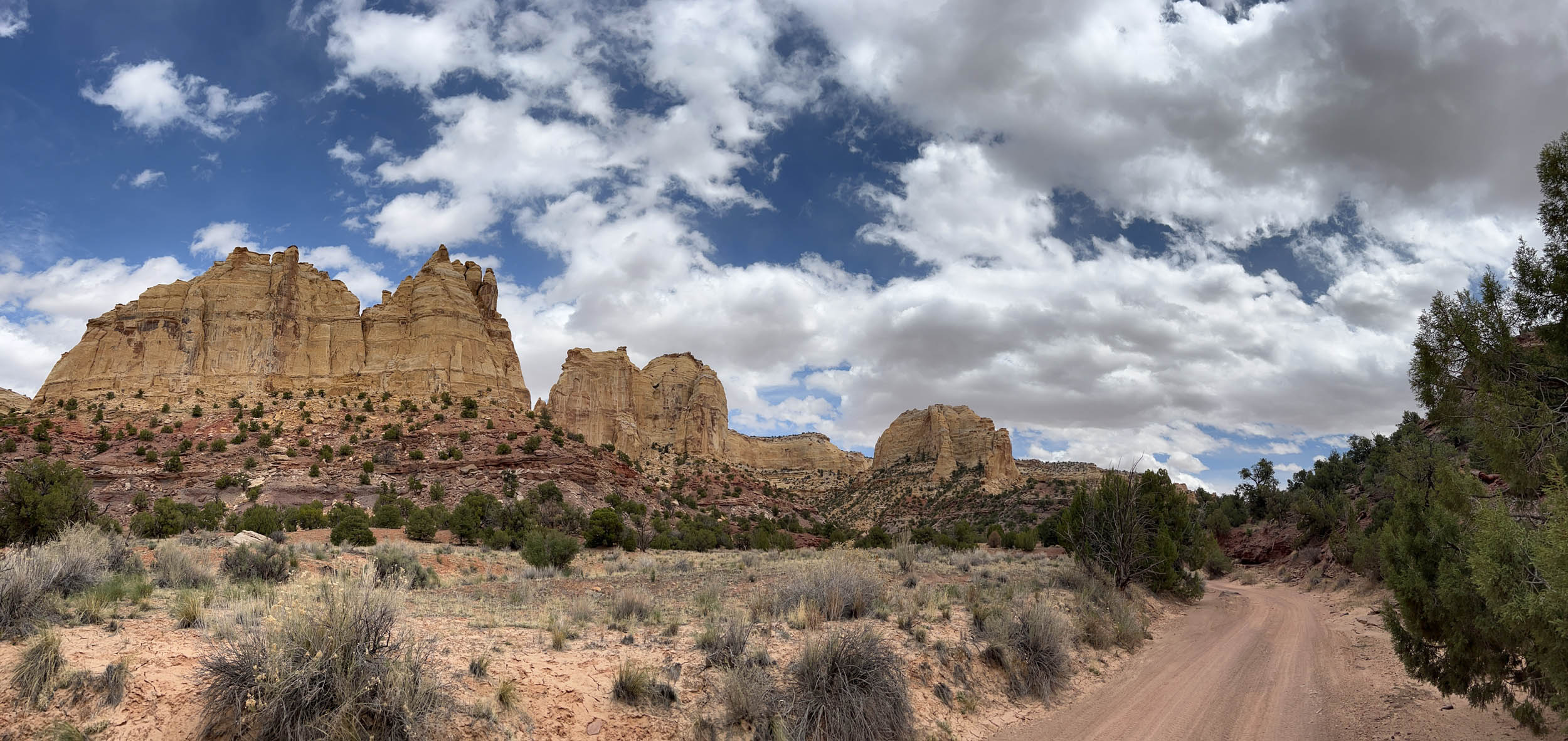
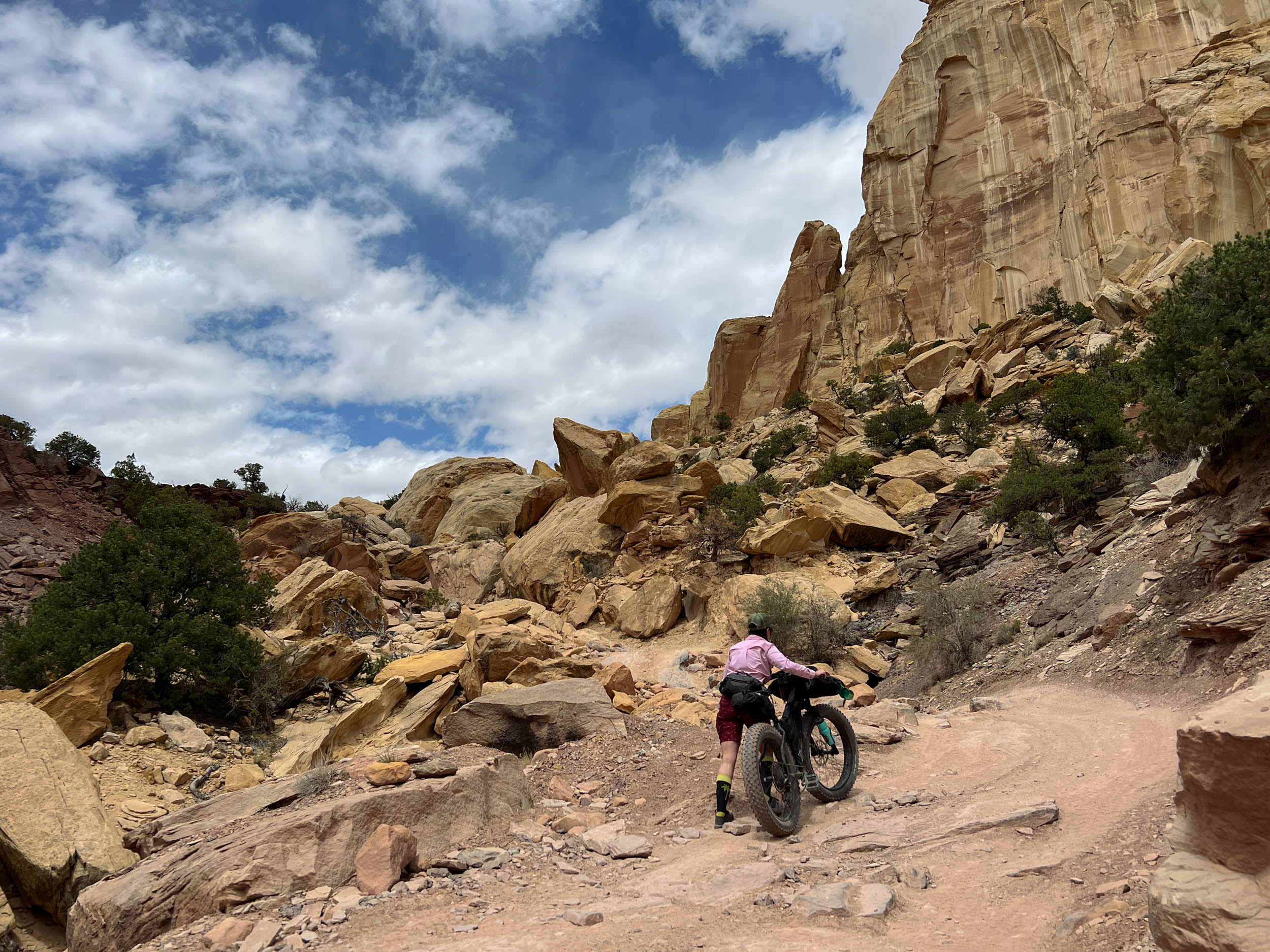
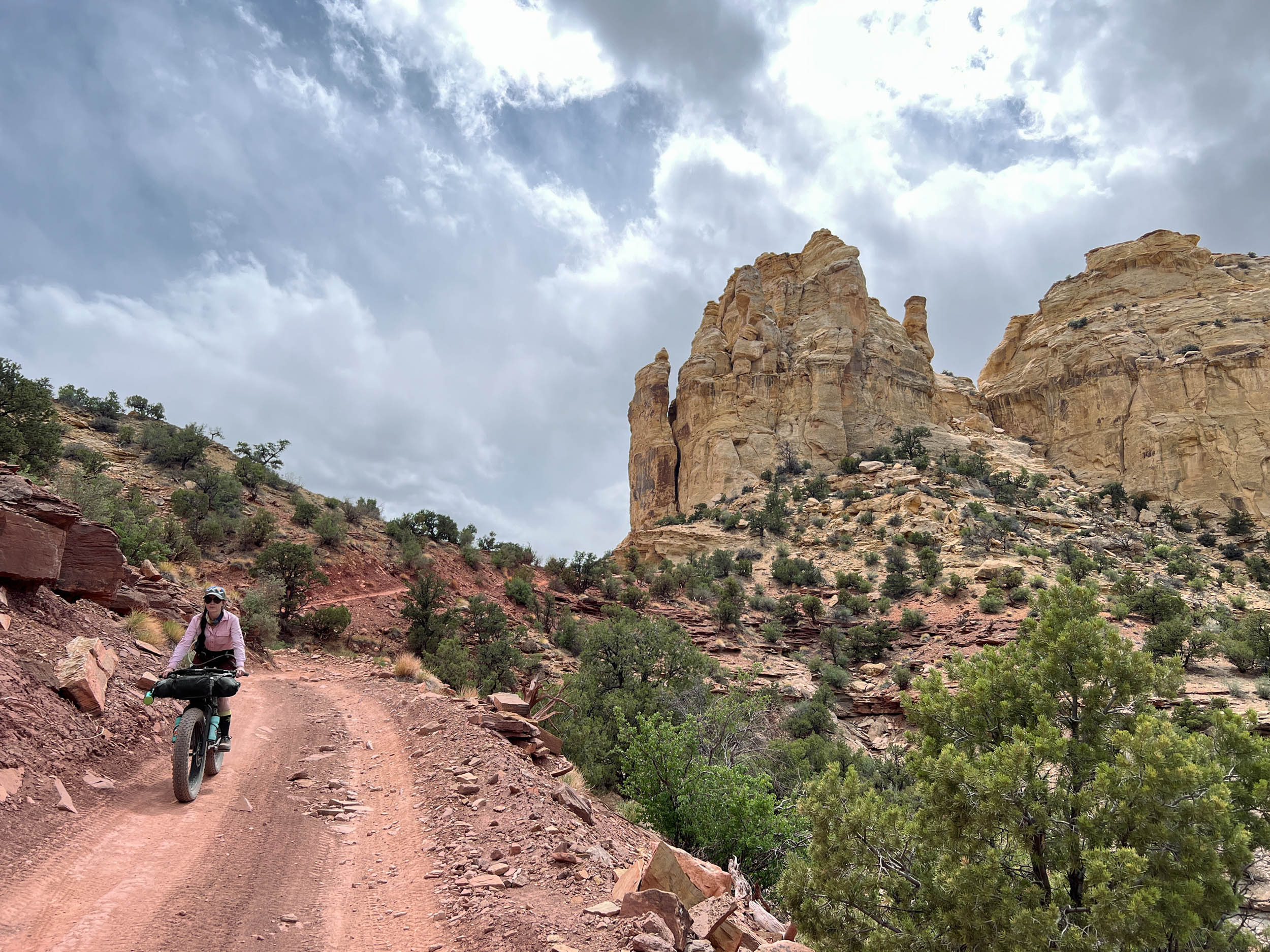
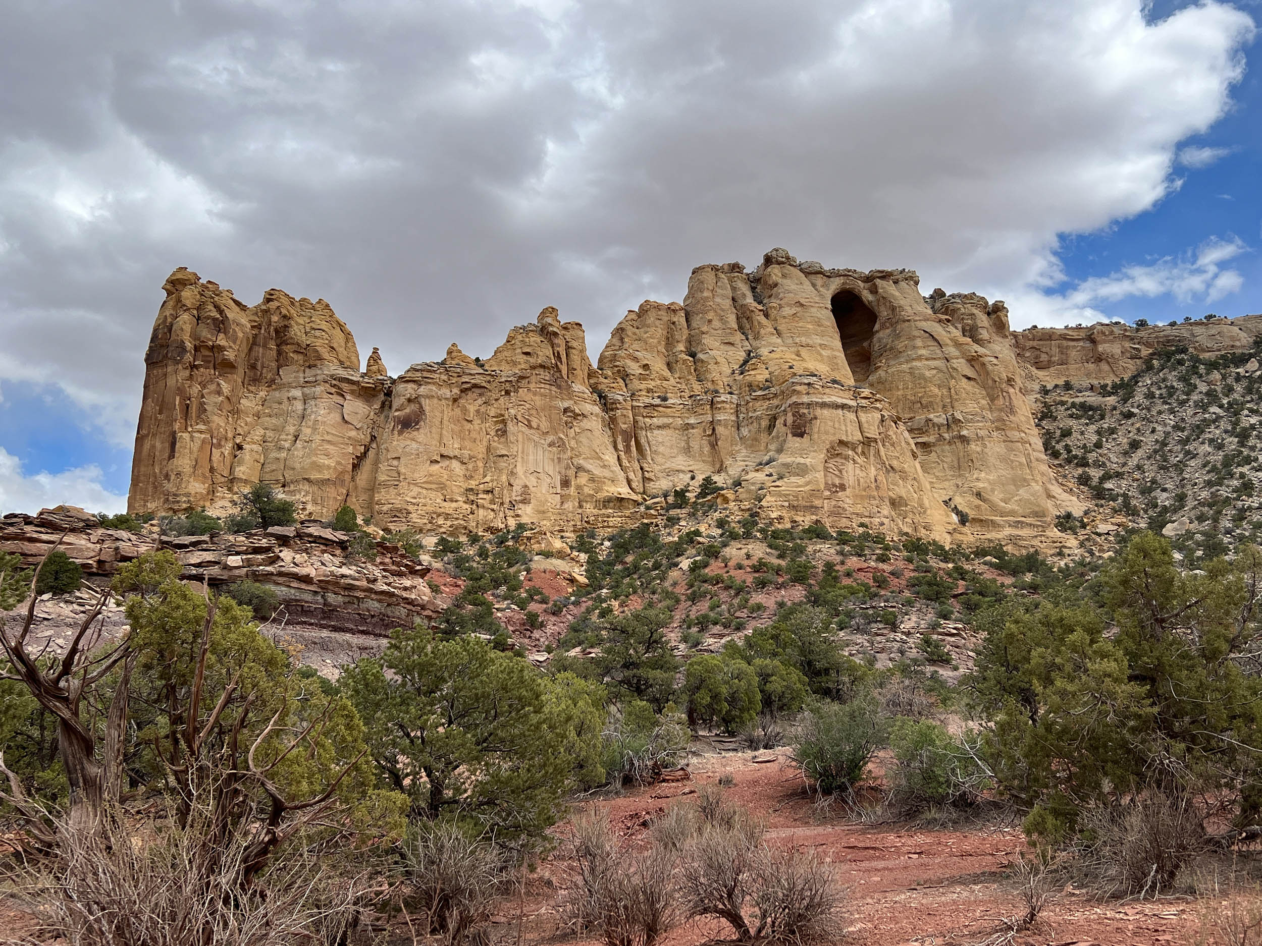
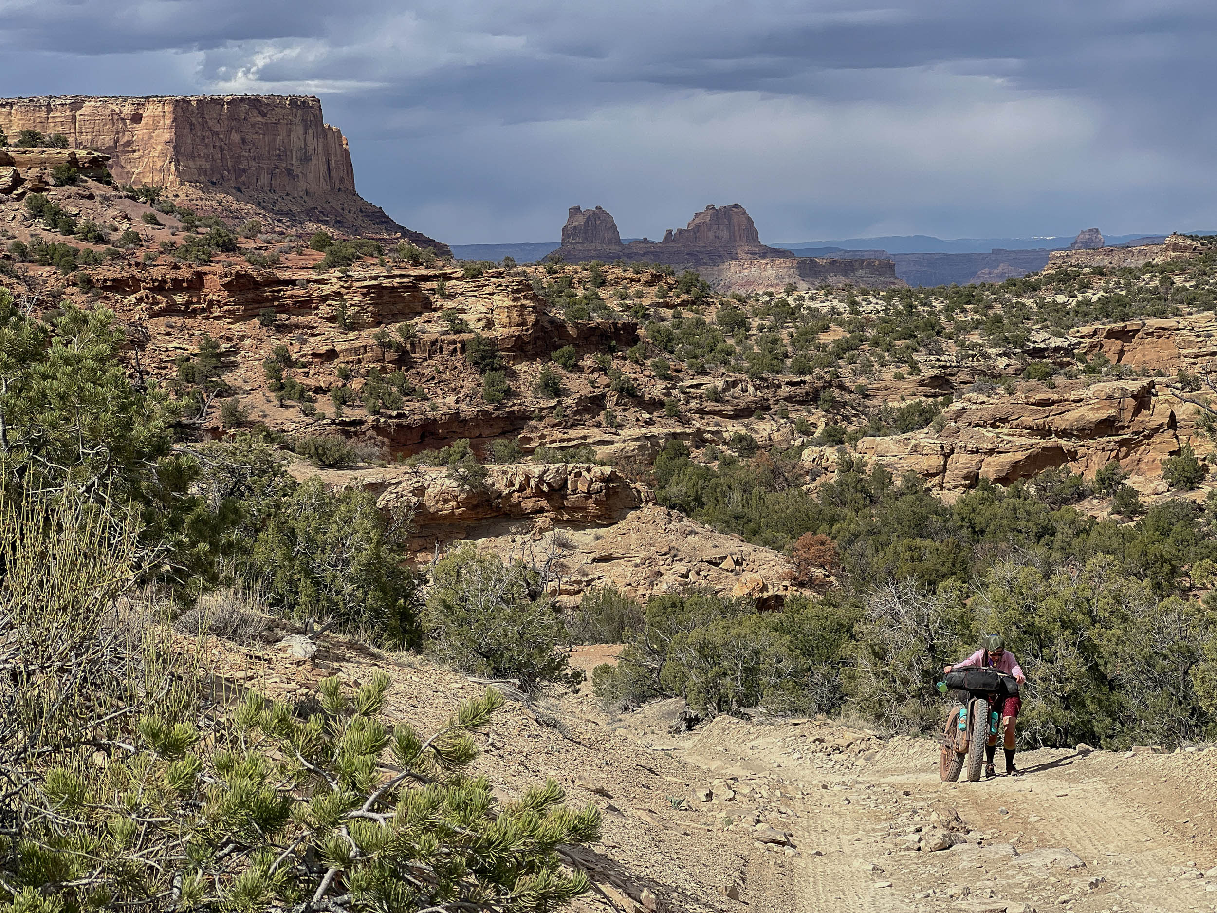
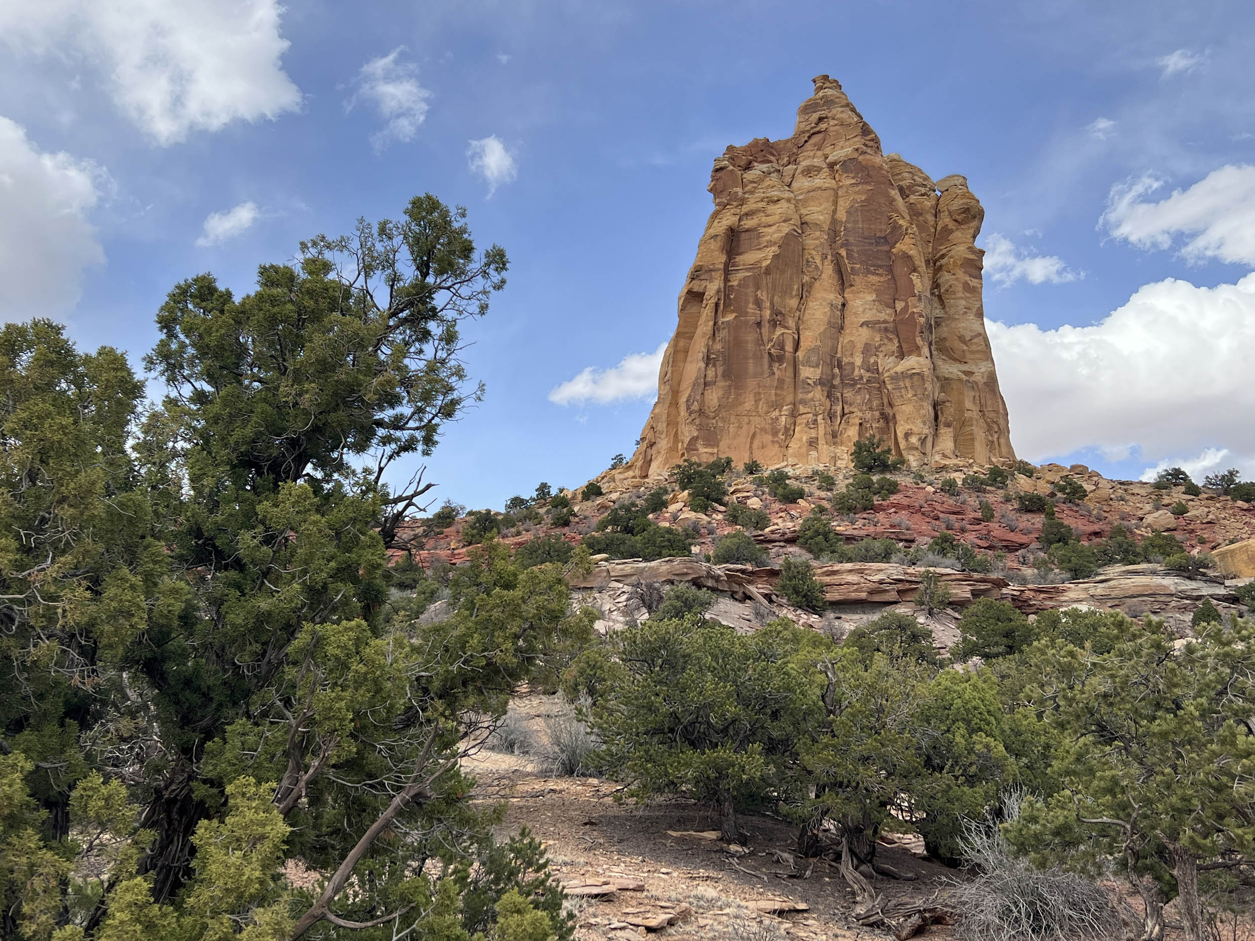
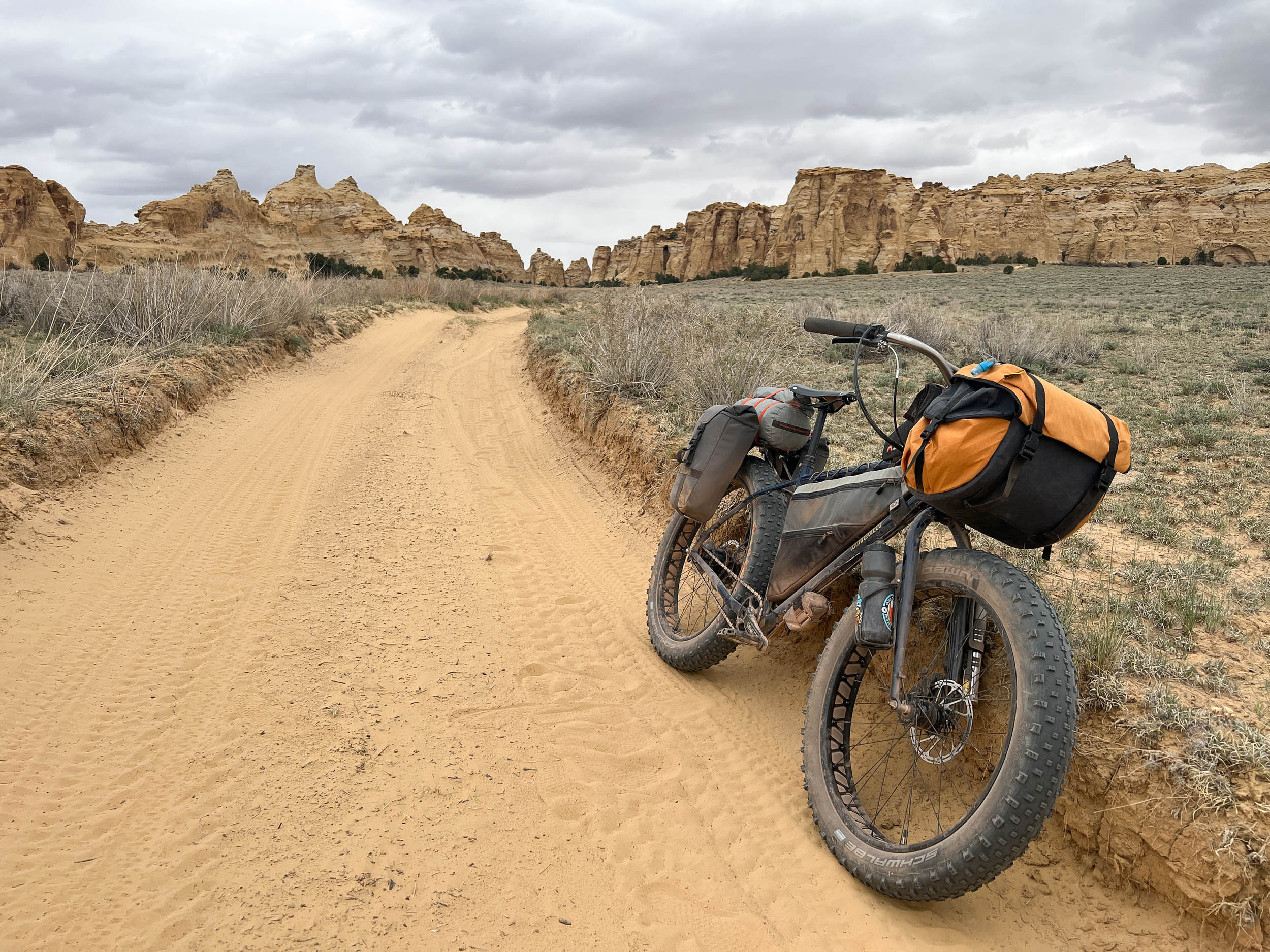
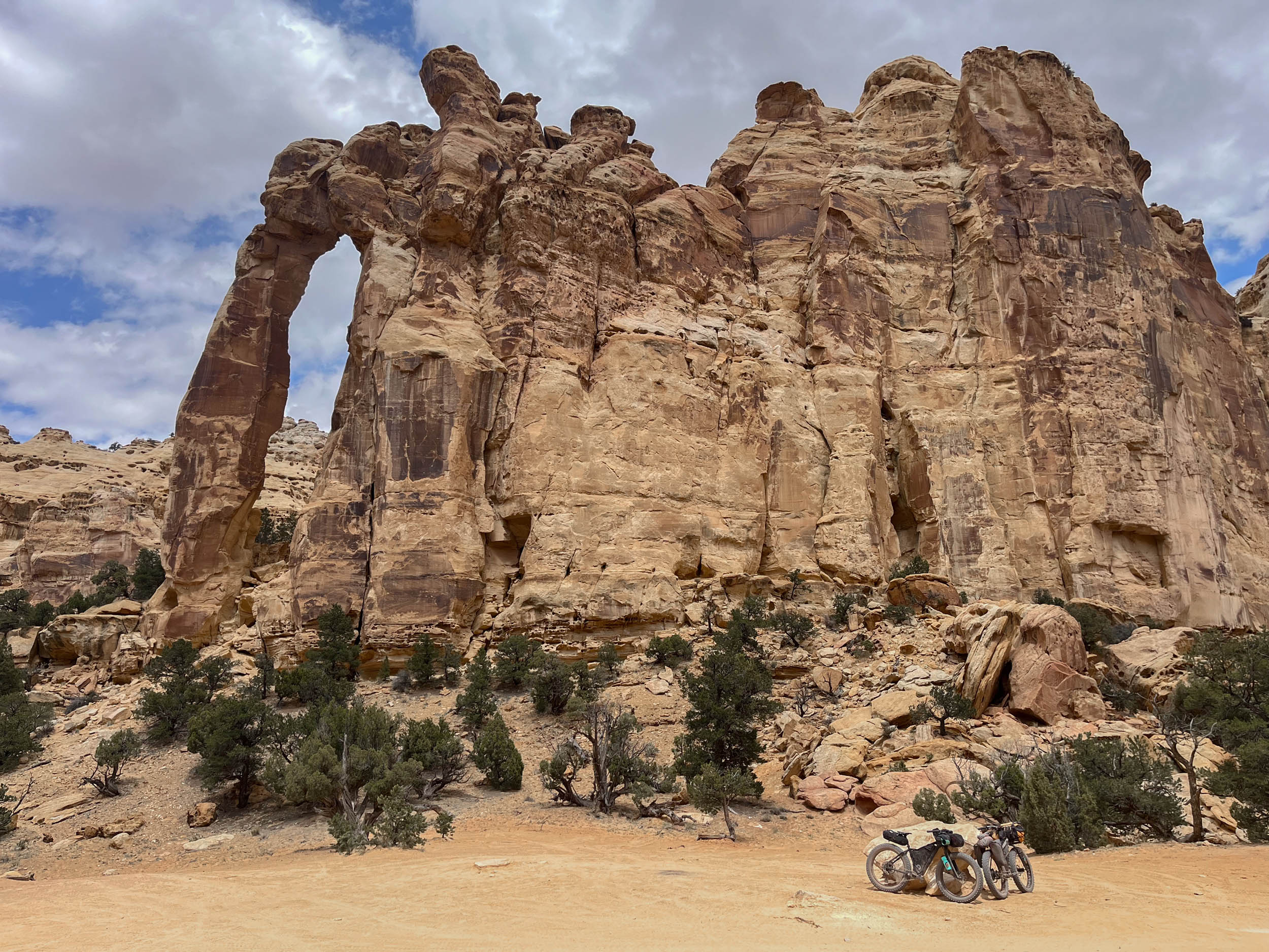
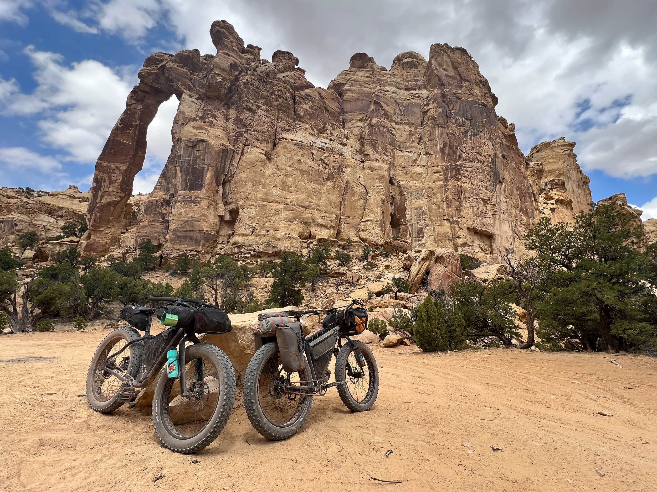
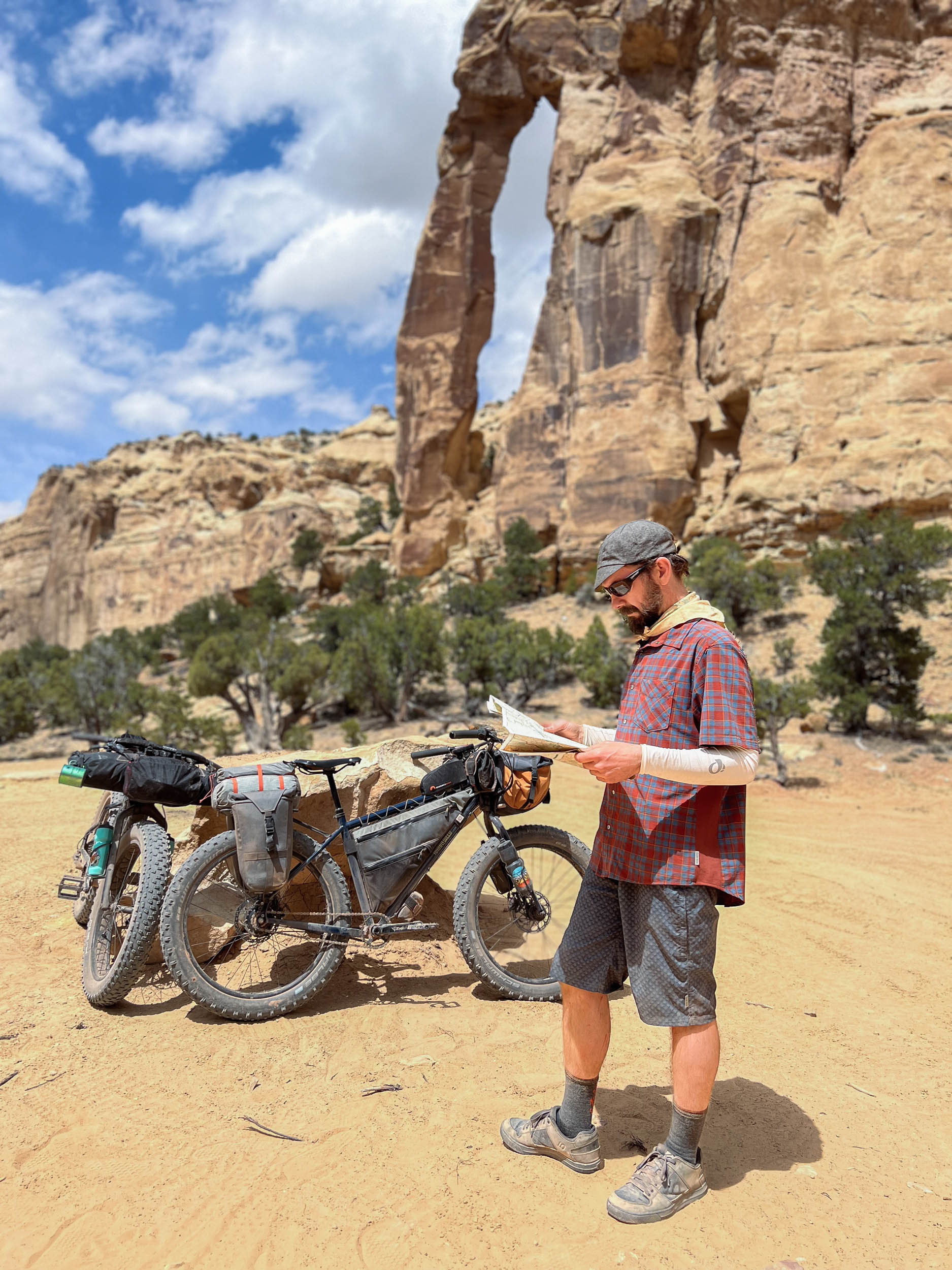
As you enter the South and North Forks of Coal Wash, the character of the route changes dramatically. The rocky ledges of the first few miles give way to a gentler landscape where the rider moves through sinuous desert washes within tight box canyons. The approximately 15 miles through Coal Wash are what necessitate a fat (or plus) bike, as they facilitate movement through sections of deep sand that characterize much of the riding surface along this portion of the route. The effortful biking here is greatly offset by the stunning visuals offered up by cliff walls and sands of continuously shifting color as the rider climbs to higher elevations but deeper into the geologic layers of the San Rafael Swell. This section of the route finds the rider climbing and descending through layers of the Carmel Formation, Navajo Sandstone, Kayenta Formation, and Chinle Formation via Fix-It Pass and portions of the Devil’s Race Track en route to Locomotive Point. Slipper Arch, the first of three major arches encountered on the route, also awaits riders in this section of the Swell.
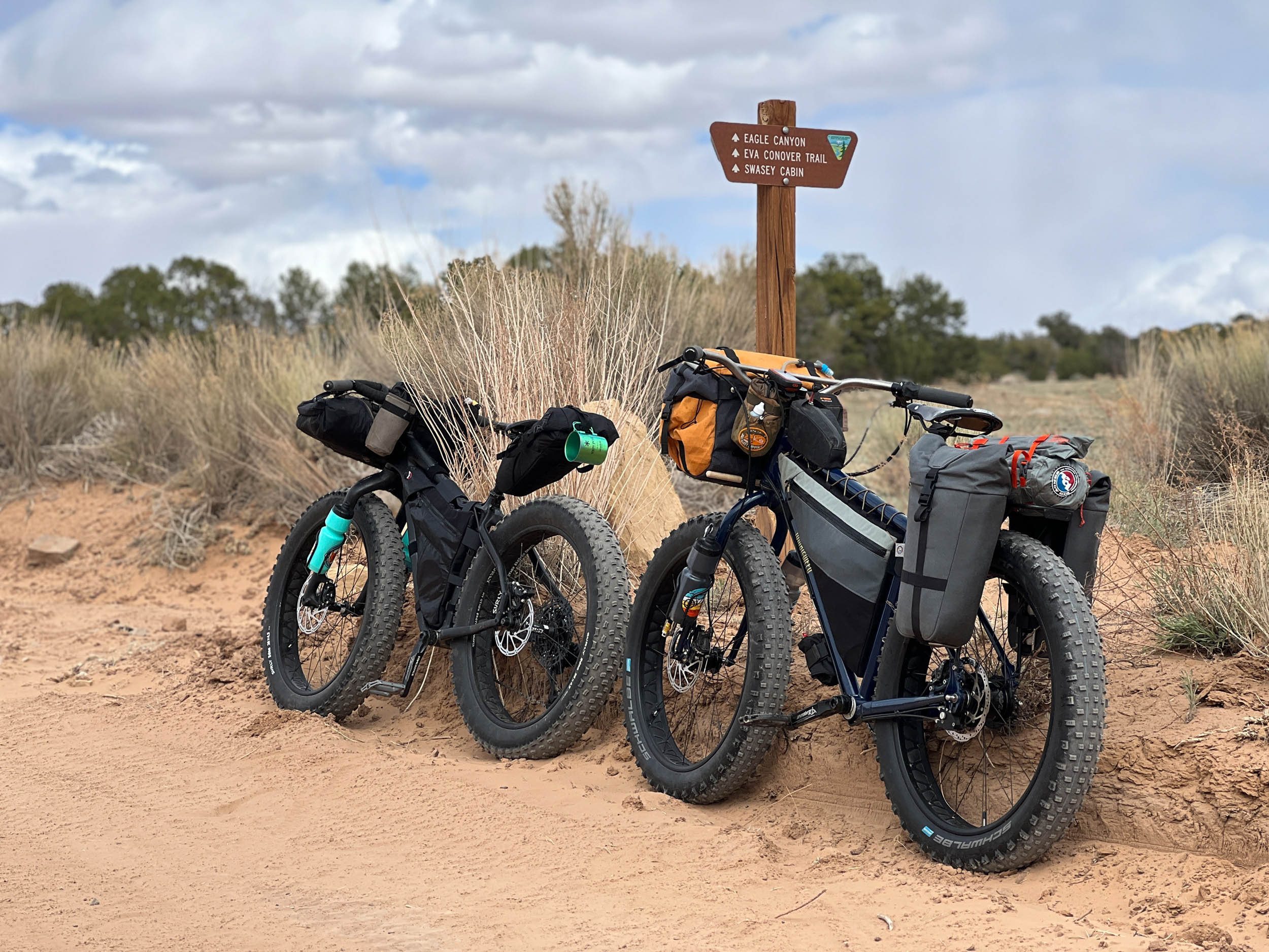
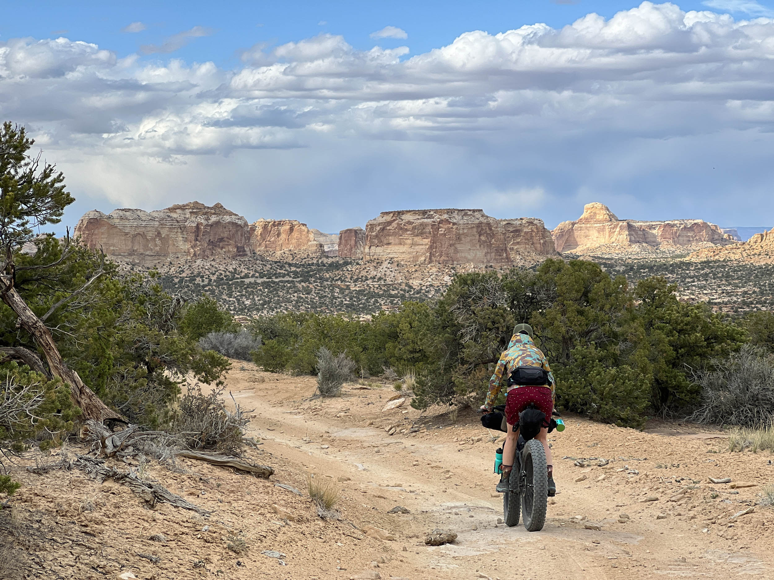
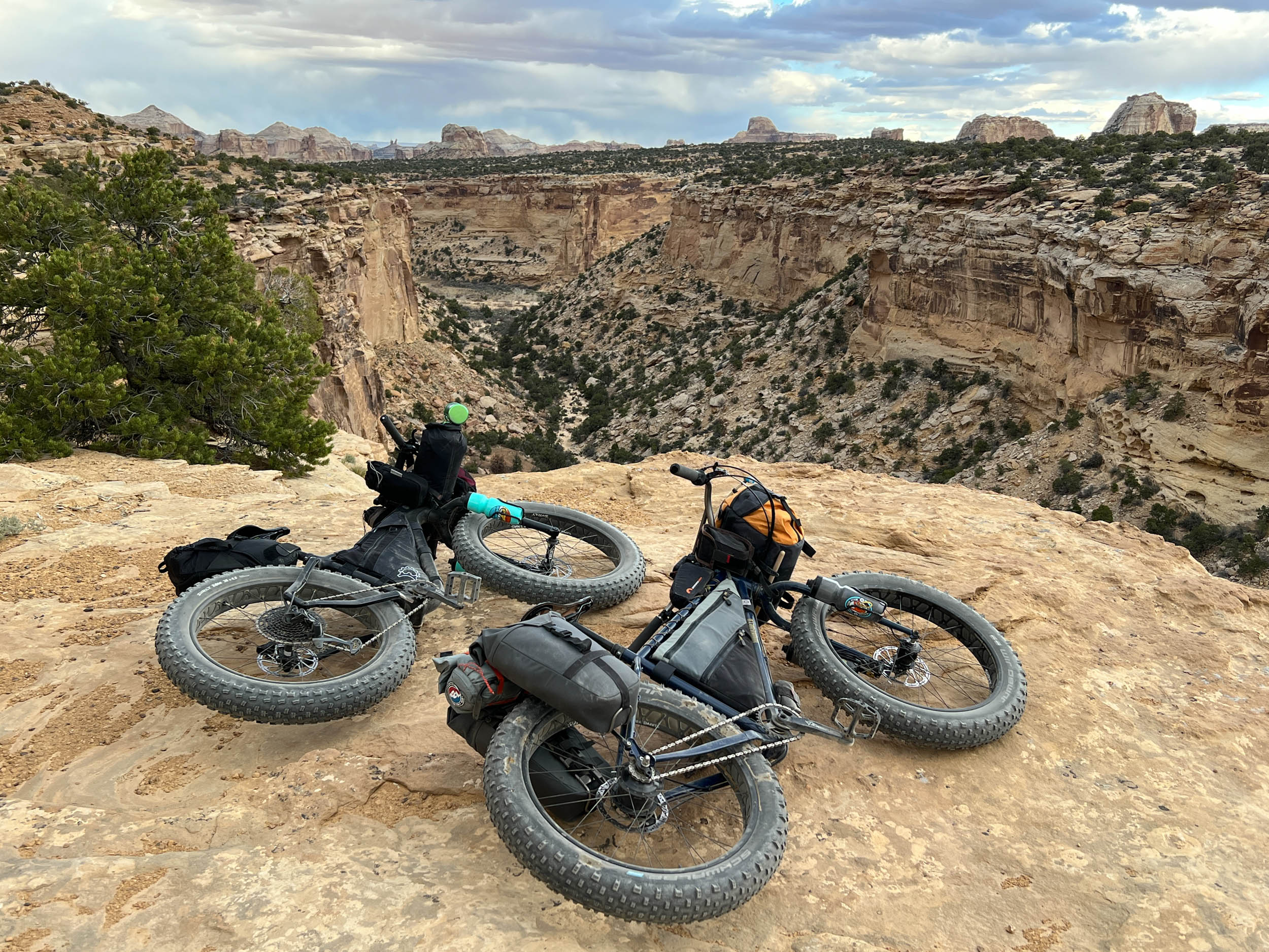
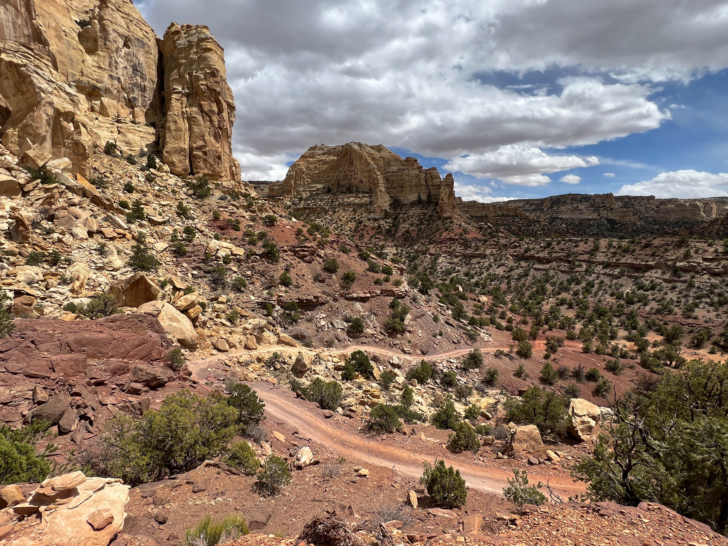
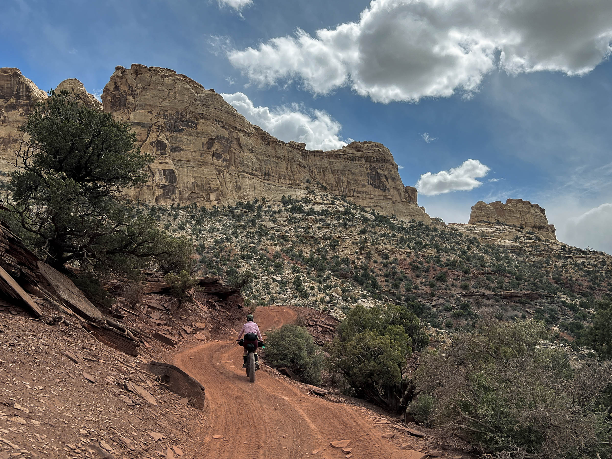
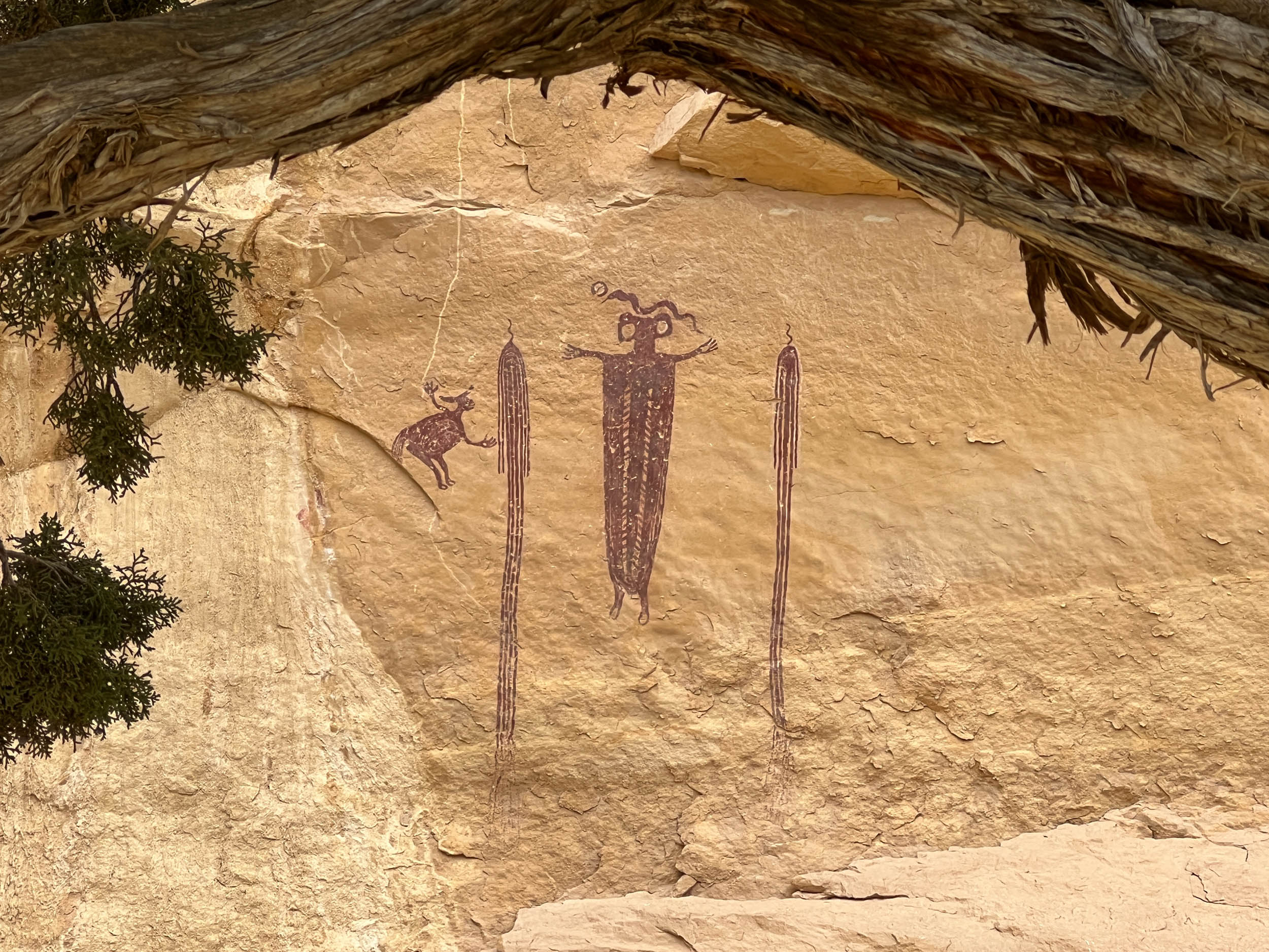
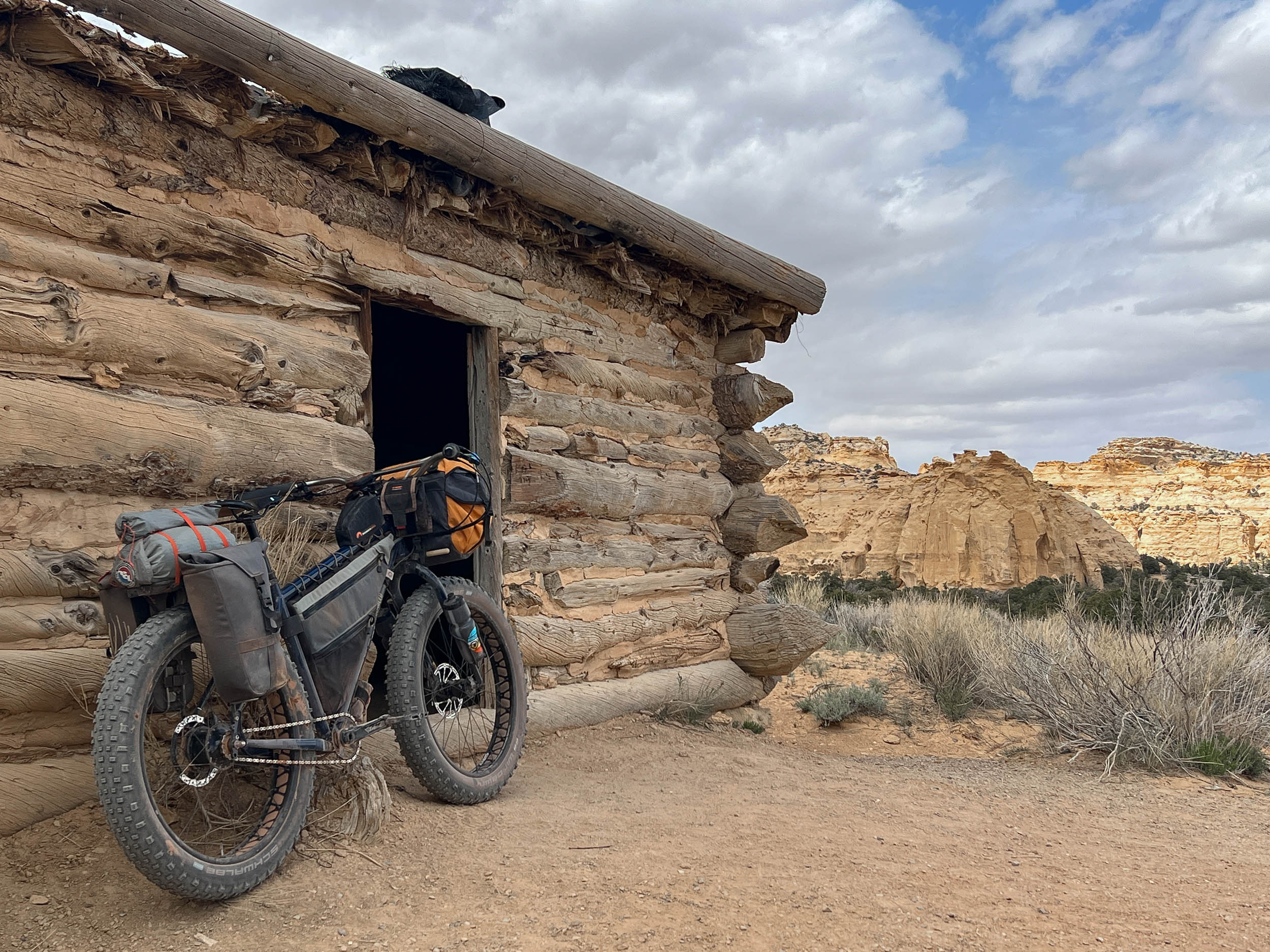
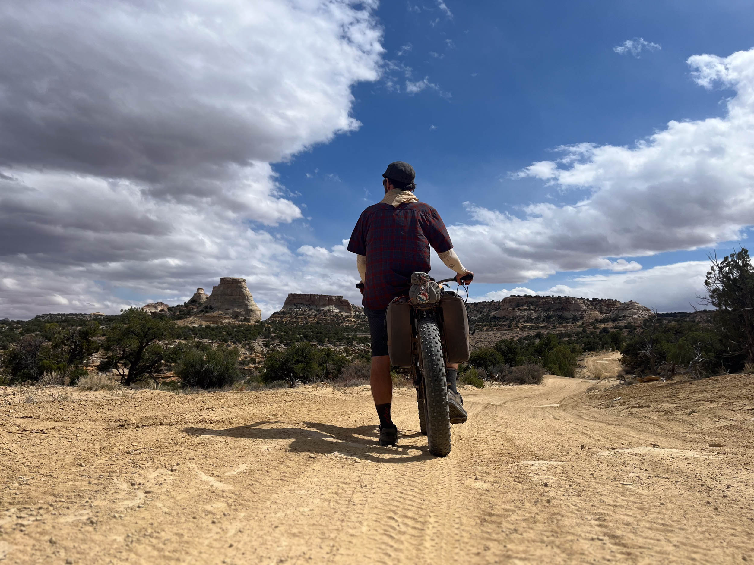
After climbing to Locomotive point, the character of the route changes again; sandy desert washes and ledgy cliffside doubletracks yield way to the rolling high plains that characterize much of the interior Swell at high elevations. Locomotive Point is a long rock butte in an area of the San Rafael Swell called “Head of Sinbad” that is home to several well-preserved petroglyph panels and a small arch near the highway known as Dutchman Arch. As you traverse southward, a number of other notable features that speak to the long history of human inhabitation of the Swell are also observed, including Lone Warrior petroglyph and Swasey Cabin at the upper reaches of Eagle Canyon, a section of the route shared with the much larger Stone House Lands Loop.
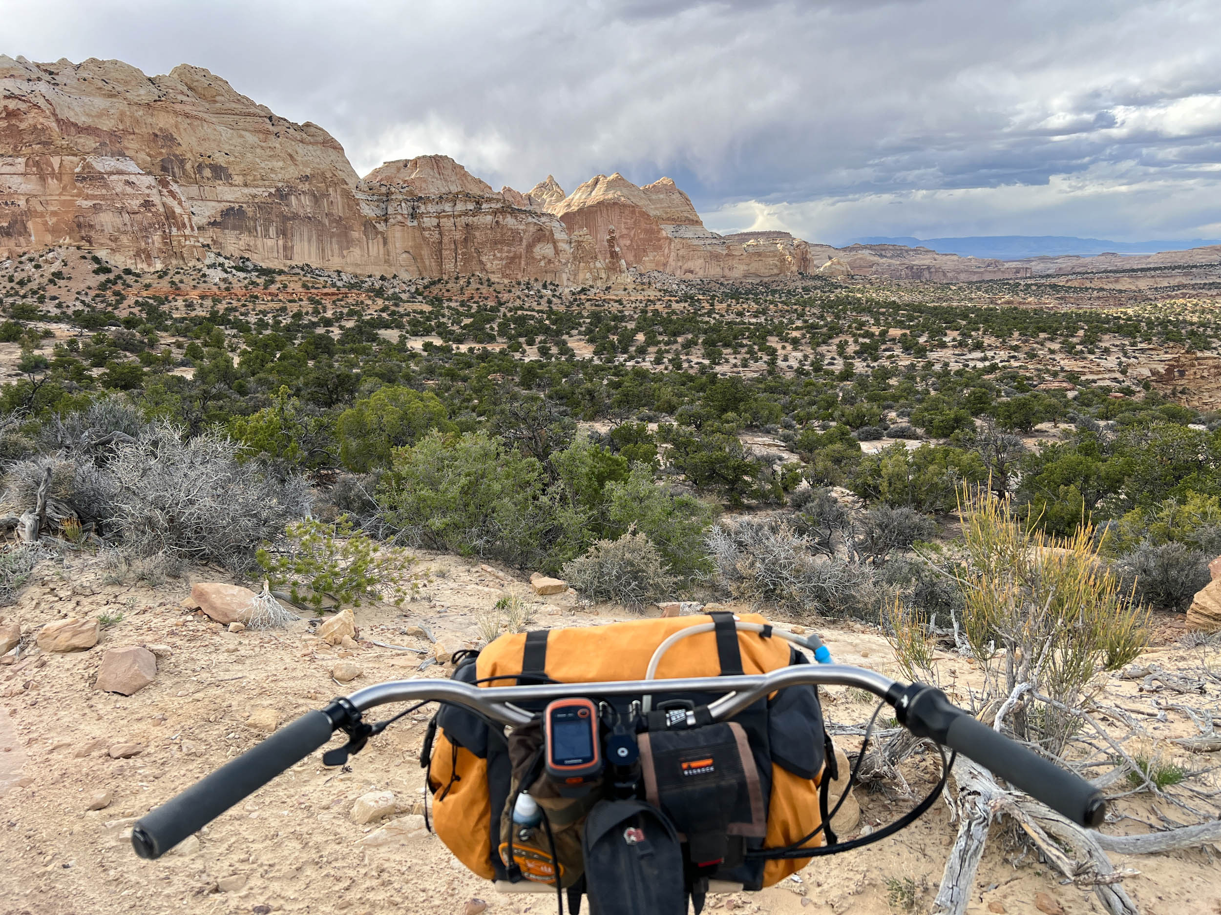
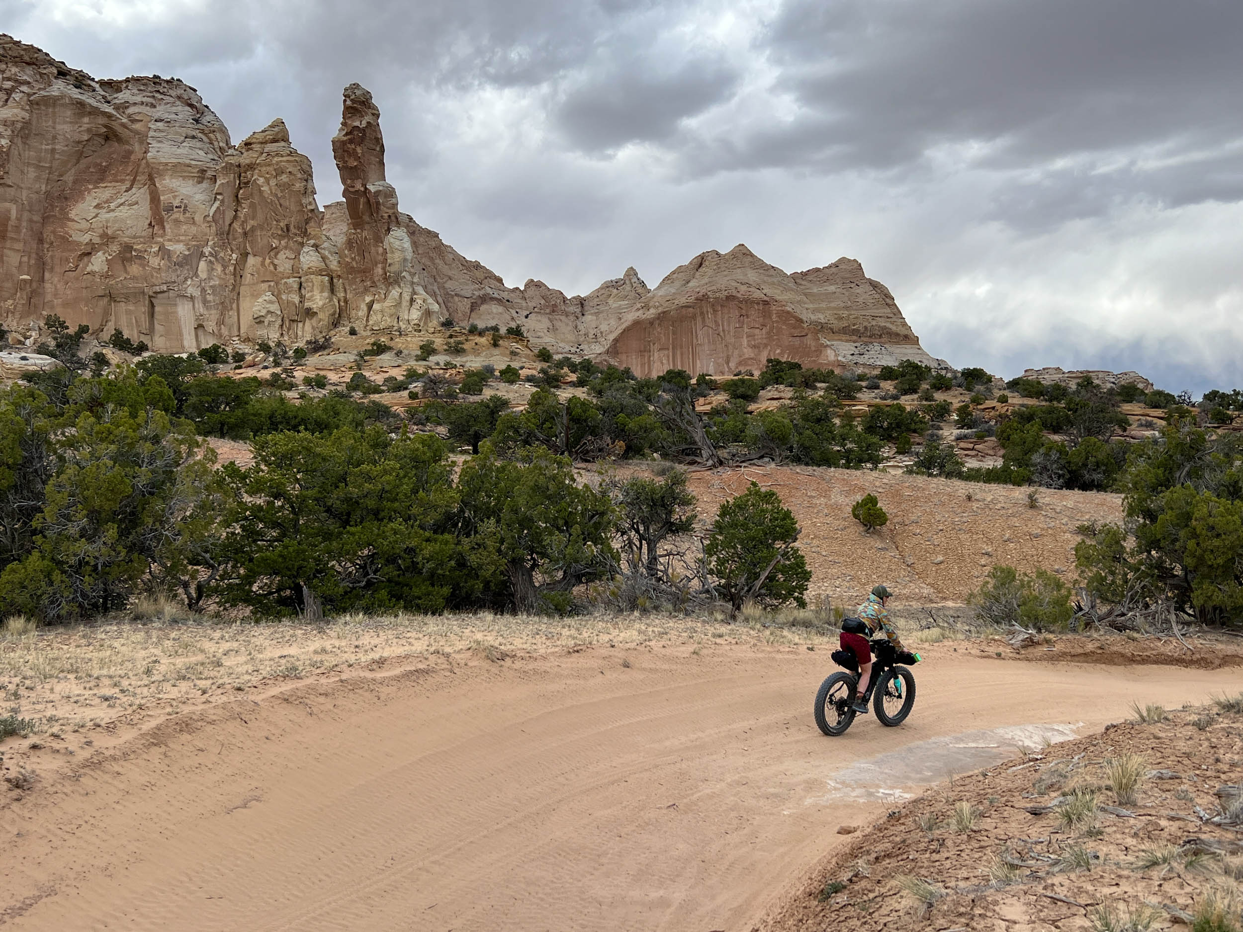
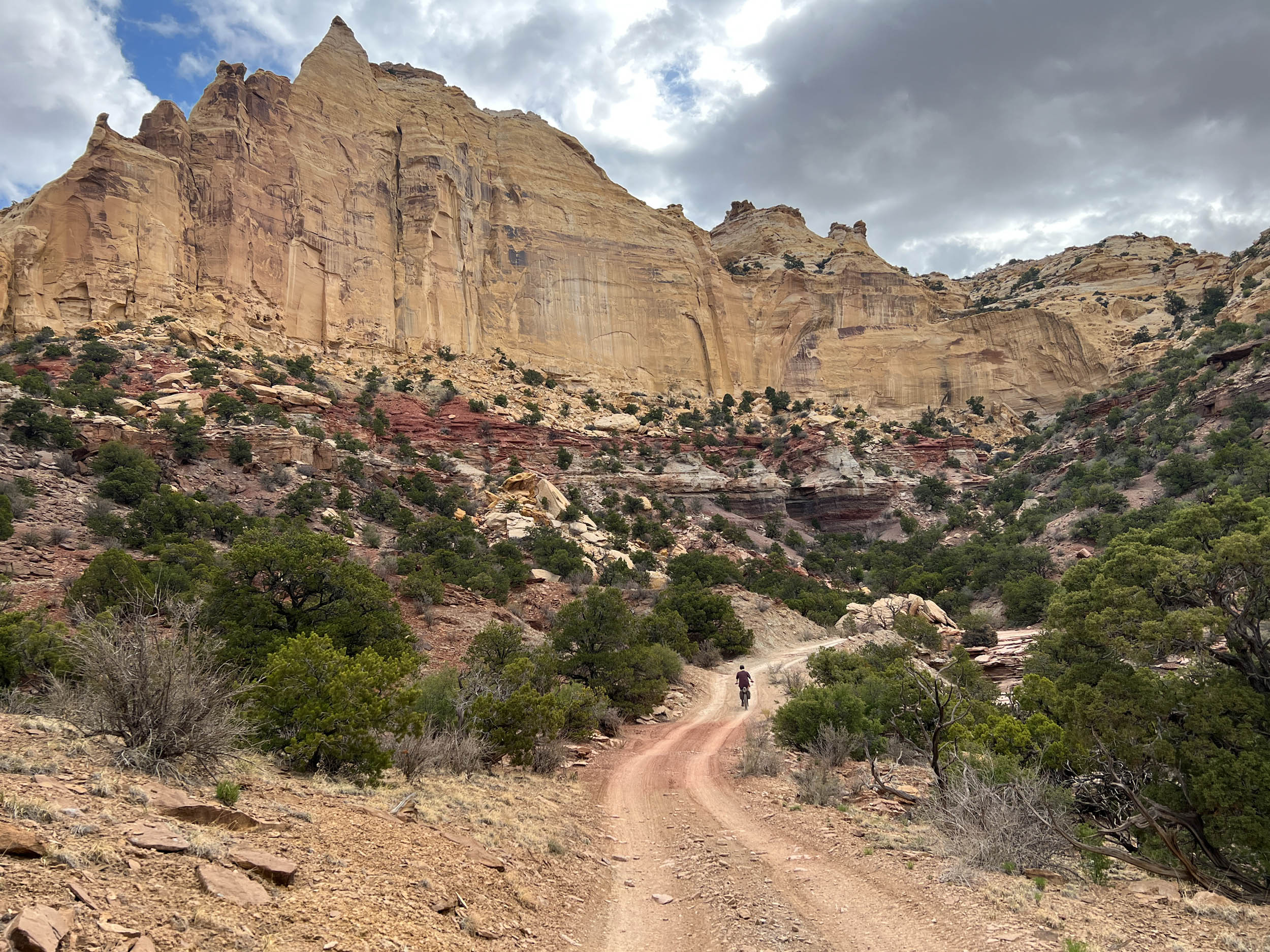
Eagle Canyon is an enjoyable and scenic culmination to the Secret Mesa Loop. Tight, twisting, and deep, the canyon is replete with vegetation and it is host to the spectacular Eagle Canyon Arch. Sandy conditions once again characterize the riding surfaces of lower Eagle Canyon whereafter riders begin their final climb back to Justensen Flat through steep graded trails with rocky ledges and rough doubletrack.
Route Difficulty
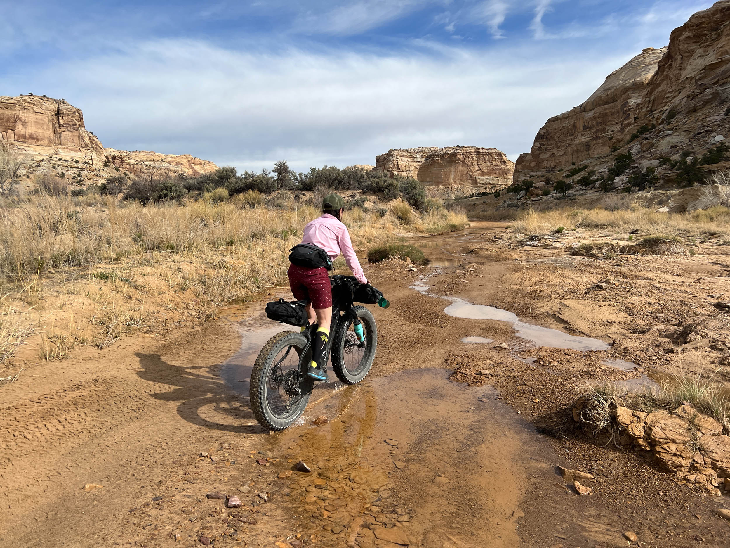
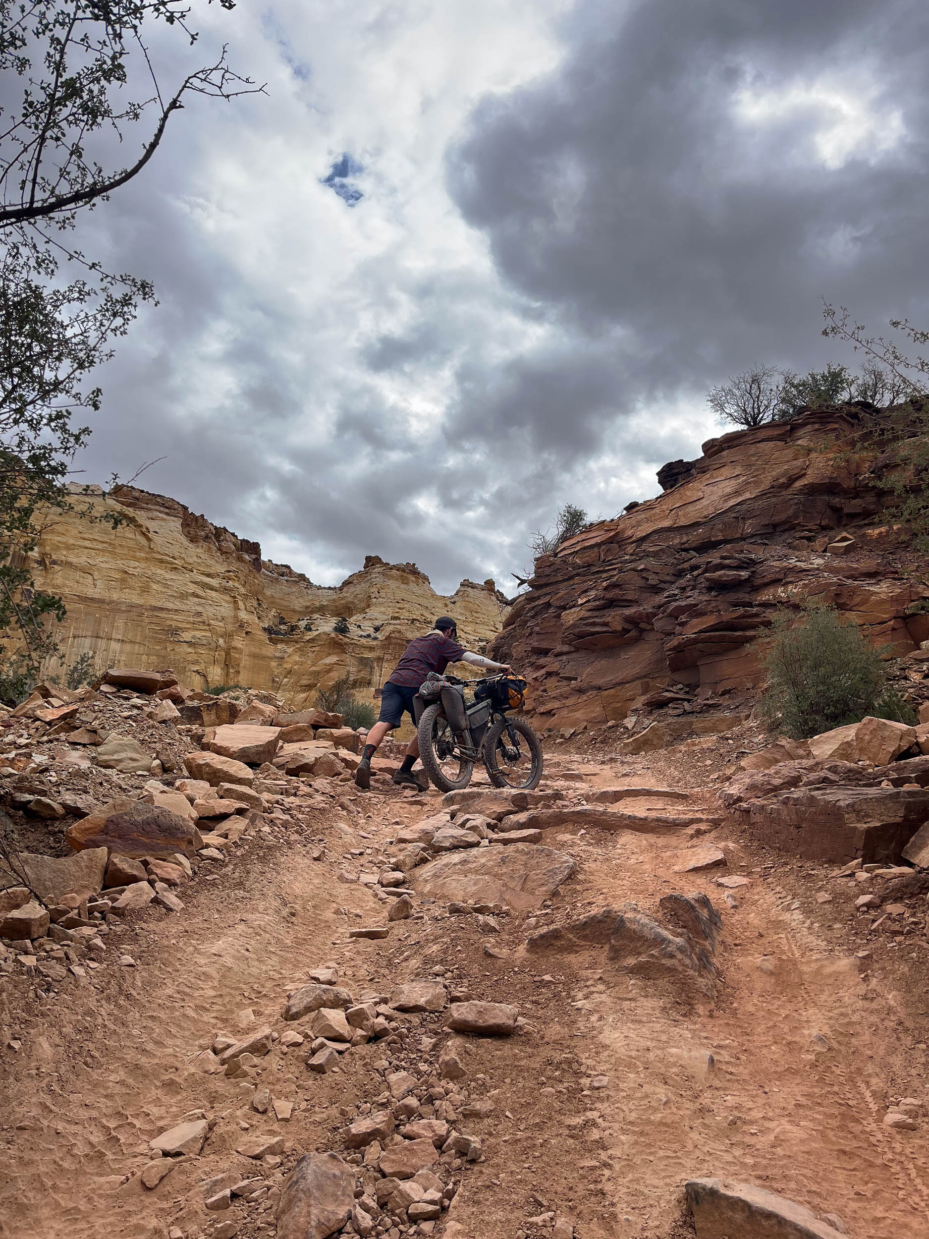
The entirety of the route is on uneven dirt roads, rocky and ledgy doubletrack with off-camber sections, or within deep sandy washes. Riders embarking on this route must be able to successfully ride through sections of deep sand that extend for up to 15 miles unbroken. Numerous climbs with steep grades on rocky off-camber sections also add to the physical exertion required on this route. There are no natural water sources over the entire length of the route, and there is no chance for resupply. Therefore, riders will need to carry enough food water for the entire of their 2-3 day journey.
Route Development
Route designed by Seth Kruckenberg. Scouted and photographed by Seth Kruckenberg and Nancy Ramer.
While the Secret Mesa Loop is located in the San Rafael Swell—an increasingly popular destination for bikepackers embarking on the A (San Rafael) Swell Night Out overnighter or its larger multi-day counterpart The Stone House Lands Loop—it is different from our previously published routes in the region. This route provides a completely different feel in terms of the geology, how one moves through the landscape, and the type of tires that are required to successfully navigate its terrain, thereby offering a completely new adventure and discovery to be had in The Swell.
The Secret Mesa Loop was created with the intention of slowing down, reaching for that fat or plus bike, and taking in even more of the all-encompassing, epic beauty that abounds in this region. While we mention slowing down, that doesn’t mean this route is easy. Embarking on this journey requires effortful biking and big tires are a requirement for successfully traversing the landscape. However, one’s effort will be rewarded with ever-changing, breathtaking scenery, varied riding conditions, and a pace that allows you to seek out and experience many of the secret places that The Swell continues to hold within the domed walls of the Stone House Lands.
Submit Route Alert
As the leading creator and publisher of bikepacking routes, BIKEPACKING.com endeavors to maintain, improve, and advocate for our growing network of bikepacking routes all over the world. As such, our editorial team, route creators, and Route Stewards serve as mediators for route improvements and opportunities for connectivity, conservation, and community growth around these routes. To facilitate these efforts, we rely on our Bikepacking Collective and the greater bikepacking community to call attention to critical issues and opportunities that are discovered while riding these routes. If you have a vital issue or opportunity regarding this route that pertains to one of the subjects below, please let us know:
Highlights
Must Know
Camping
Food/H2O
Trail Notes
- Riding from Secret Mesa into Coal Wash at the start of the route where you feel like you are riding ever deeper into the heart of the Swell, descending at the foot of towering sandstone cliffs.
- Traversing through a constantly shifting landscape formed by the uplift and erosion of diverse sedimentary layers within the San Rafael Swell.
- The deep sandy sections in Coal Wash! An absolute treat on fatbike and so much time to take in the surroundings due to the correspondingly slower pace!
- The climb up and over Fix-It Pass with its shifting colors of orange, red, and purple sand.
- The gorgeous landforms, alcoves, and arches encountered all along route.
- The immaculately preserved petroglyphs near Locomotive point including Sinbad’s Head and the Lone Warrior panel.
- The epic descent from Swasey Cabin through Eagle Canyon (ridden clockwise), and encountering the stunning final arch of the route, Eagle Canyon Arch.
- The following points cannot overstated: Due to significant sections of the trail containing deep sand (depths up to 4 to 6 inches between miles 10-25 in Coal Wash), the route should be only be attempted on a fatbike or a plus bike with tires equal to or greater than 3 inches. Depending on conditions, even a plus bike may prove significantly more challenging in the ~15 miles of sand through Coal Wash. Given the environment you will be riding through is a desert with no natural water sources, attempting this on anything less than a plus bike (minimum mandatory) or fatbike (recommended) will likely result in long hike-a-bike sections through deep sand that could result in an extremely slowed pace. The authors completed the route on fatbikes with 4 to 4.3-inch tires, which made traversing this route a fun albeit challenging experience. Even with a fatbike, you can expect your pace to drop to less than 4-5 mph for some sections of the route. Attempting this route on a bike with less than 3 inch tires is explicitly not advised.
- The best starting location for the route is off of Exit 116 on the south side of I-70 at Justensen Flats (start of GPX track). There is a large gravel parking lot that is generally safe to leave a vehicle overnight (the authors did this with no issue for two nights) and there is a pit toilet with well-marked signage.
- While it is possible to ride in either direction, it is recommended that the route be ridden clockwise as this direction will provide the rider with stunning vistas on the descent into Coal Wash, and it splits the return climbs out of Coal Wash for the second half of the route into more manageable sections that maximize fun on the descents. This is particularly true for the final descent of the route, Eagle Canyon, which is spectacularly enjoyable and scenic when ridden downhill (clockwise) on the route. If hard technical climbs are more your forte, reversing the route counterclockwise will certainly serve up a healthy dish of effort. Be forewarned.
- Due to the potential for extreme desert heat during the summer months, this route is best ridden in the early spring and fall.
- Note also that with the route being located high in the San Rafael Swell (elevations of ~5,800 to 7,200 feet), temperatures can be significantly different than surrounding regions at lower elevation (e.g., Moab, Fruita). Plan accordingly.
- Cell phone service is extremely limited or non-existent along the route. Satellite communicators (e.g., Garmin inReach Mini) are strongly recommended.
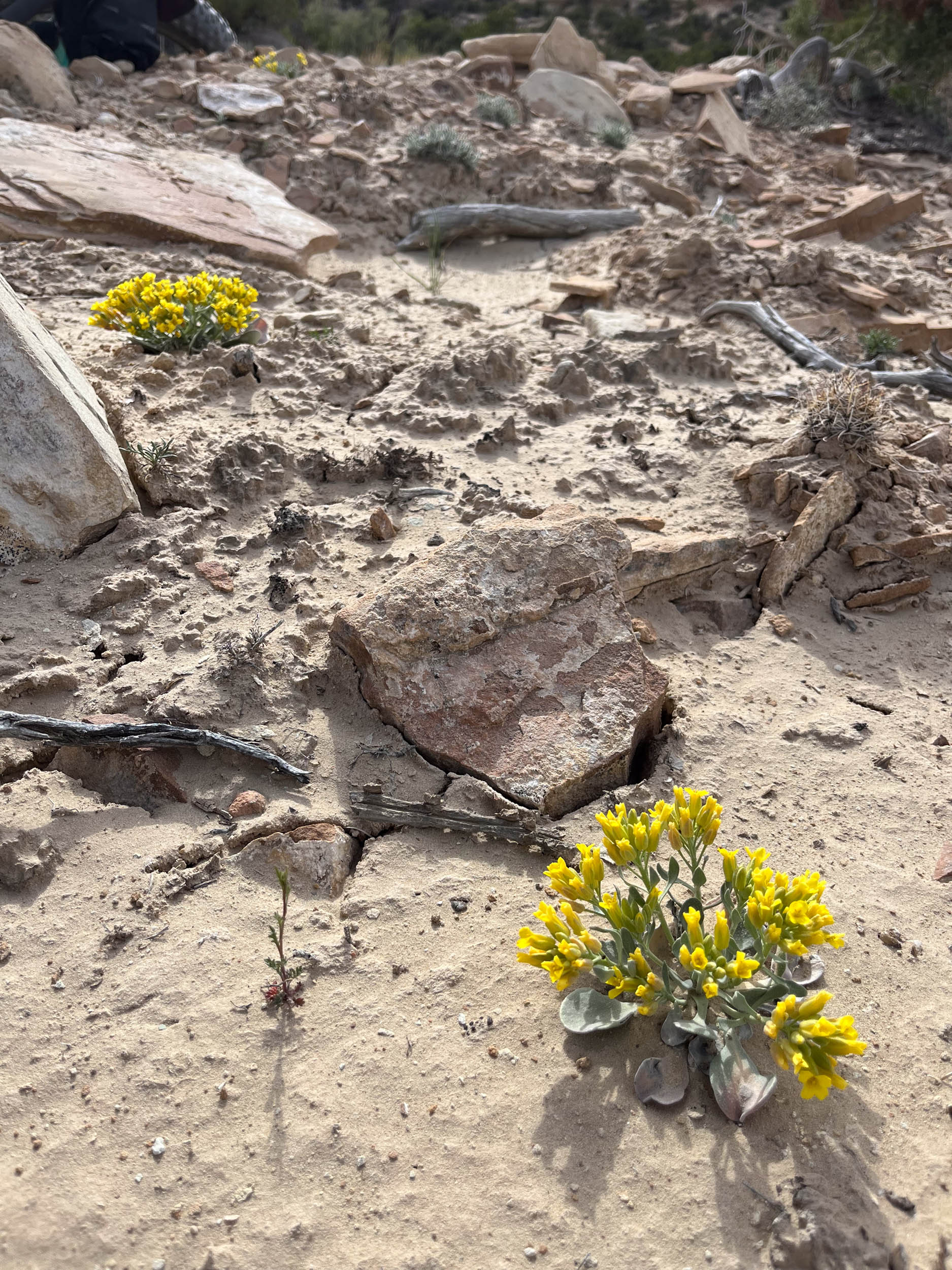
- Rock art and historic sites are fragile, non-renewable cultural resources that, once damaged, can never be replaced. Avoid touching or disturbing any petroglyphs and artifacts encountered on your travels.
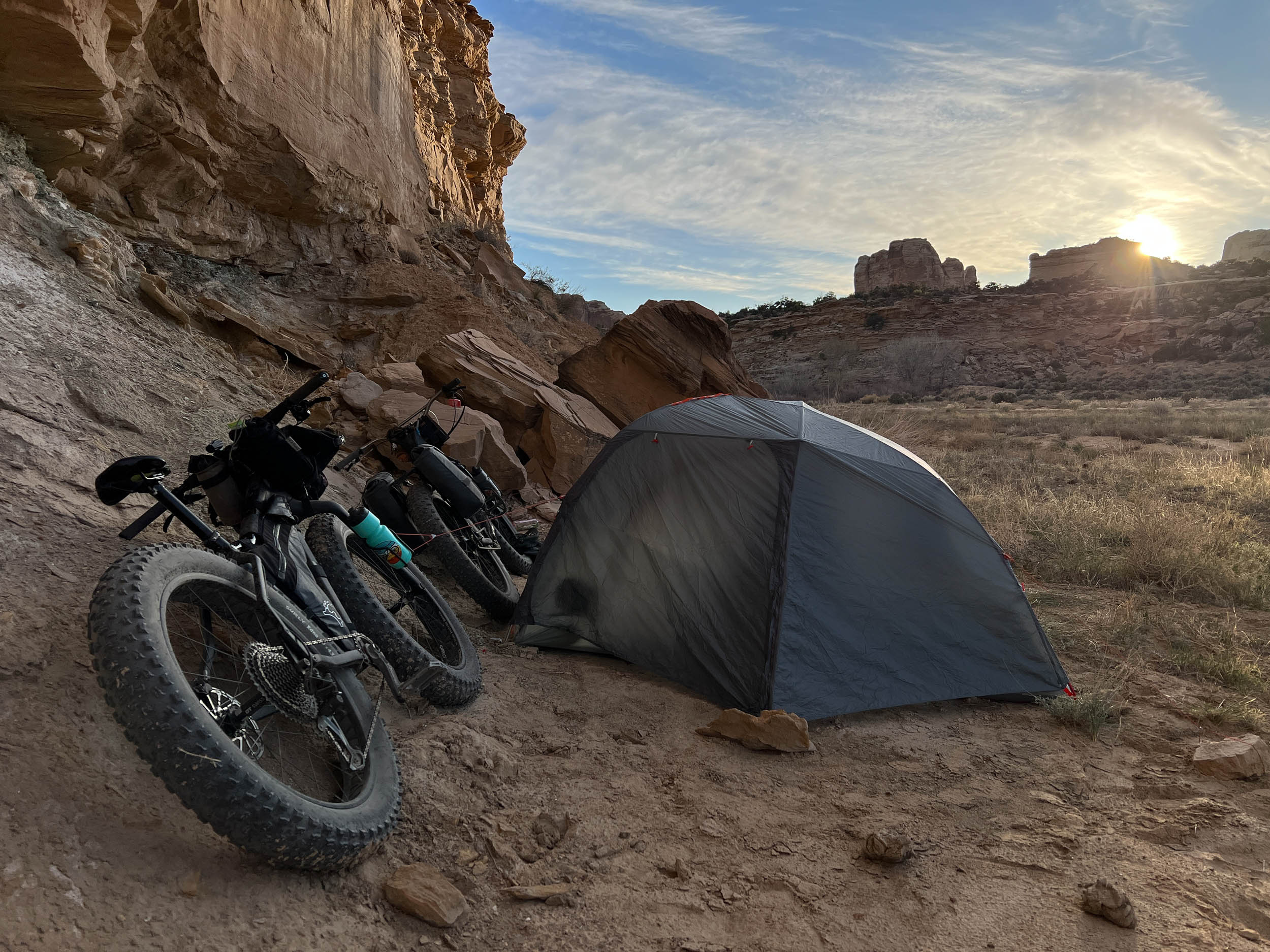
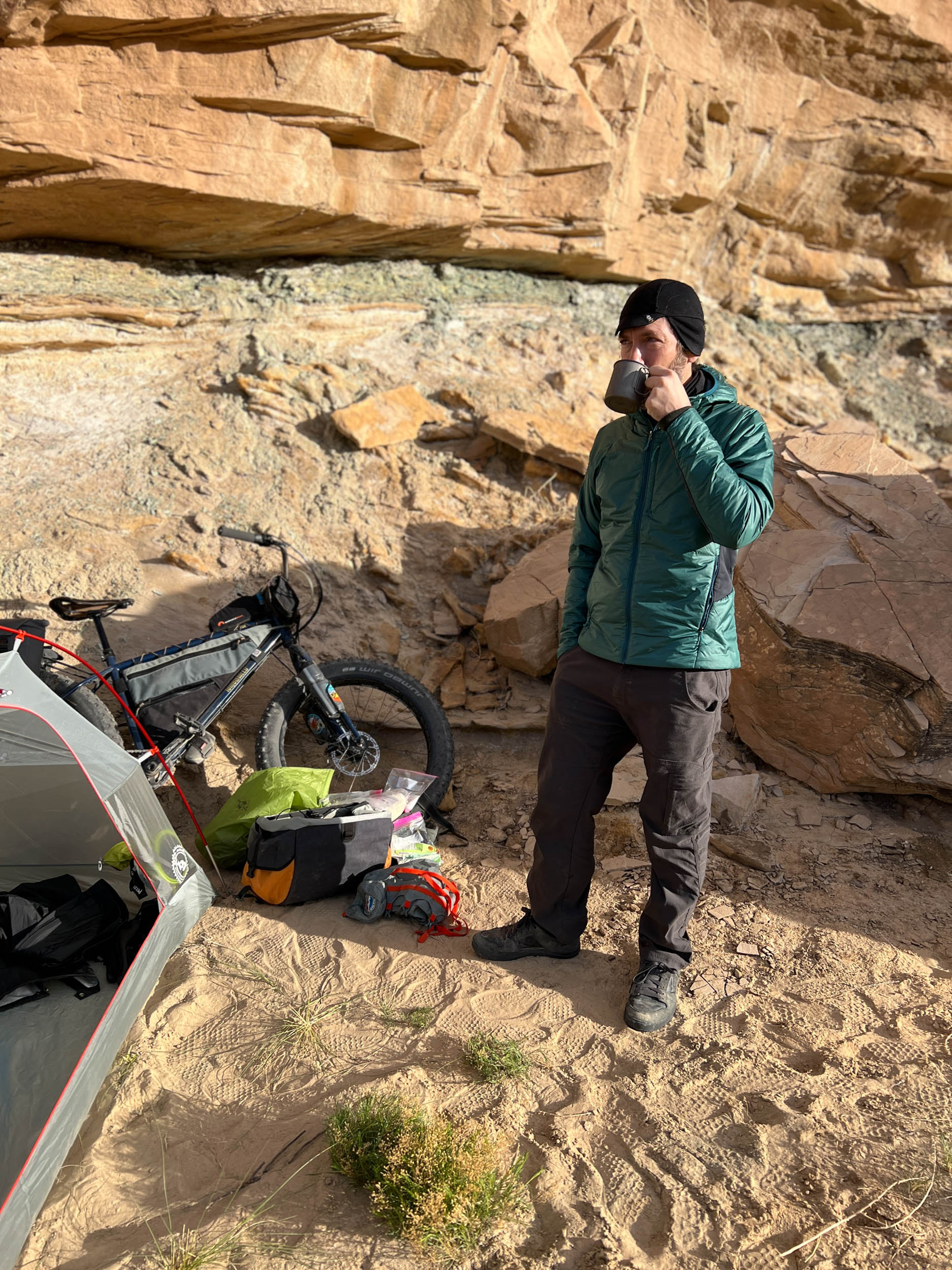
- Nearly all of the route north of I-70 passes through, and lies within, the Eagle Canyon, Coal Wash, and Sid’s Mountain Wilderness Areas. As such, there are abundant opportunities for free remote backcountry camping. However, riders are advised that bicycle travel within Wilderness areas is only permitted on established 4WD tracks, meaning that the selection of campsites should be limited to those areas that can be accessed by foot without disturbance to sensitive soils or surfaces.
- Always use minimal impact camping practices, camp on durable (i.e. rock, gravel, stone) surfaces, and avoid disturbance to (walking, riding, or camping on) regions of cryptobiotic soil. These practices are prohibited in established Wilderness areas, and should be avoided in all natural regions regardless of land protection status.
- Pack it in, pack it out.
- There are no potable water sources along the route. You should plan on carrying all of the water you will need. While you may encounter some water seeps, particularly in the south fork of Coal Wash, these sources arise from sulfur springs and should not be trusted due to high and potentially toxic mineral contents.
- Green River is the nearest town for food and supplies, though riders coming via the nearby riding meccas of Fruita, Colorado, or Moab, Utah, will have abundant options for food and gear supply in those localities.
While the Secret Mesa Loop was designed as a challenging weekend route that stands on its own, its proximity to the previously published A (San Rafael) Swell Night Out overnighter and The Stone House Lands Loop offers visitors to the region a number of ways in which to combine and/or extend these published routes into larger adventures. Find all three in the map below and scroll down for additional logical combinations of this trifecta of routes:
A (San Rafael) Swell Night Out + Secret Mesa Loop
*Ridden clockwise, as originally envisioned for both routes
Statistics: 135.9 miles, 12,009 feet climbing, 4-6 days
https://ridewithgps.com/routes/43895426
Stone House Lands Loop + Secret Mesa Loop (Figure 8 through Eagle Canyon)
*This version is a Figure 8 such that Eagle Canyon is ridden twice (well worth it!), thus preserving the entirety of the Stone House Lands Loop (ridden counter-clockwise) and the Secret Mesa Loop (ridden clockwise).
Statistics: 247.1 miles, 17,654 feet climbing, 6-8 days
https://ridewithgps.com/routes/43895206
Stone House Lands Loop + Secret Mesa Loop (no Eagle Canyon)
*This version excludes Eagle Canyon for a continuous counter-clockwise route.
Statistics: 232.8 miles, 16,849 feet climbing, 6-8 days
https://ridewithgps.com/routes/43895286


Terms of Use: As with each bikepacking route guide published on BIKEPACKING.com, should you choose to cycle this route, do so at your own risk. Prior to setting out check current local weather, conditions, and land/road closures. While riding, obey all public and private land use restrictions and rules, carry proper safety and navigational equipment, and of course, follow the #leavenotrace guidelines. The information found herein is simply a planning resource to be used as a point of inspiration in conjunction with your own due-diligence. In spite of the fact that this route, associated GPS track (GPX and maps), and all route guidelines were prepared under diligent research by the specified contributor and/or contributors, the accuracy of such and judgement of the author is not guaranteed. BIKEPACKING.com LLC, its partners, associates, and contributors are in no way liable for personal injury, damage to personal property, or any other such situation that might happen to individual riders cycling or following this route.
Please keep the conversation civil, constructive, and inclusive, or your comment will be removed.