

Ride with GPS’s latest update includes a lineup of useful weather and condition map layers that should help streamline the route planning process. Learn more here…
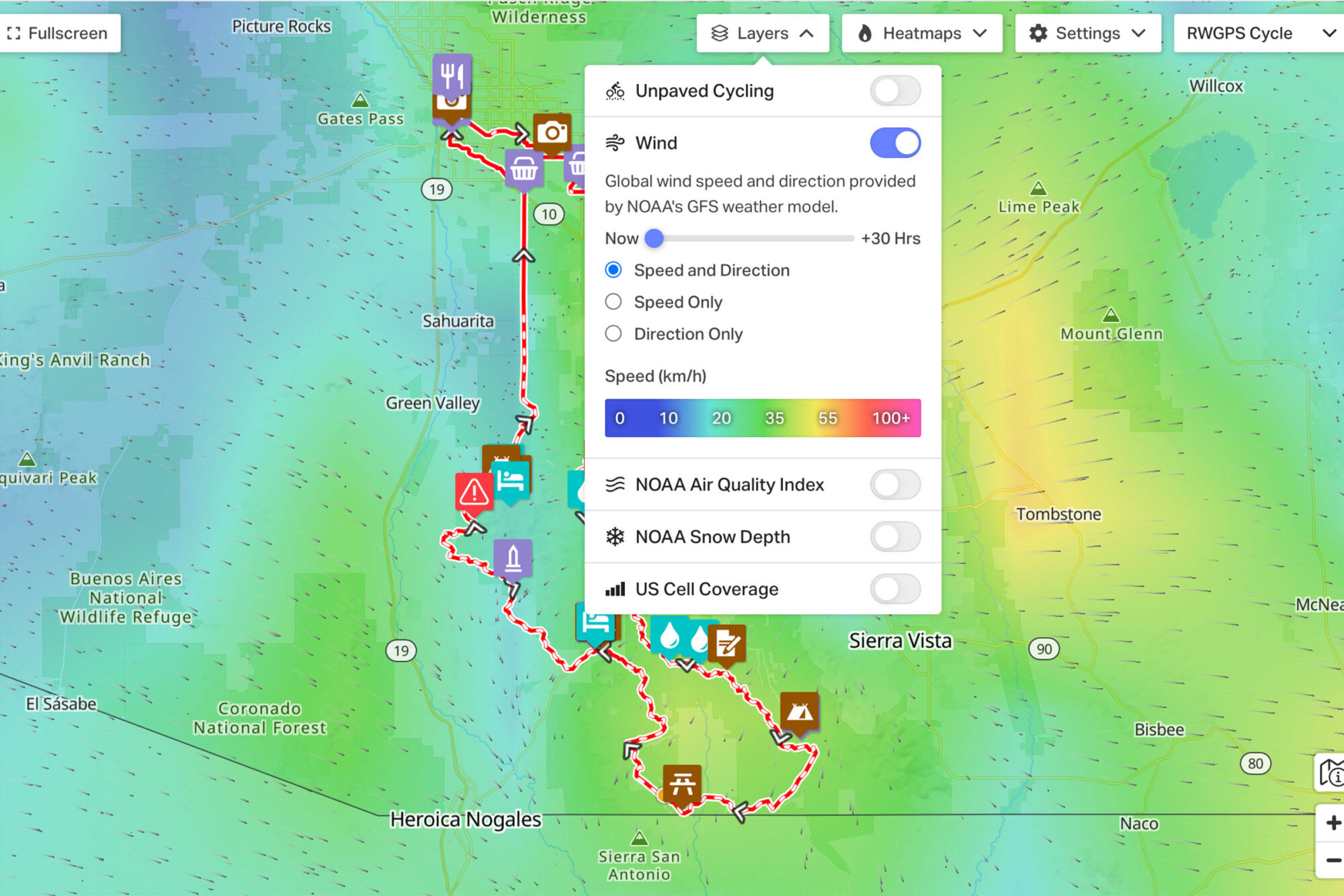
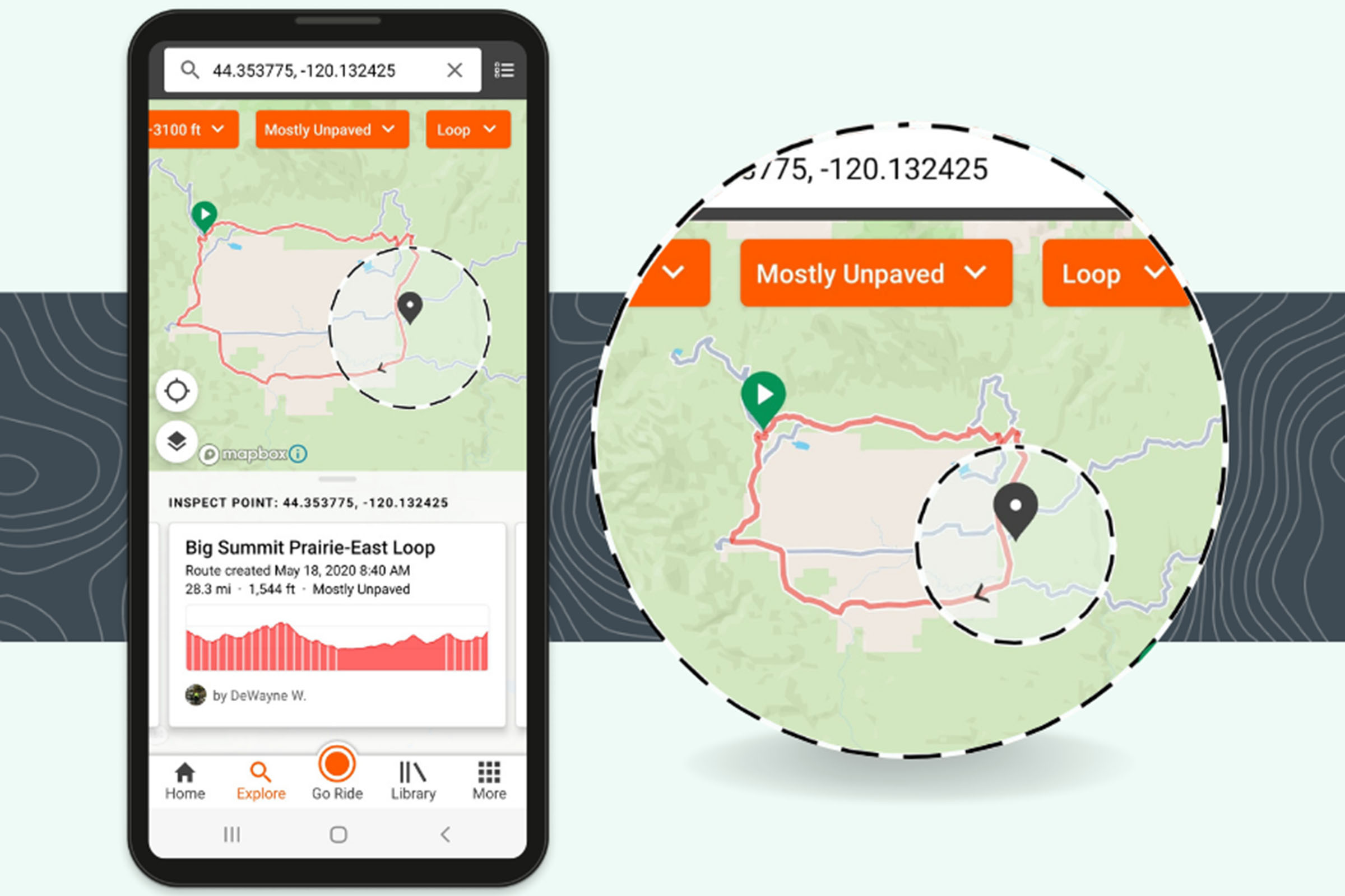
Premium Ride with GPS (RWGPS) users can now take advantage of a new menu of Advanced Map Layers while creating new routes and viewing pre-existing ones. The new menu includes a new level of environmental data to the route and trip planning process that could help users decide on gear, track, and timing choices before and during bikepacking trips. There are five layers within the new menu, which lives at the top of any route or route planner page. A reminder that Bikepacking Collective members are eligible for 20% off an annual Basic or Premium RWGPS account. Find details on each layer below.
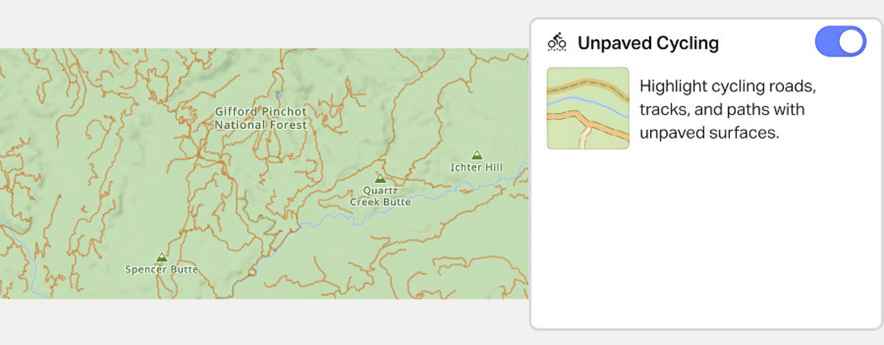
Unpaved Cycling
The Unpaved Cycling layer highlights gravel roads, tracks, cycle paths, and trails, allowing you to quickly identify either unpaved or paved terrain.
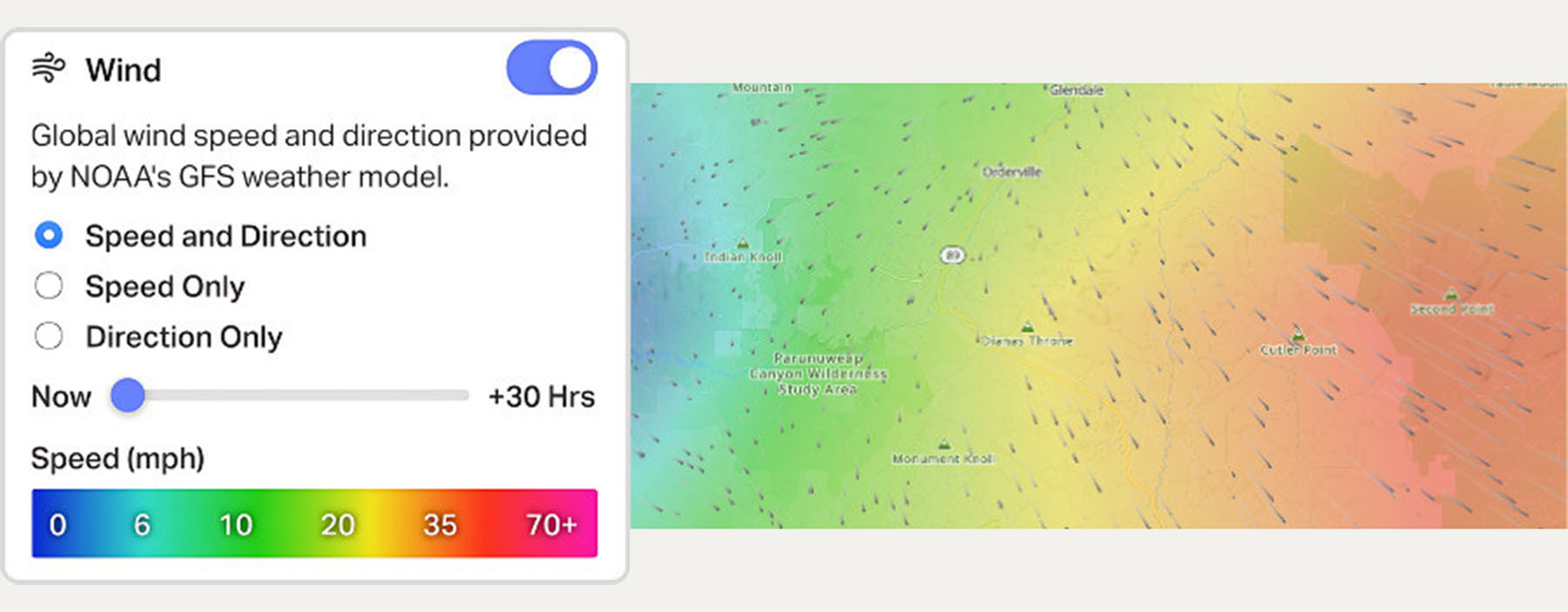
Wind
The Wind layer references NOAA’s GFS modeling data with a forecast slider configurable in hourly increments up to a 30-hour predictive window for both wind speed and direction.
Cell Coverage
Cell phones can be powerful tools for route navigation and creation, but depending on cellular coverage, they still require some planning. The Cell Coverage layer provides both data connection and voice coverage maps, with the option to display them by major provider.

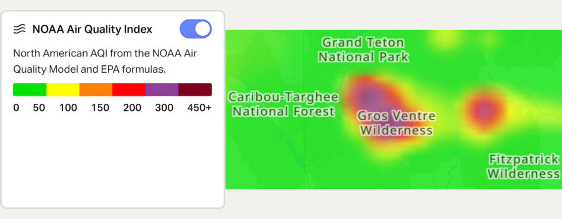
Air Quality Index
The Air Quality Index (AQI) layer provides realtime AQI maps pulls in North American NOAA and EPA modeling data to render AQI readings from 0 to 450+, so you’ll know exactly where it’s safe to ride. This is especially useful during forest fire season and could be paired with the wind layer to create your own personalized forecasts.
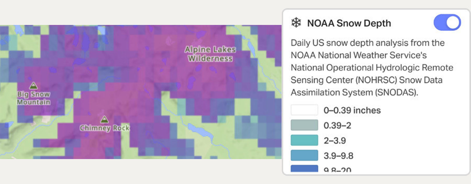
Snow Cover
Those who regularly travel at high elevations will be excited to see a new Snow Cover layer to ensure your routes are rideable and snow-free. The Snow Cover layer references realtime NOAA hydrologic snow data provides a clear snapshot of what’s rideable.
At this time, most Advanced Map Layers are currently only available in the United States. The Wind and Unpaved layers are available globally. The layers are also only available when using an Open Street Map-based map type, not a Google-based map, so you’ll have to switch basemap types to access them. Read more about Advanced Map Layers here.
Further Reading
Make sure to dig into these related articles for more info...


FILED IN (CATEGORIES & TAGS)
Dispatch
Please keep the conversation civil, constructive, and inclusive, or your comment will be removed.