


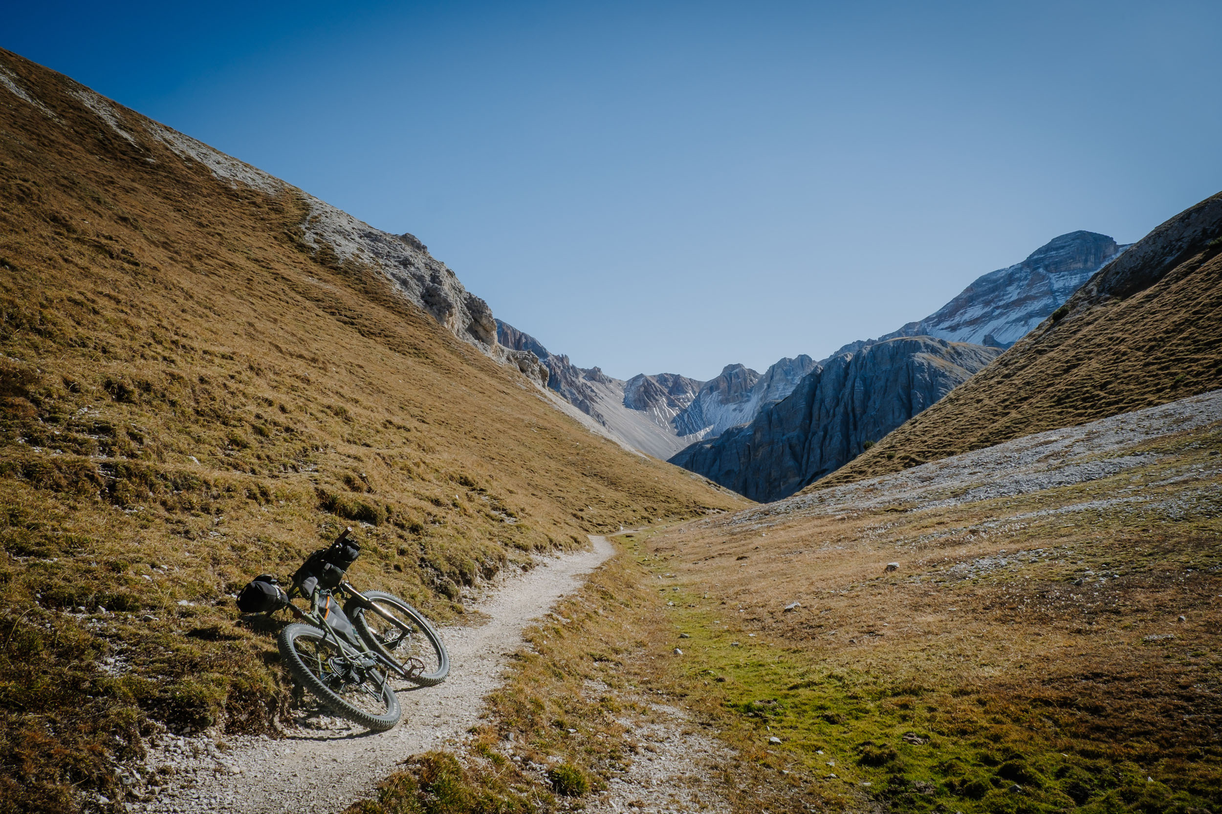
Braies Beyond
Distance
48 Mi.
(77 KM)Days
2
% Unpaved
82%
% Singletrack
3%
% Rideable (time)
95%
Total Ascent
10,528'
(3,209 M)High Point
7,480'
(2,280 M)Difficulty (1-10)
7?
- 10Climbing Scale Very Strenuous219 FT/MI (42 M/KM)
- 7Technical Difficulty Difficult
- 8Physical Demand Difficult
- 5Resupply & Logistics Moderate
Contributed By

Max Tosi
Guest Contributor
Max Tosi is an amateur cyclist and photographer drawn to slow, adventure-focused rides, whether solo or with friends. He moves fluidly between gravel, MTB, and 29+ bikes. Above all, he seeks remote, little-traveled landscapes where curiosity and discovery define the journey. Follow him on Instagram: @mrtost.
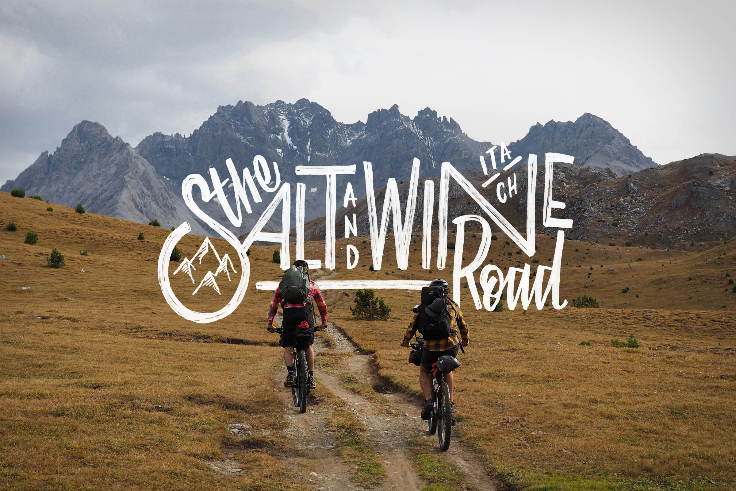
Braies Beyond starts in the small village of Braies di Dentro, along the road leading to the iconic Lake Braies. It’s a rewarding loop that weaves together forest roads, short paved connectors, and a dense web of breathtaking trails and singletrack. Some sections trace the Alta Via No. 1, the classic long-distance hiking route stretching 125 kilometers from Lake Braies to Belluno.
Along the way, the ride crosses lands shaped by linguistic minorities like Ladin culture, where casual conversations—or a radler at the local bar—often blend German, Ladin, and Italian into a single sentence.
The landscape is overwhelming. At the top of every climb, as your breathing settles, awe takes over, and your eyes wander. The constant stream of beauty challenges the urge to keep moving; you want to stop every time, lie back in the grass, and simply stare at the peaks rising all around you.
Route Difficulty
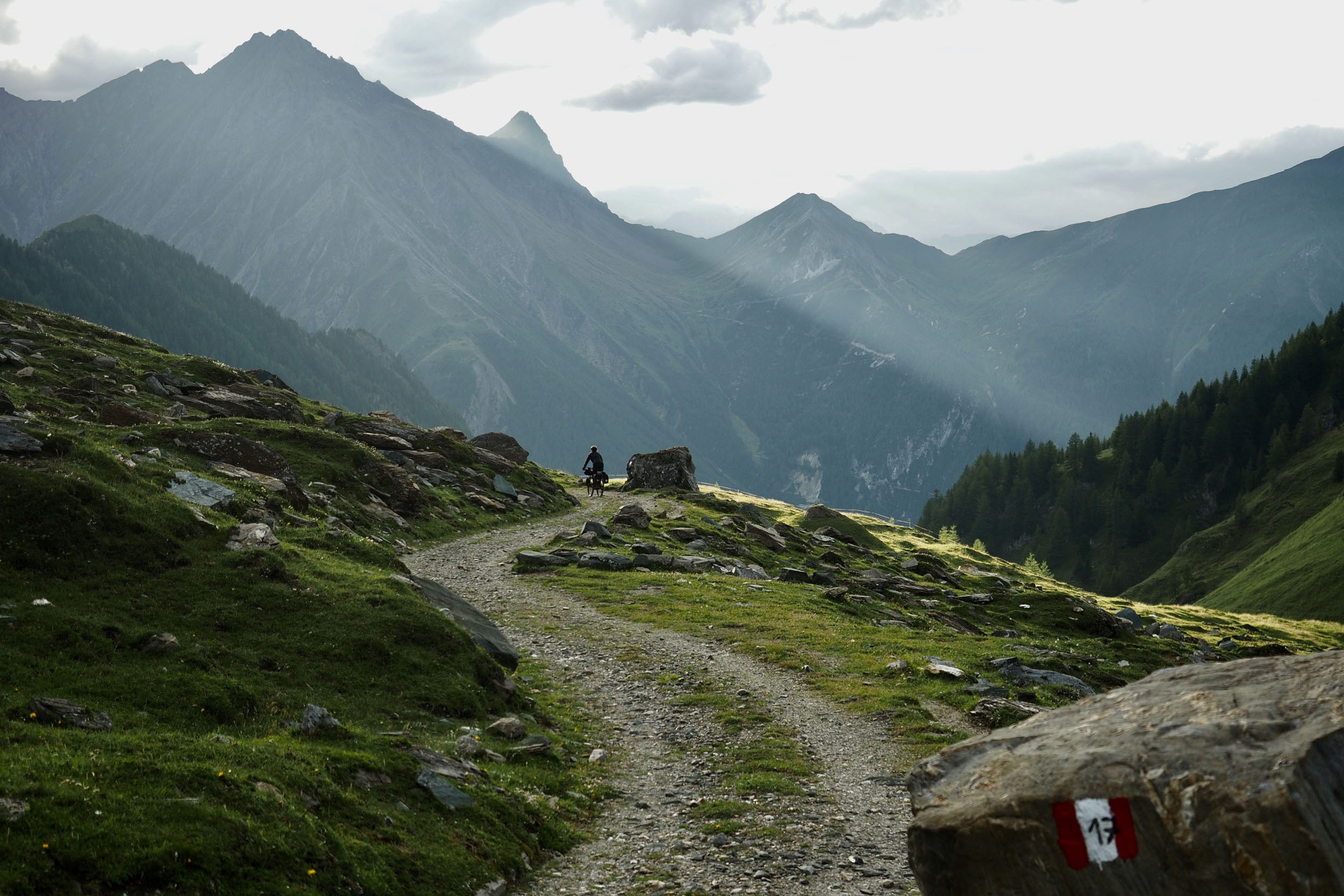
The loop delivers some serious climbing, most notably the nine-kilometer ascent from San Vigilio di Marebbe to Forcella Croce (2,283 meters), near the alpine lake of Fojedöra. It’s a demanding climb, with hike-a-bike sections due to pitches reaching up to 24%. The reward comes on the way down, with a mix of flowing, relaxed descents and more technical sections that test your handling through roots, tight switchbacks, and loose scree.
The route includes various terrain: forest and gravel roads, high-mountain trails, and singletracks. It features four demanding climbs, with brutally steep sections where the gradient takes over, and hike-a-bike becomes unavoidable. While the route offers scattered water fountains and mountain huts for a quick refuel, you won’t find any towns or resupply points along the way. Be sure to stock up on all essential provisions before heading out, as self-sufficiency is key for this stretch. Only in San Vigilio di Marebbe can you buy food, but it depends on the grocery or bakery’s opening hours.
Route Development: The route is thoughtfully partitioned into two days of comparable distance, though most of the climb is front-loaded into day one. This layout ensures you tackle the most demanding vertical gain while your legs are still fresh, allowing for a more manageable flow on the second half of the loop.


Submit Route Alert
As the leading creator and publisher of bikepacking routes, BIKEPACKING.com endeavors to maintain, improve, and advocate for our growing network of bikepacking routes all over the world. As such, our editorial team, route creators, and Route Stewards serve as mediators for route improvements and opportunities for connectivity, conservation, and community growth around these routes. To facilitate these efforts, we rely on our Bikepacking Collective and the greater bikepacking community to call attention to critical issues and opportunities that are discovered while riding these routes. If you have a vital issue or opportunity regarding this route that pertains to one of the subjects below, please let us know:
Highlights
Must Know
Camping
Food/H2O
Trail Notes
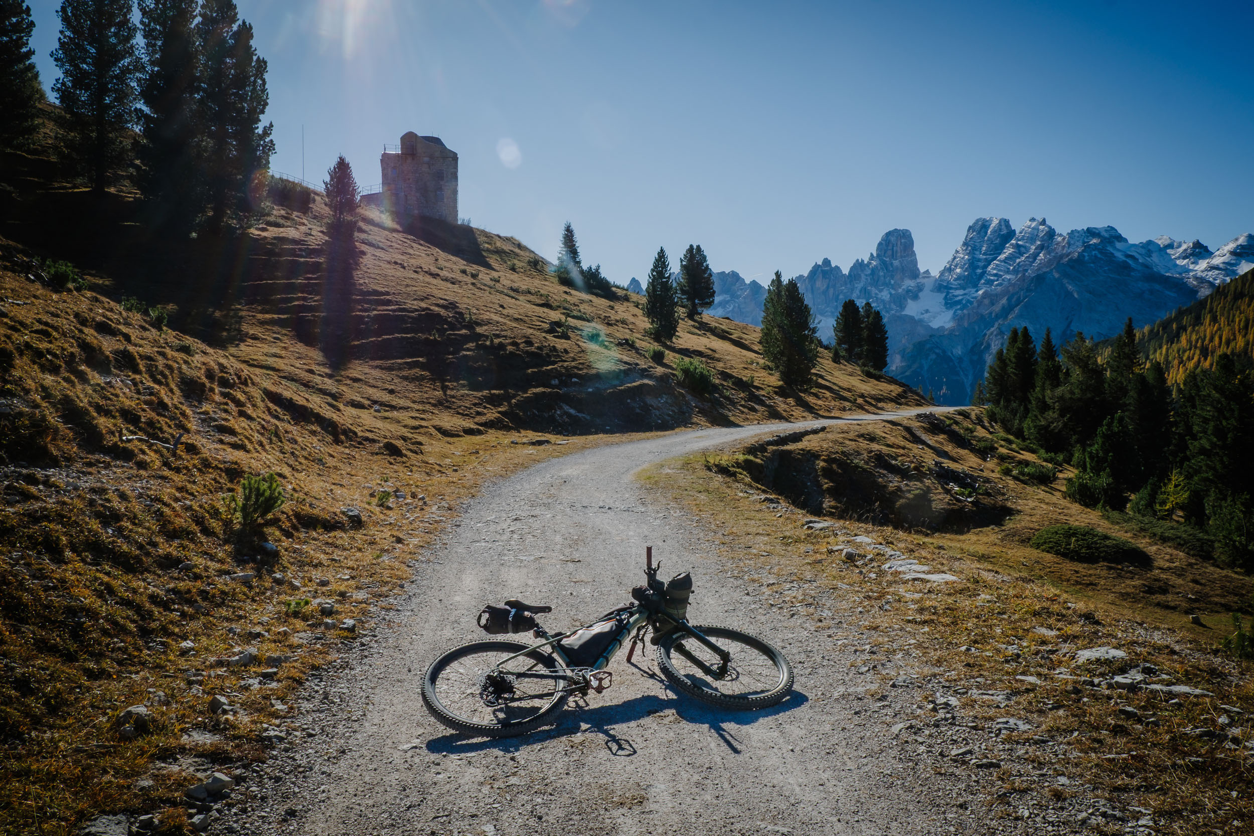
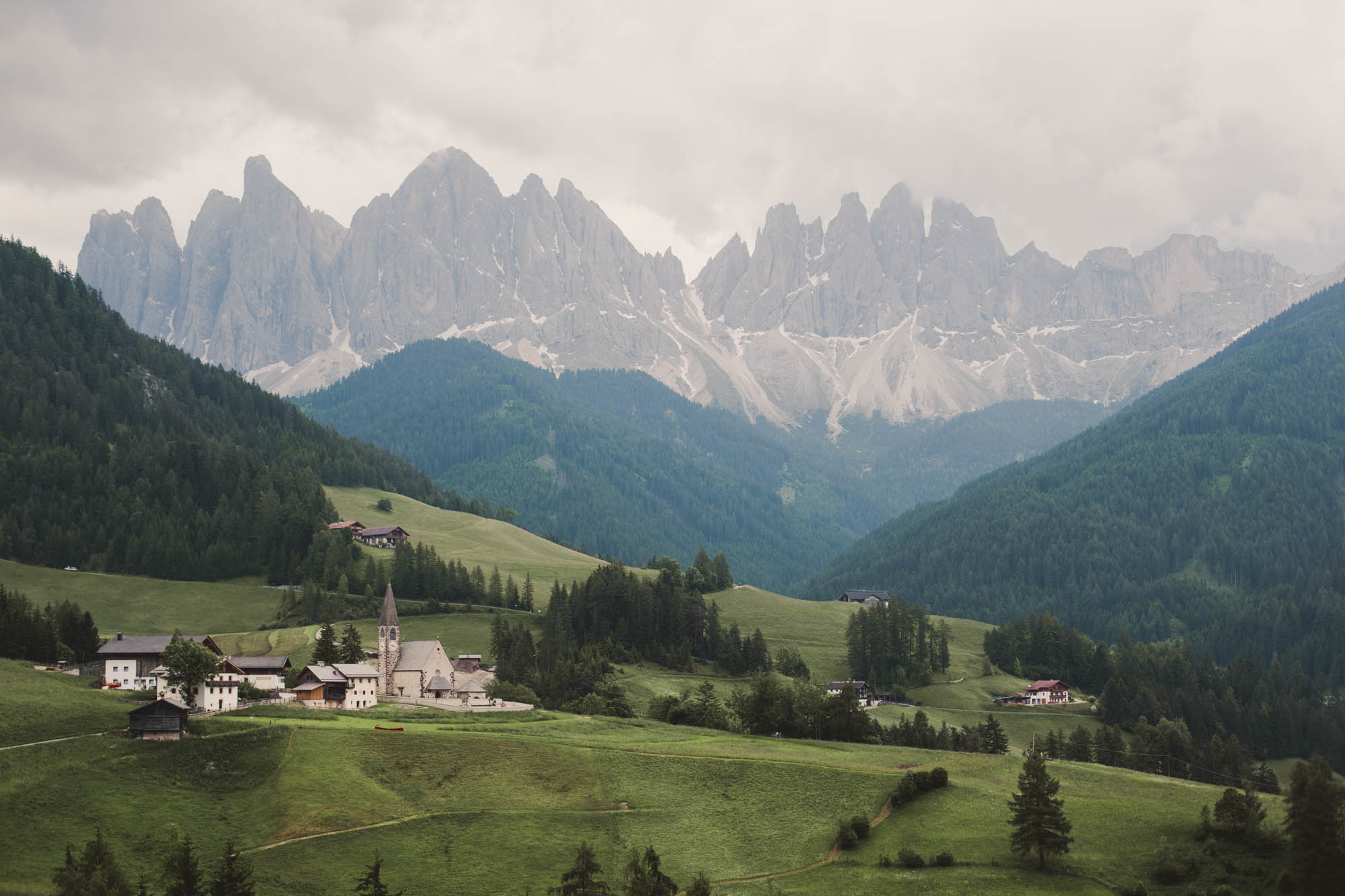
- PRATO PIAZZA: is a high Dolomite plateau, sitting at roughly 2,000 meters in the Braies Valley. Wide alpine meadows roll gently across the landscape. The views open in every direction, with Picco di Vallandro, Croda Rossa, the Tofane, and the unmistakable Tre Cime di Lavaredo framing the horizon.
- LEROSA PASS: unfolds as a vast, sun-drenched plateau, framed by an imposing amphitheater of peaks (crode).
- RA ŠTUA: is a small mountain village in the Dolomites located north of Cortina d’Ampezzo. It is a grassy area and serves as a starting point for various destinations.
- RIFUGIO SENNES: in Ladin: Üćia de Senes, is an alpine mountain refuge located at an altitude of 2,126 meters.
- RIFUGIO FODARA VEDLA: is a cozy mountain refuge located just a few minutes by bike from the Sennes Refuge. It is located in the Alpe di Fodara Vedla, which is a lush, almost surreal plain.
- FORCELLA CROCE (FOJËDORA): The finish of an exhausting climb, it feels like arriving in paradise. Silence comes naturally here, almost required. From this high point, the singletrack begins, dropping back down toward the valley.
- LAKE BRAIES: is an alpine lake, known as much for its beauty as for its popularity. Visitors from around the world gather here, lining up to rent wooden rowboats and capture the iconic, postcard-perfect images that flood social media.
When to Go
- Early summer through early autumn.
- July and August are heavily crowded, while September and October offer the best conditions—quieter trails, cooler temperatures, and peak alpine colors.
- In winter and spring, there is cold and snow.
Logistics
- No permits are required.
- Near Lake Braies, it’s best to walk your bike.
- Camping is prohibited, but bivvying is tolerated as long as you leave no trace.
- There are no grocery stores along the route—only mountain huts and water fountains—so plan carefully and resupply before entering the area.
- Only in San Vigilio di Marebbe is it possible to buy food, but it depends on the opening hours of the shops.
Dangers and Annoyances
- At the moment, there are no wildlife-related hazards.
- With a bit of luck, you might spot an ibex—the true king of these mountains—and marmots.
- Always stay on marked trails.
Travel Basics
- This all-Italian route kicks off in the Puster Valley. Just head toward Villabassa and follow the signs for Lake Braies.
- You can reach the valley easily by car or train, then complete the final leg to the lake via bus, car, or a scenic bike ride.
- Parking: if you arrive by car, park in one of the villages before Lake Braies. Roadside parking is prohibited, and parking at the lake is extremely expensive. Free parking is available at the tour’s starting point in Braies di Dentro.
- Recommendations: you’ll be riding through a Dolomite nature park and a UNESCO World Heritage Site. Ride responsibly, stay on trail, and leave no trace behind.
What Bike
- Bike: a MTB hardtail with at least 130mm of front travel is ideal. A rigid MTB or a gravel bike with big tires can work, but you’ll miss much of the flow and the fun on the technical descents. I rode a GT Zaskar LT.
- Camping Olympia (Villabassa): Located slightly off-route, this is the perfect base camp for the night before you depart. It offers excellent facilities to prep your gear.
- Camping Al Plan – Dolomites (San Vigilio): A top-tier campsite located directly in San Vigilio, offering a luxurious stopover during your ride.
- Gasthof Huber: as the starting point of the route
- Some mountain cabins are scattered along the loop.
- Rifugio Sennes and Rifugio Fodara Vedla are both excellent choices, perfectly positioned midway through the route.
- For those carrying shelter, a lightweight bikepacking tent can work, but only a discreet, overnight bivy is tolerated—meaning you’ll need to pack up and leave before sunrise.
- Additional mountain cabins include: Rifugio Biella (opening June-September) and Rifugio Pederù. Both sit slightly off the route’s midpoint, one before and one after, and can serve as useful alternatives depending on your pacing and overnight plans.
- Water Fountain: There are a lot of water fountains along the route and close to the Mountain Cabins (Loc. Braies di Dentro, Rif. Prato Piazza, Loc. Carbonin – end of descent – and San Vigilio di Marebbe)
- Food and Beverages: Along the route at Rif. Ra Stua, :Rif. Sennes, Rif. Fodara Vedla: Rif. Pederù and Malga Foresta
- Market and Bakery: San Vigilio di Marebbe
location Braies di Dentro-Rifugio Sennes
Day 1 (35 km +1,900 m)
Leaving the Gasthof in Braies di Dentro (1,200 meters), the route drops briefly toward the roundabout on the main road. After a short stretch of pavement, it dives onto a mellow riverside trail, followed by a smooth gravel road, before returning to the provincial road. Traffic is generally light outside the peak summer months. The road leads to the climb toward Prato Piazza, which is toll-only for cars. The ascent begins steadily. I chose a forest shortcut that ramps up quickly and delivers an early wake-up call. Some sections are steep on the way to Rifugio Prato Piazza (2,000 meters), but the effort is rewarded with wide alpine meadows and sweeping views of often snow-dusted peaks. A long descent follows to Carbonin, marking a regional border crossing. From here, the route parallels Highway SS51, mixing pavement, bike paths, and gravel tracks.
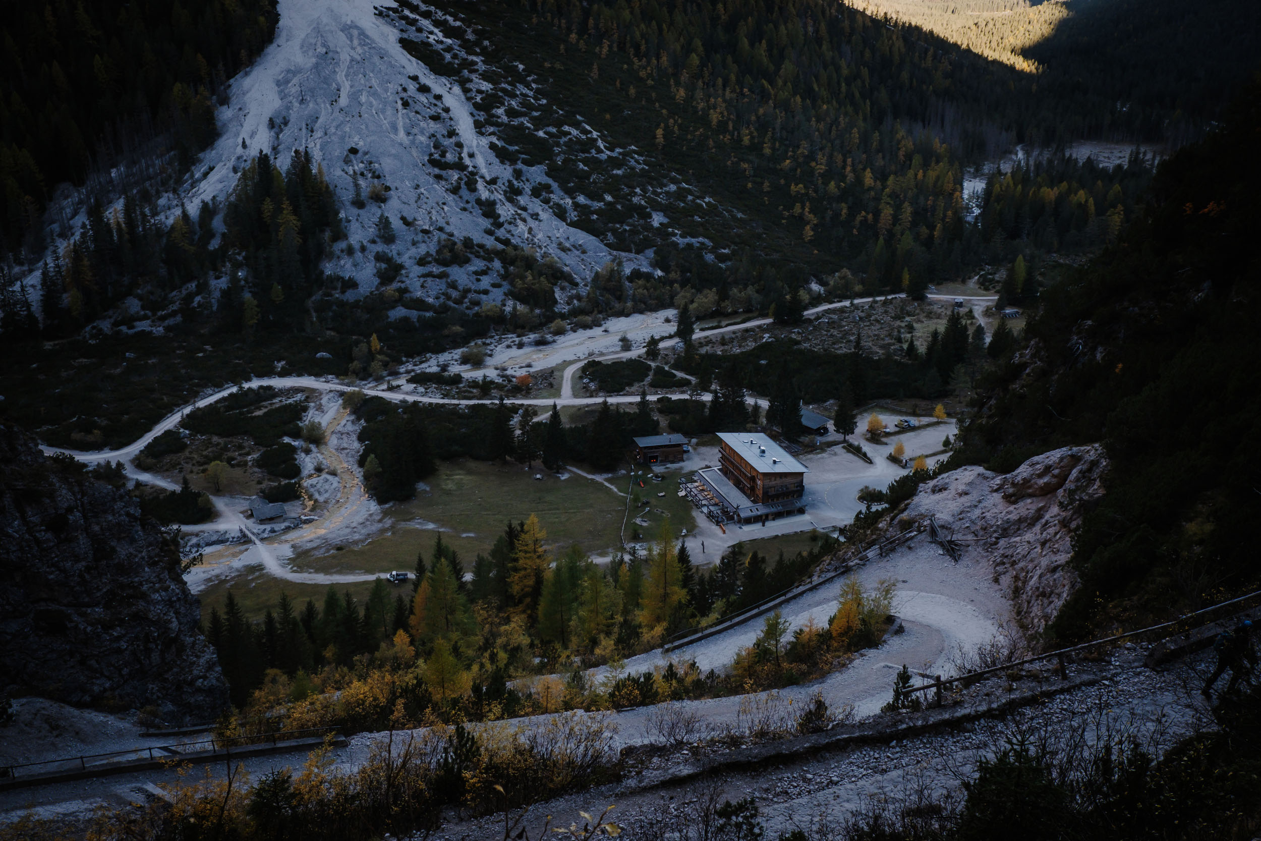
At Lago Bianco, another demanding climb begins—beautiful but tough, with hike-a-bike sections—leading to Forcella Lerosa, a former World War I battlefield. The pass opens onto a dramatic Dolomite balcony overlooking Pian de Ra Fopes, where silence and vastness make the effort worthwhile. A fast descent drops to Rifugio Ra Stua, a reliable stop for food and water. The route then climbs again toward Rifugio Sennes (2,160 meters), the high point of day one. The final five kilometers of dirt road feature grades exceeding 20% and require a hike-a-bike.
The day winds down along the gravel road to Alpe di Fodara Vedla, a historic alpine settlement of wooden mountain cabins, with an overnight stop at Rifugio Fodara Vedla.
location Rifugio Sennes-Braies di Dentro
Day 2 (42 km +1,200 m)
Day two starts with a short climb to the saddle, followed by a very steep gravel descent, packed with tight switchbacks, dropping quickly to Rifugio Pederù.
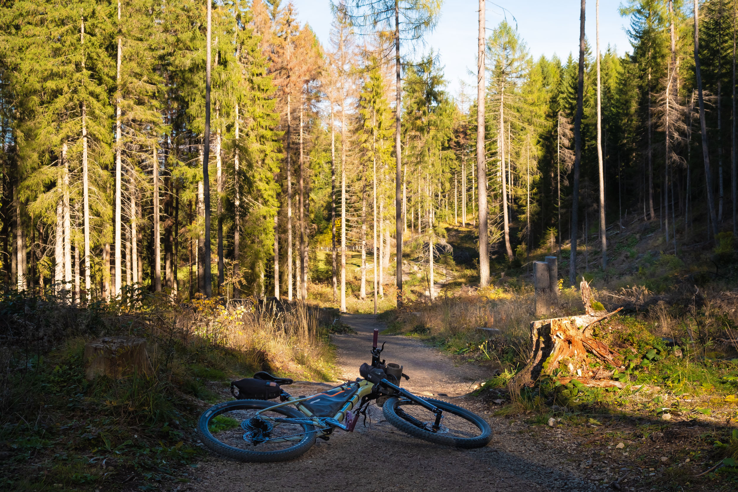
From here, roughly 12 kilometers of forest singletrack unfold, mostly downhill, delivering smooth, flowing trails all the way to San Vigilio di Marebbe (1,250 meters).
This alpine town is the last reliable resupply point before the route’s main challenge. The climb up Val Fojedöra is long, steep, and relentless—nine demanding kilometers leading to Kreuzjoch Pass (2,283 meters). Reaching the top feels like landing on another planet: vast, remote, and strikingly beautiful.
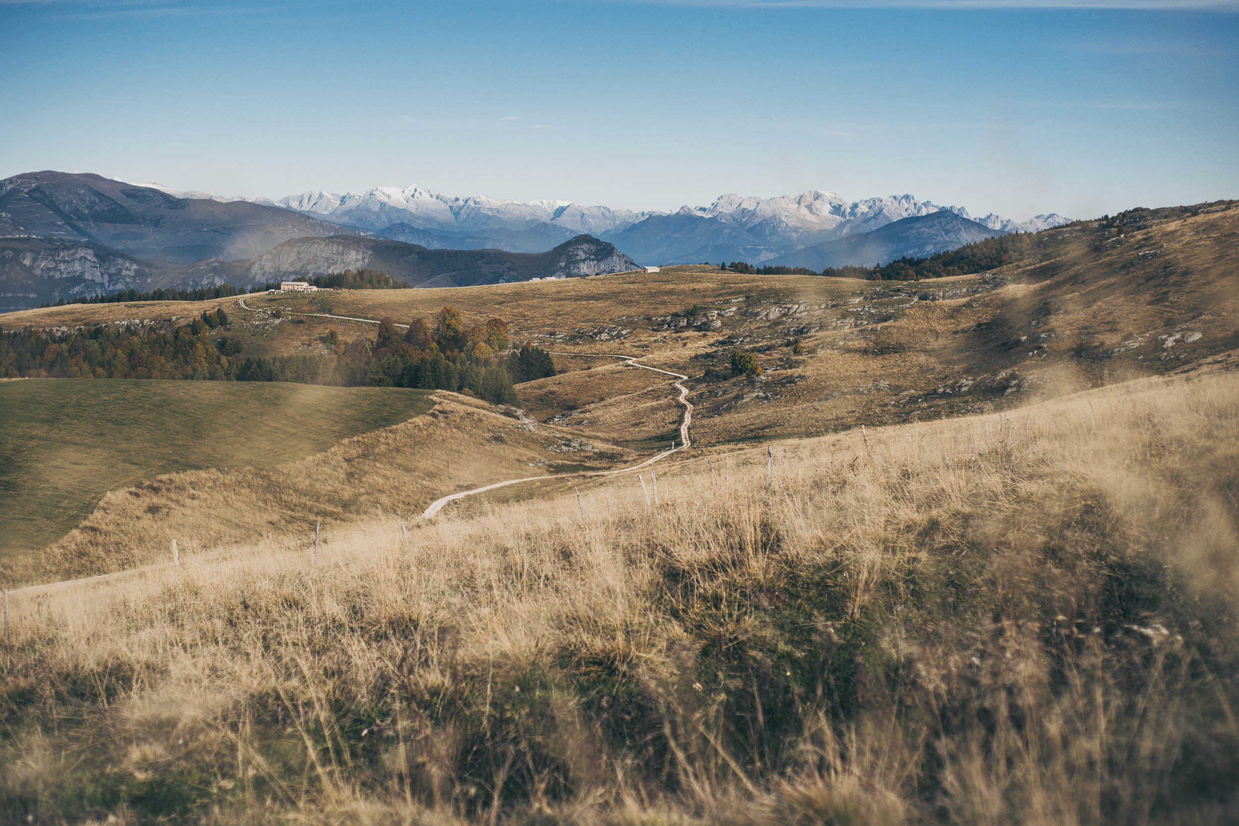
From the pass, the “super trail” begins. The upper section is fast, playful, and full of flow. Lower down, the trail steepens and becomes more technical and rough. Once past the crux, it smooths out again, weaving through low shrubs with effortless flow, then widening and mellowing until Malga Foresta—an ideal spot for a well-earned break.
From here, the ride eases off. The route rolls calmly toward Lake Braies. After the obligatory photos, follow the gravel road on the right side of the main road downhill. Shortly after, you’ll return to the starting point, completing the loop.

Terms of Use: As with each bikepacking route guide published on BIKEPACKING.com, should you choose to cycle this route, do so at your own risk. Prior to setting out check current local weather, conditions, and land/road closures. While riding, obey all public and private land use restrictions and rules, carry proper safety and navigational equipment, and of course, follow the #leavenotrace guidelines. The information found herein is simply a planning resource to be used as a point of inspiration in conjunction with your own due-diligence. In spite of the fact that this route, associated GPS track (GPX and maps), and all route guidelines were prepared under diligent research by the specified contributor and/or contributors, the accuracy of such and judgement of the author is not guaranteed. BIKEPACKING.com LLC, its partners, associates, and contributors are in no way liable for personal injury, damage to personal property, or any other such situation that might happen to individual riders cycling or following this route.
Further Riding and Reading
Here are some connected/nearby routes and related reports...
Please keep the conversation civil, constructive, and inclusive, or your comment will be removed.