


Kotlina400
Distance
257 Mi.
(414 KM)Days
4
% Unpaved
58%
% Singletrack
12%
% Rideable (time)
99%
Total Ascent
31,974'
(9,746 M)High Point
3,911'
(1,192 M)Difficulty (1-10)
7?
- 8Climbing Scale Strenuous124 FT/MI (24 M/KM)
- 7Technical Difficulty Difficult
- 9Physical Demand Very Difficult
- 6Resupply & Logistics Moderate
Contributed By

Pawel Pulawski
Guest Contributor
Pawel “Piko” Pulawski grew up in the Beskid Wyspowy region of southern Poland. He’s the creator of the Kotlina400 route and founder of Race Through Poland. A passionate gravel rider and bikepacker, he explores the Sudetes in search of climbs and forgotten trails. You can follow more of his rides and adventures on Instagram.
Photos by Paweł Rzepecki and Małgorzata Michalik
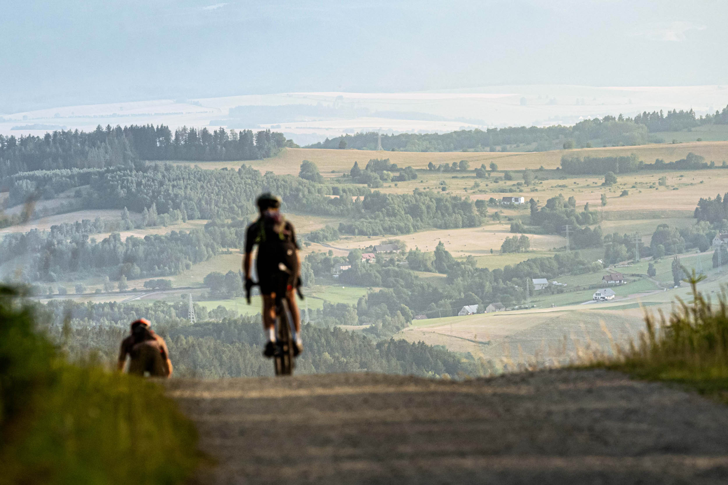
Kotlina400 is a demanding and rewarding bikepacking loop encircling the Kłodzko Valley in the Central Sudetes, Poland. This route was shaped by years of exploration, countless hours spent studying maps, and endless days in the saddle, piecing together a thoughtfully crafted loop around the valley. Every climb, descent, and connecting trail was carefully considered to create a ride that’s both beautiful and challenging, staying as close as possible to the valley’s natural rim and its highest surrounding peaks.
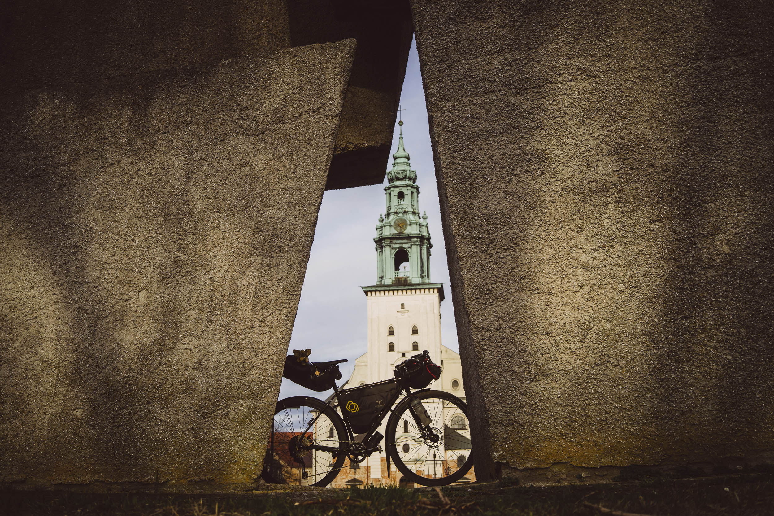
The Kłodzko Valley has long been a crossroads of cultures, shaped by Polish, Czech, and German influences over centuries. This history is evident in the towns dotting the route, which include former German settlements with well-preserved architecture, cobbled squares, and towering churches. Descending into towns like Bystrzyca Kłodzka, Lądek-Zdrój, and Międzygórze from the remote mountain roads feels like stepping back in time. Each has its own character, from spa towns famous for their healing waters to medieval fortresses that once guarded trade routes through the Sudetes.
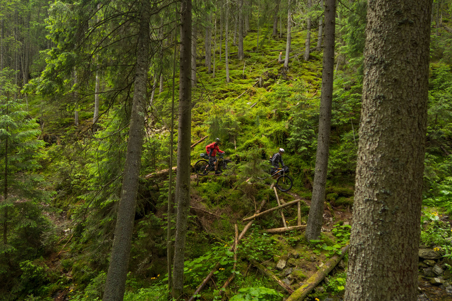
The terrain is as varied as the history. The route traverses everything from smooth tarmac to rugged gravel roads, forest tracks, and even a few technical singletrack sections. There are a handful of short but steep sections where hike-a-bike is inevitable. However, the overall flow of the route remains true to the spirit of gravel riding. Riders will climb above 1,000 meters four times, with the highest point reaching 1,213 meters above sea level. The ascents are often long and relentless, but they reward riders with panoramic views of the valley, dense spruce forests, and windswept ridges.
Beyond its historical and geographical appeal, the Kłodzko Valley is a region of rich ecological significance. The Sudetes Mountains, including the ranges encircling the valley, are home to diverse flora and fauna. Cyclists may encounter deer, foxes, and even wild boar in the more remote stretches of forest. The high-altitude meadows burst into color during spring and summer, with wildflowers dotting the landscape. Riding through these areas offers a rare chance to experience the solitude of nature, with only the sound of the wind and crunching gravel beneath the tires.
Kotlina400 is as much an endurance challenge as it is a cultural and scenic journey. Riders can choose to approach it as a fast-paced effort, chasing the current fastest known time (FKT), or they can take it at a slower pace, stretching the adventure over two to four days. With wild camping allowed in most national forests, self-sufficient bikepacking is entirely possible, and the route also passes near several mountain huts, offering cozy places to rest and refuel.


Whether approached as a personal challenge or a chance to soak in the unique blend of history, nature, and adventure, Kotlina400 is a route that leaves a lasting impression. It encapsulates the essence of the Sudetes—remote, rugged, and rich in heritage—offering riders an unforgettable journey through one of Poland’s most captivating mountain regions.
Route Difficulty
Overall Difficulty: 7/10 – The Kotlina400 presents a challenging bikepacking experience, with demanding climbs, varied terrain, and remote sections. It’s designed for riders seeking an adventure that tests both endurance and skill. The combination of technical riding and significant elevation gain, balanced by relatively accessible resupply options, makes the route tough but achievable. This rating should be considered significantly higher if attempting a non-stop ride.
Technical Difficulty: 7/10 – The route features a diverse mix of gravel, forest roads, and occasional technical singletrack, which can be especially tricky in wet conditions. Several short, steep hike-a-bike sections require strong bike handling and confidence on rough terrain. While it’s not an overly technical route overall, the surface variety and occasional trail sections demand solid gravel-riding skills and good control.
Physical Demand: 9/10 – With more than 9,600 meters of climbing packed into 400 kilometers, this route is physically intense. Riders face multiple long climbs, including ascents over 1,000 meters, with the highest point reaching 1,213 meters above sea level. The mountainous terrain is relentless and will test your stamina, particularly if you’re aiming to complete the loop in a short timeframe. The difficulty here is all about sustained elevation gain and rugged surfaces, not technical obstacles.
The Kotlina400 ranks as 7/10 on the climbing scale, placing it firmly in the “strenuous” category. With an average of 23.6 meters of ascent per kilometer (124.5 feet per mile), the climbing is demanding and frequent but not extreme. Steep sections do appear, but most ascents are manageable with consistent effort. The elevation profile demands persistence rather than explosiveness, and the rewards—open ridgelines, sweeping views, and long descents—are more than worth it.
Resupply and Logistics: 6/10 – The Kotlina400 is reasonably accessible, especially at the starting point, where you’ll find parking, hotels, B&Bs, and a nearby train station. Proximity to Wrocław, a major city with an international airport and rail connections, adds further convenience. While the route passes through a series of historic towns, these are spaced in a way that requires thoughtful planning. In rural or high-mountain sections, shops, water sources, and food can be scarce. Still, with smart preparation, resupply is manageable. Wild camping is permitted in most forest areas, and several mountain huts along the way offer meals and shelter.
Route Development: The Kotlina400 was created over several years by Paweł “Piko” Puławski, a passionate gravel rider and bikepacking enthusiast, with the goal of connecting the highest peaks surrounding the Kłodzko Valley into a single, continuous loop. Originally envisioned as a gravel race, the project soon revealed that the region had far more to offer than just competition. After countless hours of mapping and scouting the Central and Eastern Sudetes, Paweł realized that this landscape—rich in cultural heritage, natural beauty, and rugged terrain—deserved to be shared more openly.
The result is a carefully curated route that blends wild backcountry with purposeful design, drawing on both lesser-known forest paths and existing trail infrastructure. Small portion of the loop incorporate select segments of the Strefa MTB Sudety network, one of Poland’s premier mountain biking systems, adding flow, quality surface, and a connection to the local cycling community. Today, Kotlina400 stands as an open invitation for riders from around the world to explore this stunning and storied corner of southern Poland.


Submit Route Alert
As the leading creator and publisher of bikepacking routes, BIKEPACKING.com endeavors to maintain, improve, and advocate for our growing network of bikepacking routes all over the world. As such, our editorial team, route creators, and Route Stewards serve as mediators for route improvements and opportunities for connectivity, conservation, and community growth around these routes. To facilitate these efforts, we rely on our Bikepacking Collective and the greater bikepacking community to call attention to critical issues and opportunities that are discovered while riding these routes. If you have a vital issue or opportunity regarding this route that pertains to one of the subjects below, please let us know:
Highlights
Must Know
Camping
Food/H2O
Trail Notes
- Epic Summit Views: The route delivers breathtaking panoramas from peaks towering above 1,000 meters – Orlica, Wielka Sowa, and Jagodna – each crowned with viewing towers offering sweeping vistas of the Kłodzko Valley and the distant ridgelines of the Sudetes.
- Twelve Historic Towns: Scattered along the route, towns like Lądek-Zdrój, Bystrzyca Kłodzka, and Międzylesie showcase centuries of layered heritage. With cobbled squares, baroque churches, and spa traditions rooted in German, Czech, and Polish history, each stop feels like stepping into a different era.
- Ever-Changing Landscapes: From dense spruce forests and open alpine plateaus to jagged sandstone ridges and high mountain passes, Kotlina400 traverses eight distinct mountain ranges, each with its own terrain, mood, and scenery.
- The Śnieżnik Ascent: Topping out at 1,213 meters, the route’s highest point sits just beneath Śnieżnik’s 1,423-meter summit. A short but steep off-route climb rewards those who go the extra mile with a newly built viewing tower and sweeping alpine vista – easily one of the most dramatic panoramas in the Sudetes.
- The Dukt nad Spławami: A peaceful, historic forest road winding through the Puszcza Śnieżnej Białki nature reserve. This section offers deep solitude, pristine landscapes, and a sense of complete disconnection from civilization.
- Srebrna Góra Fortress: One of Europe’s largest mountain fortresses, perched high above the valley. Its preserved walls, tunnels, and scenic ramparts offer a powerful blend of military history and epic views.
- The Pastoral Savannah: Near Pasterka, expansive meadows stretch out beneath the Table Mountains’ sandstone peaks. Dotted with bizarre rock formations and surrounded by open sky, this area is as surreal as it is beautiful.
- Premium Gravel via Strefa Sudety MTB: Select segments of the route tap into the Strefa Sudety MTB trail network – smooth, well-designed gravel roads that cut across the Owl Mountains, adding flow and local trail flavor to the adventure.
- Złoty Stok Gold Mine: In the historic town of Złoty Stok, riders pass by one of Poland’s oldest gold mines, active since the Middle Ages. A tour through its underground tunnels is a unique and atmospheric side trip for the curious.
- Trójmorski Wierch: Near Jodłów, the route skirts a rare geographical gem – Trójmorski Wierch, where waters divide and flow toward three seas: the Baltic, Black, and North. It’s not on the main trail, but it’s a worthwhile detour for geography lovers and summit collectors.
- Camp Where You Ride: With wild camping allowed in most national forests and several mountain huts along the route, riders can choose between off-grid adventure or a warm meal and bed – no matter their style or experience level.
- Big Climbs, Bigger Payoffs: With 9,700+ meters of climbing, Kotlina400 is built around effort and reward. For every punishing ascent, there’s a thrilling descent – and a view that’ll stop you in your tracks.
- Easy Access, Wild Reward: Though remote in feel, the route begins near Wrocław, a major city with an international airport and rail connections. It’s surprisingly accessible for an adventure this wild and remote.
When to Go
The best time to ride the Kotlina400 is from late spring to early autumn, with optimal conditions typically between May and October. Summer offers the most stable weather and comfortable temperatures, while early and late season rides can bring cooler air and more solitude – but also the chance of rain or even early snow. Winter riding is not recommended due to snow-covered trails and icy conditions at higher elevations.
Logistics
- The route is easily accessible from Wrocław, a major city with an international airport, extensive rail connections, and plenty of accommodation options.
- The starting point offers parking, hotels, and B&Bs, making it easy to arrive and prepare for your ride.
- Public transportation is available to reach the start, and the return trip can be made by train, with several towns along the route – including Bardo and Międzylesie – offering direct rail connections back to Wrocław.
Dangers & Annoyances
While the Kotlina400 is a rewarding ride, there are a few things to keep in mind for a safe and enjoyable experience:
- Wildlife encounters are rare but possible in remote areas—mainly wild boar, foxes, and deer. These animals typically avoid humans, but when camping, it’s wise to store food securely and stay aware of your surroundings.
- The route passes through active forestry zones, where logging operations may be in progress. Keep a safe distance from machinery and stay visible on shared roads and trails.
- Wet conditions can turn gravel roads slick, especially on climbs and descents. Be extra cautious during or after rainfall—some sections become muddy or rutted fast.
- Mountain weather is unpredictable. Fog, sudden downpours, and rapid temperature drops are common at higher altitudes. Always check the forecast and pack appropriate clothing.
Travel Basics
- For international riders, the most convenient point of entry is Wrocław’s international airport, which offers connections to many major European cities. From there, it’s an easy train or car journey to the start of the route.
- Poland is part of the Schengen Area, so no visa is required for travelers from other Schengen countries. Visitors from outside the zone should check current visa requirements before arrival, as policies may vary depending on nationality and length of stay.
- Traveling with a bike is straightforward in Poland – bikes are allowed on most trains, and you simply need to purchase a separate bike ticket, which is inexpensive and easy to get.
What Bike?
- A gravel or adventure bike is the ideal choice for the Kotlina400. Tires with a minimum width of 40mm are recommended, though going wider – up to 45mm – will add comfort and control on rougher gravel and forest tracks. For riders who prefer extra capability on technical sections, a hardtail mountain bike or a gravel bike with front suspension can be a smart alternative.
- The route includes numerous long climbs and steep gradients, so wide-range gearing is essential. A 1x drivetrain with a large cassette or a 2x setup for extra flexibility will help tackle the steeper mountain passes.
- To manage the descents – especially on loose or wet terrain – hydraulic disc brakes are highly recommended for their stopping power and reliability.
- Wild camping is permitted along most of the Kotlina400 route, especially within national forest areas, making self-supported bikepacking both viable and rewarding.
- Riders are encouraged to follow Leave No Trace principles to help preserve the natural environment.
- Throughout the route, mountain huts and shelters provide basic accommodation, meals, and a place to rest – particularly valuable in poor weather or for those not carrying full camping gear.
- In more remote areas, refuges and lean-tos – often maintained by local communities or forestry services – offer simple, free overnight shelter. These are typically located near hiking trails and are first-come, first-served.
- Private land camping is not allowed without explicit permission from the landowner. Avoid pitching your tent near private homes, fenced properties, or cultivated land unless you have clear consent.
- Some sections of the route pass through protected environmental zones or nature reserves, where camping is strictly prohibited. Notably, Table Mountain National Park (km 60–85) does not allow wild camping. These areas are marked by signage – pay close attention and plan accordingly to avoid unintentional violations.
- In historic towns along the route, riders will find a range of guesthouses, B&Bs, and small hotels. These provide a comfortable alternative, especially during bad weather or planned rest days. While no official campgrounds sit directly on the route, nearby tourist villages and spa towns often have designated camping areas during the summer months. Facilities and fees vary by location.
- Open fires are not permitted in most forested and protected areas due to wildfire risk. If cooking, use a camp stove responsibly and only in appropriate settings.
- During peak season (June–September), popular huts and guesthouses may fill up – particularly on weekends – so booking in advance is recommended if you plan to stay indoors.
- Fresh water is generally available in towns and villages along the route. Small shops, cafés, and restaurants often have taps or spigots where you can refill bottles. In the mountains, streams and springs are common—especially in forested areas—but filtering or treating all natural water sources is recommended due to potential agricultural or animal contamination.
- Mountain huts are reliable stops for water refills, meals, and often snacks or basic groceries. These become especially valuable in remote sections with limited services.
- Food availability varies along the route. While Kotlina400 passes through more than a dozen towns, the distances between them can be significant, and some rural stretches have no shops. Always carry extra food for emergencies and plan resupply stops carefully. Shops and bakeries in towns are often small and locally owned, with limited hours—some may be closed on Sundays or open only in the mornings. Stock up when you can.
- Don’t miss the chance to enjoy local cuisine in traditional eateries along the way. Many towns feature milk bars (bar mleczny) or rustic restaurants serving hearty, affordable Polish meals. Must-try regional dishes include: Pierogi – dumplings filled with cheese, potatoes, meat, or fruit; Żurek – sour rye soup, often served with sausage and egg; Gołąbki – cabbage rolls stuffed with meat and rice
- Look out for local bakeries and cafés in towns like Bystrzyca Kłodzka, Lądek-Zdrój, Złoty Stok, Duszniki-Zdrój, and Nowa Ruda—you’ll often find great pastries, espresso, and a warm, welcoming vibe, perfect for a short recharge.
- Restaurants, pizzerias, bars, and pubs are found in larger towns, offering not just food and drink but also an authentic glimpse into local culture. Czech-style beers are especially popular here, thanks to the region’s proximity to the Czech border.
Recommended Stops Along the Route:
- Bar Kaktus (km 0): Located at ul. Okrzei 2 in Bystrzyca Kłodzka, this local favorite offers hearty home-cooked Polish meals at excellent prices.
- Kawiarnia Dzień Dobry Cafe (km 49): At ul. Juliusza Słowackiego 1/1c in Duszniki-Zdrój, known for good coffee, cakes, and a cozy interior.
- Schronisko PTTK Pasterka (km 74): A mountain hostel offering meals and accommodation in the heart of Stołowe Mountains National Park.
- Schronisko Górskie “Orzeł” (km 131): A historic mountain hut in the Sowie Mountains serving traditional Polish dishes.
- Kawiarnia Stary Most (km 190): A charming café in Bardo with great coffee, wine, beer, books, and music.
- Diabli Nadali (km 228): A cozy café in Złoty Stok offering high-quality coffee and sweet treats
- Schronisko na Śnieżniku (km 332): Located just below the summit of Śnieżnik, this mountain hut provides meals and simple lodging for hikers and bikepackers.
- Schronisko PTTK Jagodna (km 400): A welcoming hut in the Bystrzyckie Mountains, known for its food and proximity to outdoor trails.
You can ride this route in many ways – go all in with a non-stop push, break it into two big days, or take it slower over five or six. My suggested itinerary splits the route into four days, striking a balance between challenge and enjoyment. With over 2,500 meters of climbing each day, it’s still a solid achievement and a demanding ride, but one that gives you enough space to soak in the beauty, variety, and character of the landscape along the way.
location Bystrzyca Kłdzka – Nowa Ruda
Day 1 (113 km +2,571 m)
Leaving the cobbled city centre of Bystrzyca Kłodzka, our start-line city, we quickly transition into the rural outskirts. For several kilometers, a gently climbing tarmac road leads us into the Bystrzyckie Mountains until we reach our first real challenge: the famous Wataszka Climb. This steep ascent takes us sharply above 800 meters a.s.l. – starting on brutally steep tarmac, then transitioning into a rugged forest road.
By getting to the top, we are crossing the Bystrzyckie Range and descend through Torfowisko pod Zieleńcem (Zieleniec Peat Bog) into the valley of the Bystrzyca Dusznicka River. From here, we tackle our first summit above 1,000 meters: Orlica, the highest peak in the Orlické Mountains. Past the top, after a wild and mixed section – blending natural trails with professionally built singletrack – we pass through the Zieleniec Ski Centre and descend a fast, flowing gravel road into Duszniki-Zdrój, a renowned mountain spa town. I recommend stopping for coffee and cake at one of the cafés in the town square – perfect for a mid-ride energy boost.
Leaving town, we begin climbing into another mountain range: the Table Mountains. The route starts with steep gravel sections and picturesque meadows near Zielone Ludowe, then skirts around Grodczyn Mountain before reaching the base of the actual range. A long gravel climb takes us to the Błędne Skały parking lot and then on to Karłów, a town nestled in the heart of these distinctive flat-topped mountains.
Here, we enter the Pastoral Savannah – a vast open meadow with panoramic views and a thrilling stretch of singletrack. You absolutely must stop at Schronisko Pasterka, a mountain hotel known for its local cuisine and welcoming atmosphere. From there, we climb back to the top of the range before descending one of the most enjoyable roads in the region: the legendary Road of 100 Bends.
At the bottom, in the town of Radków, we enter the lower-lying terrain of the route. But don’t be fooled – Obniżenie Noworudzkie is packed with short, punchy climbs and constantly changing surfaces. After a pleasant stretch of small tarmac roads along the Ścinawka River valley, we arrive at Góra Wszystkich Świętych, considered by many to be the toughest climb of the route. It’s not long, but it’s steep, rocky, and usually requires a bit of hike-a-bike. At the summit, there’s an old and impressive viewing tower, and the descent follows the Stations of the Cross steps – another potential hike-a-bike section, depending on your skills and confidence.
One final steep climb leads us to Góra Świętej Anny, where we’re rewarded with an incredible panorama of the entire Owl Mountains range. From here, we recommend descending into Nowa Ruda, where you can call it a day at one of the local B&Bs. Alternatively, push on for another 15 kilometers and find a solid wild camping spot further along the route.
location Nowa Ruda – Złoty Stok
Day 2 (114 km +2,600 m)
After leaving Nowa Ruda, we follow quiet tarmac roads that weave through a series of small local towns. Soon, we turn north and begin climbing on gravel, heading into the Owl Mountains (Góry Sowie), one of the oldest ranges in the Sudetes. Known for their mysterious atmosphere and dark WWII history, this area is home to an extensive system of post-German underground tunnels and bunkers, including remnants of the infamous Project Riese – a network of secret Nazi constructions hidden deep in the rock.
The biggest challenge of the day is the ascent to Wielka Sowa (Big Owl), which stands at 1,015 meters above sea level and is the highest peak of the Owl Mountains. Before we reach it, we face a few already demanding climbs leading up to the mountain resort village of Sokolec. From there, we begin our final, steady gravel ascent to the summit. Consider stopping at the local mountain hut, Schronisko Orzeł, as there won’t be many places to get food until you descend from the range. The climb is long but not particularly brutal. Reaching the top is rewarded with a visit to the iconic white stone observation tower on the summit. Be sure to go up – it offers a stunning 360-degree view of the surrounding ranges and valleys.
Descending from the peak is not easy either. The upper section is rocky and steep in places, so extra caution is advised – this is not the place to rush. After a few technical kilometers, the trail improves significantly, turning into one of the best gravel tracks in the region. From here, you’ll traverse a series of iconic mountain passes – Przełęcz Jugowska, Przełęcz Woliborska – along sweeping forest gravel roads. The scenery is breathtaking, with wide views over the Owl Mountains and neighboring ranges. Once you reach Srebrna Góra, marked by the imposing Twierdza Srebrna Góra (Srebrna Góra Fortress), you’ll know you’ve conquered another significant pass.
Next comes the Bardzkie Mountains (Góry Bardzkie). This range welcomes you with forest double-track roads, plenty of climbing, and equally thrilling descents. Make sure to stop in the historic town of Bardo for food and coffee – this is the halfway point through the range. From Bardo, you’ll climb back up to the ridge and cross over once again toward Złoty Stok, a charming old town known for its historic gold mine, which is well worth a visit. Here, you can enjoy a stop at a local café for wine or craft beer and rest in one of the cozy B&Bs.
Alternatively, if you’re still feeling strong, you can start climbing into the next mountain range and find a suitable wild camping spot along the way.
location Złoty Stok – Schronisko Pod Śnieżnikiem
Day 3 (104 km +2,800 m)
Day 3 is a deep dive into the highlands – long climbs, remote wilderness, and the rugged beauty of the Sudetes. It begins with a proper wake-up call: a steep, 9-kilometer gravel climb into the Golden Mountains. The gradient is unforgiving at first but eases as you climb higher into dense forest. The final stretch to the pass is paved, and the descent that follows is pure flow -fast, smooth, and immensely satisfying. But the rest is short-lived. A sharp turn off the main road sends you onto another gravel ascent, this time heading toward Krowia Góra Wielka, which rises to 889 meters. There’s little to see at the summit aside from a modest information sign, but the descent that follows a steep, loose gravel chute -leads you directly to the spa town of Lądek-Zdrój. The route skirts the resort area, but it’s worth taking a short detour into town for a pizza or to restock at a grocery store. This is the last convenient resupply point for a long while, and the biggest climbs are still ahead.
Beyond Lądek-Zdrój, the route begins another long gravel ascent, crossing the Golden Mountains for the second time. A scenic, high-altitude traverse delivers you to the valley of the Biała Lądecka River, which you’ll follow upstream toward its source in the Bialskie Mountains. The paved road ends in the quiet village of Bielice, where the sense of remoteness begins in earnest. From here, you enter the Dukt nad Spławami – a wide, historic timber road that gently climbs through dense, untouched forest. This segment is magical: nearly 30 kilometers of uninterrupted calm, passing over 1,000 meters elevation, weaving through old forest asphalt and well-maintained gravel, with long views toward the distant Śnieżnik Massif. Eventually, you descend from the Bialskie Mountains and curve toward the Czech border. A beautiful paved climb marks the beginning of the final and most demanding section of the day. At the top, you meet the Staromorawska gravel road, an old military route that hugs the ridgeline.
This is where the three-part climb to Śnieżnik begins. The first section is a combination of tarmac and gravel leading to Przełęcz Staromorawska, followed by a short, energizing descent with sweeping views of the mountain ahead. Then comes the second phase – a long gravel traverse that wraps around the northeastern flanks of Śnieżnik, gently gaining elevation with each curve. The third and final part is the real test: eight steep kilometers of rocky, uneven surface that rarely lets up. It’s a grind, both physically and mentally, and when you reach the large forest junction near the top, it’ll feel like a small victory. From there, it’s just under a kilometer to the open alpine zone where the mountain hut – Schronisko na Śnieżniku -sits at 1,215 meters above sea level. The shelter offers hot meals, drinks, and beds, making it an ideal place to wrap up the day.
If you prefer to sleep under the stars, there are wild camping options in the surrounding forest. But whether in a bunk or a bivvy, this is a day that leaves you feeling far away from the world – and closer to the heart of the Sudetes.
Just above rises Śnieżnik itself, the highest peak of the entire route at 1,423 meters. It’s a short hike or a determined MTB effort to reach the top, where a newly built observation tower provides sweeping 360-degree views into both Poland and the Czech Republic. The climb to the peak is optional but highly recommended – especially for those chasing the full experience. You can do it on a gravel bike; it’s an adventure after all. :)
location Schronisko pod Śnieżnikiem – Bystrzyca Kłodzka
Day 4 (104 km +2,800 m)
The final day begins high in the mountains, and that can only mean one thing: we start with a descent. A long, fast, exhilarating one – arguably one of the best gravel descents in all of Poland. Leaving the Śnieżnik Massif, we drop for several kilometers along a wide, flowing gravel road, winding through alpine meadows and forested slopes, all the way down to the charming village of Międzygórze. This historic resort town was once a favorite among 19th-century aristocracy and retains its wooden alpine architecture and spa-town atmosphere. If you didn’t stock up at the mountain hut, this is a great place to stop at a local shop. It’s your last solid chance to resupply for a while.
From Międzygórze, the work begins again. We climb the southern slopes of the Śnieżnik Massif via a series of steep, punchy gravel climbs, eventually reaching the small mountain village of Jodłów. Here, you’ll pass a sign pointing to Trójmorski Wierch, a unique geographical site where waters from three drainage basins divide – flowing to the Baltic, North, and Black Seas. Although it’s not on the main route, it’s a worthy side trip for fans of natural landmarks.
A long tarmac descent leads us from Jodłów into Międzylesie, the last major town before we turn back into the wilderness. From here, we enter our final mountain range – the Bystrzyckie Mountains – which we also crossed on Day 1. Some riders call this area “gravel gold,” and it’s easy to see why.
What follows is a glorious section of wide forest roads and flowing gravel tracks, including a stretch of the legendary Autostrada Sudecka – a Cold War-era military road built along the ridgeline of the Sudetes. It’s rough in places but offers unmatched views and uninterrupted riding through deep forest and open highlands. There’s no flat riding here – it’s either up or down. The main objective of this stage is Jagodna (985 m), the highest peak in the Bystrzyckie range. A short detour takes you to the summit, where a tall aluminum observation tower rewards you with sweeping views. Definitely worth the extra push.
From there, a gentle descent leads you to Przełęcz Spalona. Be sure to stop at Schronisko PTTK Jagodna, a beloved mountain hut known for its home-cooked meals and friendly atmosphere. The food here is legendary – and it’s the perfect spot to celebrate the last real climb of the route. All that remains is the finale: a fast, twisting road descent packed with tight hairpin turns, a favorite among local roadies. It leads you straight back to Bystrzyca Kłodzka, closing the loop in style.
Back in town, if you’re still hungry, treat yourself to a hearty meal at Bar Mleczny Kaktus or a pastry and coffee at Cukiernio-Kawiarnia Pudrowa. Take a moment to sit in the market square and reflect on what you’ve accomplished. Four days, hundreds of kilometers, thousands of meters climbed – and memories made across one of Poland’s most captivating mountain landscapes.
Route complete!
Options for change:
For those looking to shorten the route or break it into smaller segments, there are a couple of natural exit points along the way. The route passes directly through two towns with railway stations connected to the national network – Bardo (km 190) and Międzylesie (km 371). Both offer frequent regional trains toward Bystrzyca Kłodzka (start of the route) and Wrocław, making it easy to modify your plans if needed. Whether you’re cutting the route short due to weather, time constraints, or just to take a more relaxed approach, these stations provide convenient and reliable bailout options.


Terms of Use: As with each bikepacking route guide published on BIKEPACKING.com, should you choose to cycle this route, do so at your own risk. Prior to setting out check current local weather, conditions, and land/road closures. While riding, obey all public and private land use restrictions and rules, carry proper safety and navigational equipment, and of course, follow the #leavenotrace guidelines. The information found herein is simply a planning resource to be used as a point of inspiration in conjunction with your own due-diligence. In spite of the fact that this route, associated GPS track (GPX and maps), and all route guidelines were prepared under diligent research by the specified contributor and/or contributors, the accuracy of such and judgement of the author is not guaranteed. BIKEPACKING.com LLC, its partners, associates, and contributors are in no way liable for personal injury, damage to personal property, or any other such situation that might happen to individual riders cycling or following this route.
Further Riding and Reading
Here are some connected/nearby routes and related reports...
Please keep the conversation civil, constructive, and inclusive, or your comment will be removed.