


SAND: Segment 5 – Kaokoveld
Distance
830 Mi.
(1,336 KM)Days
19
% Unpaved
93%
% Singletrack
5%
% Rideable (time)
95%
Total Ascent
34,734'
(10,587 M)High Point
4,880'
(1,487 M)Difficulty (1-10)
8?
- 3Climbing Scale Fair42 FT/MI (8 M/KM)
- 7Technical Difficulty Difficult
- 8Physical Demand Difficult
- 8Resupply & Logistics Strenuous
Contributed By
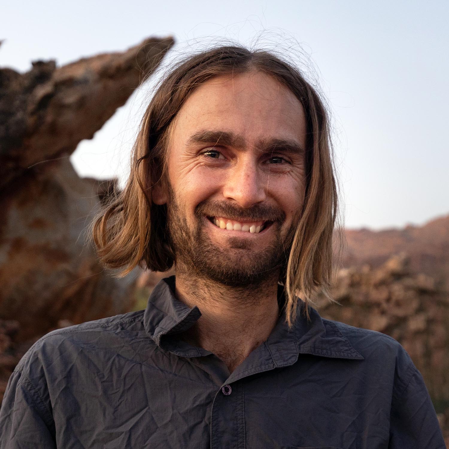
Johan Wahl
A Whale Away
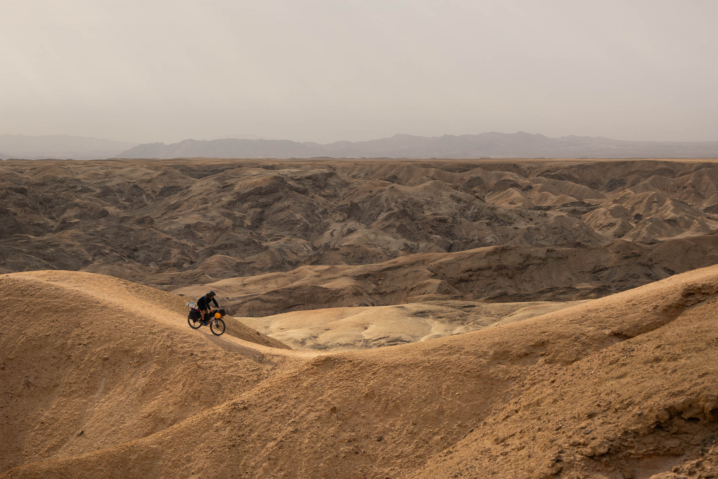
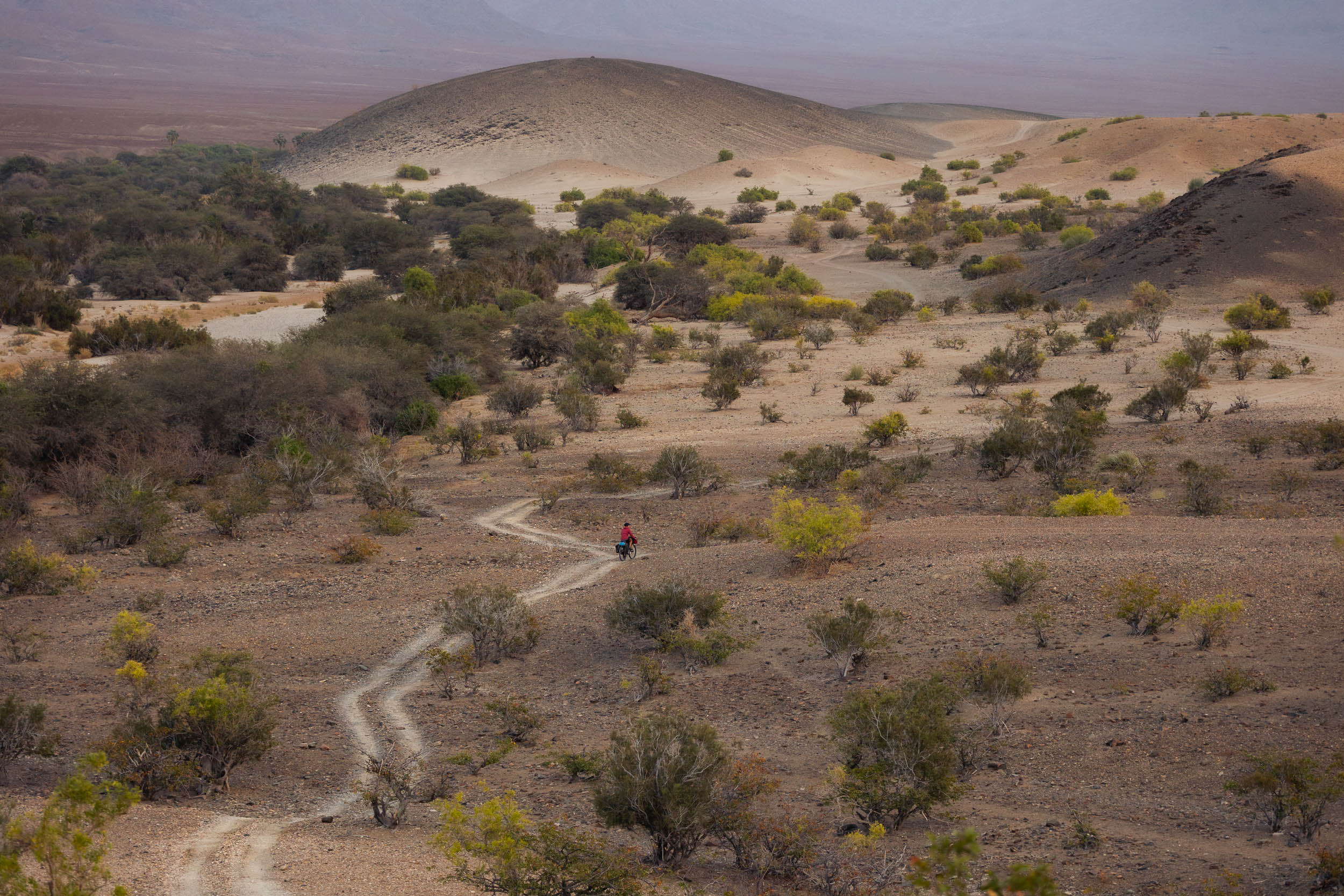
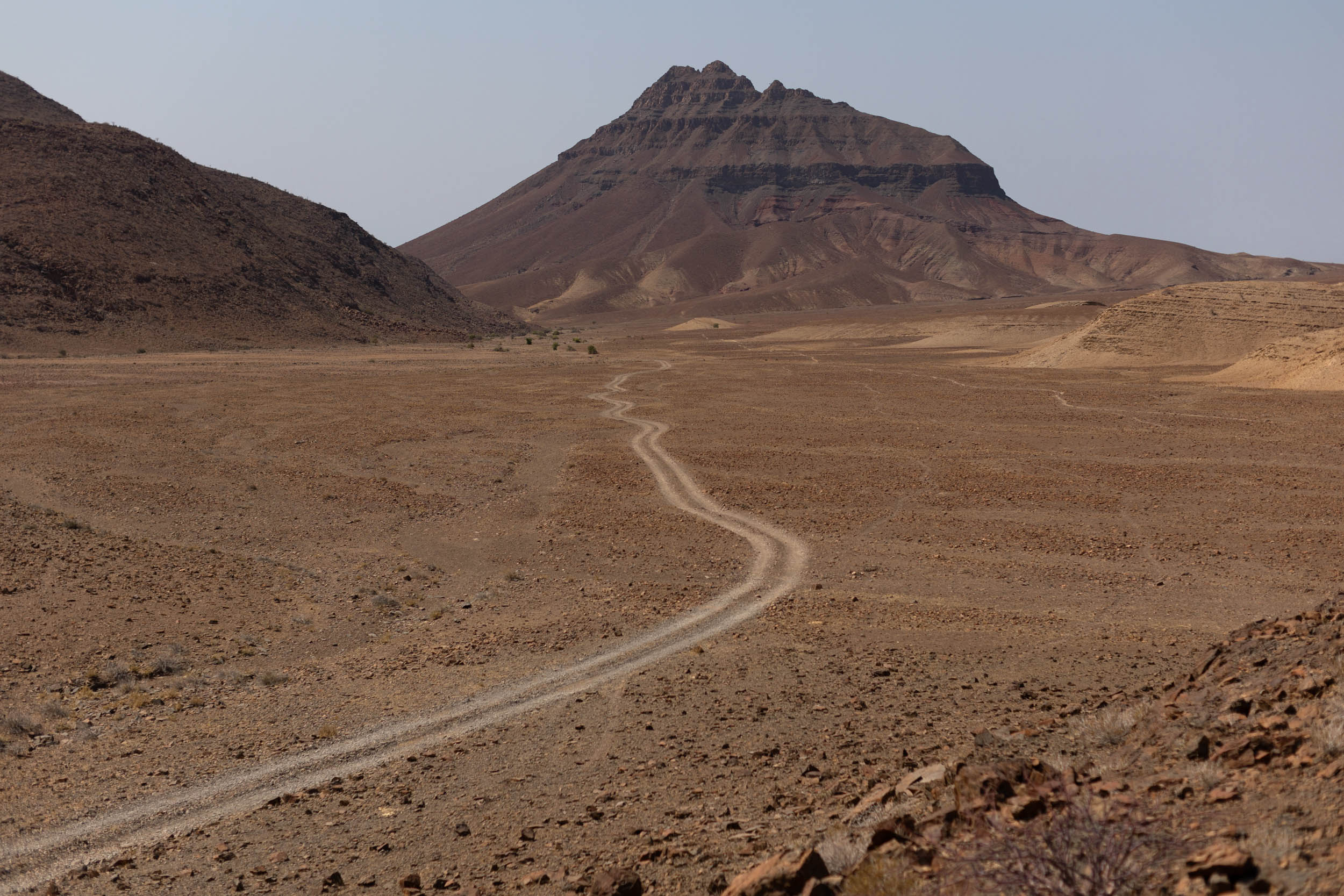
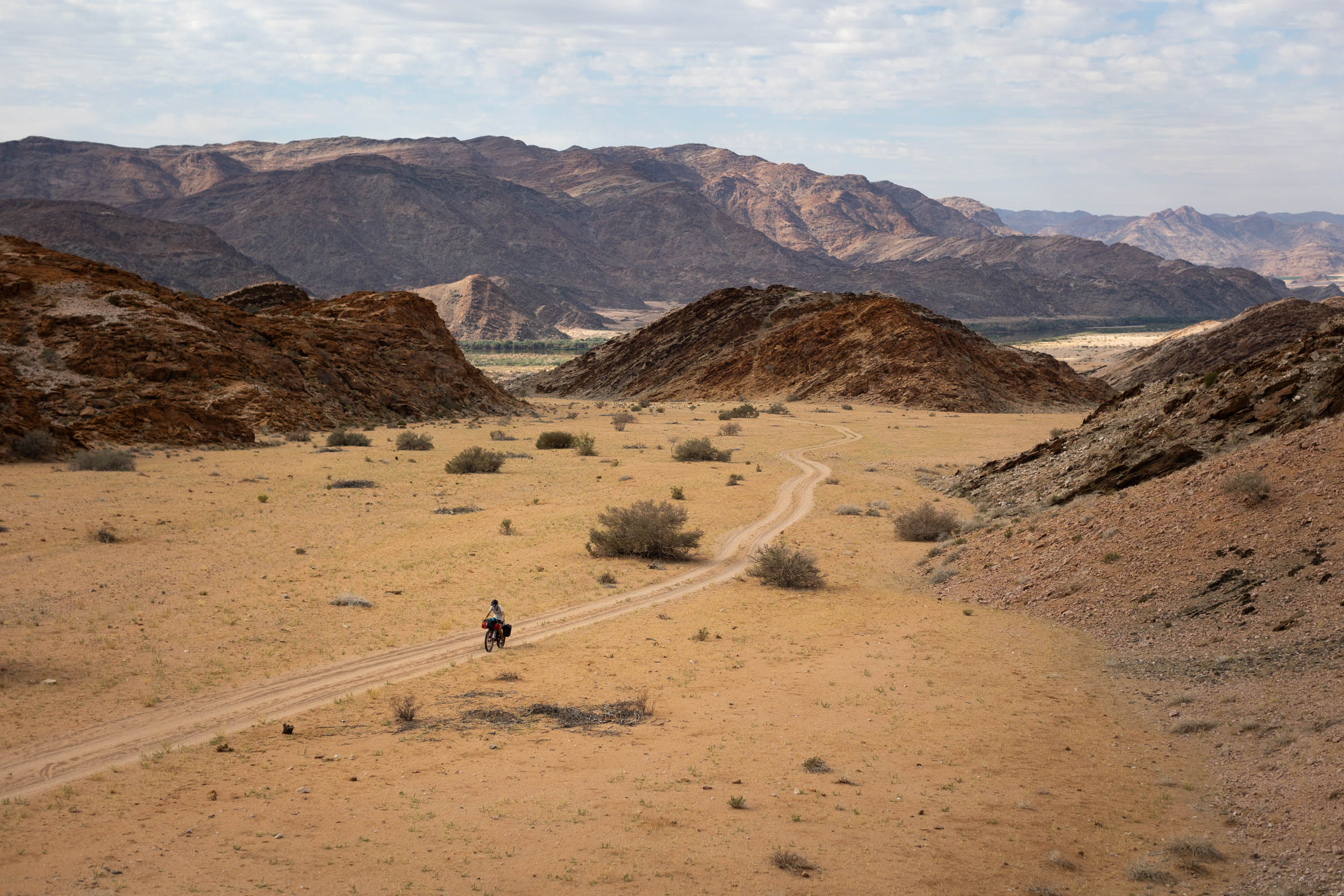
Each segment of the SAND route has its own unique appeal, but if you’re like me and you’re drawn to unspoiled wilderness, then this one could easily be considered the highlight of the entire route. It radiates wilderness in virtually every aspect.
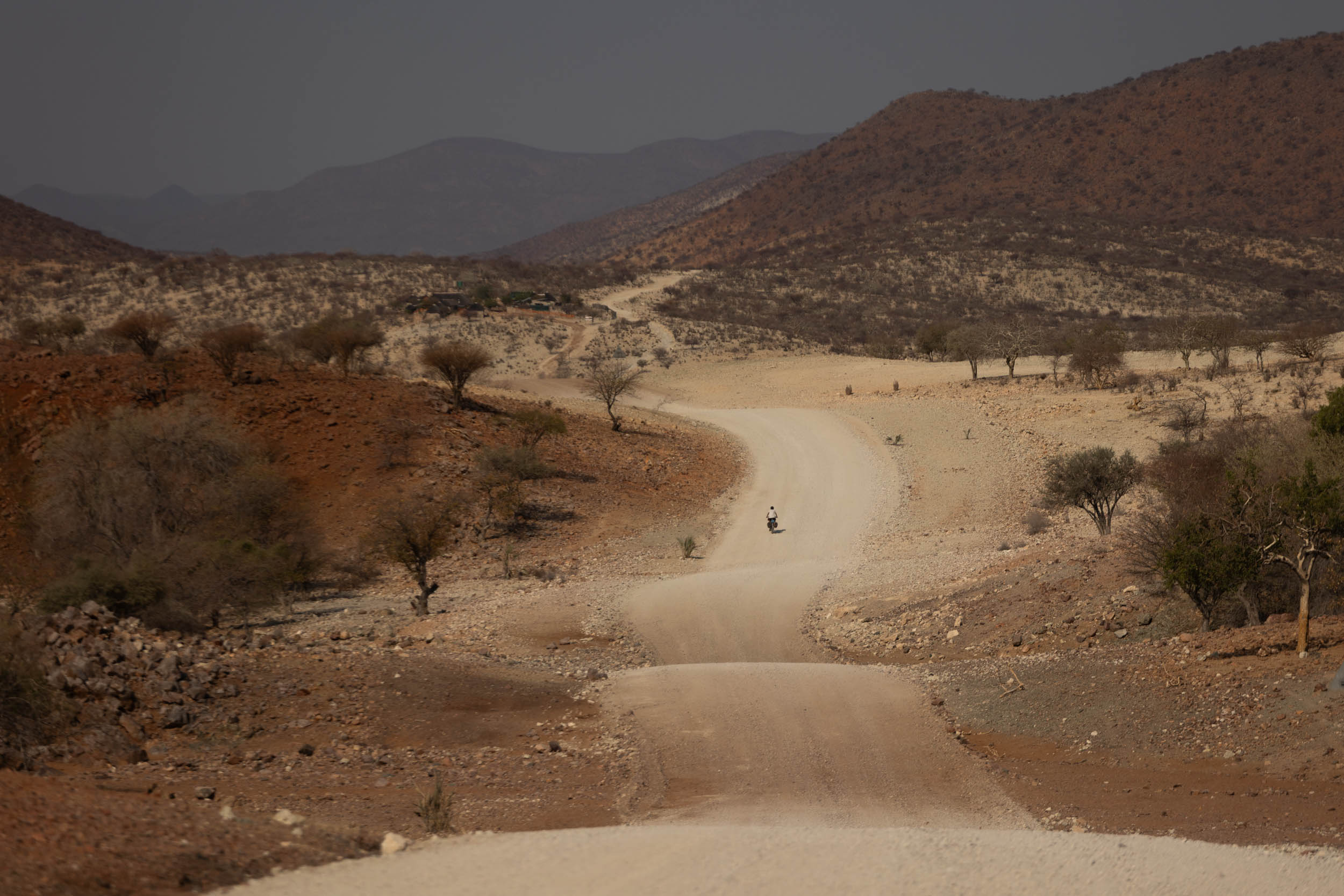
Northern Namibia boasts a great number of natural conservancies, land set aside for the conservation of wildlife and ecosystems that also serve as essential spaces for Indigenous communities to continue and preserve traditional agricultural practices and livelihoods. With these widespread conservation efforts and a general lack of major infrastructure or developments, this part of the country takes on a wonderfully wild and natural feel. Moreover, the region is criss-crossed with countless secluded paths and tracks, making it possible to explore in the desert’s farthest-flung nooks and crannies without being burdened with fences, private property or traffic of any kind. Indeed, there are few places anywhere on the continent that offer the same kind of access to such vast swaths of wilderness.
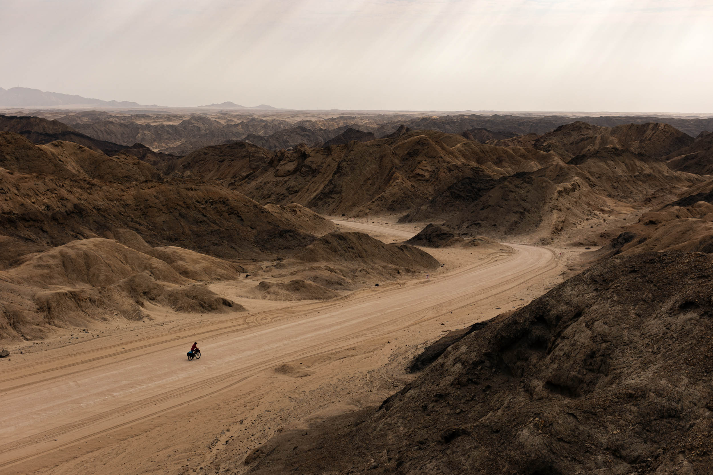
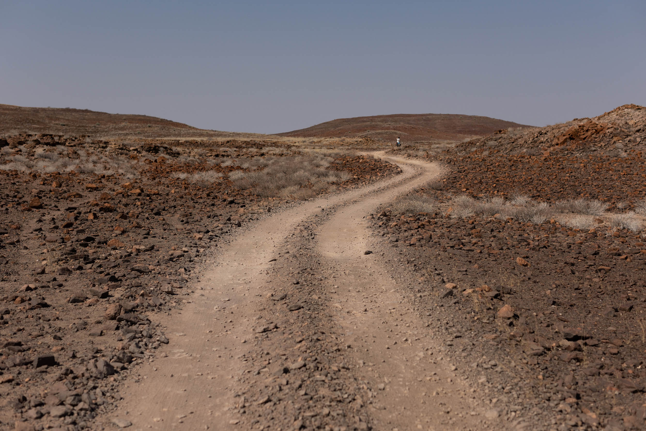
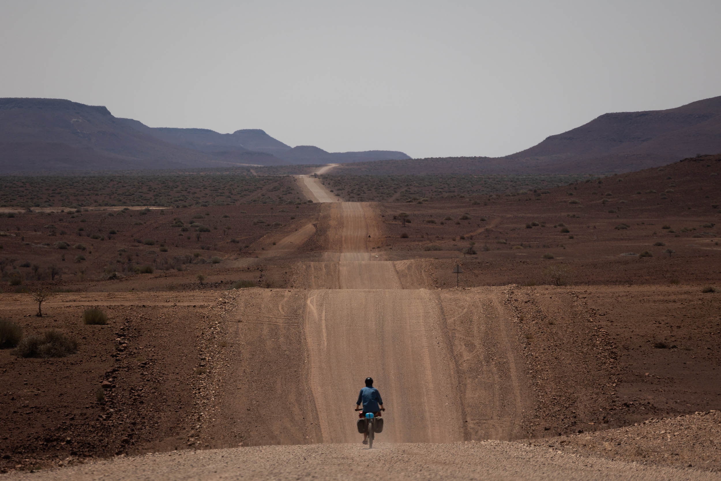
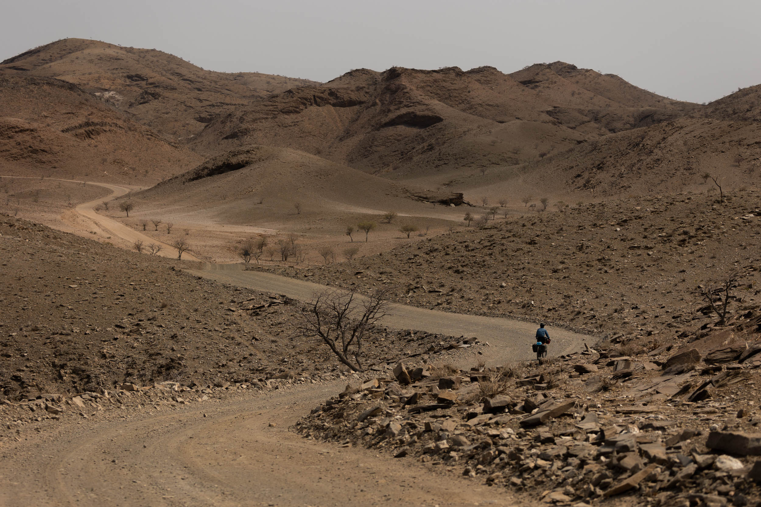
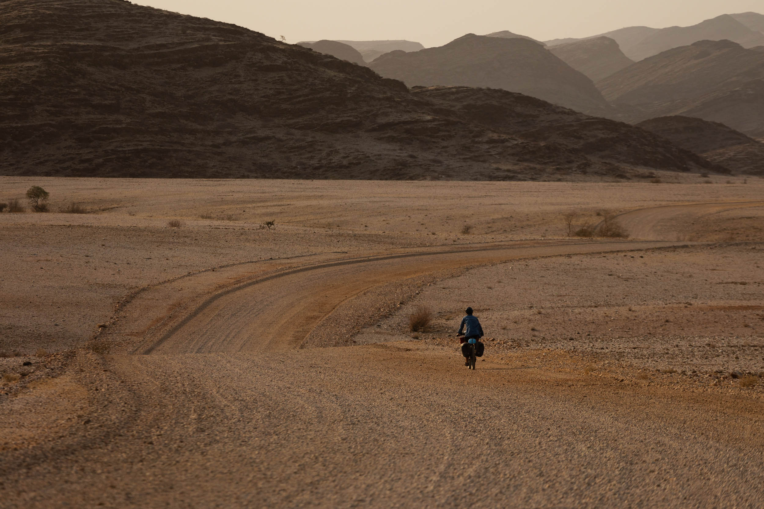
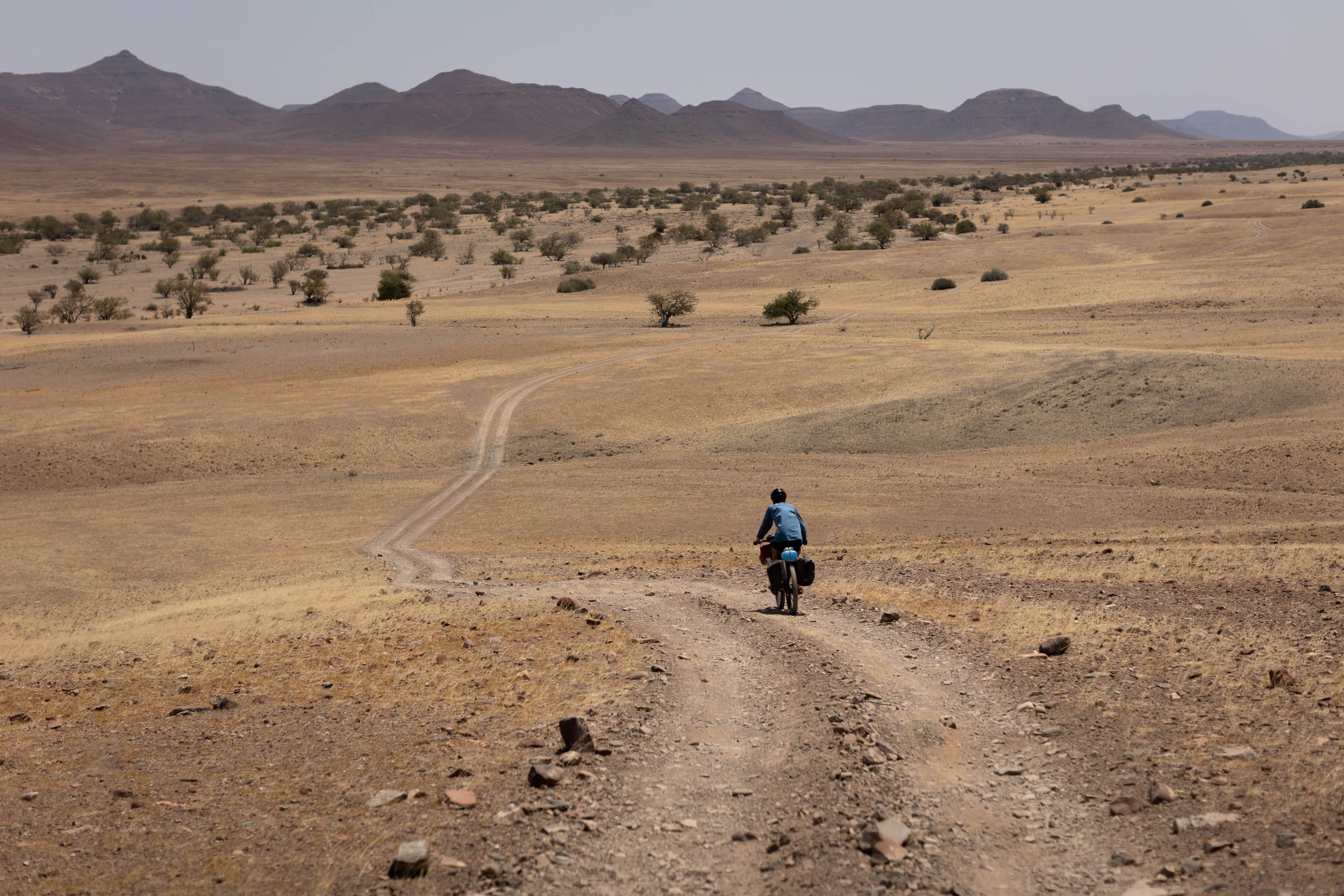
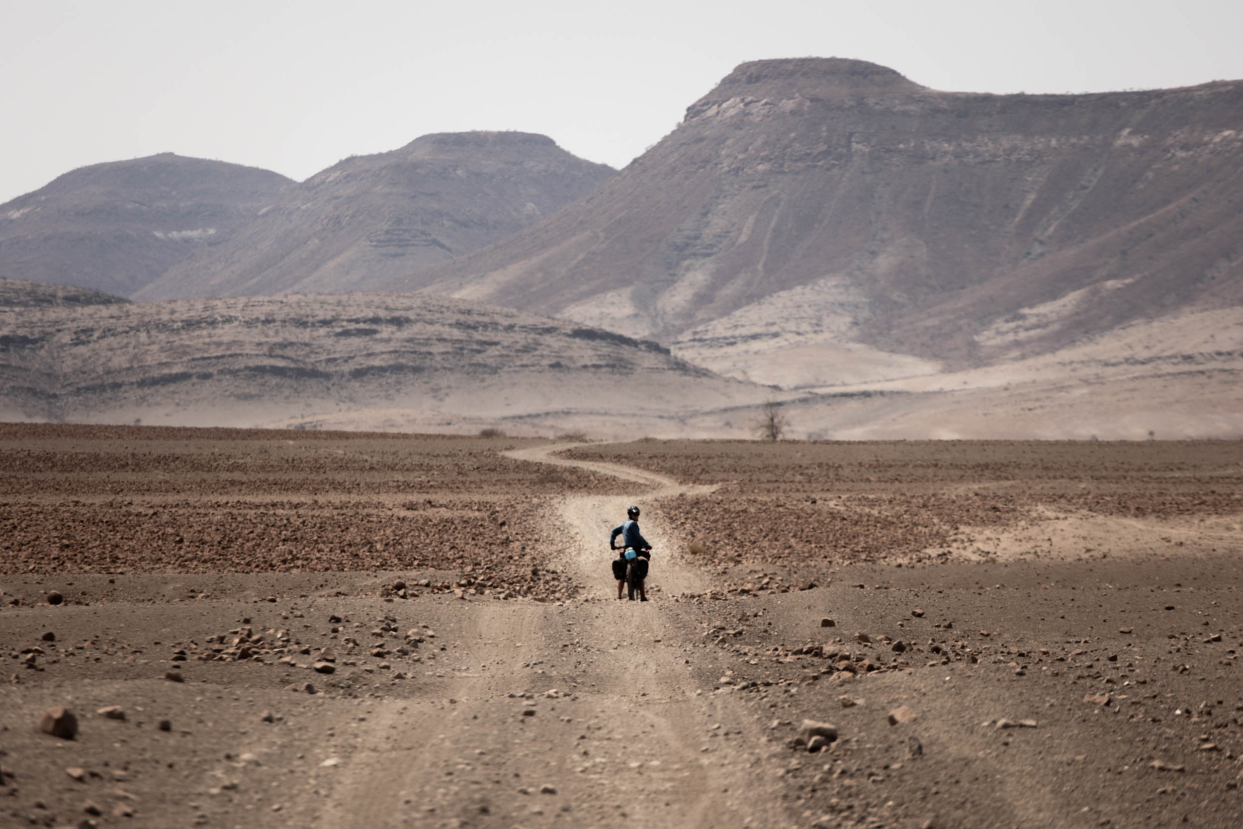
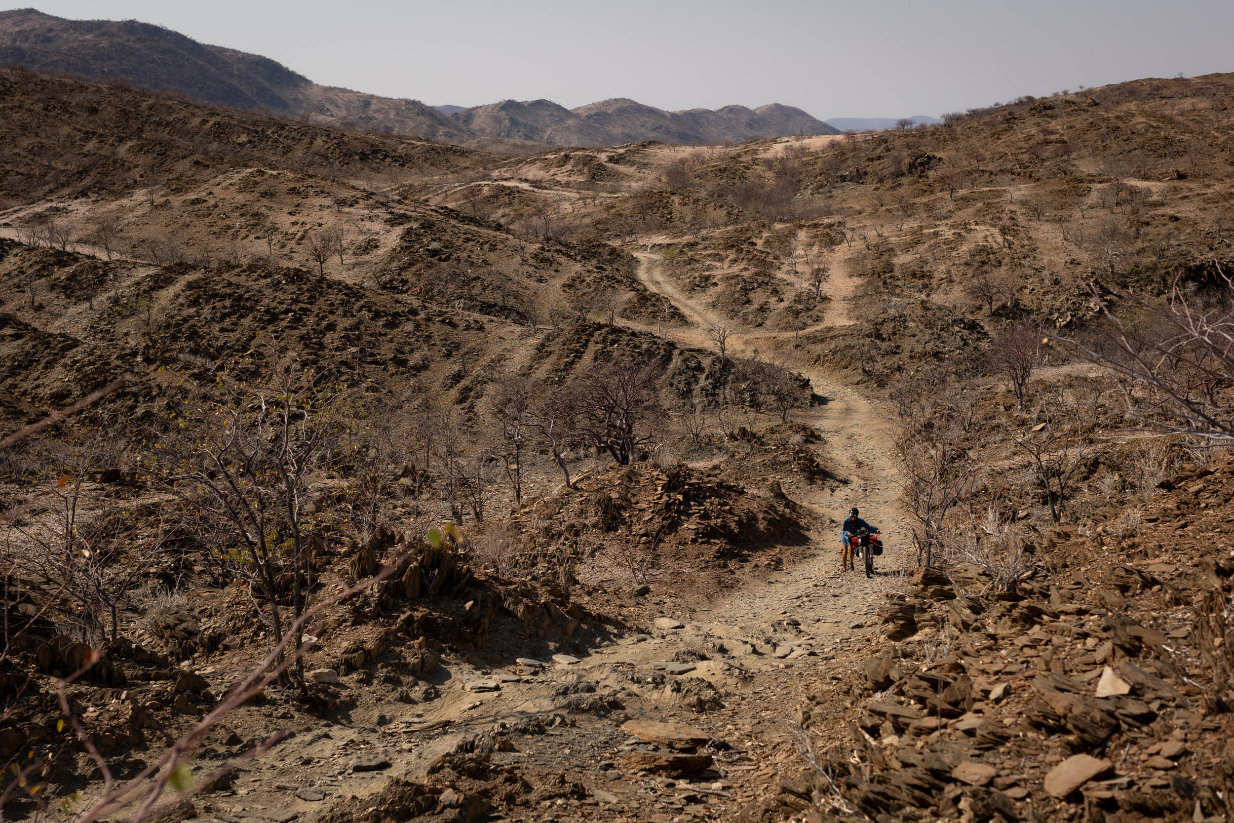
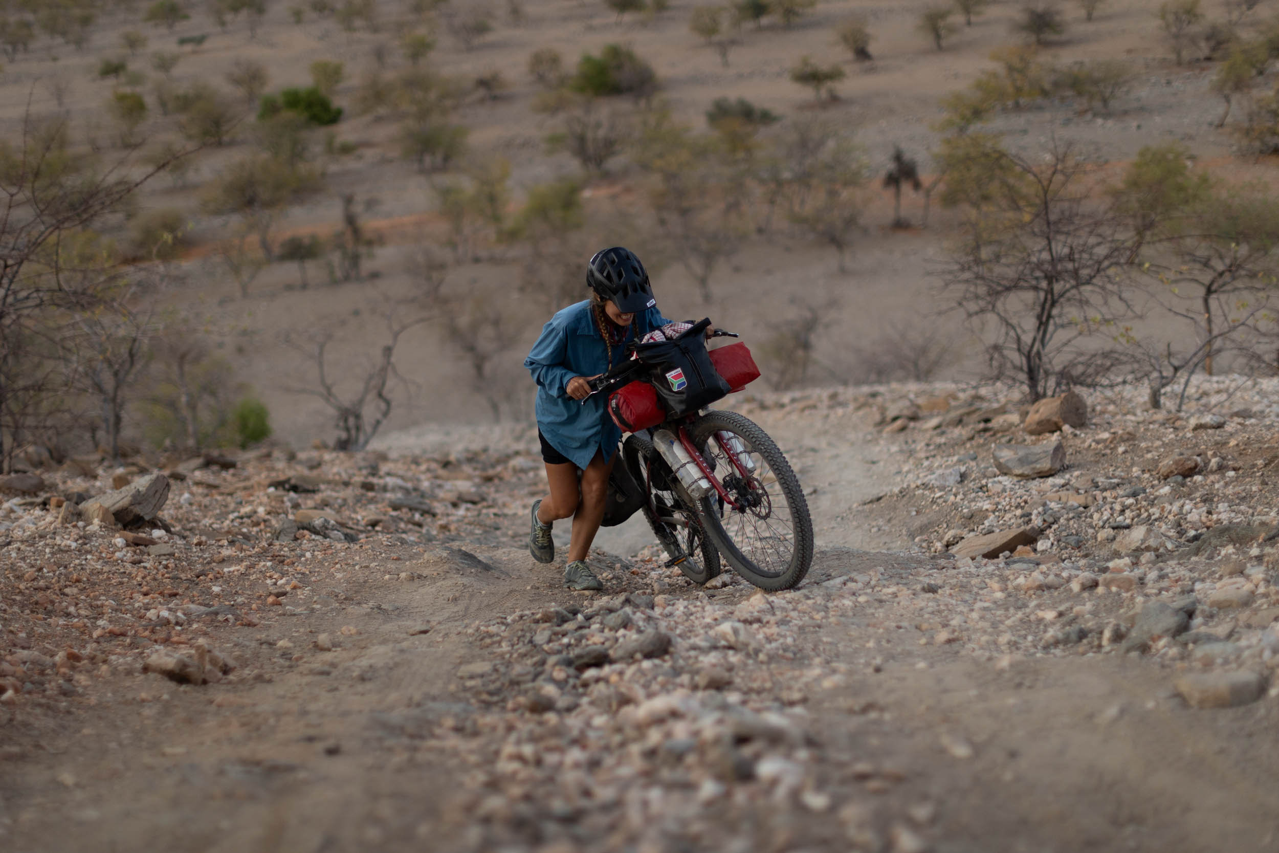
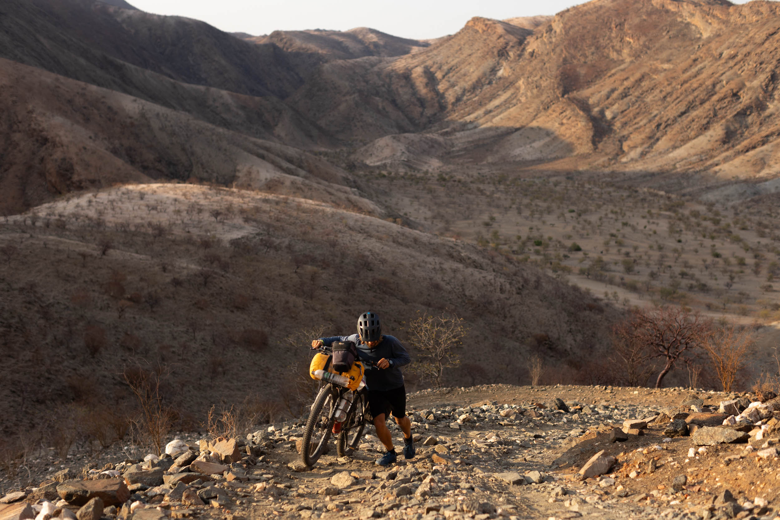
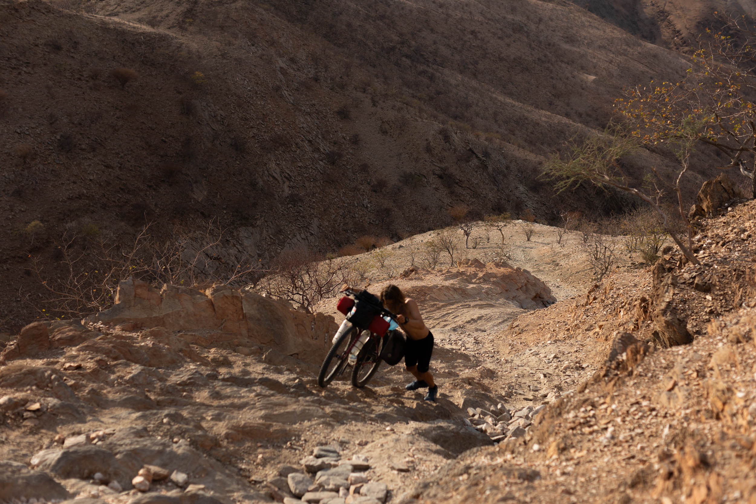
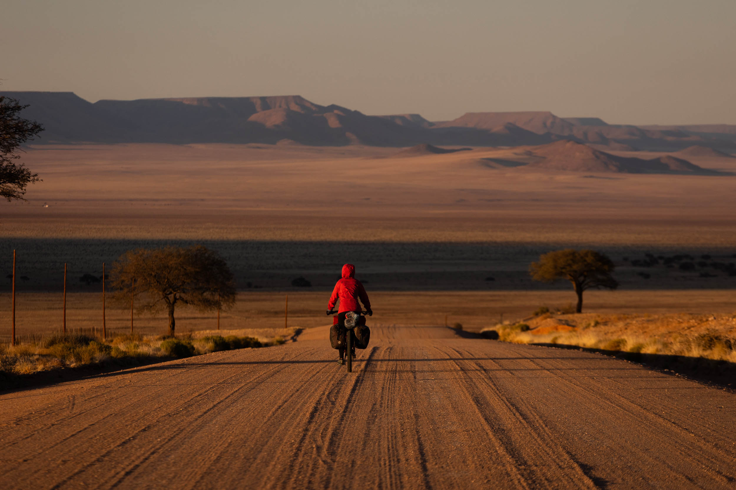
In keeping with the untamed terrain, the riding in this segment leans more toward the adventurous side, featuring an exciting mix of challenging 4×4 tracks, remote doubletrack, sandy river beds, and quiet gravel roads that stretch deep into unforgiving territory. It’s thrilling and committing.
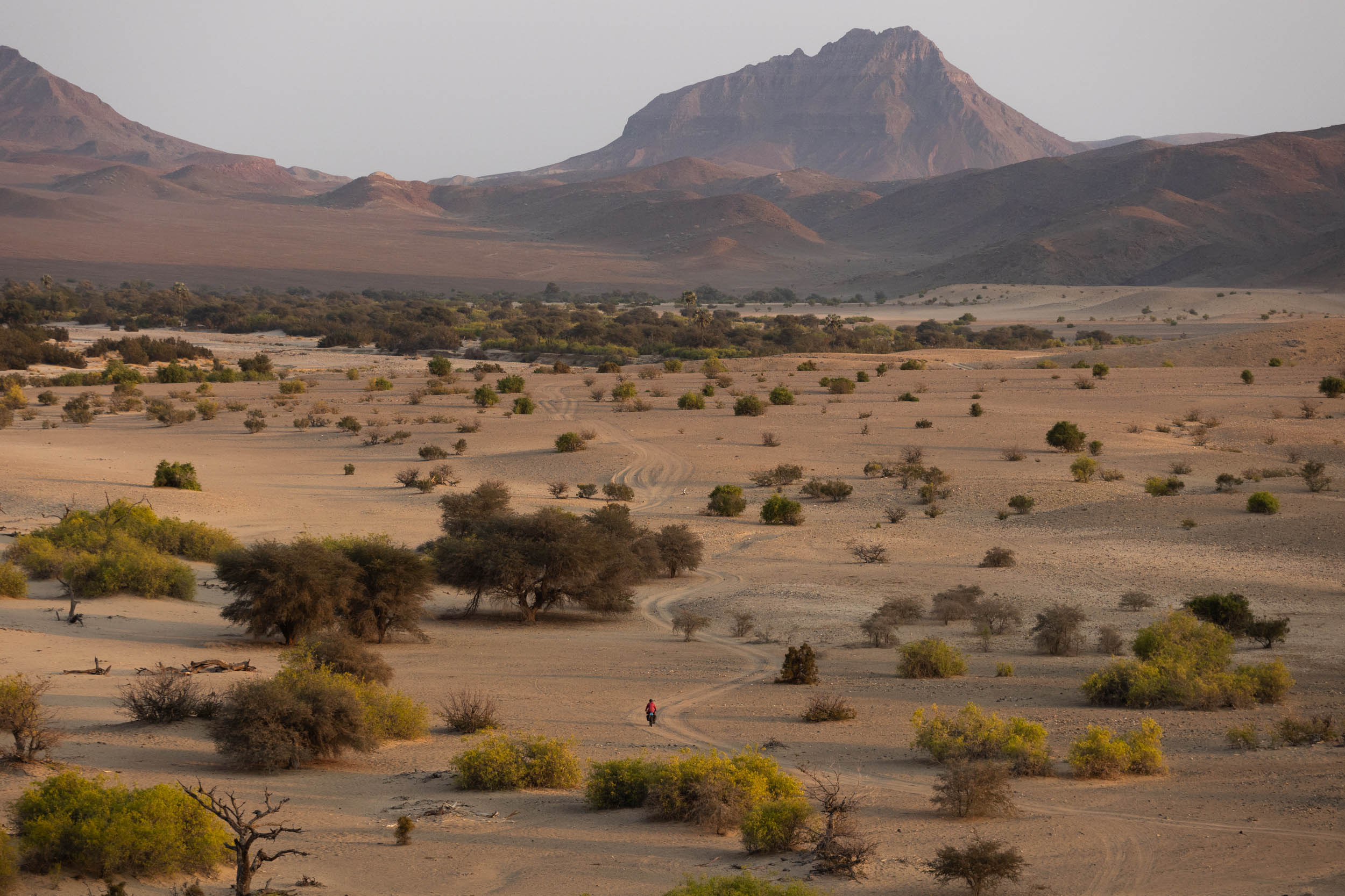
The route does a south to north traverse of the Erongo and Kunene provinces, starting in Swakopmund and ending in Ruacana. Along the way, it explores the best of Damaraland and braves a long, intimidating stretch through the ultra-remote Kaokoveld, which is where this segment takes its name from. It passes by several famous sights such as Swakopmund’s Moon Landscape, the Epupa falls, Spitzkoppe, Brandberg and the wildlife-rich Ugab River, among others, and offers immersive encounters with wildlife, rare yet striking endemic flora, and last but not least, the region’s incredible people. By the segment’s end, you will possibly have explored more of Namibia’s secluded north than even the most seasoned travelers of the region.
If the essence of the SAND route is to adventure, connect, and embrace the desert’s rugged and challenging terrain, and to bask in its solitude, then there could not be a better segment to conclude the route with.
Route difficulty
The terrain and the environment that Segment 5 traverses is extremely harsh and unforgiving—arguably beyond the threshold of what most people would consider safe. Riders are urged to come very well prepared. As with the other segments, we offer alternatives and detours for avoiding the most arduous obstacles (find those under Trail Notes), optionally reducing the overall difficulty for those looking to shorten the trip or tamper the desert bikepacking experience.
Technical difficulty (7/10): For reference, this one’s similar in technical difficulty to Segment 3 (Richtersveld). It takes on some formidable 4X4 trails, rough, rocky tracks and long stretches of soft sand. It demands a fair bit of hike-a-biking, though mostly for short stints. Physical demand (8/10): Despite minimal climbing, this segment is long and demands sustained effort on tough terrain and a heavier than usual setup. Resupply and Logistics (8/10): Compared to southern Namibia (Segment 4), villages and small shops are more numerous here, which is a definite plus. However, it remains a challenge to get your hands on anything with substance. Most shops stock the bare essentials only. Similarly, water supply options remain minimal. Also, notably, there are a couple of sections with no food or water for multiple days. What’s more, they usually coincide with the toughest, most demanding terrain. Another aspect, not quite covered in any of the above scores, but worth highlighting, is the mental strain of staying calm amid fears and warnings about encountering dangerous animals on this segment. Although the actual risk is considered low, the mere thought can be unsettling and definitely adds some wind-chill to the overall difficulty.
Route Development
The SAND Bikepacking route was developed by South African bikepacker and photographer Johan Wahl and his partner Jana. They first attempted the route in 2021, intriguing us with inspiring images as they rode, but it wasn’t until recently that Johan fine-tuned his ideas from that initial journey into a structured route that could be repeated and published here. For this segment, additional thanks goes out to Alee Denham and Laura for test riding portions of it, as well as to Dan Craven and Marc Bassingthwaighte for sharing their local knowledge. Use these links to dig into Segment 1, Segment 2, Segment 3, and Segment 4 of this incredible 5,500+ kilometer route.
Submit Route Alert
As the leading creator and publisher of bikepacking routes, BIKEPACKING.com endeavors to maintain, improve, and advocate for our growing network of bikepacking routes all over the world. As such, our editorial team, route creators, and Route Stewards serve as mediators for route improvements and opportunities for connectivity, conservation, and community growth around these routes. To facilitate these efforts, we rely on our Bikepacking Collective and the greater bikepacking community to call attention to critical issues and opportunities that are discovered while riding these routes. If you have a vital issue or opportunity regarding this route that pertains to one of the subjects below, please let us know:
Highlights
Must Know
Camping
Food/H2O
Trail Notes
Resources
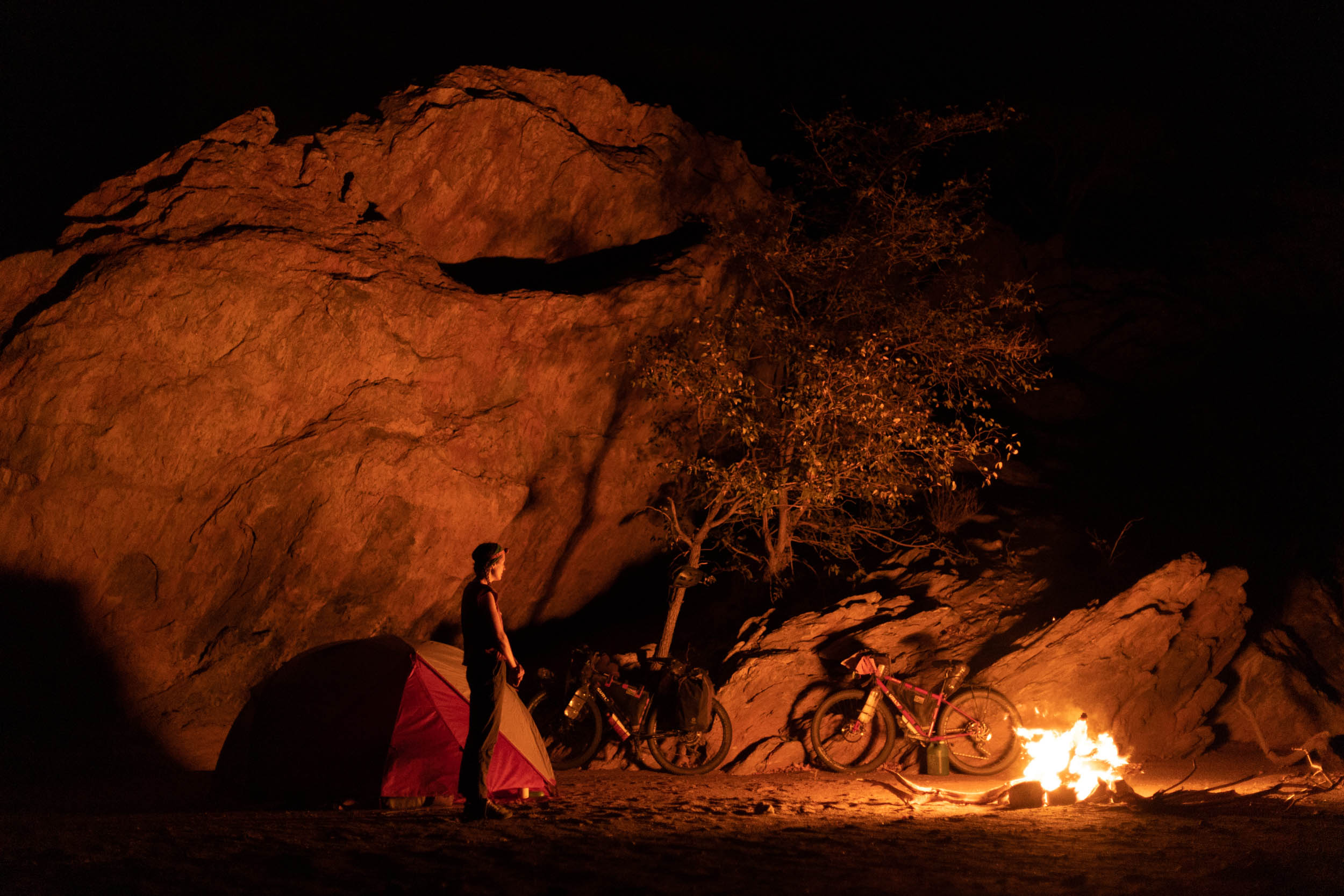
- Unrestricted wilderness: Free roaming animals, minimal fencing and unlimited wild camping.
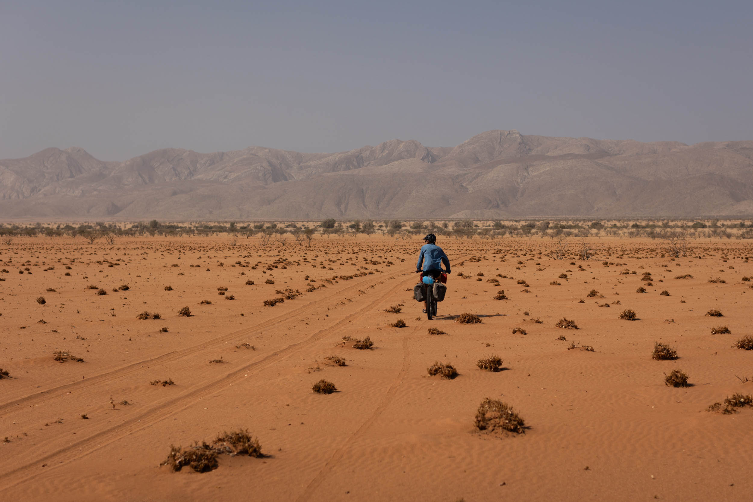
- Solitude: Empty roads and vast, rugged desertscapes for miles and miles.
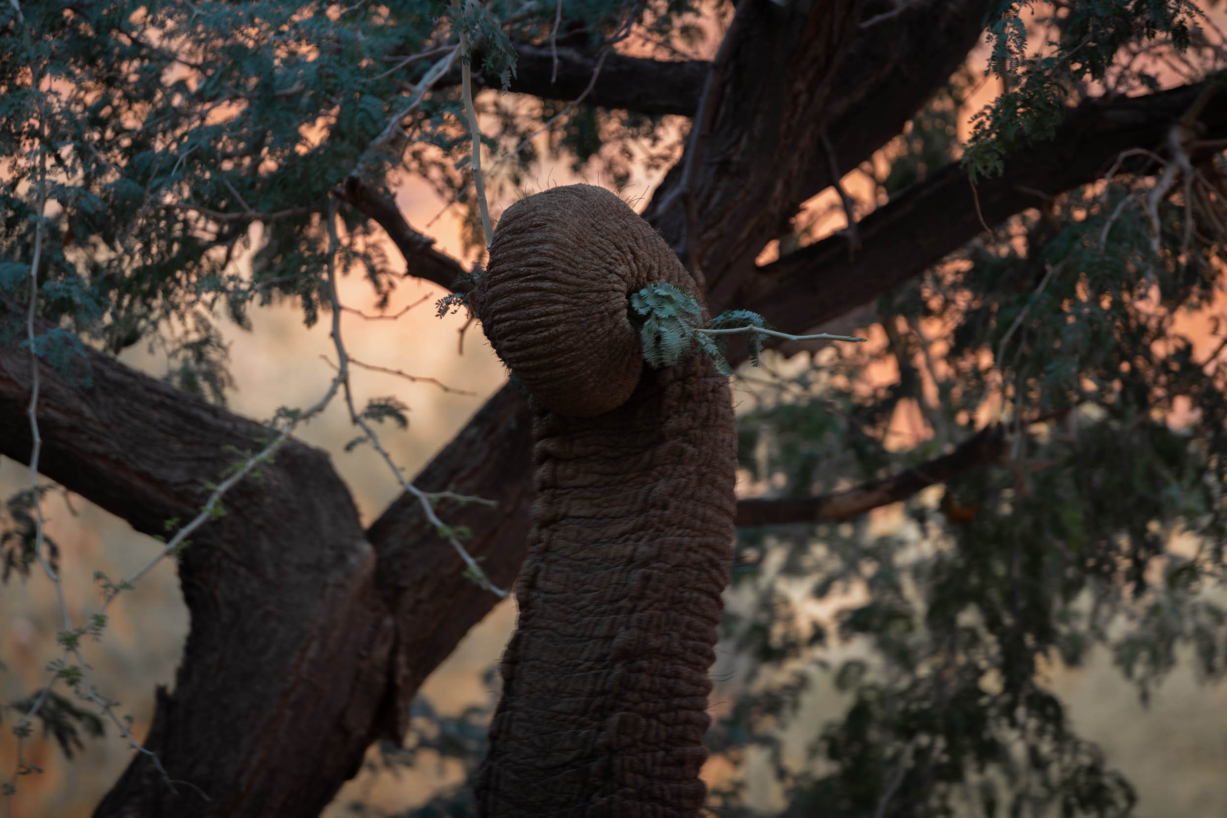
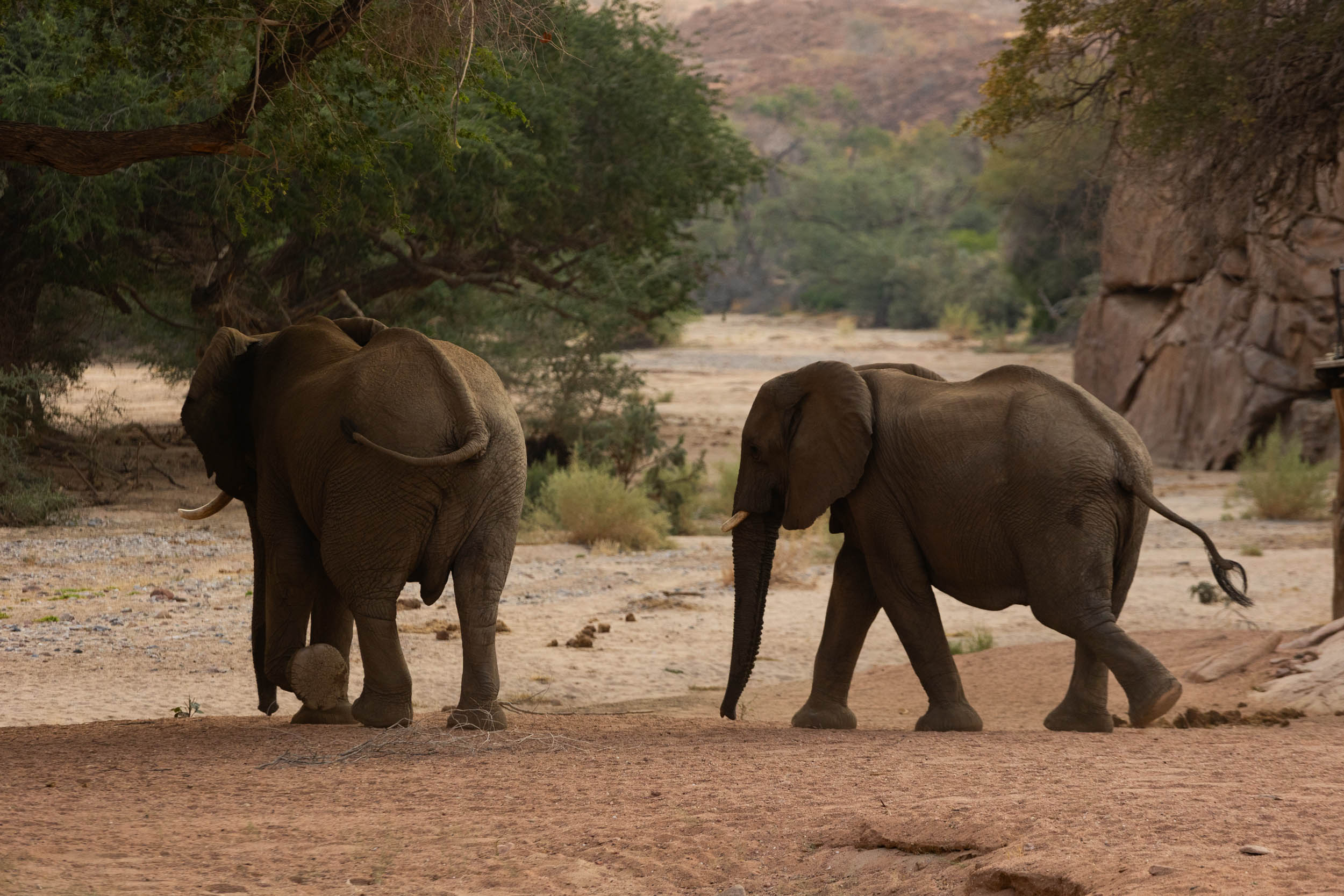
- Desert Elephants: It’s beyond special to see these desert-adapted giants in their natural environment.
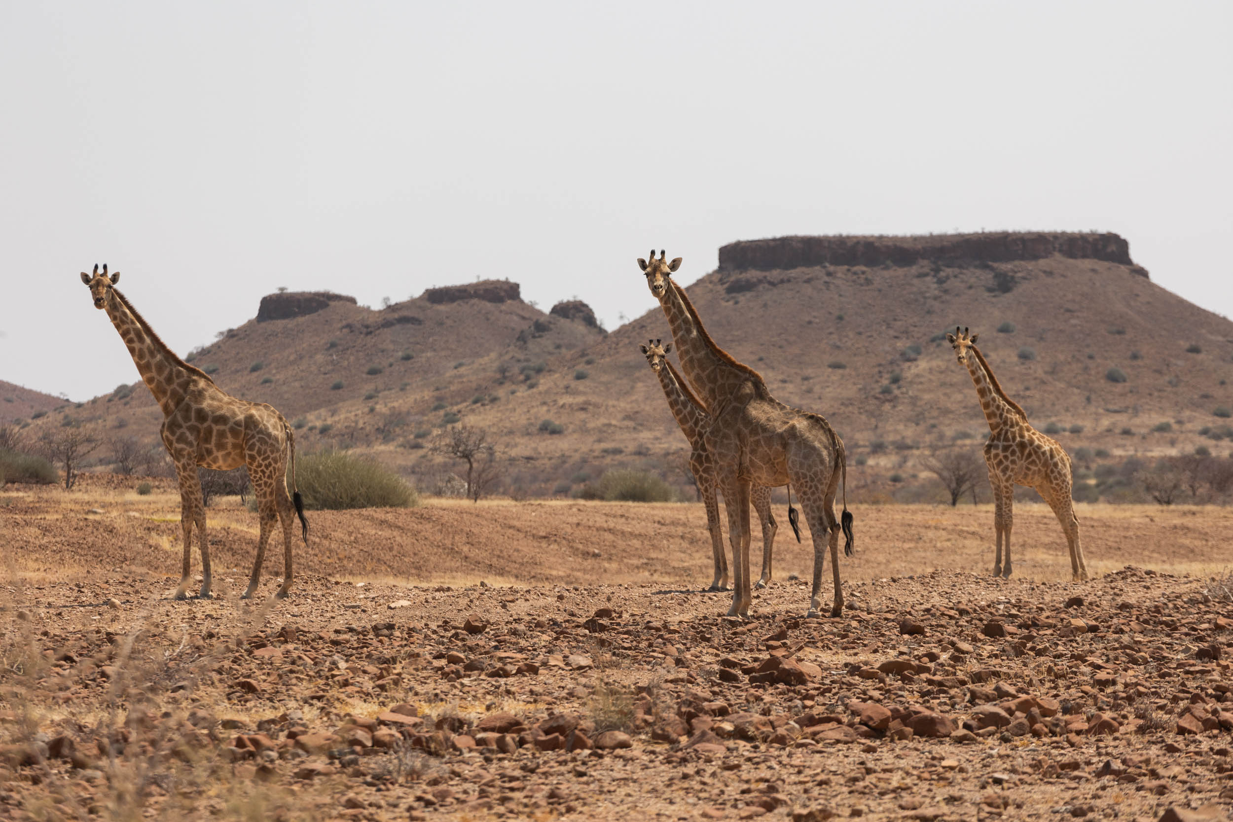
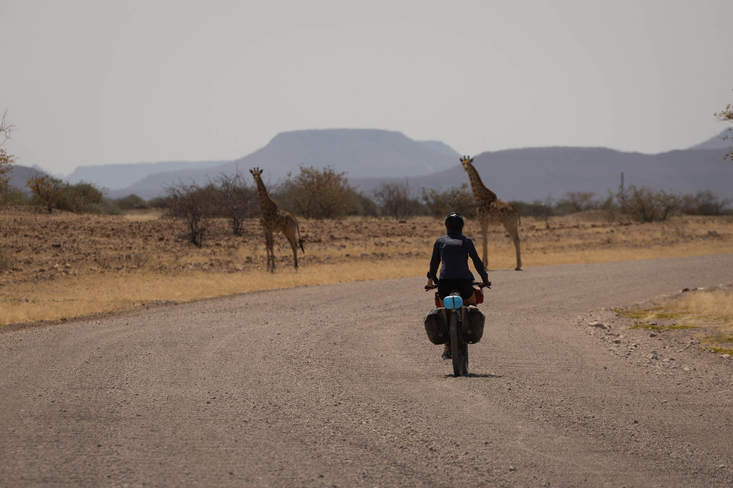
- Wildlife: Look out for other animals, too, including Giraffes, zebras, hyenas, crocodiles, even lions. This part of Namibia teems with wildlife!
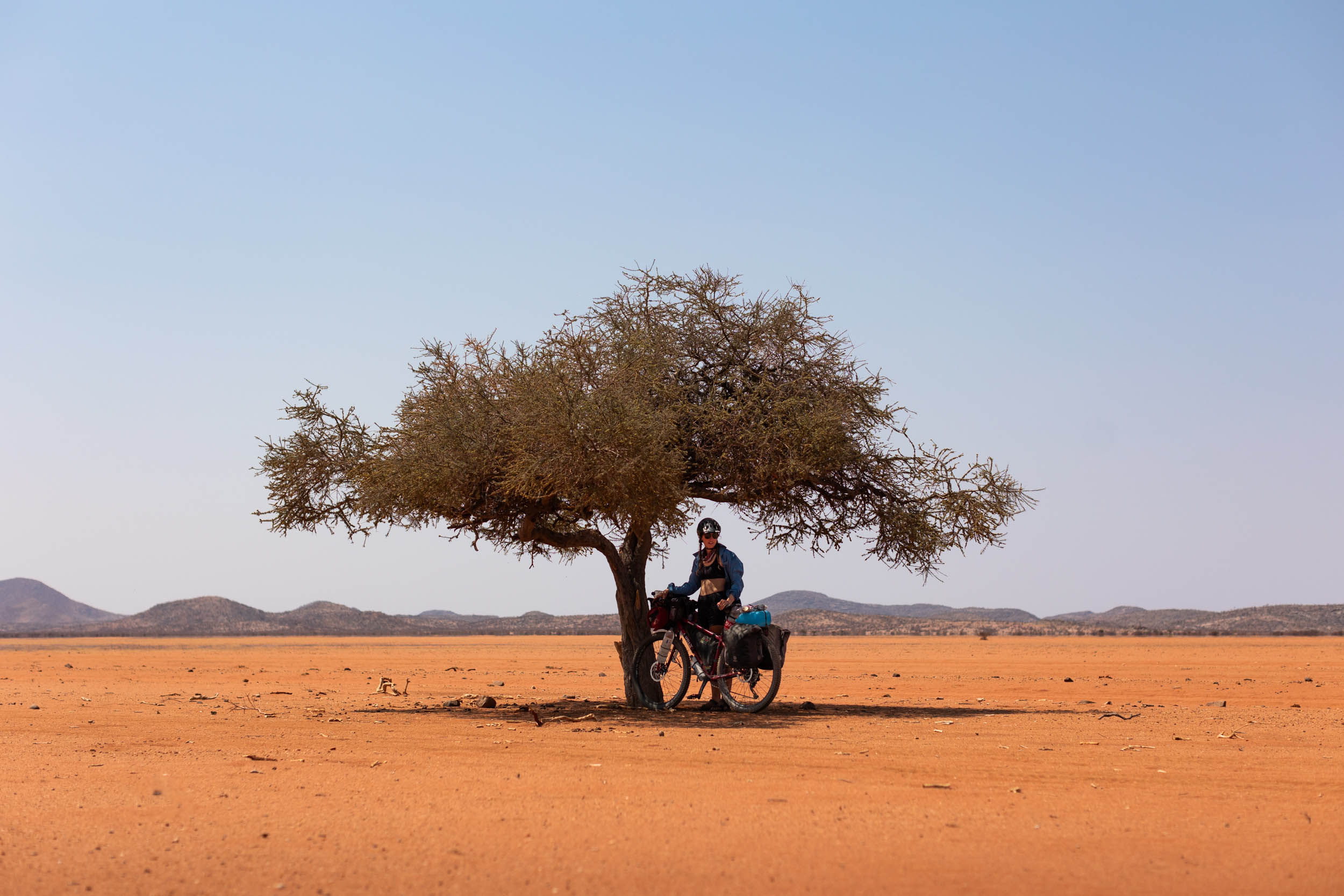
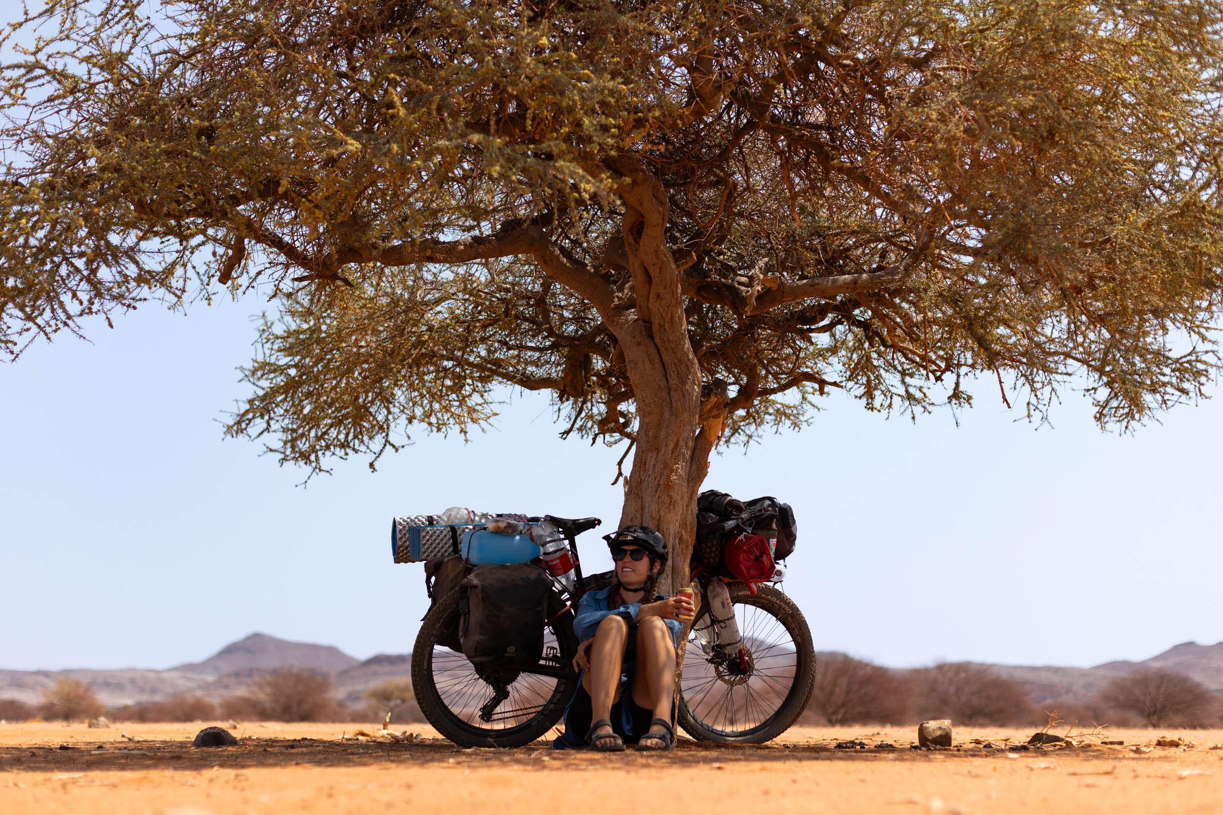
- River beds: Essential shade, greenery, and captivating endemic trees.
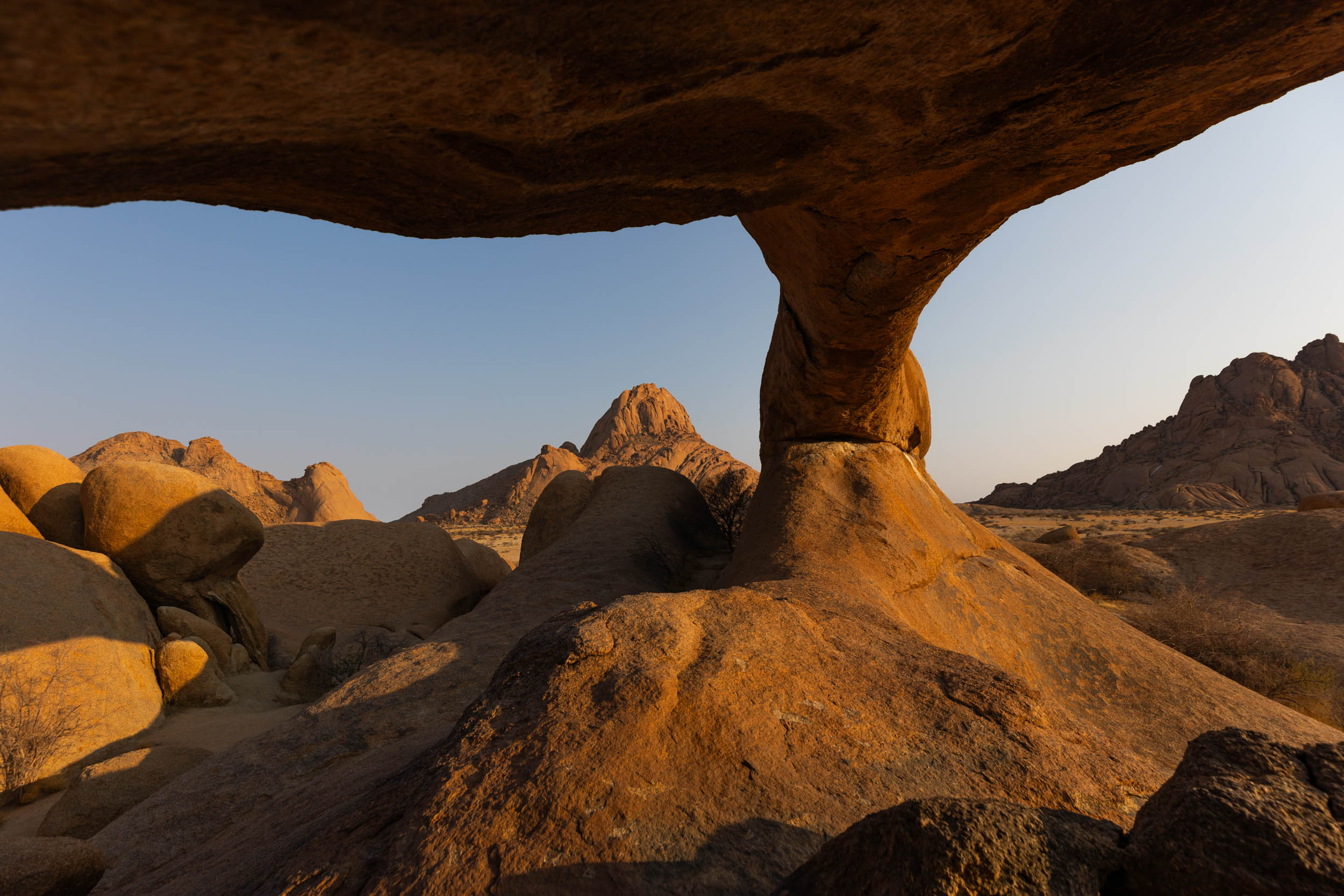
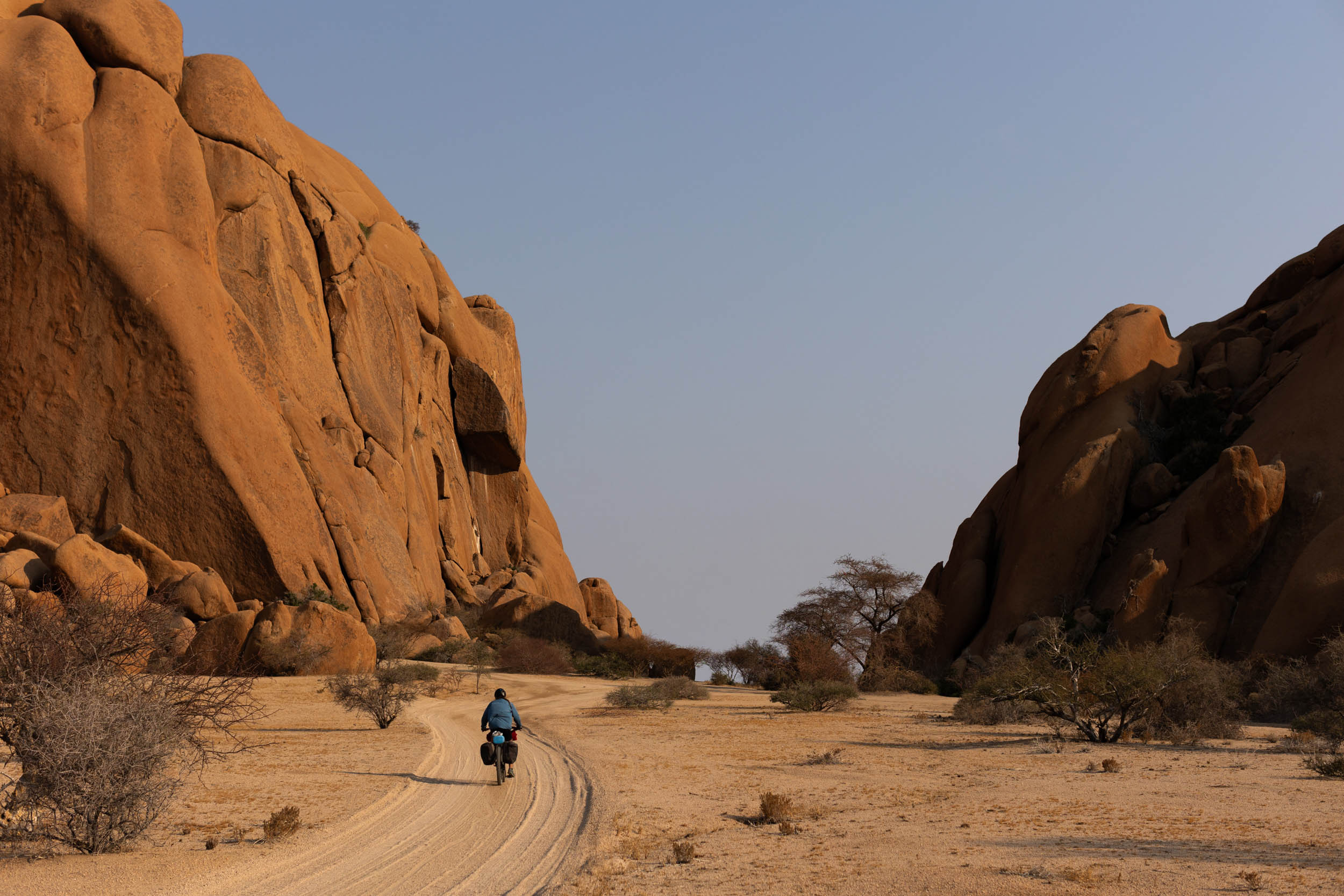
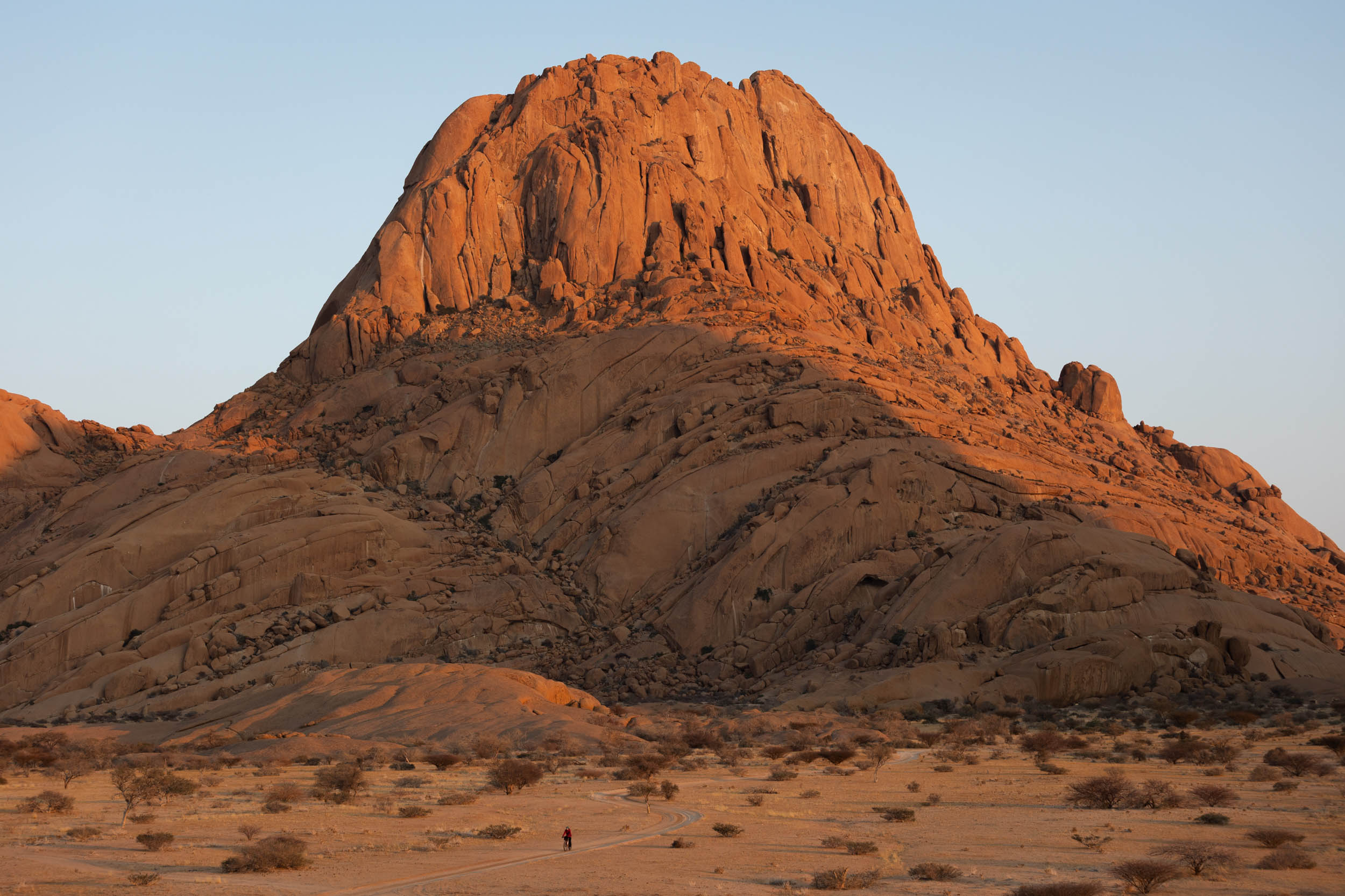
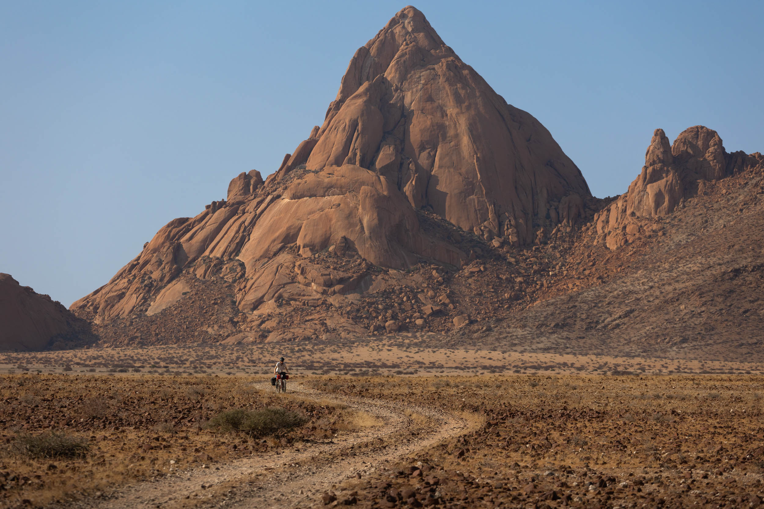
- Spitzkoppe: A series of spectacular granite peaks, or inselbergs, nearly 500 meters tall. Also an excellent camp site.
- 4×4 trails: Take on some of southern Africa’s most formidable roads and 4X4 tracks, including the infamous van Zyl’s pass.
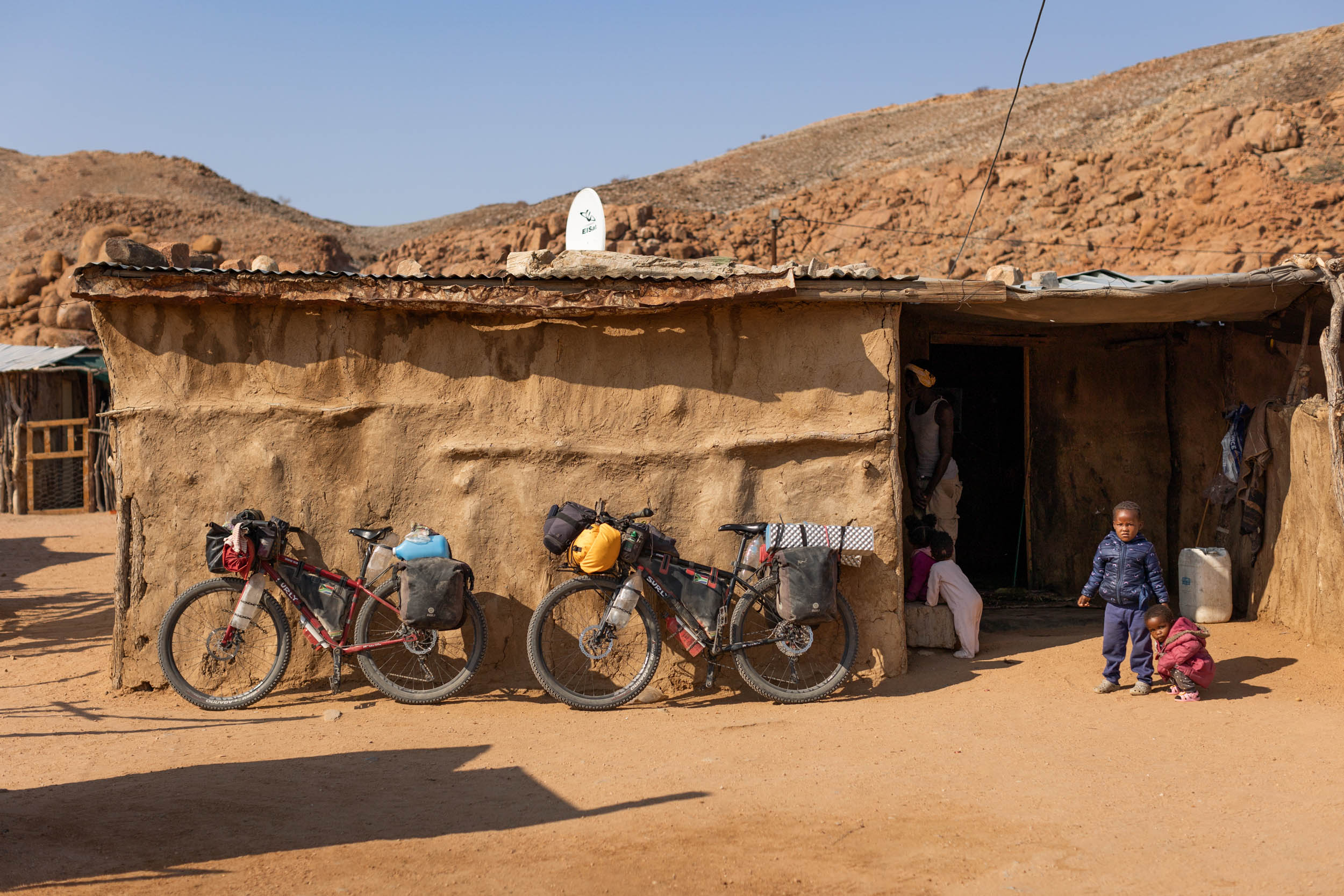
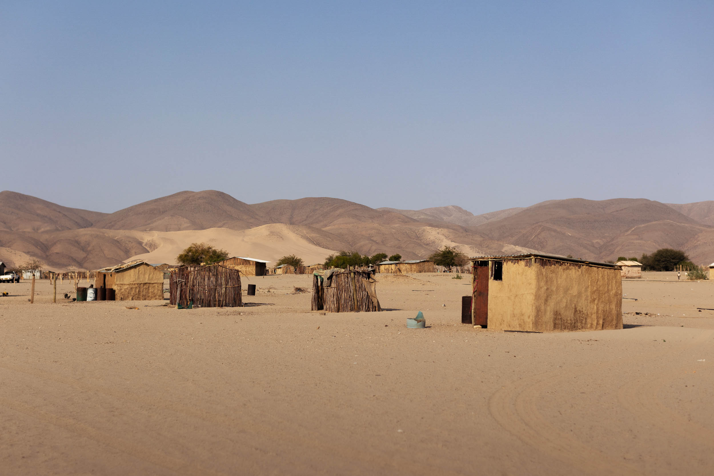
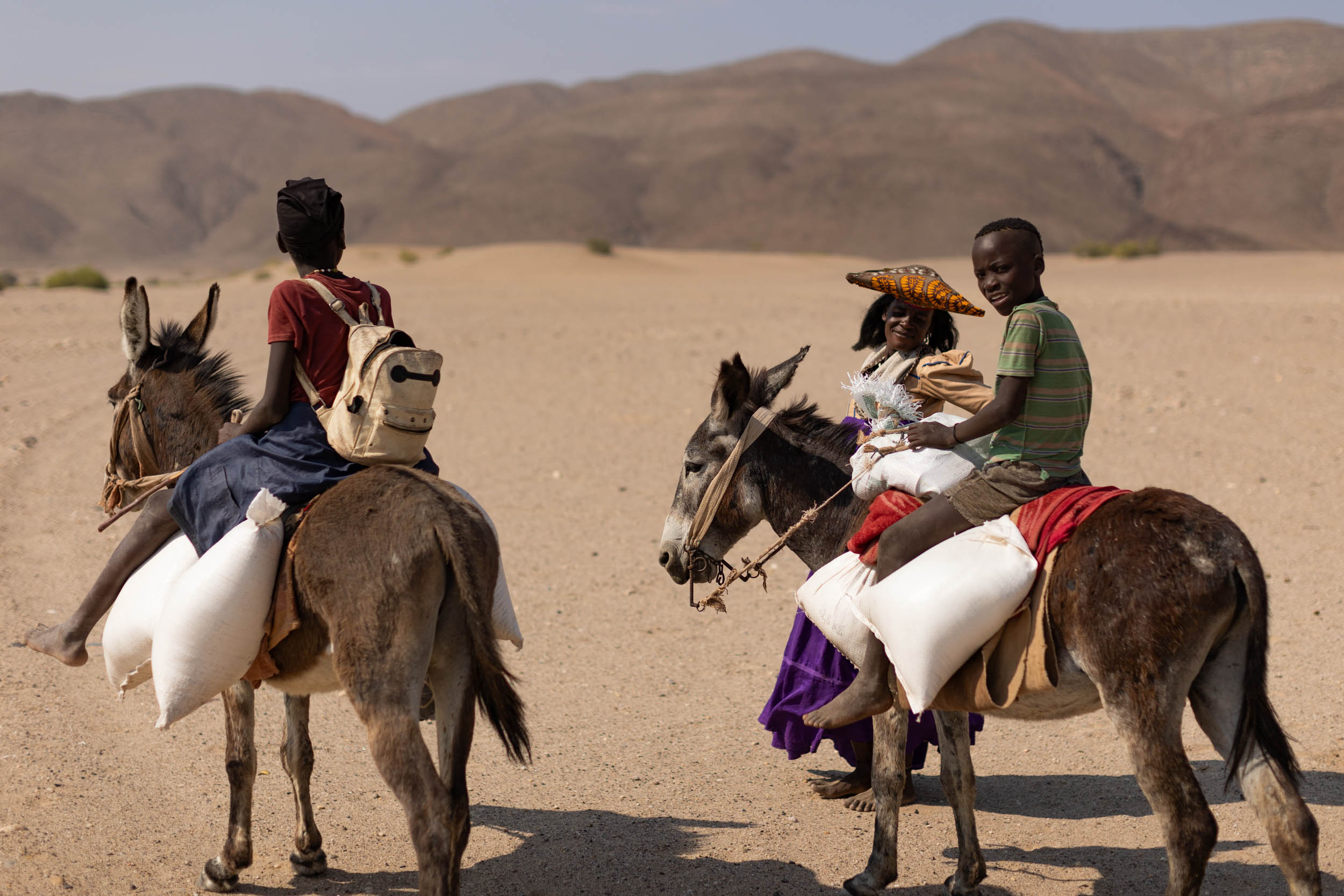
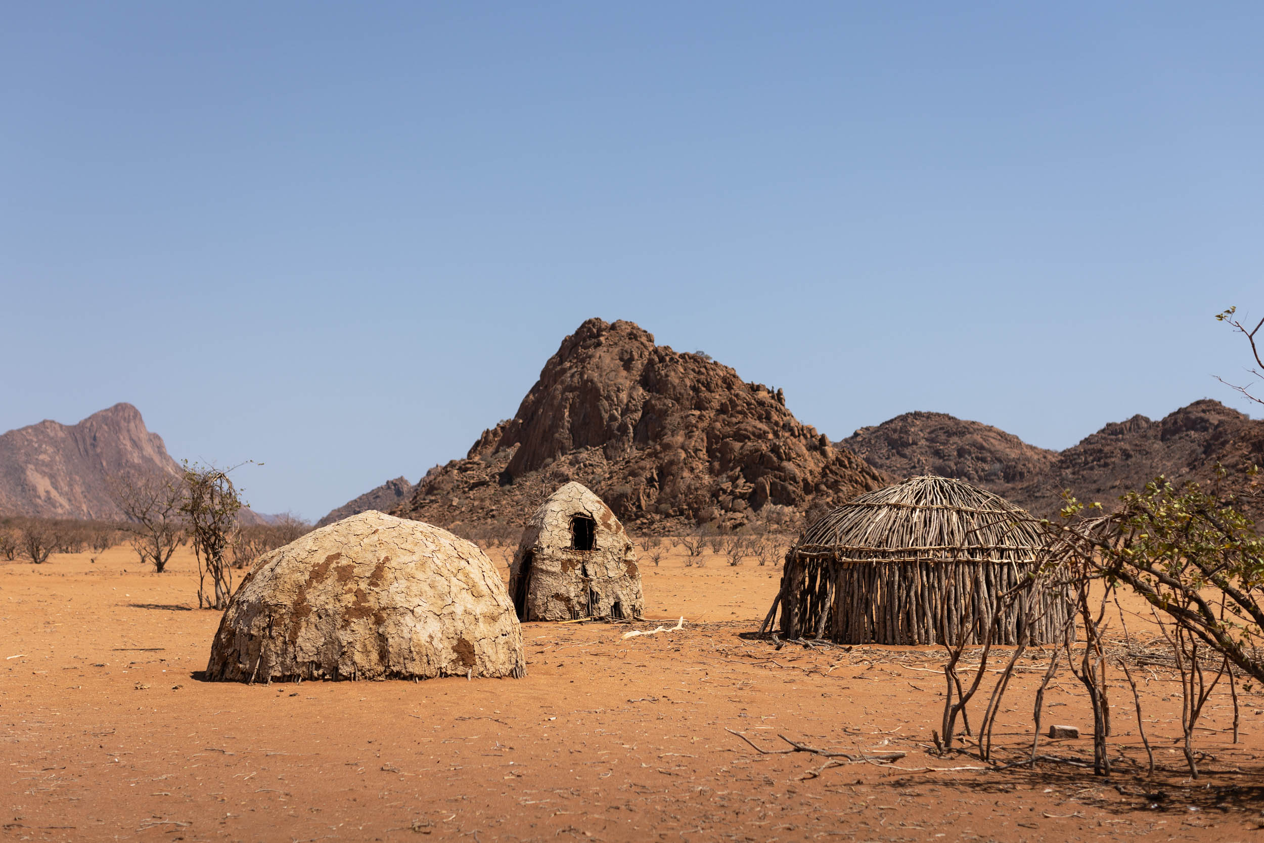
- The people: The region is home to several friendly remote communities made up of cultural groups including the Himba, the Herrero, and the Damara people.
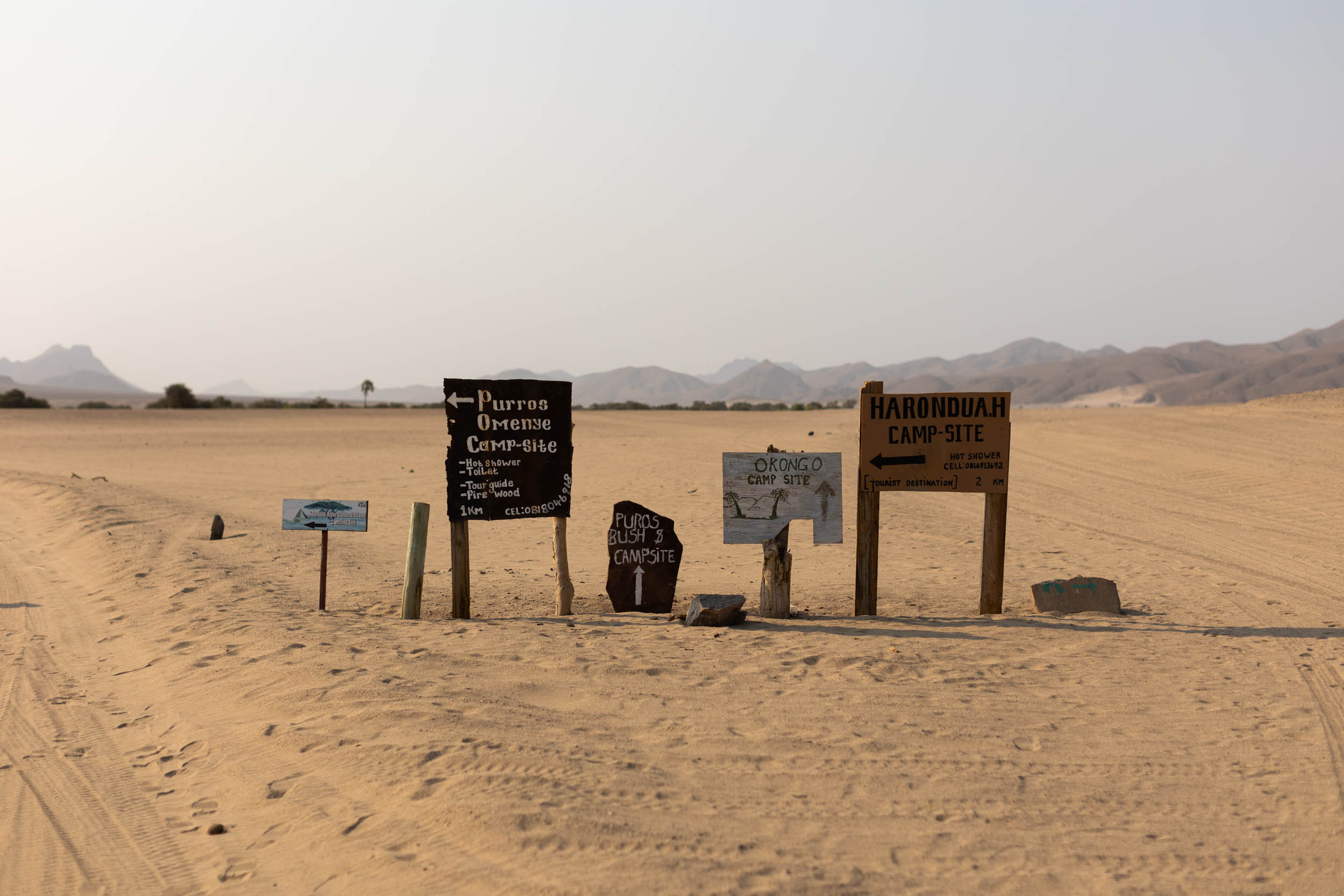
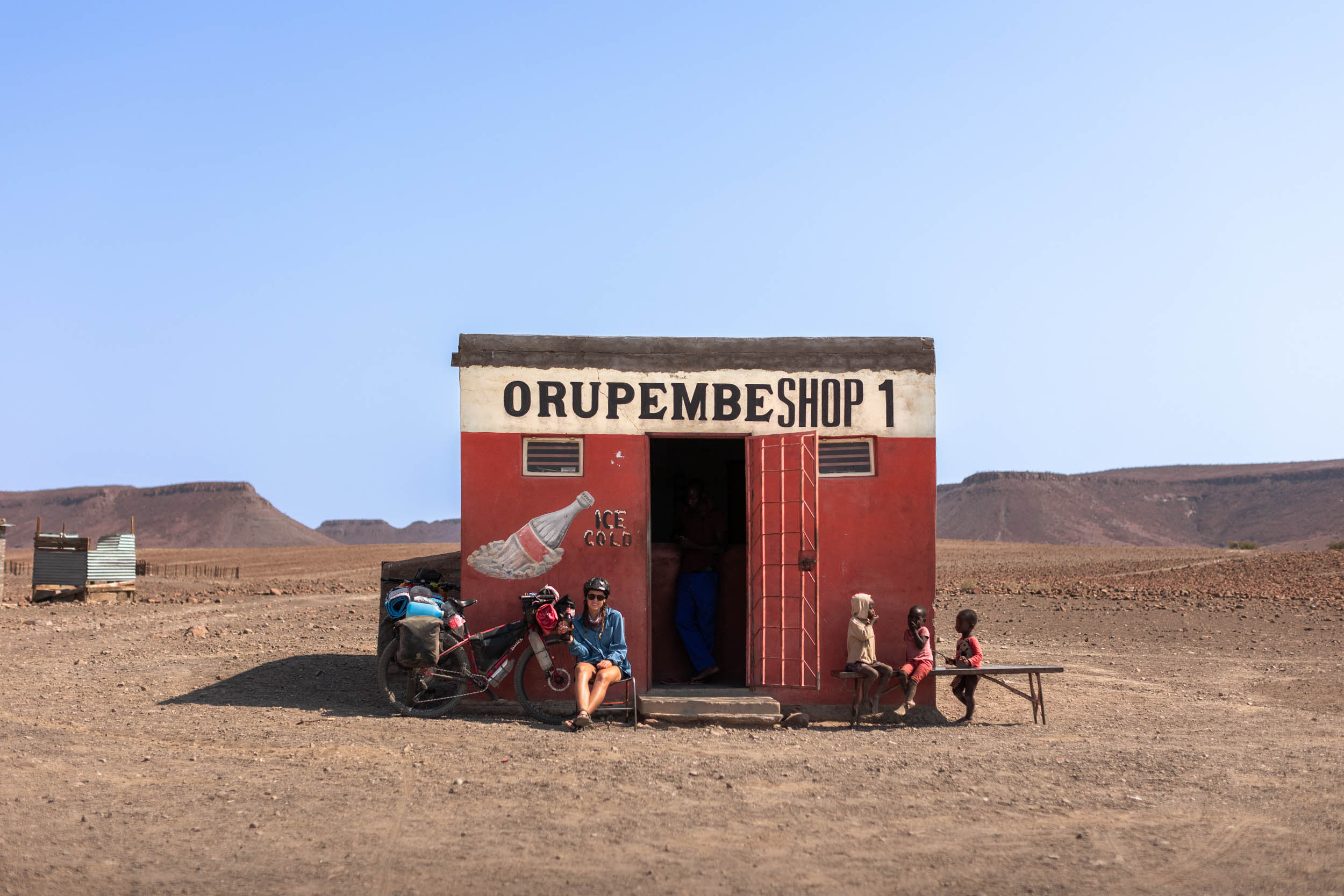
- Orupembe Shop One: An iconic little village shop in the middle of nowhere, famous for selling, against all odds, ice cold beer.
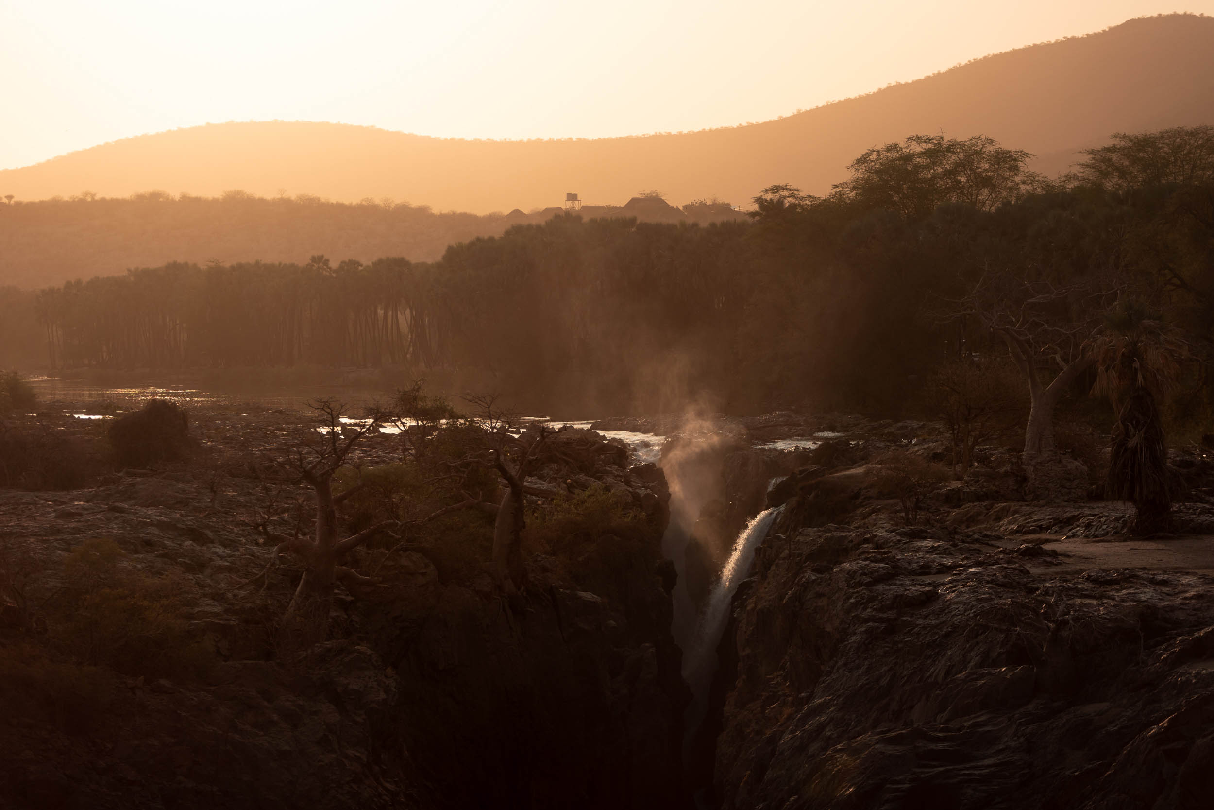
- Epupa falls: A picturesque waterfall on the Kunene river, with a nearby village offering a variety of accommodation options and plenty of food.
- Community campsites: Beautiful, rustic campsites, built and run by local communities.
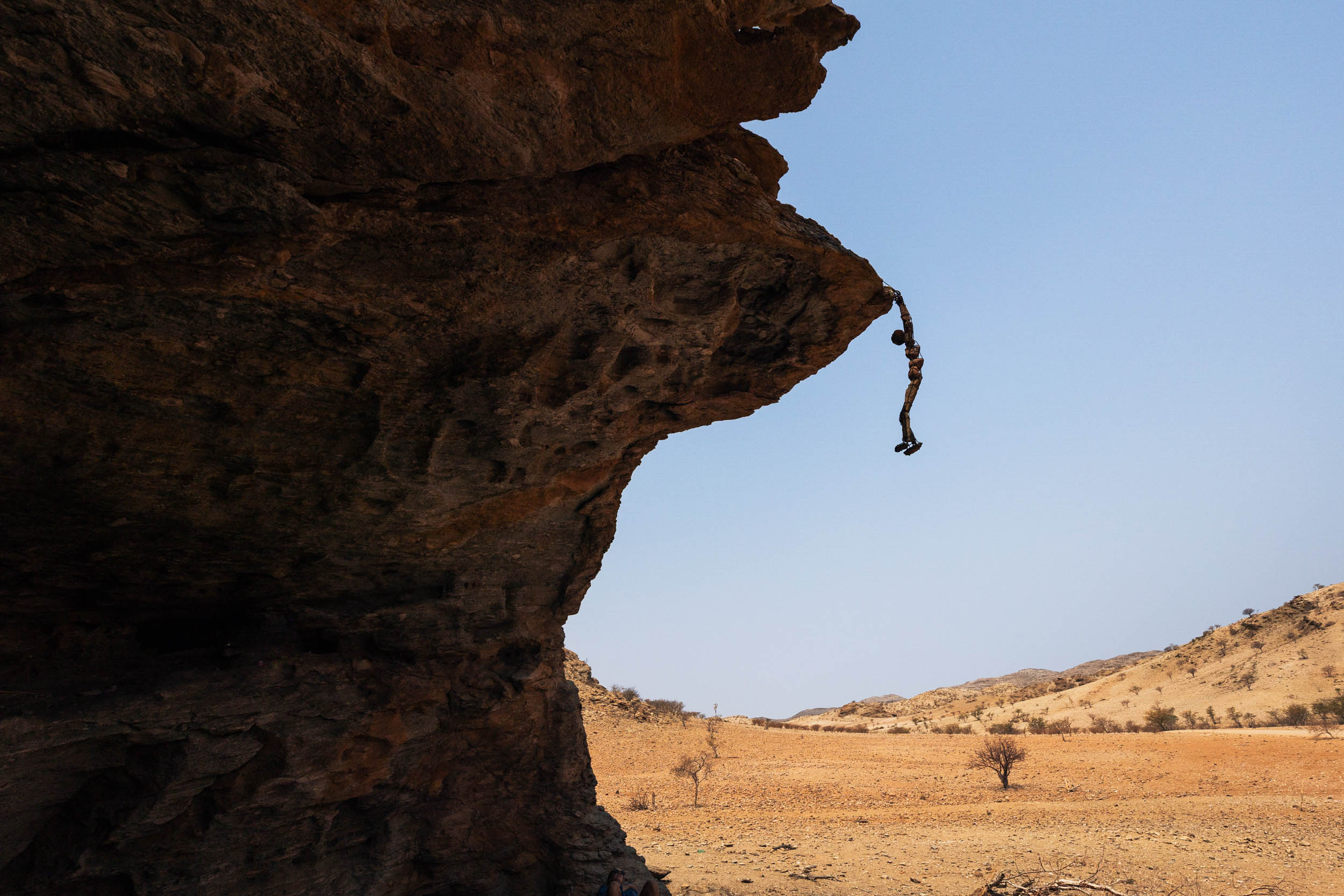
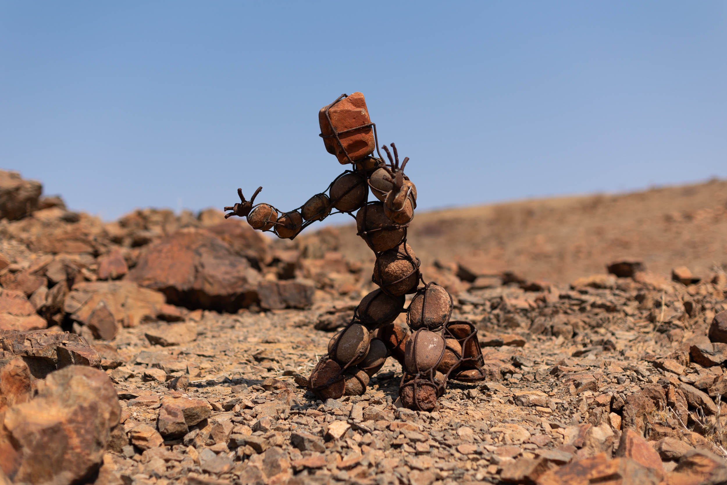
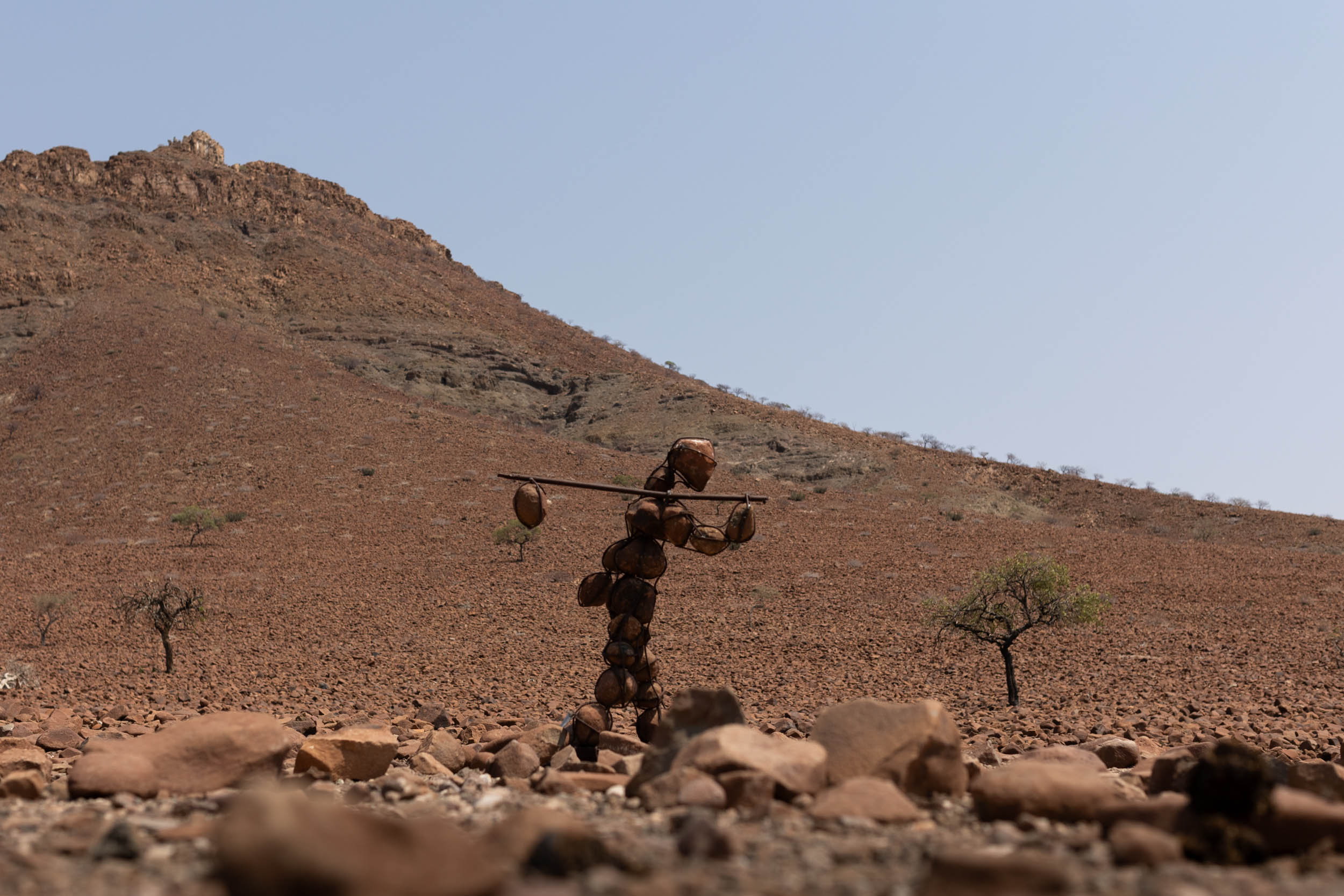
- The Lone Men of the Kaokoveld: Rock and steel structures, hidden throughout the desert. Searching for them is like a treasure hunt.
When to go
- Winter—April through August—is the coolest period and by far the best time to ride this segment. Summer temps soar well into the 40s on most days, and even winter days are only just bearable, often in the mid 30s (Celcius).
- Additionally, the inland catchments of some rivers explored in this segment—much of the riding is done on dry river beds—receive heavy rainfall in the summer months, leading to flooding downstream that could render parts of the route impassable. As a precaution, always keep an eye on the inland rain forecasts, even when it seems desperately dry on the route.
Logistics
- The segment starts in Swakopmund, continuing directly from the end of the previous segment (S4). Swakopmund is a large coastal town, right next to the port city of Walvis Bay. The two blend into each other almost seamlessly. Being a popular tourist stop, it has all the accommodation and amenities a bikepacker could ask for. It’s also well connected to the capital city, Windhoek, with regular buses and other transport services. It’s by far the largest, and best serviced town on the segment.
- It ends in Ruacana, but a connection to Oshakati is necessary. Ideally, the segment—and with it, the SAND route—could terminate at Ruacana. Situated on the periphery of the desert, Ruacana marks a significant shift in landscape, climate, ecology and culture. Where for the most part, the whole route is overwhelmingly characterised by desert terrain, sparse population and unpaved roads, that picture changes drastically once you reach Ruacana. It would seem logical to draw the line here, but Ruacana’s a small town that lacks adequate transportation services to and from other parts of the country. Thus, it’s advised to continue to Oshakati, the nearest major centre/city. In other words, consider Ruacana the true end of the SAND bikepacking route, with the final stretch to Oshakati serving solely as a logistical connection. From Oshakati, there are daily buses to the capital, Windhoek.
- If you don’t fancy the idea of highwaying the last 150 kilometers between Ruacana and Oshakati, it could also be possible to get a ride on local informal transportation. Factor in some extra time if this is your strategy. For example it took us a full day of haggling to arrange a lift for two people and our bikes, but we eventually succeeded.
- Park fees and permits: This segment goes through several communal wildlife conservancies, most of which are freely accessible. One notable exception is Spitzkoppe. You’ll need a permit to enter this site. If you do opt for the Welwitschia trail detour in the opening section, then you’ll need a Namib Naukluft Park permit. Sold in the Swakopmund Park office.
- Riding direction: The segment can be done in either direction. There are steep climbs going both ways, so the difficulty should remain more or less unchanged.
- Safety: In terms of crime, Namibia is generally very safe, and with the extremely sparse population along this segment, the chance of experiencing any crime is very small. However, the usual words of caution apply. Keep your wits about you and don’t flaunt valuables in towns and busy campsites.
Dangerous Animals
The route traverses several wildlife conservancies where animals roam freely. Elephants are particularly abundant and, needless to say, are very dangerous. Try to follow these guidelines to avoid conflict and do your own research about animal safety:
- Camping is generally safe, in our experience. Elephants are unlikely to disturb you in your sleep.
- If you see elephants on the road ahead, stop, be still, and wait. As long as it takes.
- Do not make sudden movements. Avoid startling them.
- Look out for fresh footprints and dung. This means they could be near. You do not want to surprise a herd when coming around a corner.
- The locals (in populated areas) keep close tabs on the whereabouts of herds. Ask around and heed advice.
Other Animals
- Giraffes are also plentiful. They’re typically not aggressive, but beware of them if they have calves.
- Lions: There are lions in this region, although not a great many of them. There’s a bit of stigma surrounding these animals and a great deal of fear mongering. Keep a cool head. The fact is that encounters with them are very rare.
- Hyenas: Probably a more legitimate concern would be Hyenas. They’re not as infamously ferocious as lions, but they’re known to be unpredictable and devious. Steer clear of them and don’t give them a reason to come sniffing around. In other words, keep a clean camp at night, and keep meaty-smelling foods out of your tent.
- Crocodiles are plentiful in the Kunene river. As a rule, stay out of the water.
- Baboons and monkeys: As per elsewhere on the route, keep your distance. They’re territorial and dangerous and should not be toyed with or fed.
- Scorpions: Wear closed footwear and look out for them at night.
- Snakes: There are several dangerous snakes to keep an eye out for. A document containing images and emergency numbers is included in the EXTRAS/ADDITIONAL RESOURCES tab.
- Don’t ride at night: A popular precaution in these parts is usually to refrain from traveling at night. Although, I’m not certain of its merit.
Annoyances
- Dust: The route gets extremely dusty. Carry plenty of chain lube and a rag for cleaning.
- Thorns: Plenty of nasty thorns on the route, especially in and near river beds. Make sure to have ample sealant, a repair kit and knowledge and experience of how to properly use it all.
Travel basics
- Language: The languages spoken on this segment are a mix of Afrikaans, Otjiwambo, Khoekhoegowab (Nama), Otjiherero, Otjihimba and English. However, most shopkeepers and camp owners will have a good command of English. In remote parts, you may have to rely on hand gestures to get by.
- Cultural diversity: Culturally, this segment is the most diverse and possibly also the most interesting on the route. The region is home to several distinct ethnic groups, or tribes, most notably, the Damara people, the Herero people, the Himba people and the Oshiwambo. Cultural tourism is widespread in these regions, but is often misunderstood and controversial. As a rule, always be respectful, especially when it comes to photography.
- Money: Namibia’s currency is the Namibian Dollar (NAD). Its value is fixed to the value of the South African Rand (ZAR). One NAD is always worth exactly one ZAR and, in Namibia, the two are completely interchangeable. Be sure to carry cash on this segment. Cards are rarely accepted anywhere in this segment except at some high end lodges. Uis has an ATM, it being possibly the only and last until Ruacana. It’s important to draw enough cash here to see you through to the end.
- Cellphone: MTC seems to be the region’s most trusted mobile network, but, generally, there’s little to no connectivity outside of larger towns. The more upmarket lodges and guesthouses, of which there are a handful on the route, usually have wifi. However, prepare to be without connectivity for most of the way.
Bikes
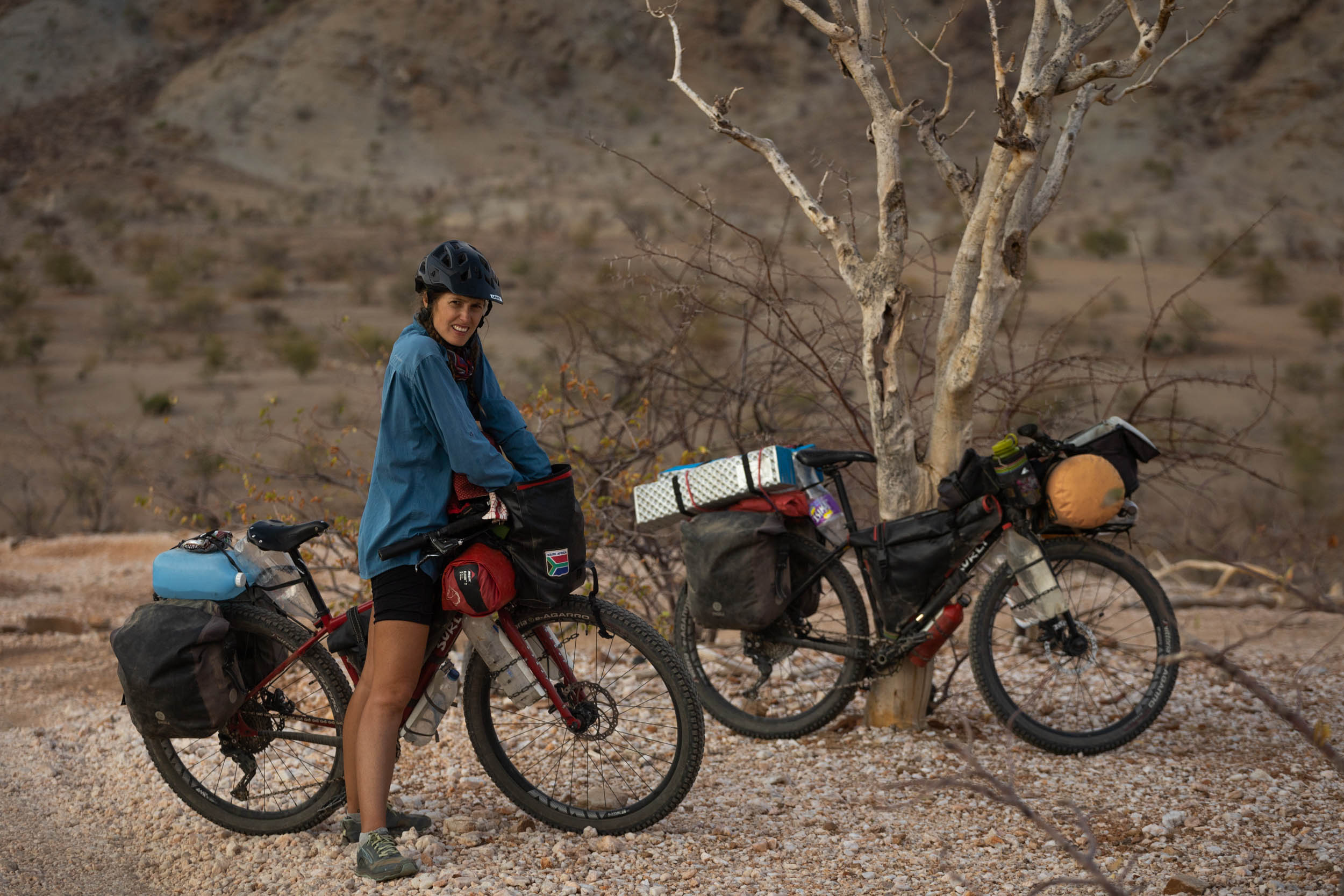
- Bike selection is a make-or-break in this segment. You’ll want something with wide tyres for soft sand—the wider, the better—and something that’s capable of reliably hauling heavy loads.
- For reference, on our 27.5 rigid ATBs with 2.6 inch tyres, we definitely felt underbiked at times.
- Crucially, whatever bike you choose, ensure that it’s reliable, tried and tested. There are places on this segment where any assistance or backup is very, very far away. You need to have 100% trust in your equipment.
- Bike Shops: The only bike shops on this segment are located at the start in Walvis Bay/Swakopmund. Nothing thereafter. Manie’s Bike Mecca in Swakop comes highly recommended.
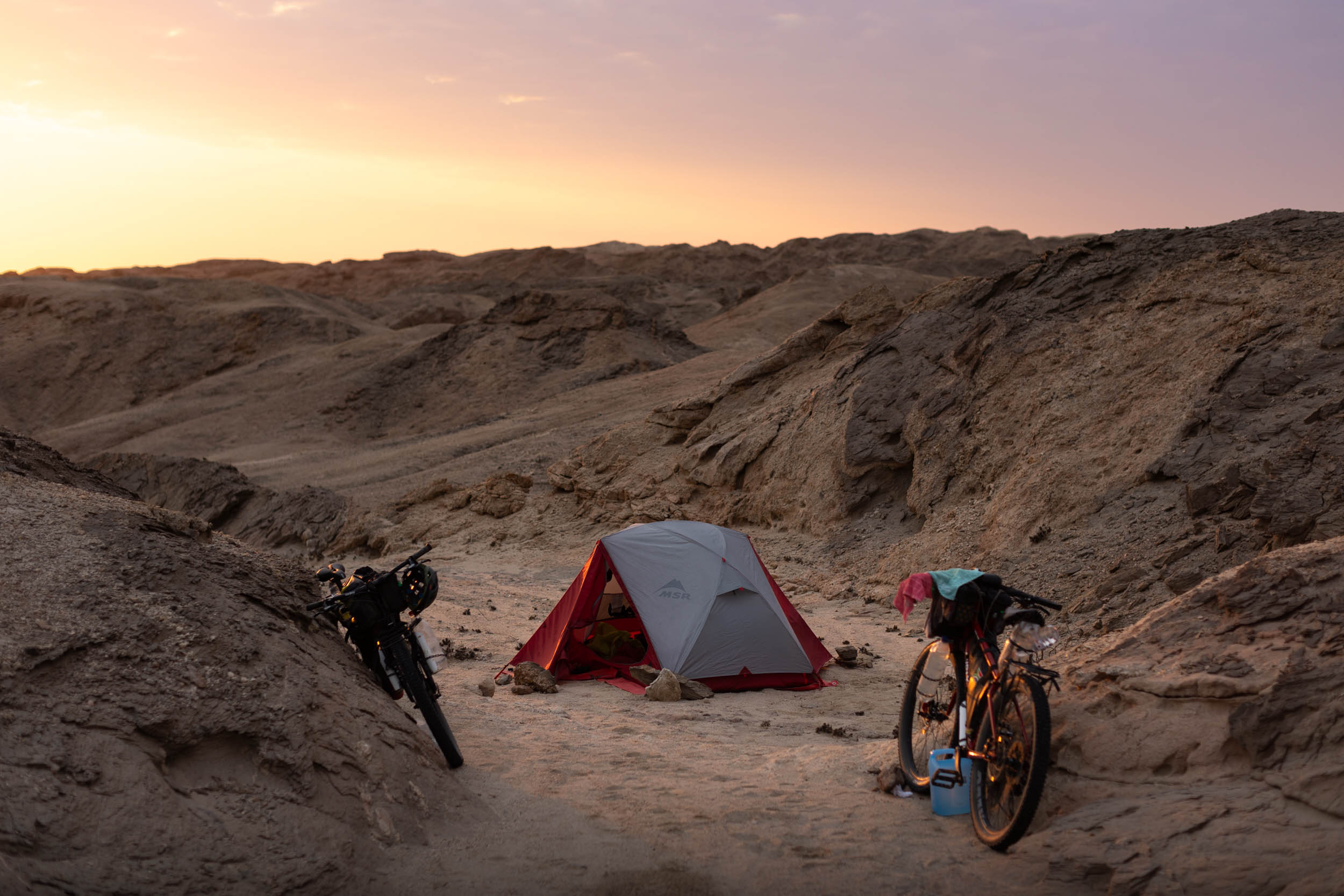
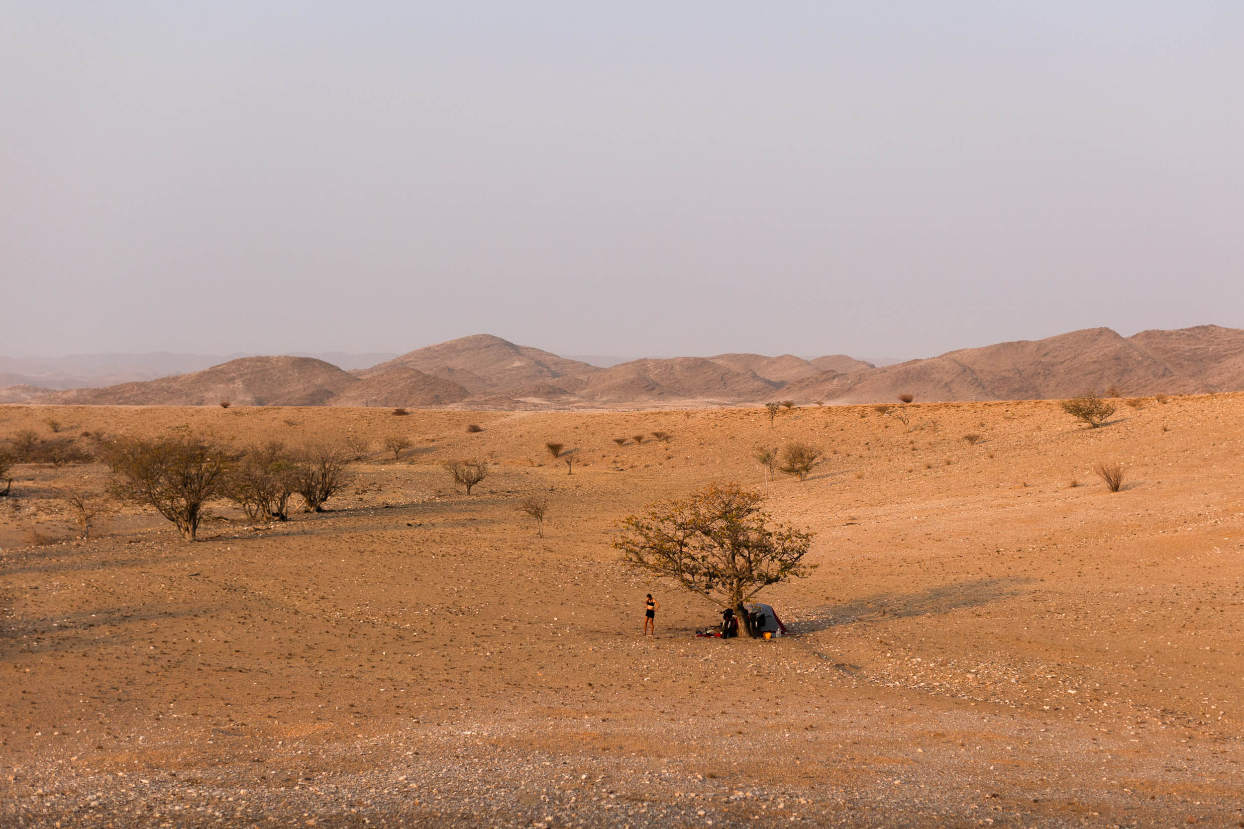
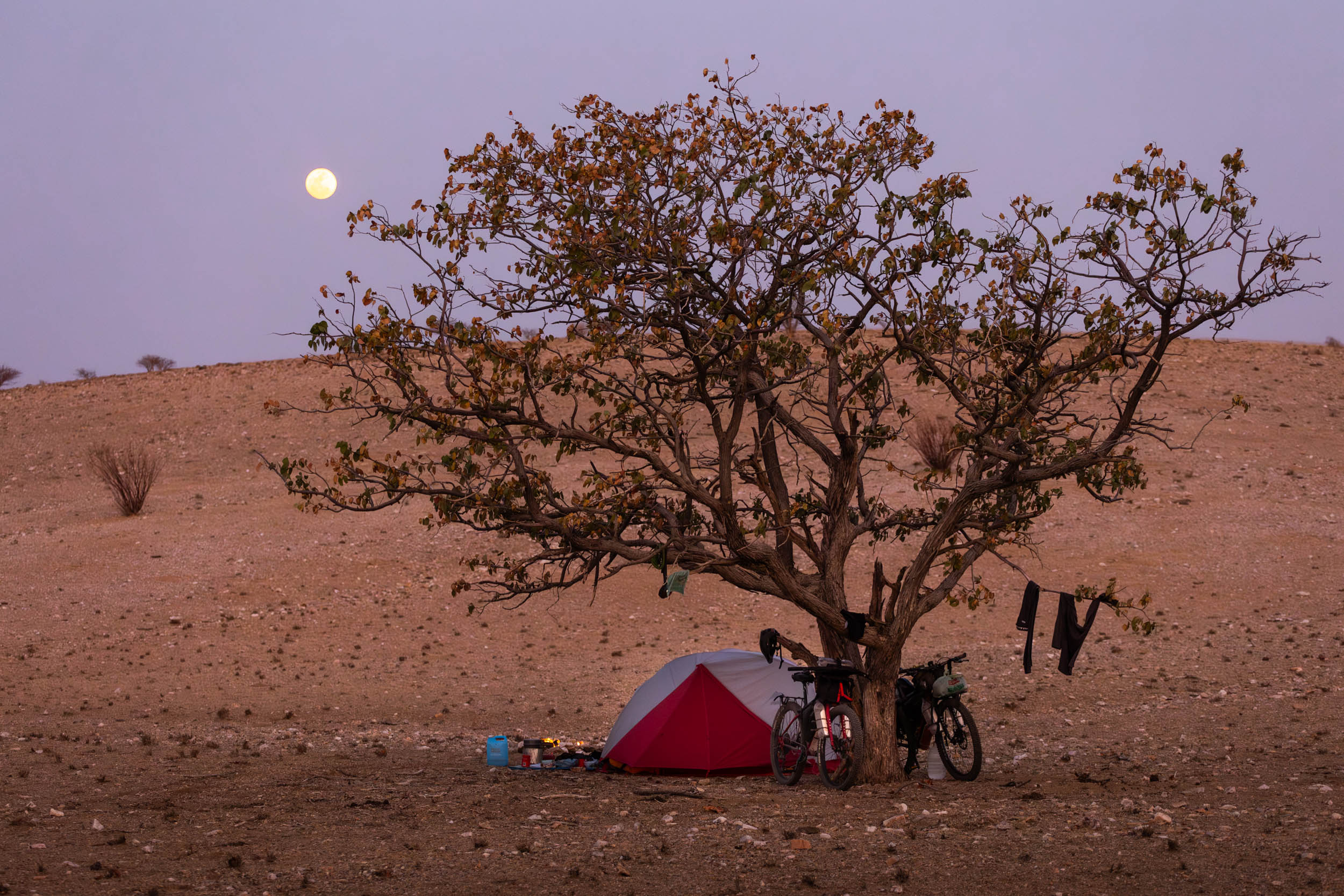
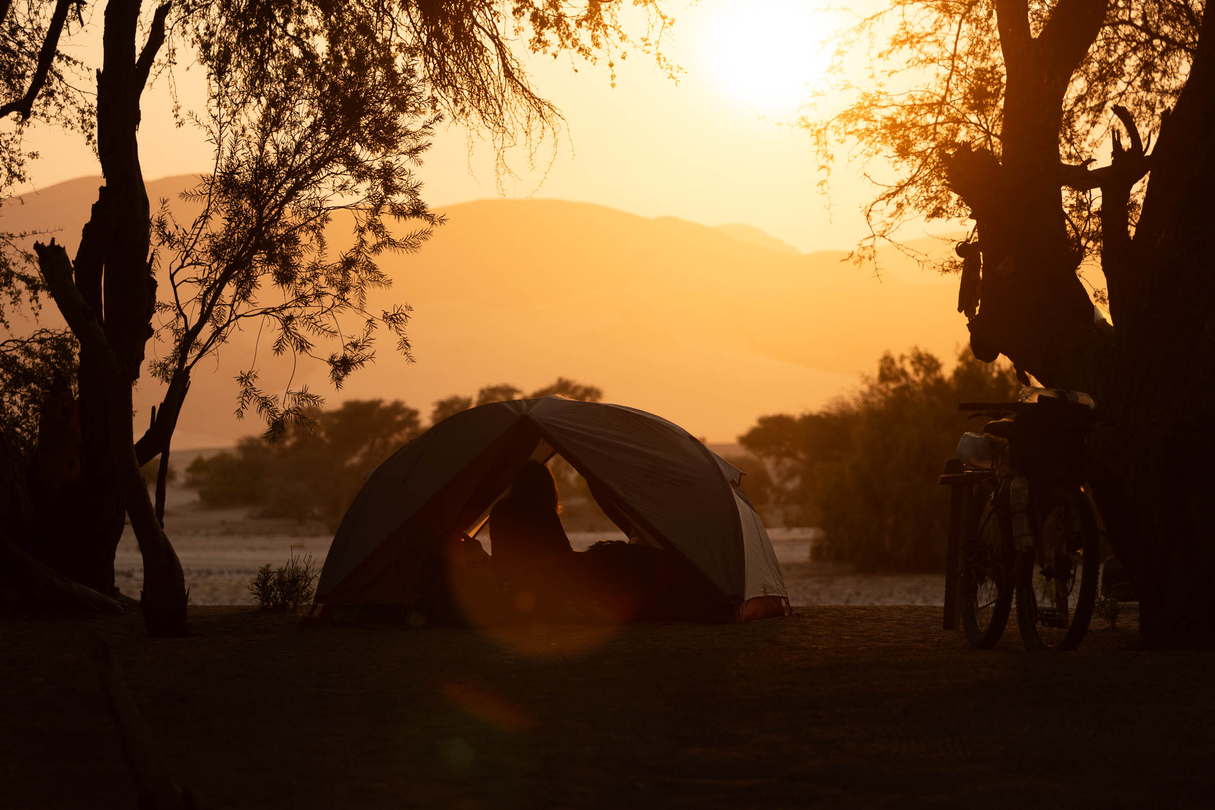
- With all the animal activity, wild camping in these parts can be quite unnerving. However, most riders will have no choice but to do so at least once or twice. This is irrespective of preference, due to the sometimes long distance between towns and camps. Hopefully, it’s reassuring to know that wild camping is a widely accepted and fairly common practice in these parts. Besides, it’s probably amongst the best you’ll experience, anywhere.
- Scattered across this region are also what’s known as community campsites, run by local community groups. While basic, they offer charming sheltered spots and simple cleaning facilities. These sites often boast picturesque settings, making them worth supporting and utilising. The Umene Community Camp in Purros is particularly beautiful.
- There are also a few excellent lodges that you can stay at along the way, though these are pricey and often need to be booked in advance.
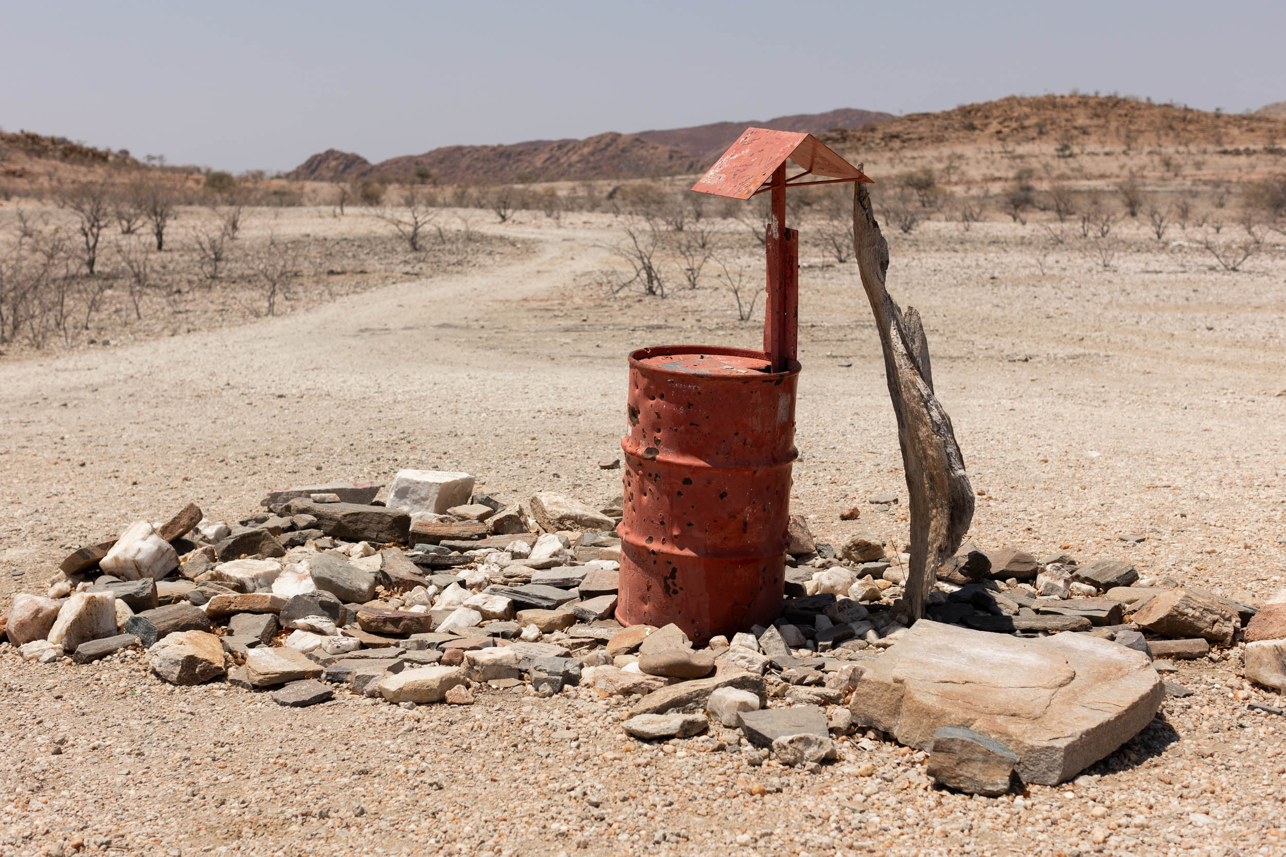
Water
It should come as no surprise that water management on this segment is absolutely critical. Here are some guidelines we used:
- Recommended carrying capacity: 10-12 litres.
- Critical refill opportunities are indicated on the GPX.
- Fill up at every possible opportunity.
- Rare as they are, flag down cars, if needed. Most drivers carry a bottle or two and will be happy to help.
- Most local water is from underground sources and has a strong mineral taste. Adding some juice mix to it can improve the taste.
- Ask ahead. Gather up-to-date intel as you travel along. Don’t rely solely on the information in this guide or GPX. The situation on the ground changes constantly.
Food
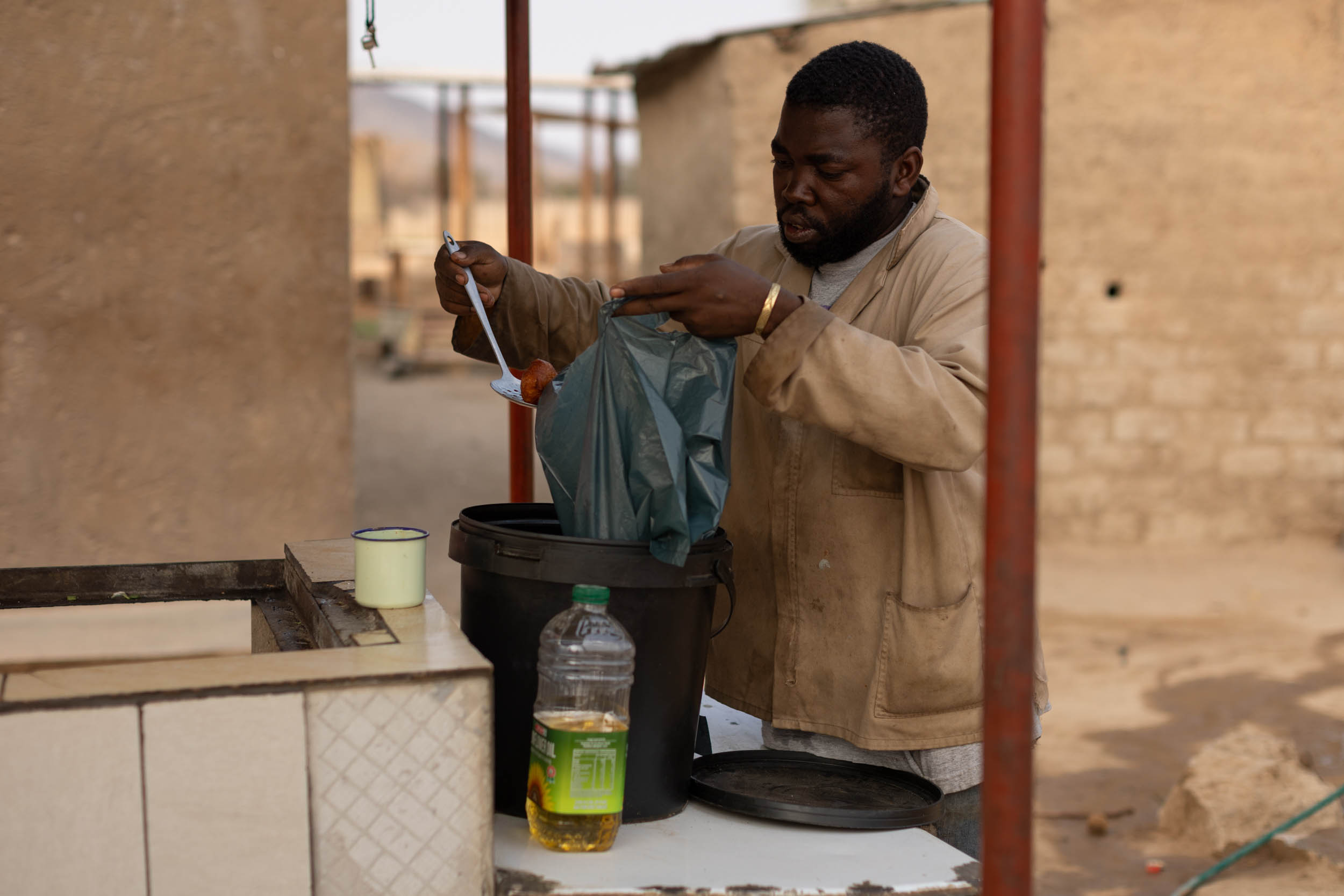
- Much like the previous segment, the food on this one is not exactly something to look forward to. Most local meals are very basic and so is the variety at local shops. The good news is that, with there generally being more frequent villages on this segment, there are also more frequent little shops and taverns that sell basic snacks and treats.
- Fat cakes (similar to South African vetkoek) are a local favourite. However, getting your hands on real, wholesome food is near impossible.
- Important food stops are indicated on the GPX. Some larger towns are off route, but not totally out of reach. Don’t hesitate to venture off to some of these if it gets desperate.
Swakopmund to Spitzkoppe: The Moon Landscape
Truth be told, this opening section is a bit of a conundrum. Between Swakopmund and Spitzkope, there’s an horrendous stretch of highway, the B2, that’s without a doubt one of the worst roads in all of Namibia to cycle on. It’s busy and narrow. Ideally, we want to avoid this road completely, but that’s easier said than done, especially if we want to incorporate the breathtaking Moon Landscape, south of the Khan River, into the route—which we do. Ultimately we have three options to consider here, but not all three have been thoroughly tested to our satisfaction.
Option 1 – As indicated on the main GPX file – Khan River 4×4 Trail
This is the route we tested in 2021. We liked it, but it still contains a 70-odd kilometre long stint on the dreaded B2. Admittedly, we hitchhiked the last stretch to Spitzkoppe’s turnoff to avoid getting killed by trucks (which, honestly, was not that much of a hassle). We recommend doing the same.
This option goes right through the famous Moon Landscape, and takes in a short, but thrilling section of the Khan River trail, exiting to the B2 via the Husab Uranium mine’s access road.
Option 2 – Not tested – More of the Khan River 4×4 Trail
The next alternative is to continue further along the Khan river trail, cutting out an additional 25 km of highway. However it still leaves you with a good 50-odd kilometres to go on the highway, so you’re not gaining much, especially considering the river trail is technical and quite demanding, physically. However, the trail is stunningly beautiful, and the more adventurous riders will find this an exciting challenge. Find the GPX here.
Option 3 – Not tested – Welwitschia trail and D-roads to Usakos
This second alternative cuts out nearly all of the B2 highway, taking you to Usakos and backtracking a short distance to Spitzkoppe. There’s every reason to believe that this will be stunningly beautiful, however, it does add some extra mileage to the route and it involves nearly 150 km of riding through desperately barren terrain. Water management will be crucial. Sadly, it also misses out on the Khan River trail. Find the GPX here.
As for the B2 highway, it’s worth mentioning that for some of the way, there are smaller informal gravel roads that run directly parallel to it, making it possible to avoid having trucks wheezing past your shoulders. But only for some of the way.
Spitzkoppe to Uis: The Omaruru Valley
From Spitzkoppe, the route proceeds north on a series of fun double tracks. They’re hard-packed and flowy, making for enjoyable riding down to the Omaruru river. From here, it’s a gentle climb back up to the D1930 gravel road that goes to Uis.
Uis to Twyfelfontein: Damaraland
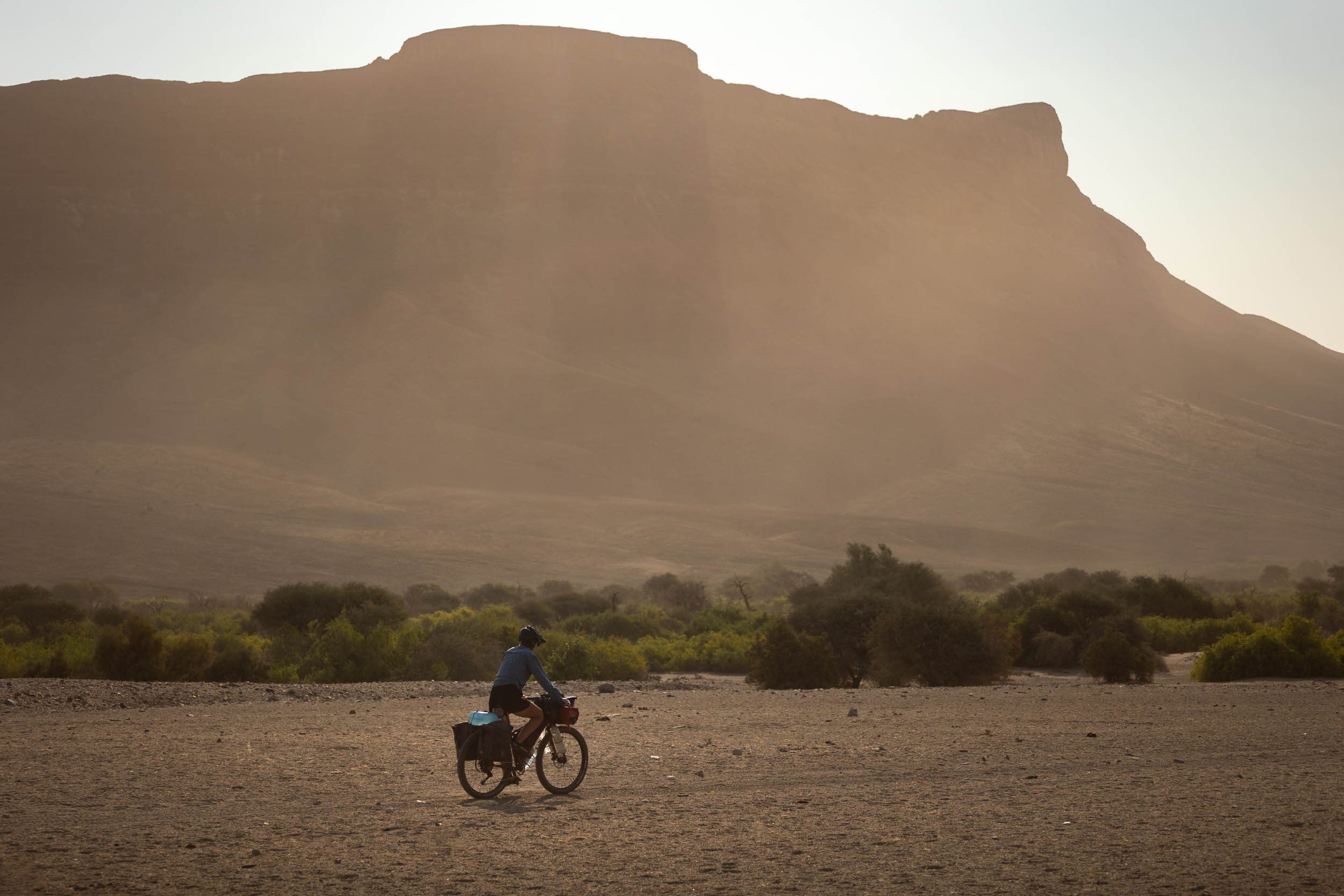
This is where it starts to get truly remote.
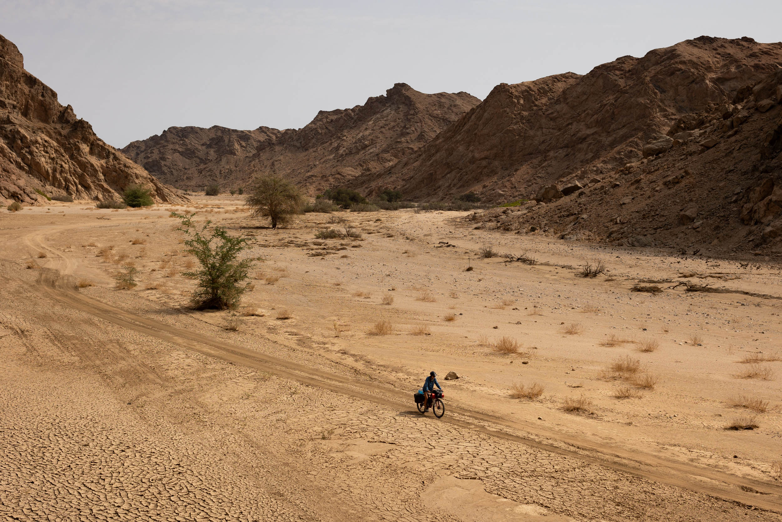
The first 110-odd kilometres out of Uis takes you south around the Brandberg massif (Namibia’s biggest and tallest mountain) on mostly straightforward (but dead quiet) gravel roads to the Ugab River. Here you’ll find the Save the Rhino Trust Community Campsite, a critical water refill stop, also a lovely camp and a worthy project to support. The rest of the way to Twyfelfontein is on remote 4X4 tracks, mostly hard packed double tracks, but rugged and quite sandy in places.
Alternative: The GPX indicates the “main” 4X4 trail to Twyfelfontein. There’s also a slightly more (or, even more) adventurous option to consider: the Divorce pass. This pass goes up to the east of the Doros Crater and is arguably more challenging and rugged than the advised route on the GPX. Find the GPX here.
As for Twyfelfontein, it’s more of a village than a town, but there are some basic facilities like campsites, some decent little shops and cell phone connection. There’s also a helpful car repair shop, for what it’s worth. I picked up some life saving tyre plugs there.
Look out for animals on this stretch. We had a Hyanna at our tent near Twyfelfontein, and saw plenty of elephants in the Ugab. The Ugab river (and surrounds) is also reputed to be home to a population of lions.
The Welwitcia’s on this section are amongst the most spectacular found anywhere in the country.
Twyfelfontein to Sesfontein: The Otjitheka Trail
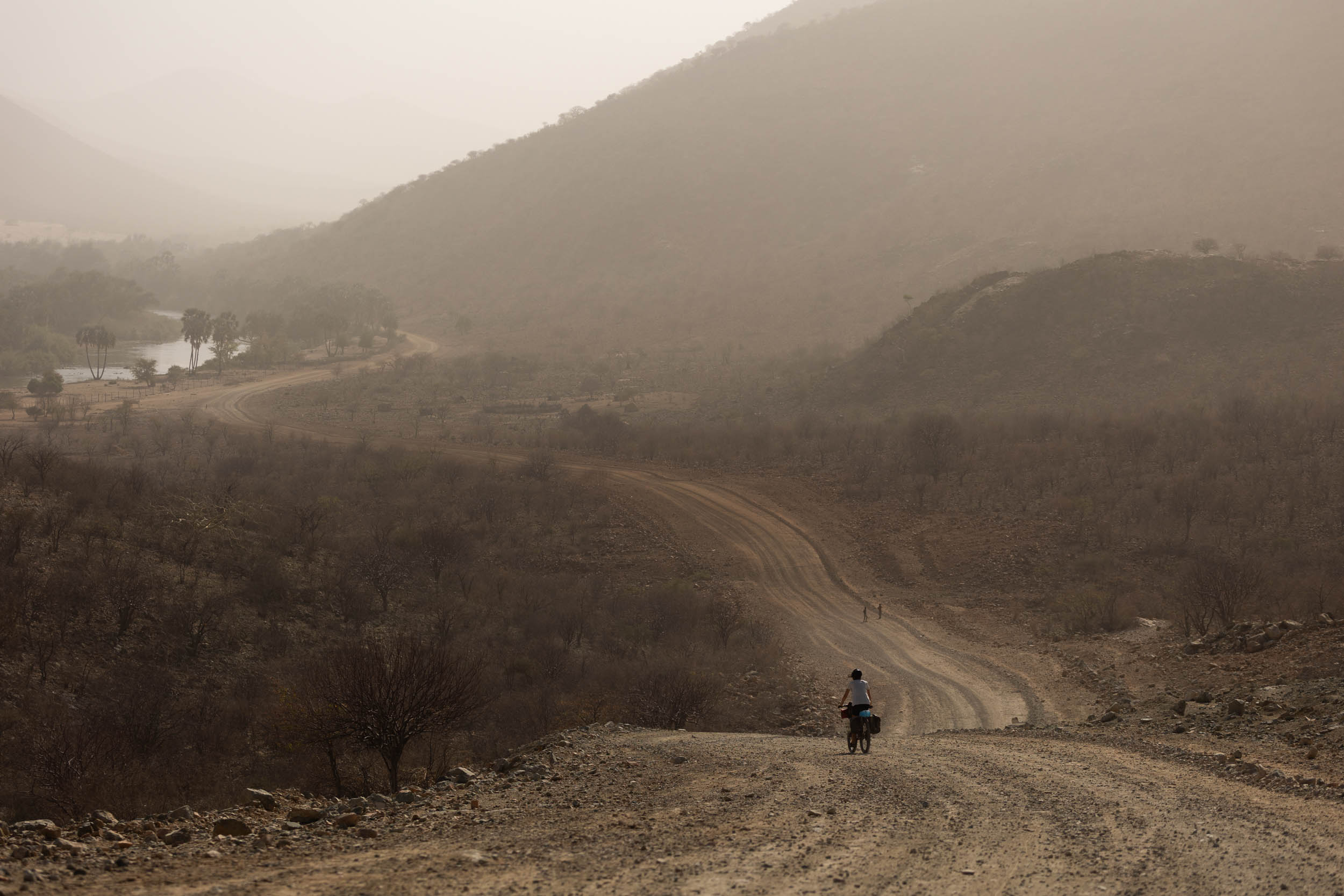
This is an extremely remote section, yet remarkably picturesque and brimming with wildlife.
From Twyfelfontein, the route takes the C39 for approximately 40 km of straightforward gravel grinding to the small settlement of Vrede. Here it turns off onto a series of remote double tracks and dead-quiet gravel roads until crossing the C40 at another small town called Erwee. From here it’s an adventurous and challenging 4X4 trail, the Otjitheka trail, back west to the C43. This trail is rocky and rugged and, conditions depending, can get very sandy in places. It also has one very steep section on it that, in the ascending direction (doing the route north to south) can be an obstacle of note. Not to be taken lightly. On the flipside, this section had more wildlife than anywhere else on the route when we tested it in 2023. We saw hundreds of zebras and countless giraffes. Incredible!
Shortly after reaching the C43, the route passes by a village called Warmquelle, here it’s recommended to take a short detour to the nearby Ongongo hot springs and waterfall. A lovely place to relax and cool off.
The rest of the road to Sesfontein is straightforward.
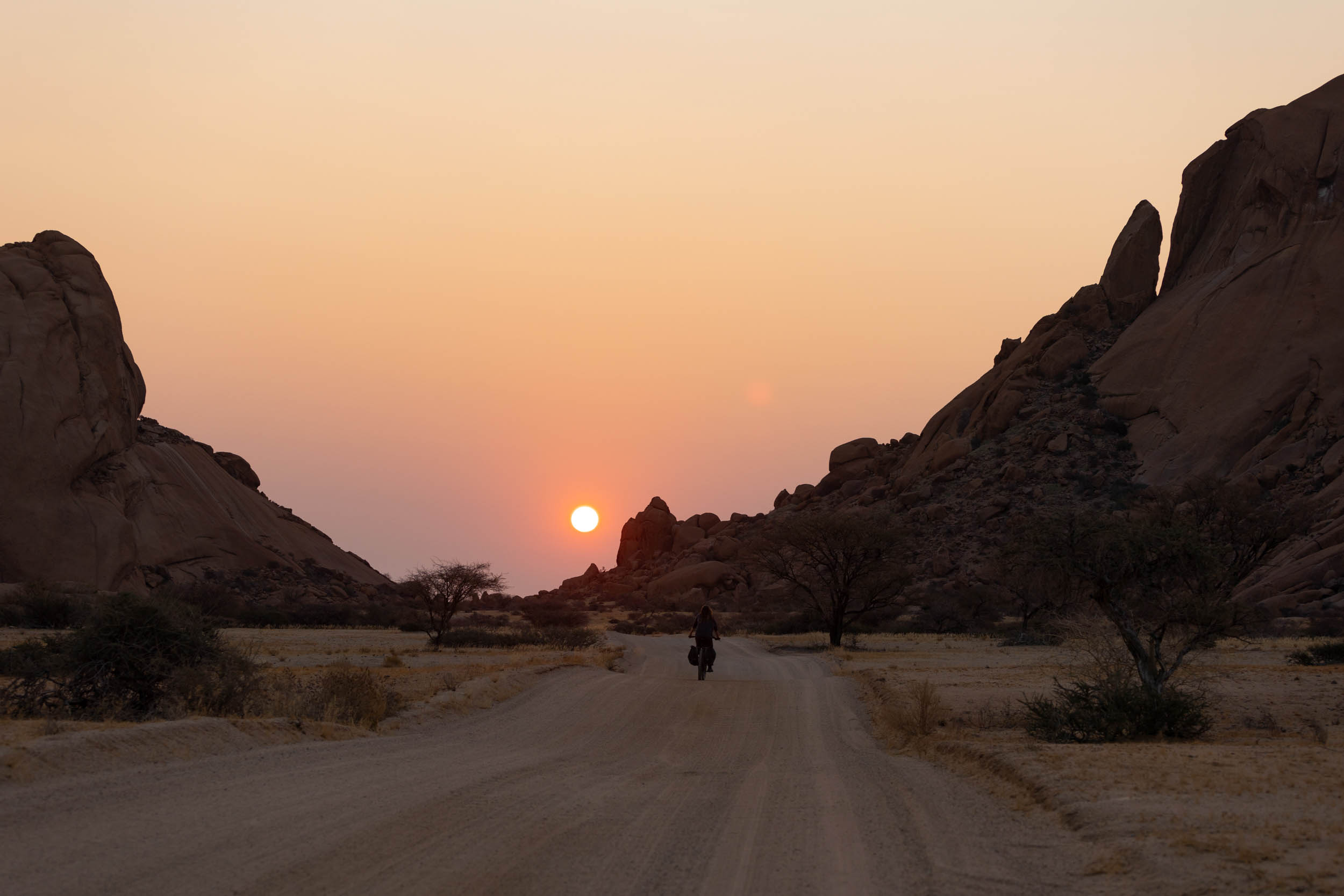
Sesfontein to Epupa: Kaokoveld
Another profoundly isolated stretch, possibly the most untamed of the whole route.
The first 100-odd kilometres from Sesfontein to Purros is on fairly straightforward gravel roads, although it does get quite sandy around halfway through.
From Purros, it gets truly wild as you follow a series of riverbed tracks and remote 4×4 trails north for the next 80-odd kilometres to a small Himba village called Orupembe. This village is iconic for its vibrantly painted little shop called “Shop 1”, famously selling ice cold beer—remarkable, considering its extremely remote location. But don’t get your hopes too high as they do sometimes run out. I know of cyclists who have had their hearts broken here.
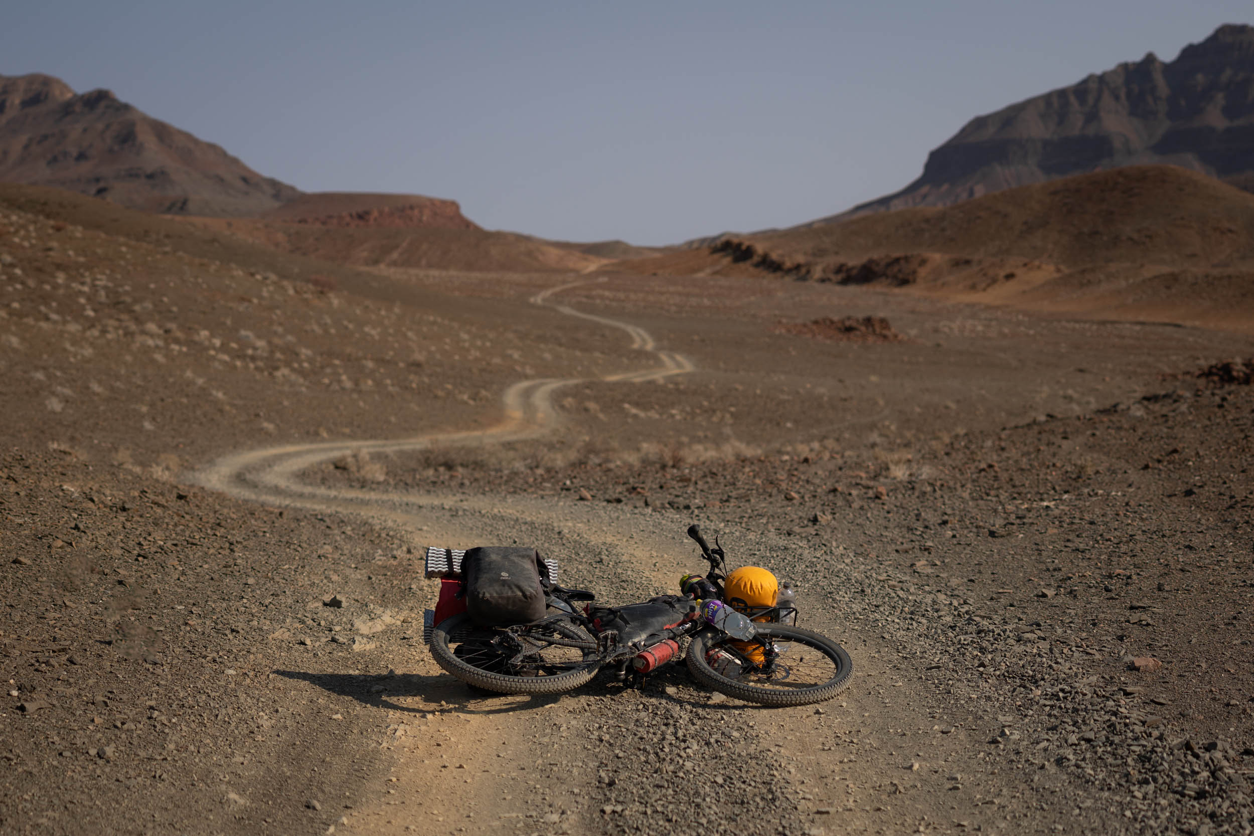
Brace yourself, after Orupembe it remains wild and rugged. The first obstacle is Joubert’s pass. This one’s not too physical, but notably rocky (sharp rocks). Next, after passing a landmark called Red Drum—it literally is no more than a red drum—you’ll descend down a long soft sandy track to the bottom of the Marienflus River. From here, you’ll gently ascend to the foot of the infamous van Zyl’s pass. Extremely rocky and notably steep, van Zyl’s could be a feather in the cap of any avid offroad adventurer. Tackling it on a bicycle, especially while ascending—since it’s typically only done the descending direction—earns you instant respect among Namibia’s hardiest 4×4 masters. Little would they know (or need to know) that you walked most of it. That’s our secret!
But don’t worry. Van Zyl’s pass, on its own, is not as brutal as its reputation suggests, although it does require some hike-a-biking and should not be underestimated. Additionally, the 80 km after the pass remains challenging, and with mounting fatigue, this can be more demanding than the pass itself.
The first real town after van Zyl’s is Okanguati. From here, it’s a straightforward gravel ride to reach the picturesque village of Epupa. Alternatively, there’s also a more adventurous 4×4 track to Epupa. Your choice. Find the GPX here.
In Epupa, you can finally kick back and enjoy the tranquillity of the Kunene river.
Kunene to end: The Kunene River
From Epupa, the route follows the river road to Ruacanna. The first 140 km of it is unpaved and rather hilly. The road is reputed to be rough and challenging, but it was freshly graded at the time of testing. No real challenges. But it probably only takes a few serious weather events to turn it back into a mess. You’ll have to just hope for the best. There are a number of Himba villages on this stretch, and several campsites where you can sleep or refill water. The last 20 km to Ruacana is all paved.
If you do opt to pedal the 160 km connection to Oshakati, the quickest way is on the C46, the main road. It’s virtually flat all the way and not too sketchy in terms of traffic.
If you’re going to try to get a ride on local transport, the best place to enquire would be from Oshifo, just outside of Ruacana.
LESS DIFFICULT ROUTE ALTERNATIVES
For less experienced, or more conservative riders, we recommend cutting out some of the more demanding sections of the main route, rerouting onto bigger roads instead. Refer to the alternative GPX file below. This makes the segment much less demanding, technically, but still involves extremely remote riding and should still not be taken lightly.
Additional Resources
- I-overlander: A popular app used by overland travelers to share information about roads, amenities, campsites etc. It’s particularly useful in these parts of Namibia as it contains loads of suggestions for wild camping spots.
- Tracks4africa has some of the better maps out therefor Namibia
- Snakes: African Snake Bite Institute (PDF)


Terms of Use: As with each bikepacking route guide published on BIKEPACKING.com, should you choose to cycle this route, do so at your own risk. Prior to setting out check current local weather, conditions, and land/road closures. While riding, obey all public and private land use restrictions and rules, carry proper safety and navigational equipment, and of course, follow the #leavenotrace guidelines. The information found herein is simply a planning resource to be used as a point of inspiration in conjunction with your own due-diligence. In spite of the fact that this route, associated GPS track (GPX and maps), and all route guidelines were prepared under diligent research by the specified contributor and/or contributors, the accuracy of such and judgement of the author is not guaranteed. BIKEPACKING.com LLC, its partners, associates, and contributors are in no way liable for personal injury, damage to personal property, or any other such situation that might happen to individual riders cycling or following this route.
Further Riding and Reading
Here are some connected/nearby routes and related reports...
Please keep the conversation civil, constructive, and inclusive, or your comment will be removed.